Niobrara (/ˌnaɪ.əˈbrærə/; Omaha: Ní Ubthátha Tʰáⁿwaⁿgthaⁿ [nĩꜜ ubɫᶞaꜜɫᶞa tʰãꜜwãŋɡɫᶞã], meaning “water spread-out village”) is a village in Knox County, Nebraska, United States. The population was 363 at the 2020 census.
| Name: | Niobrara village |
|---|---|
| LSAD Code: | 47 |
| LSAD Description: | village (suffix) |
| State: | Nebraska |
| County: | Knox County |
| Elevation: | 1,230 ft (375 m) |
| Total Area: | 0.73 sq mi (1.89 km²) |
| Land Area: | 0.73 sq mi (1.89 km²) |
| Water Area: | 0.00 sq mi (0.00 km²) |
| Total Population: | 365 |
| Population Density: | 501.37/sq mi (193.49/km²) |
| ZIP code: | 68760 |
| Area code: | 402 |
| FIPS code: | 3134370 |
| GNISfeature ID: | 0831636 |
| Website: | www.niobrarane.com |
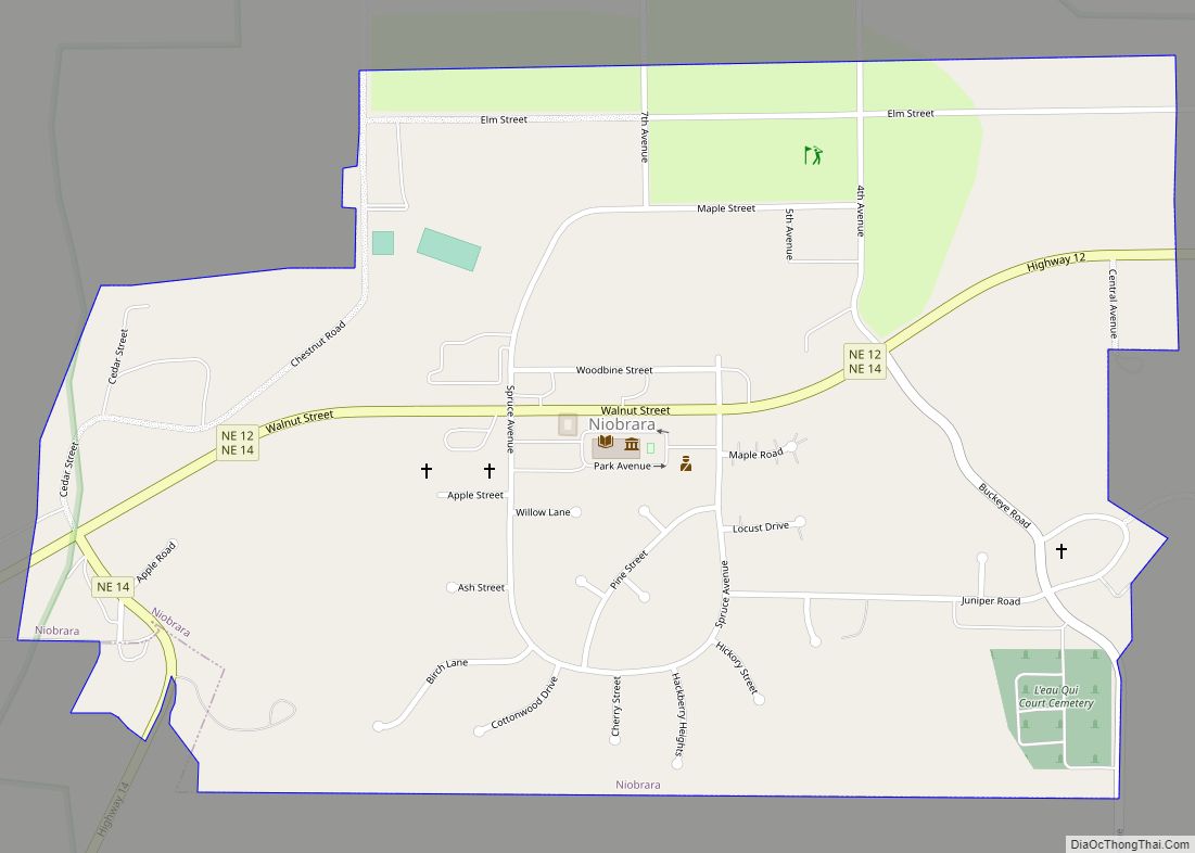
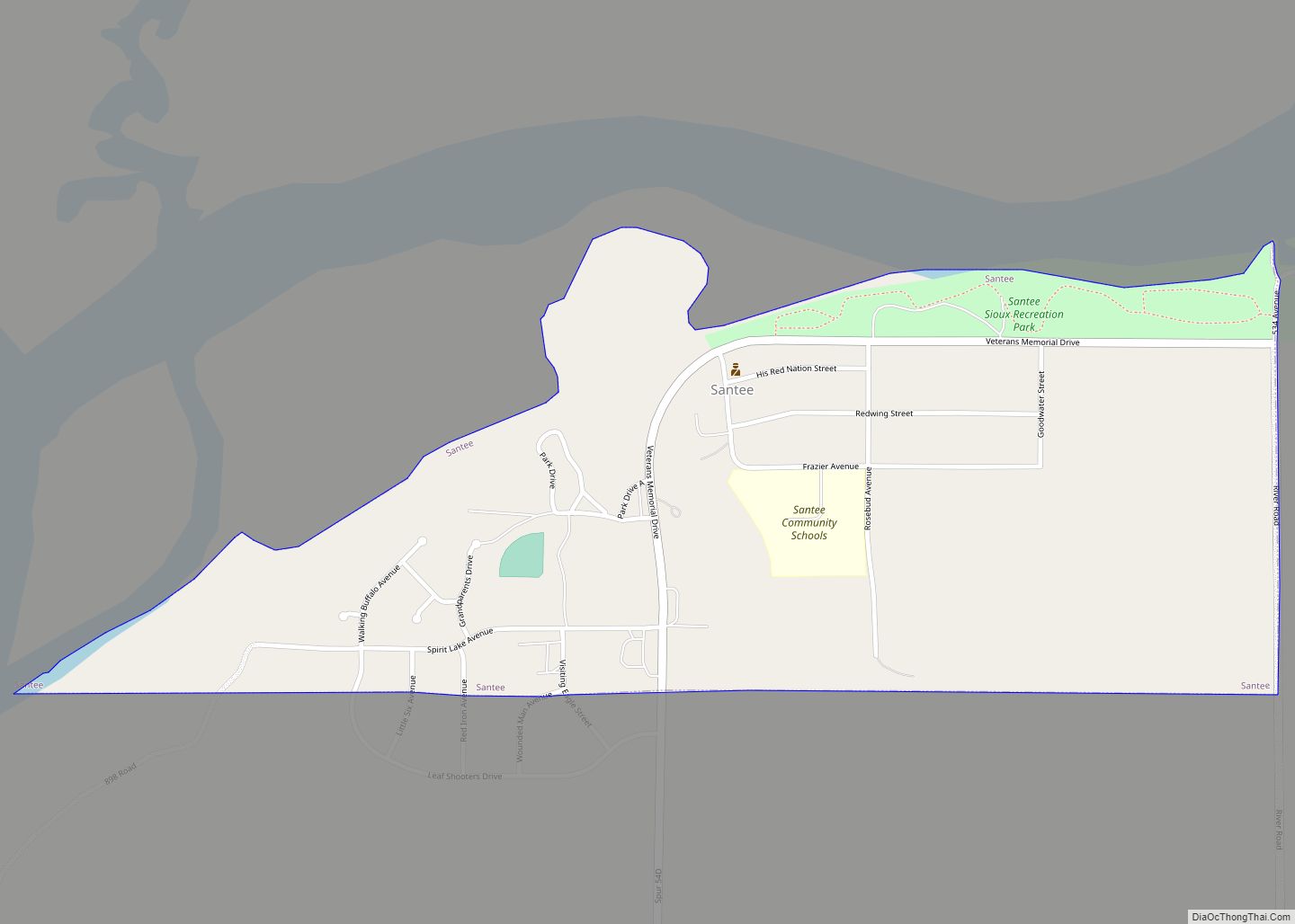
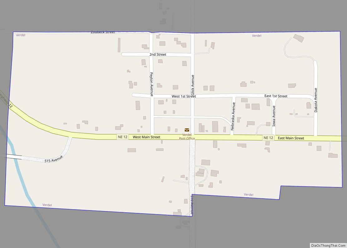
Online Interactive Map
Click on ![]() to view map in "full screen" mode.
to view map in "full screen" mode.
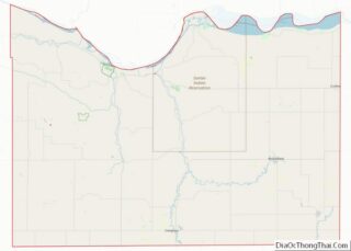
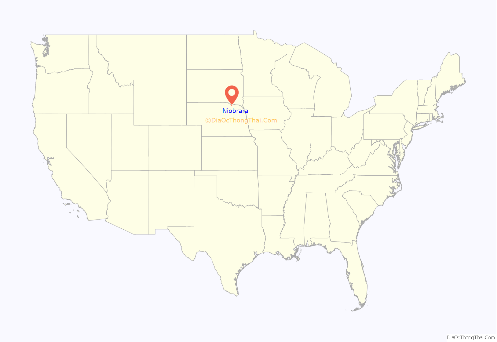
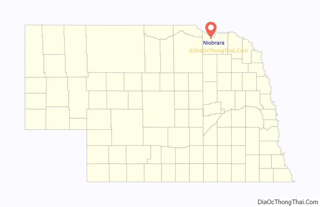
Niobrara location map. Where is Niobrara village?
History
Niobrara was founded in 1856, when a group of men headed by a Dr. Benneville Yeakel Shelly marked their claim to an area on the banks of the Missouri River. There, a fort was built to protect the early settlers from Indian attacks. The settlement took its name from the Niobrara River.
They built a log garrison of cottonwood, which later became known as “Old Cabin”. The company, founded by Shelly and others, was called L’eau Qui Court Company. This Company failed, and the Niobrara Township Company was organized. The new town was eventually called “Niobrara”, an Omaha word for “running water”. On June 29, 1857, a steam sawmill was brought to Niobrara from St. Louis by the steamer “Omaha” and was immediately put into operation sawing lumber for the building of the new town. In spite of early hardships, the new town continued to grow, and the 1881 population was reported to be about 500. Just as the Missouri River was responsible for the original settlement of Niobrara, it was also responsible for the first move. In March 1881, the spring thaw produced one of the largest Missouri River floods on record. After the danger of flooding, Mother Nature and the mighty Missouri again invaded Niobrara in April 1952, and much of the town and the surrounding area was flooded. This record flow came shortly before the completion of the Missouri River dams, citizens were relieved that flooding along the Missouri would be a thing of the past and life could continue at a more or less routine pace. A big event of the 1950s was the Centennial Celebration of June 16–17, 1956. There were many events leading up to the two day celebration which was attended by an estimated 20,000 people. Later, in the 1950s and in the 1960s, it became apparent that the mighty Missouri would, again, influence Niobrara history. Silt from the Niobrara River, which began to accumulate in the river bed, raised the ground water level in Niobrara and the surrounding area. Many basements became flooded, requiring constant pumping and it was apparent that the problem would continue to intensify. By 1969, community officials began to look for solutions. The US Army Corps of having seemingly passed, on March 28, 1881, an ice gorge broke and Niobrara residents were greeted by a surge of muddy water. The water continued to overflow until most of the town was covered, forcing people and animals alike to seek the safety of higher ground. Fortunately, there were no deaths but this disastrous flood influenced the citizens of Niobrara to pick up and move to a new town site west and south of the old site. The town grew and flourished at the new location providing most of the goods and services required by a rural Nebraska community of that era. Noteworthy events of the era included the first school house in 1886, the first waterworks system which was supplied by an artesian well completed in 1892, the construction of an electric light plant in 1899 and the coming of the railroad in 1902. 1902 also marked the moving of the county seat from Niobrara to a new central location in the newly formed town of Center.Through most of Niobrara’s history, ferry boats have provided an important transportation link with South Dakota. The first ferry boat began operation in about 1860 and was operated by horses walking on a treadmill.1910 marked the grand opening of the Niobrara Island Park. The land on which the park was built was given to the village for a park in 1881 by the U.S. Department of the Interior. The village operated the park until approximately 1930 when it was given to the State of Nebraska and was added to the Nebraska Park System. Engineers became involved and eventually suggested three solutions. These included abandonment of the town, an elaborate dike and pumping system, or relocation to a new site. Niobrara citizens accepted the challenge of, once again, moving Niobrara and the site selection process followed. Funds were appropriated by Congress to pay a sizable portion of the cost of the move. Site preparation began in September 1973 and was completed in April 1974. Next came the water, sewer, storm sewer, paving, water wells and water storage tank. The sale of residential lots followed in the summer of 1974 and residential construction moved forward at a fast pace. By the end of 1977, the move was nearly completed. The 1980 census showed 420 and 213 homes in Niobrara. 1981 marked the 112th anniversary of the original settlement and was celebrated with a historical pageant, parade and other activities. Through volunteer efforts, a nine-hole grass greens golf course was completed on the old town site. The Niobrara State Park was relocated, suffering the same fate as the old town. Niobrara’s history can best be summarized as being destined by the mighty Missouri on whose banks it was founded and from whose reach it has continuously tried to escape.
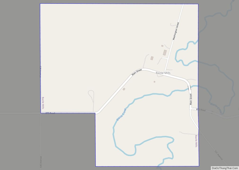
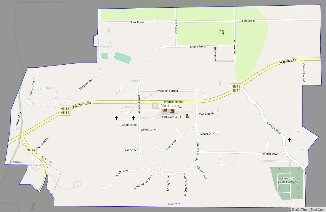
Niobrara Road Map
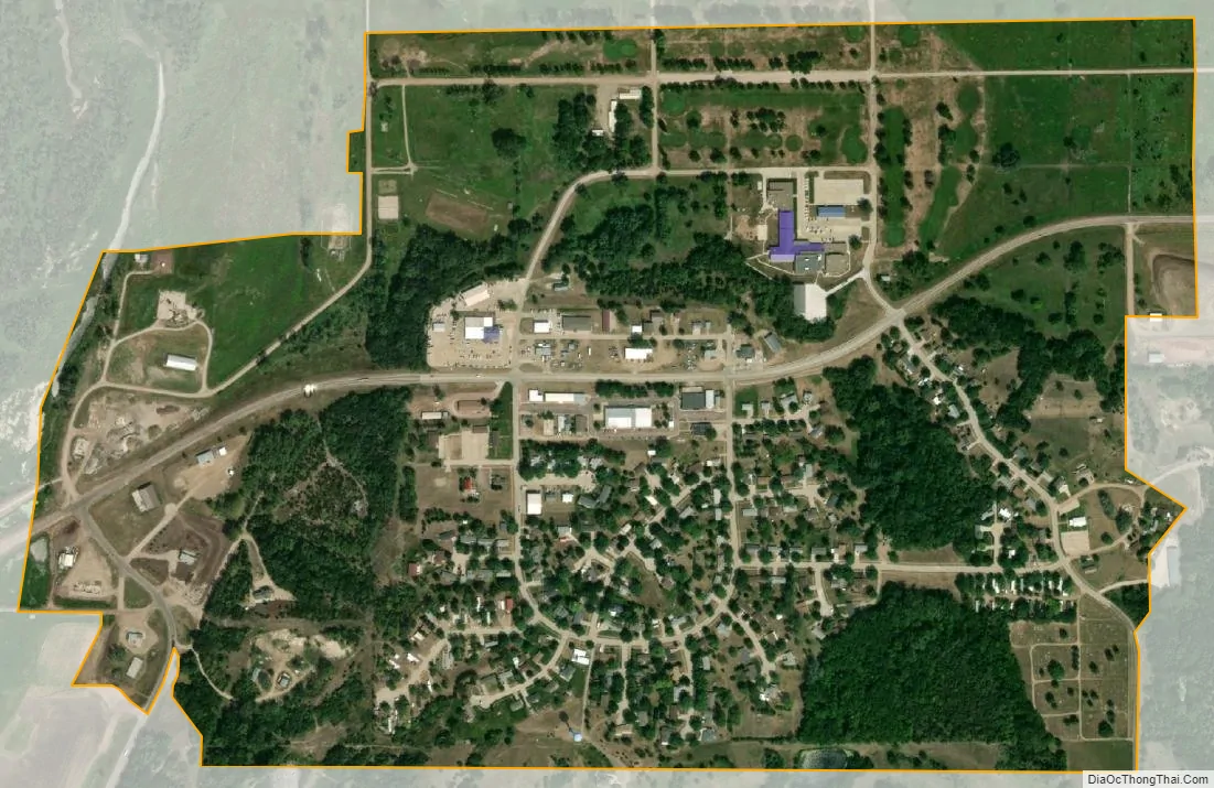
Niobrara city Satellite Map
Geography
Niobrara is located at 42°45′0″N 98°1′55″W / 42.75000°N 98.03194°W / 42.75000; -98.03194 (42.750000, -98.031989). Nebraska highways 12 and 14 run through the village, Highway 14 connects Nebraska with South Dakota via the Chief Standing Bear Memorial Bridge, just east of the village across the Missouri River.
According to the United States Census Bureau, the village has a total area of 0.73 square miles (1.89 km), all land. The Niobrara River, which is right next to the town, actually courses through the Mormon Canal rather than its original riverbed.
See also
Map of Nebraska State and its subdivision:- Adams
- Antelope
- Arthur
- Banner
- Blaine
- Boone
- Box Butte
- Boyd
- Brown
- Buffalo
- Burt
- Butler
- Cass
- Cedar
- Chase
- Cherry
- Cheyenne
- Clay
- Colfax
- Cuming
- Custer
- Dakota
- Dawes
- Dawson
- Deuel
- Dixon
- Dodge
- Douglas
- Dundy
- Fillmore
- Franklin
- Frontier
- Furnas
- Gage
- Garden
- Garfield
- Gosper
- Grant
- Greeley
- Hall
- Hamilton
- Harlan
- Hayes
- Hitchcock
- Holt
- Hooker
- Howard
- Jefferson
- Johnson
- Kearney
- Keith
- Keya Paha
- Kimball
- Knox
- Lancaster
- Lincoln
- Logan
- Loup
- Madison
- McPherson
- Merrick
- Morrill
- Nance
- Nemaha
- Nuckolls
- Otoe
- Pawnee
- Perkins
- Phelps
- Pierce
- Platte
- Polk
- Red Willow
- Richardson
- Rock
- Saline
- Sarpy
- Saunders
- Scotts Bluff
- Seward
- Sheridan
- Sherman
- Sioux
- Stanton
- Thayer
- Thomas
- Thurston
- Valley
- Washington
- Wayne
- Webster
- Wheeler
- York
- Alabama
- Alaska
- Arizona
- Arkansas
- California
- Colorado
- Connecticut
- Delaware
- District of Columbia
- Florida
- Georgia
- Hawaii
- Idaho
- Illinois
- Indiana
- Iowa
- Kansas
- Kentucky
- Louisiana
- Maine
- Maryland
- Massachusetts
- Michigan
- Minnesota
- Mississippi
- Missouri
- Montana
- Nebraska
- Nevada
- New Hampshire
- New Jersey
- New Mexico
- New York
- North Carolina
- North Dakota
- Ohio
- Oklahoma
- Oregon
- Pennsylvania
- Rhode Island
- South Carolina
- South Dakota
- Tennessee
- Texas
- Utah
- Vermont
- Virginia
- Washington
- West Virginia
- Wisconsin
- Wyoming