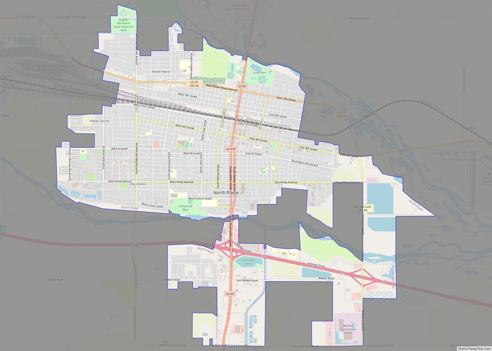
North Platte is a city in and the county seat of Lincoln County, Nebraska, United States. It is located in the west-central part of the state, along Interstate 80, at the confluence of the North and South Platte Rivers forming the Platte River. The population was 23,390 at the 2020 census.
North Platte is a railroad town; Union Pacific Railroad’s large Bailey Yard is located within the city. Today, North Platte is served only by freight trains, but during World War II the city was known for the North Platte Canteen, a volunteer organization serving food to millions of traveling soldiers.
North Platte is the principal city of the North Platte Micropolitan Statistical Area, which includes Lincoln, Logan, and McPherson counties.
| Name: | North Platte city |
|---|---|
| LSAD Code: | 25 |
| LSAD Description: | city (suffix) |
| State: | Nebraska |
| County: | Lincoln County |
| Elevation: | 2,802 ft (854 m) |
| Total Area: | 13.71 sq mi (35.50 km²) |
| Land Area: | 13.52 sq mi (35.02 km²) |
| Water Area: | 0.19 sq mi (0.48 km²) |
| Total Population: | 23,390 |
| Population Density: | 1,729.90/sq mi (667.93/km²) |
| ZIP code: | 69101, 69103 |
| Area code: | 308 |
| FIPS code: | 3135000 |
| GNISfeature ID: | 0831719 |
| Website: | www.ci.north-platte.ne.us |
Online Interactive Map
Click on ![]() to view map in "full screen" mode.
to view map in "full screen" mode.
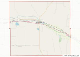
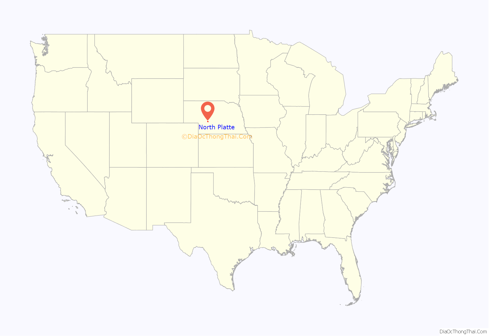
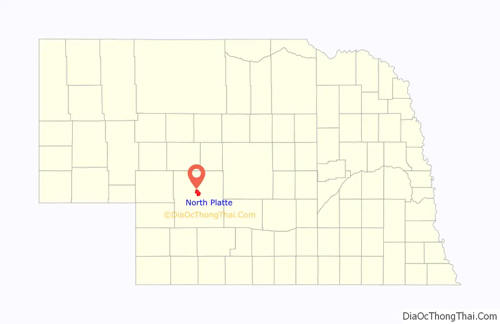
North Platte location map. Where is North Platte city?
History
North Platte was established in 1866 when the Union Pacific Railroad was extended to that point. It derives its name from the North Platte River.
North Platte was the western terminus of the Union Pacific Railway from the summer of 1867 until the next section to Laramie, Wyoming, was opened the following summer. Even though Congress had authorized the building of the Transcontinental Railroad in 1862, it had been extended only as far as Nebraska City by the start of the summer of 1867. The 275-mile (443 km) section from Nebraska City to North Platte was completed in less than six weeks.
In the 1880s, Buffalo Bill Cody established his ranch, known as Scout’s Rest Ranch, just north of town. It is now a National Historic Landmark.
On July 13, 1929, a black man shot and killed a white police officer. The black man reportedly took his own life, being trapped by a mob. This led to the formation of white mobs combing the city, and ordering black residents to leave North Platte. Fearing mob violence, most of North Platte’s black residents fled.
The North Platte Canteen was one of the largest volunteer efforts of World War II, originating in 1941. Tens of thousands of volunteers from North Platte and surrounding towns met the troop trains passing through North Platte, offering coffee, sandwiches, dessert, and hospitality to nearly seven million servicemen.
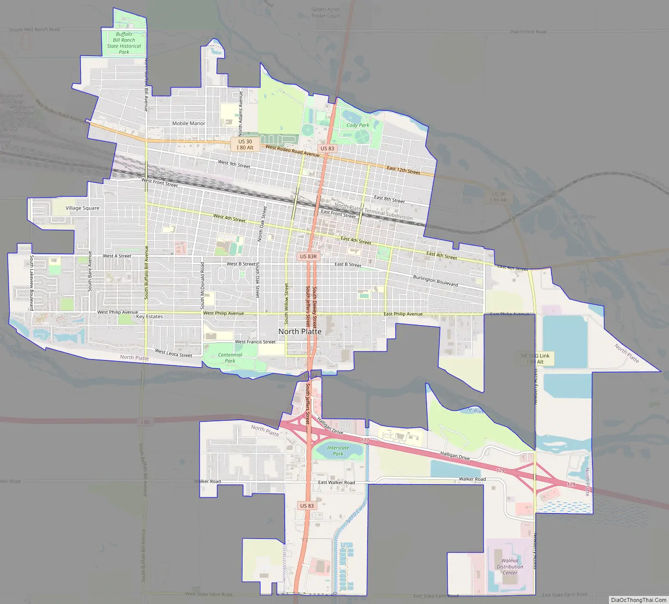
North Platte Road Map
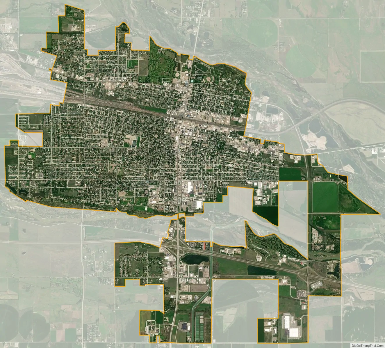
North Platte city Satellite Map
Geography
According to the United States Census Bureau, the city has a total area of 13.39 square miles (34.68 km), of which 13.20 square miles (34.19 km) is land and 0.19 square miles (0.49 km) is water.
Climate
North Platte experiences a dry continental climate similar to that of the Nebraska High Plains, classified as hot-summer humid continental (Köppen Dwa), and, with an annual average precipitation of 21.08 inches (535 mm), barely avoids semi-arid classification; it is part of USDA Hardiness zone 5a. The normal monthly mean temperature ranges from 26.3 °F (−3.2 °C) in January to 75.6 °F (24.2 °C) in July. On an average year, there are 3.8 afternoons that reach 100 °F (37.8 °C) or higher, 39 afternoons that reach 90 °F (32.2 °C) or higher, 31.4 afternoons that do not climb above freezing, and 12.2 mornings with a low of 0 °F (−17.8 °C) or below. The average window for freezing temperatures is September 30 thru May 13, allowing a growing season of 139 days. Extreme temperatures officially range from −35 °F (−37.2 °C) on January 15, 1888, and February 12, 1899, up to 112 °F (44.4 °C) on July 11, 1954; the record cold daily maximum is −15 °F (−26.1 °C) on January 14, 1888, while, conversely, the record warm daily minimum is 80 °F (26.7 °C) on July 25, 1940.
Precipitation is greatest in May and June and has ranged from 10.01 inches (254.3 mm) in 1931 to 33.44 inches (849.4 mm) in 1951. Snowfall averages 29.6 inches (0.75 m) per season, and has historically ranged from 3.0 inches (0.08 m) in 1903–04 to 66.3 inches (1.68 m) in 1979–80; the average window for measurable (≥0.1 inches or 0.0025 metres) snowfall is November 1 thru April 12, with May and October snow being rare.
See also
Map of Nebraska State and its subdivision:- Adams
- Antelope
- Arthur
- Banner
- Blaine
- Boone
- Box Butte
- Boyd
- Brown
- Buffalo
- Burt
- Butler
- Cass
- Cedar
- Chase
- Cherry
- Cheyenne
- Clay
- Colfax
- Cuming
- Custer
- Dakota
- Dawes
- Dawson
- Deuel
- Dixon
- Dodge
- Douglas
- Dundy
- Fillmore
- Franklin
- Frontier
- Furnas
- Gage
- Garden
- Garfield
- Gosper
- Grant
- Greeley
- Hall
- Hamilton
- Harlan
- Hayes
- Hitchcock
- Holt
- Hooker
- Howard
- Jefferson
- Johnson
- Kearney
- Keith
- Keya Paha
- Kimball
- Knox
- Lancaster
- Lincoln
- Logan
- Loup
- Madison
- McPherson
- Merrick
- Morrill
- Nance
- Nemaha
- Nuckolls
- Otoe
- Pawnee
- Perkins
- Phelps
- Pierce
- Platte
- Polk
- Red Willow
- Richardson
- Rock
- Saline
- Sarpy
- Saunders
- Scotts Bluff
- Seward
- Sheridan
- Sherman
- Sioux
- Stanton
- Thayer
- Thomas
- Thurston
- Valley
- Washington
- Wayne
- Webster
- Wheeler
- York
- Alabama
- Alaska
- Arizona
- Arkansas
- California
- Colorado
- Connecticut
- Delaware
- District of Columbia
- Florida
- Georgia
- Hawaii
- Idaho
- Illinois
- Indiana
- Iowa
- Kansas
- Kentucky
- Louisiana
- Maine
- Maryland
- Massachusetts
- Michigan
- Minnesota
- Mississippi
- Missouri
- Montana
- Nebraska
- Nevada
- New Hampshire
- New Jersey
- New Mexico
- New York
- North Carolina
- North Dakota
- Ohio
- Oklahoma
- Oregon
- Pennsylvania
- Rhode Island
- South Carolina
- South Dakota
- Tennessee
- Texas
- Utah
- Vermont
- Virginia
- Washington
- West Virginia
- Wisconsin
- Wyoming