Ogallala is a city in and the county seat of Keith County, Nebraska, United States. The population was 4,737 at the 2010 census. In the days of the Nebraska Territory, the city was a stop on the Pony Express and later along the transcontinental railroad. The Ogallala Aquifer was named after the city.
| Name: | Ogallala city |
|---|---|
| LSAD Code: | 25 |
| LSAD Description: | city (suffix) |
| State: | Nebraska |
| County: | Keith County |
| Founded: | 1868 |
| Elevation: | 3,222 ft (982 m) |
| Total Area: | 5.02 sq mi (13.00 km²) |
| Land Area: | 4.96 sq mi (12.84 km²) |
| Water Area: | 0.06 sq mi (0.16 km²) |
| Total Population: | 4,878 |
| Population Density: | 984.06/sq mi (379.96/km²) |
| ZIP code: | 69153 |
| Area code: | 308 |
| FIPS code: | 3135980 |
| GNISfeature ID: | 0831832 |
| Website: | ogallala-ne.gov |
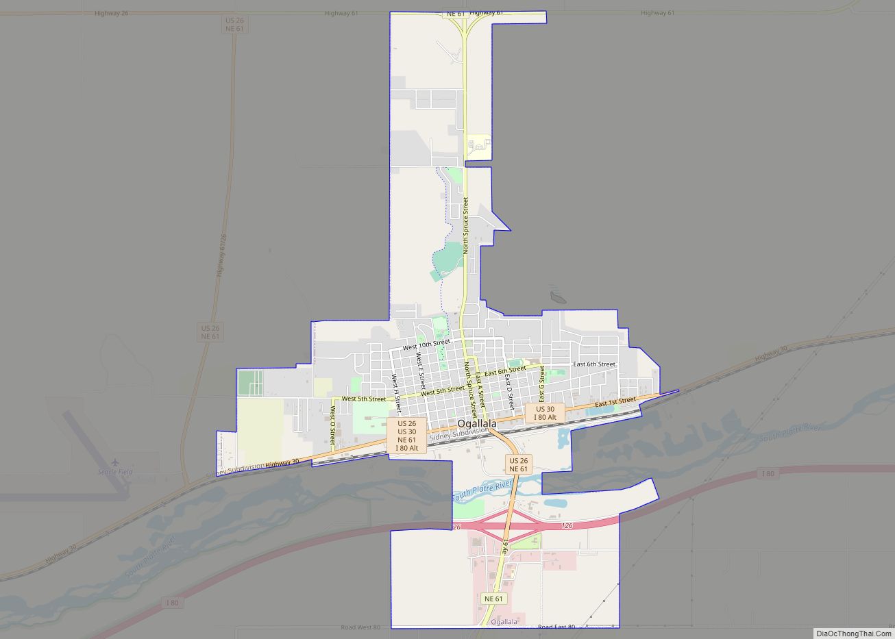
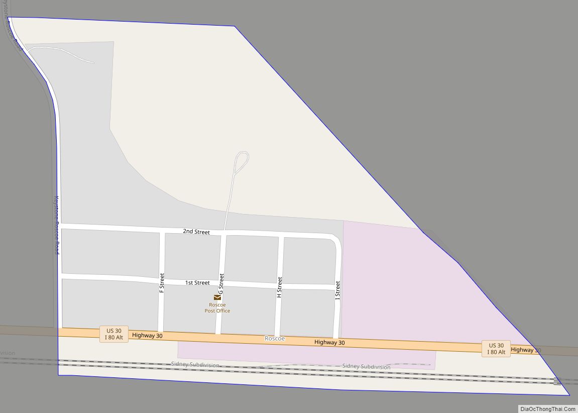
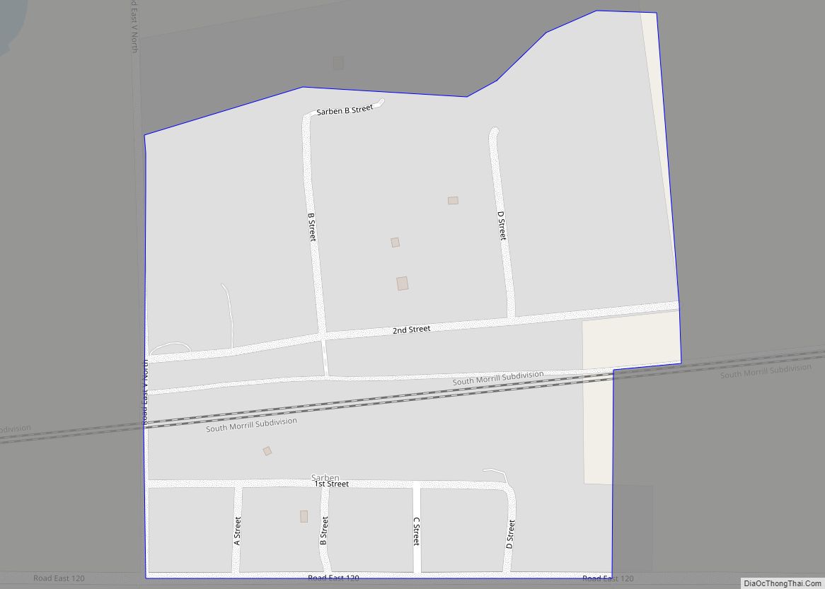
Online Interactive Map
Click on ![]() to view map in "full screen" mode.
to view map in "full screen" mode.
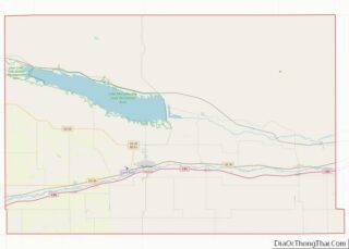
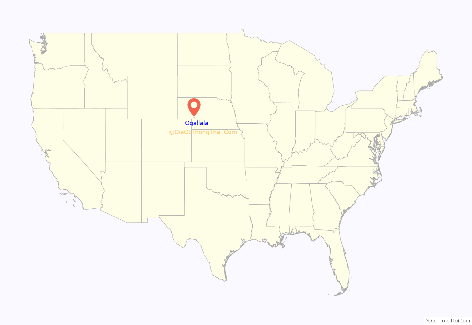
Ogallala location map. Where is Ogallala city?
History
Ogallala first gained fame as a terminus for cattle drives that traveled from Texas to the Union Pacific railhead located there. These trails are known as the Western or Great Western trails. The Union Pacific Railroad reached Ogallala on May 24, 1867. The city itself was not laid out until 1875 and not incorporated until 1884 The town’s name comes from the Oglala Sioux tribe.
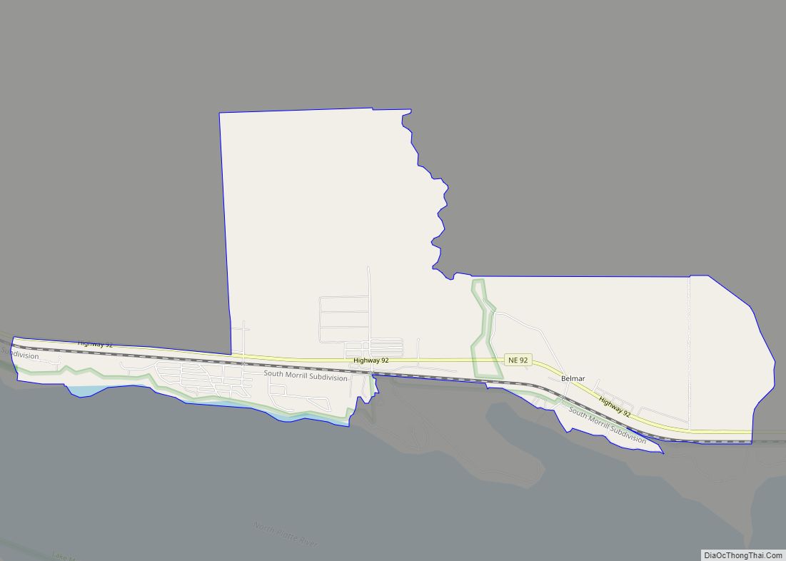
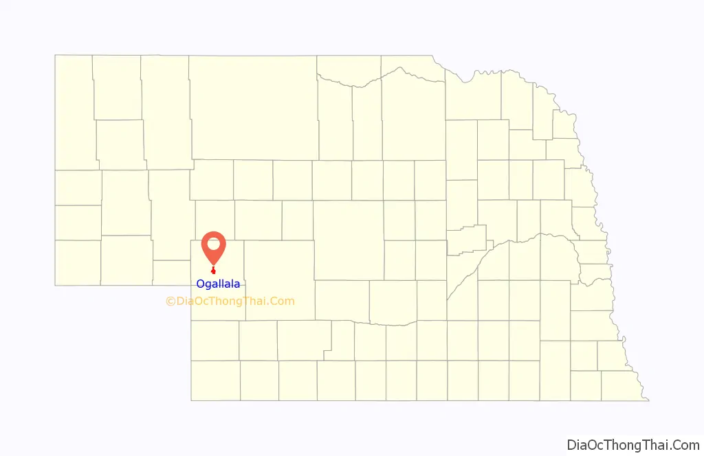
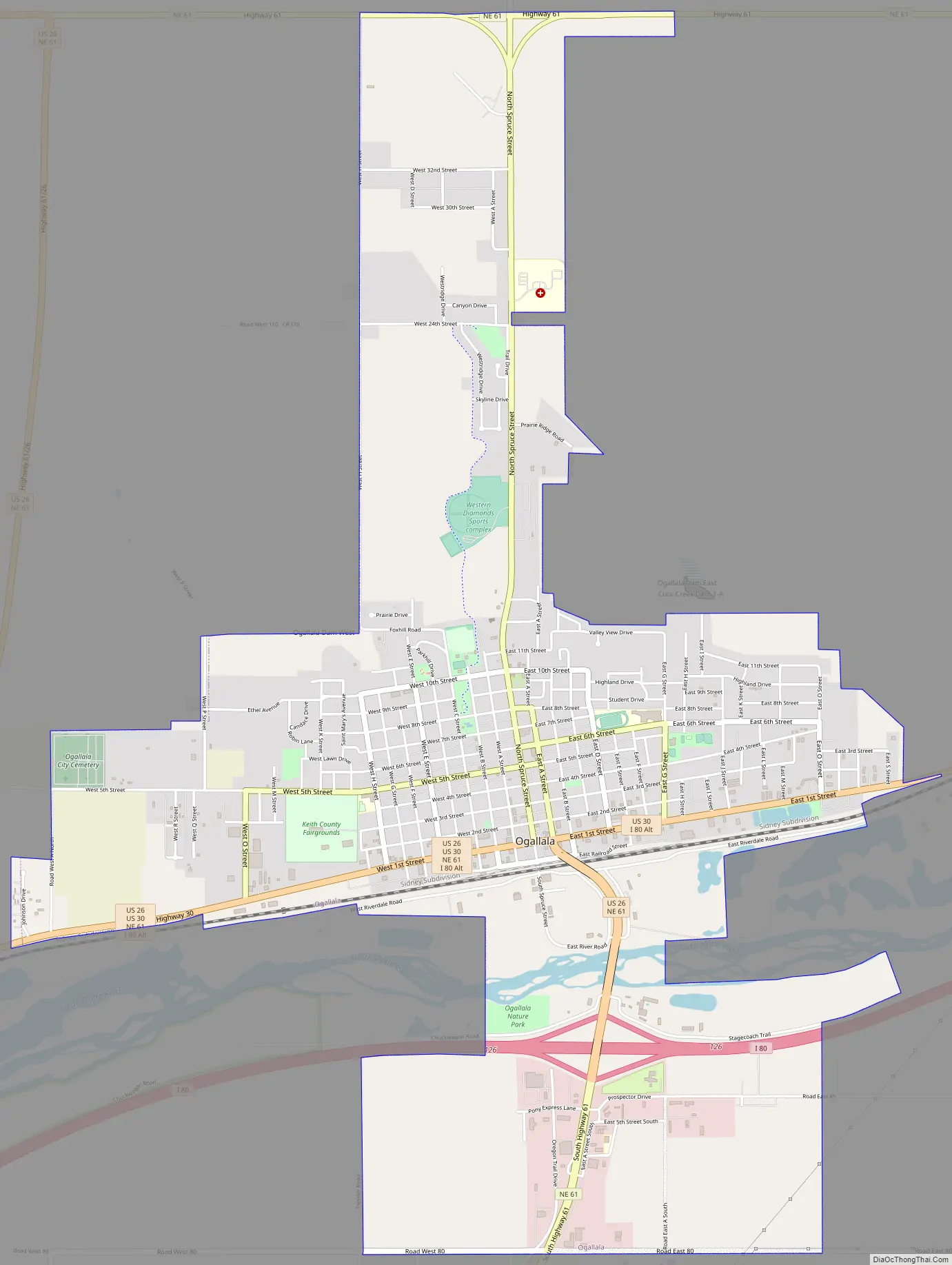
Ogallala Road Map
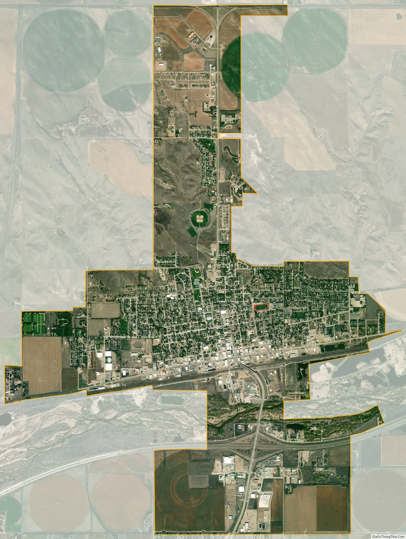
Ogallala city Satellite Map
Geography
Ogallala is located at 41°7′44″N 101°43′10″W / 41.12889°N 101.71944°W / 41.12889; -101.71944 (41.128806, −101.719460). According to the United States Census Bureau, the city has a total area of 5.02 square miles (13.00 km), of which 4.96 square miles (12.85 km) is land and 0.06 square miles (0.16 km) is water. Ogallala is in the US Mountain Time Zone (UTC−7/-6). Ogallala is close to Lake McConaughy, a large man-made lake and a state recreation area with sandy beaches, boating and swimming. The South Platte River runs through Ogallala.
See also
Map of Nebraska State and its subdivision:- Adams
- Antelope
- Arthur
- Banner
- Blaine
- Boone
- Box Butte
- Boyd
- Brown
- Buffalo
- Burt
- Butler
- Cass
- Cedar
- Chase
- Cherry
- Cheyenne
- Clay
- Colfax
- Cuming
- Custer
- Dakota
- Dawes
- Dawson
- Deuel
- Dixon
- Dodge
- Douglas
- Dundy
- Fillmore
- Franklin
- Frontier
- Furnas
- Gage
- Garden
- Garfield
- Gosper
- Grant
- Greeley
- Hall
- Hamilton
- Harlan
- Hayes
- Hitchcock
- Holt
- Hooker
- Howard
- Jefferson
- Johnson
- Kearney
- Keith
- Keya Paha
- Kimball
- Knox
- Lancaster
- Lincoln
- Logan
- Loup
- Madison
- McPherson
- Merrick
- Morrill
- Nance
- Nemaha
- Nuckolls
- Otoe
- Pawnee
- Perkins
- Phelps
- Pierce
- Platte
- Polk
- Red Willow
- Richardson
- Rock
- Saline
- Sarpy
- Saunders
- Scotts Bluff
- Seward
- Sheridan
- Sherman
- Sioux
- Stanton
- Thayer
- Thomas
- Thurston
- Valley
- Washington
- Wayne
- Webster
- Wheeler
- York
- Alabama
- Alaska
- Arizona
- Arkansas
- California
- Colorado
- Connecticut
- Delaware
- District of Columbia
- Florida
- Georgia
- Hawaii
- Idaho
- Illinois
- Indiana
- Iowa
- Kansas
- Kentucky
- Louisiana
- Maine
- Maryland
- Massachusetts
- Michigan
- Minnesota
- Mississippi
- Missouri
- Montana
- Nebraska
- Nevada
- New Hampshire
- New Jersey
- New Mexico
- New York
- North Carolina
- North Dakota
- Ohio
- Oklahoma
- Oregon
- Pennsylvania
- Rhode Island
- South Carolina
- South Dakota
- Tennessee
- Texas
- Utah
- Vermont
- Virginia
- Washington
- West Virginia
- Wisconsin
- Wyoming