Map of Unionville CDP, Nevada
Unionville is a small hamlet in Pershing County, Nevada, located south of I-80 and just west of State Route 400 on Unionville Road, with the most recent population estimate being approximately 20 people. The town’s best years were during the 1870s, when it was an active mining and prospecting town serving the surrounding hilly region. ... Read more
Map of Unionville CDP, Nevada
Map of Topaz Ranch Estates CDP
Topaz Ranch Estates is a census-designated place (CDP) in Douglas County, Nevada, United States. The population was 1,501 at the 2010 census. Topaz Ranch Estates CDP overview: Name: Topaz Ranch Estates CDP LSAD Code: 57 LSAD Description: CDP (suffix) State: Nevada County: Douglas County Elevation: 5,140 ft (1,570 m) Total Area: 14.39 sq mi (37.27 km²) Land Area: 14.39 sq mi (37.27 km²) ... Read more
Map of Topaz Ranch Estates CDP
Map of Topaz Lake CDP
Topaz Lake is a census-designated place (CDP) in Douglas County, Nevada, United States. The population was 157 at the 2010 census. Topaz Lake CDP overview: Name: Topaz Lake CDP LSAD Code: 57 LSAD Description: CDP (suffix) State: Nevada County: Douglas County Elevation: 5,059 ft (1,542 m) Total Area: 1.70 sq mi (4.39 km²) Land Area: 1.24 sq mi (3.21 km²) Water Area: 0.45 sq mi ... Read more
Map of Topaz Lake CDP
Map of Tonopah CDP, Nevada
Tonopah (/ˈtoʊnəˌpɑː/ TOHN-ə-pah, Shoshoni language: Tonampaa) is an unincorporated town in, and the county seat of, Nye County, Nevada, United States. Nicknamed the Queen of the Silver Camps for its mining-rich history, it is now primarily a tourism-based resort city, notable for attractions like the Mizpah Hotel and the Clown Motel. Tonopah is located at ... Read more
Map of Tonopah CDP, Nevada
Map of Sutcliffe CDP
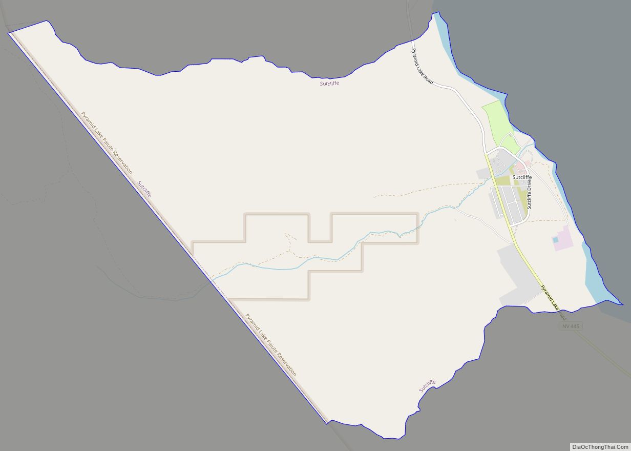
Sutcliffe is a census-designated place (CDP) in Washoe County, Nevada, United States. The population was 253 at the 2010 census. It is part of the Reno–Sparks Metropolitan Statistical Area. Sutcliffe CDP overview: Name: Sutcliffe CDP LSAD Code: 57 LSAD Description: CDP (suffix) State: Nevada County: Washoe County Elevation: 3,888 ft (1,185 m) Total Area: 9.99 sq mi (25.89 km²) Land ... Read more
Map of Sutcliffe CDP
Map of Sunrise Manor CDP
Sunrise Manor is a census-designated place in Clark County, Nevada, United States, located on the western base of Frenchman Mountain, east of Las Vegas. The population was 205,618 at the 2020 census. If Sunrise Manor were to be incorporated, it would be one of the largest cities in Nevada. Sunrise Manor was formed in May ... Read more
Map of Sunrise Manor CDP
Map of Sun Valley CDP, Nevada
Sun Valley is a census-designated place (CDP) in Washoe County, Nevada, United States. The population was 19,299 at the 2010 census. It is north of Reno and is part of the Reno–Sparks Metropolitan Statistical Area. Sun Valley CDP overview: Name: Sun Valley CDP LSAD Code: 57 LSAD Description: CDP (suffix) State: Nevada County: Washoe County ... Read more
Map of Sun Valley CDP, Nevada
Map of Summerlin South CDP
Summerlin South, also seen on maps as South Summerlin, is a census-designated place (CDP) in Clark County, Nevada, United States, on the western edge of the Las Vegas Valley and adjacent to the Red Rock Canyon National Conservation Area. It is so named because it is a southward extension of the master-planned community of Summerlin. ... Read more
Map of Summerlin South CDP
Map of Wells city, Nevada
Wells is a small city in Elko County, in northeast Nevada in the western United States. The Shoshone name for the area was Toyagadzu, meaning “The end of the set of mountains”. The population was 1,292 at the 2010 census. Wells is located at the junction of Interstate 80 and U.S. Route 93, approximately 50 ... Read more
Map of Wells city, Nevada
Map of Washoe Valley CDP
Washoe Valley is a census-designated place (CDP) in Washoe County, Nevada, United States. It corresponds closely to the unincorporated community of New Washoe City. The population was 3,019 at the 2010 census. It is part of the Reno–Sparks Metropolitan Statistical Area. The CDP takes its name from the Washoe Valley, a region between Reno and ... Read more
Map of Washoe Valley CDP
Map of Walker Lake CDP
Walker Lake is an unincorporated town and census-designated place in Mineral County, Nevada, United States. As of the 2010 census, the population of Walker Lake was 275. Walker Lake CDP overview: Name: Walker Lake CDP LSAD Code: 57 LSAD Description: CDP (suffix) State: Nevada County: Mineral County Total Area: 1.26 sq mi (3.27 km²) Land Area: 1.26 sq mi (3.27 km²) ... Read more
Map of Walker Lake CDP
Map of Wadsworth CDP, Nevada
Wadsworth is a census-designated place (CDP) in Washoe County, Nevada. The population was 834 at the time of the 2010 census. It is part of the Reno–Sparks Metropolitan Statistical Area and located entirely within the Pyramid Lake Indian Reservation. The town was named for General James S. Wadsworth, a Civil War general killed during the ... Read more
Map of Wadsworth CDP, Nevada