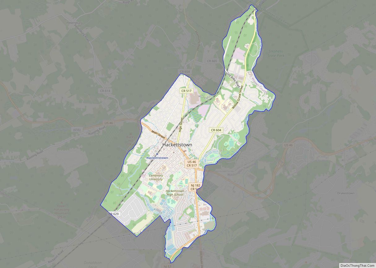
Groveville is an unincorporated community and census-designated place (CDP) located within Hamilton Township, in Mercer County, New Jersey, United States. As of the 2010 United States Census, the CDP’s population was 2,945. Before the 2010 Census, the area was part of the Yardville-Groville CDP. Groveville CDP overview: Name: Groveville CDP LSAD Code: 57 LSAD Description: ... Read more
New Jersey Cities and Places
Griggstown is an unincorporated community and census-designated place (CDP) located within Franklin Township, in Somerset County, New Jersey, United States. As of the 2010 United States Census, the CDP’s population was 819. The area was first settled around 1733. Griggstown CDP overview: Name: Griggstown CDP LSAD Code: 57 LSAD Description: CDP (suffix) State: New Jersey ... Read more
Greenwich is an unincorporated community and census-designated place (CDP) located within Greenwich Township in Warren County, New Jersey, United States, that was defined as part of the 2010 United States Census. As of the 2010 Census, the CDP’s population was 2,755. Greenwich CDP overview: Name: Greenwich CDP LSAD Code: 57 LSAD Description: CDP (suffix) State: ... Read more
Greentree is an unincorporated community and census-designated place (CDP) located within Cherry Hill Township, in Camden County, New Jersey, United States. As of the 2010 United States Census, the CDP’s population was 11,367. Greentree CDP overview: Name: Greentree CDP LSAD Code: 57 LSAD Description: CDP (suffix) State: New Jersey County: Camden County Elevation: 89 ft (27 m) ... Read more
Hamilton Square is an unincorporated community and census-designated place (CDP) located within Hamilton Township, in Mercer County, New Jersey, United States, that is the site of a historic colonial village. Until the 2000 Census the area was part of the Mercerville-Hamilton Square CDP, which was split into two CDPs as of 2010: Mercerville and Hamilton ... Read more
Hamburg is a borough in Sussex County, in the U.S. state of New Jersey. As of the 2020 United States census, the borough’s population was 3,266, a decrease of 11 (−0.3%) from the 2010 census count of 3,277, which in turn reflected an increase of 172 (+5.5%) from the 3,105 counted at the 2000 census. ... Read more
Haledon (/heɪldən/ HAIL-don) is a borough in Passaic County, in the U.S. state of New Jersey. As of the 2020 United States census, the borough’s population was 9,052, an increase of 734 (+8.8%) from the 2010 census count of 8,318, which in turn reflected an increase of 66 (+0.8%) from the 8,252 counted in the ... Read more
Harrison is a town in the western part of Hudson County in the U.S. state of New Jersey. It is part of the New York metropolitan area. It is a suburb of the nearby city of Newark, New Jersey, and is located 8 miles (13 km) from New York City. Once considered “the beehive of industry”, ... Read more
Harrington Park is a borough in Bergen County, in the U.S. state of New Jersey. As of the 2020 United States census, the borough’s population was 4,741, an increase of 77 (+1.7%) from the 2010 census count of 4,664, which in turn reflected a decrease of 76 (−1.6%) from the 4,740 counted in the 2000 ... Read more
Harmony is an unincorporated community and census-designated place (CDP) located within Harmony Township in Warren County, New Jersey, United States, that was defined as part of the 2010 United States Census. As of the 2010 Census, the CDP’s population was 441. Harmony CDP overview: Name: Harmony CDP LSAD Code: 57 LSAD Description: CDP (suffix) State: ... Read more
Harlingen is an unincorporated community and census-designated place (CDP) located within Montgomery Township, in Somerset County, New Jersey, United States. As of the 2010 United States Census, the CDP’s population was 297. It is adjacent to the historical areas of Dutchtown and Bridgepoint. Harlingen Road and U.S. Route 206 intersect in the center of Harlingen. ... Read more
Hancocks Bridge CDP overview: Name: Hancocks Bridge CDP LSAD Code: 57 LSAD Description: CDP (suffix) State: New Jersey County: Salem County FIPS code: 3429520 Online Interactive Map Hancocks Bridge online map. Source: Basemap layers from Google Map, Open Street Map (OSM), Arcgisonline, Wmflabs. Boundary Data from Database of Global Administrative Areas. Hancocks Bridge location map. ... Read more