The City of Hackensack is the most populous municipality and the county seat of Bergen County, in the U.S. state of New Jersey. The area was officially named New Barbadoes Township until 1921, but has informally been known as Hackensack since at least the 18th century. As of the 2020 United States census, the city’s population was 46,030, its highest decennial count ever and an increase of 3,020 (+7.0%) from the 2010 census count of 43,010, which in turn reflected an increase of 333 (+0.8%) from the 42,677 counted in the 2000 census.
An inner suburb of New York City, Hackensack is located approximately 12 miles (19 km) northwest of Midtown Manhattan and about 7 miles (11 km) from the George Washington Bridge. From a number of locations, including portions of Prospect Avenue, the New York City skyline can be seen.
The Metropolitan Campus of Fairleigh Dickinson University straddles the Hackensack River in both Hackensack and Teaneck. Hackensack is also the home of the former New Jersey Naval Museum and the World War II submarine USS Ling. Astronaut Wally Schirra is perhaps Hackensack’s most famous native son.
The city has diverse neighborhoods and land uses located close to one another. Within its borders are the Hackensack University Medical Center, a residential high-rise district about a mile long (along Prospect Avenue between Beech Street and Passaic Street), suburban neighborhoods of single-family houses, stately older homes on acre-plus lots, older two-family neighborhoods, large garden apartment complexes, industrial areas, the Bergen County Jail, a tidal river, Hackensack River County Park, Borg’s Woods Nature Preserve, various city parks, large office buildings, a major college campus, the Bergen County Court House, a vibrant small-city downtown district, and various small neighborhood business districts.
| Name: | Hackensack city |
|---|---|
| LSAD Code: | 25 |
| LSAD Description: | city (suffix) |
| State: | New Jersey |
| County: | Bergen County |
| Incorporated: | October 31, 1693 (as New Barbadoes Township) |
| Elevation: | 20 ft (6 m) |
| Total Area: | 4.35 sq mi (11.27 km²) |
| Land Area: | 4.19 sq mi (10.86 km²) |
| Water Area: | 0.16 sq mi (0.41 km²) 3.63% |
| Total Population: | 46,030 |
| Population Density: | 10,983.1/sq mi (4,240.6/km²) |
| ZIP code: | 07601 |
| Area code: | 201 |
| FIPS code: | 3428680 |
| GNISfeature ID: | 885236 |
| Website: | www.hackensack.org |
Online Interactive Map
Click on ![]() to view map in "full screen" mode.
to view map in "full screen" mode.
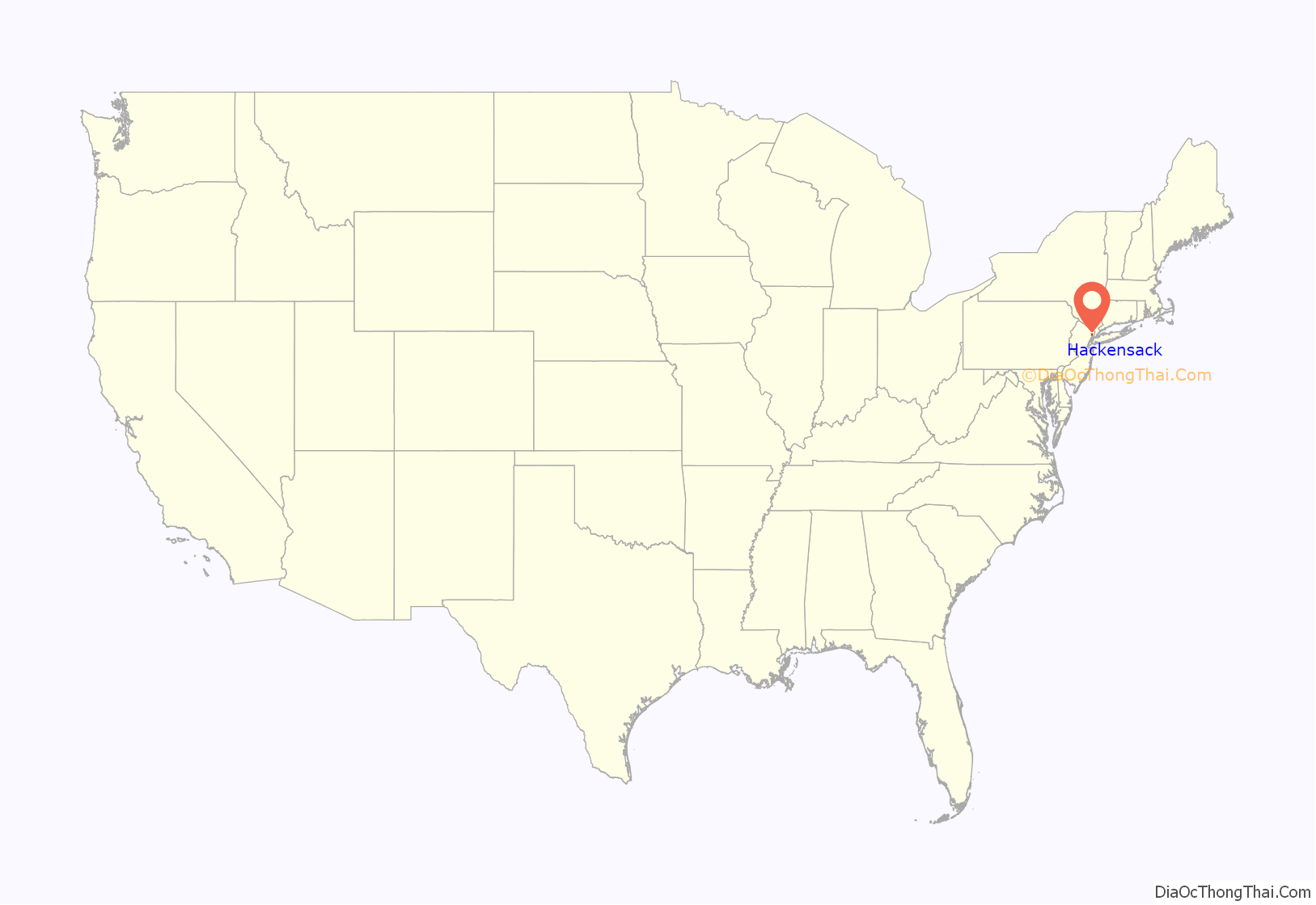
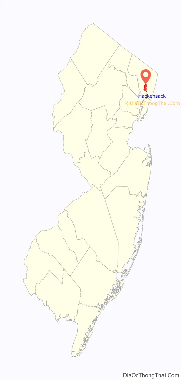
Hackensack location map. Where is Hackensack city?
History
The first inhabitants of the area were the Lenni Lenape, an Algonquian people who became known to settlers as ‘the Delaware Indians.’ They lived along a river they called Achinigeu-hach, or “Ackingsah-sack“, which translates to stony ground—today this river is more commonly known by the name ‘the Hackensack River.’ A representation of Chief Oratam of the Achkinhenhcky appears on the Hackensack municipal seal. The most common explanation is that the city was named for the Native American tribe, though other sources attribute it to a Native American word variously translated as meaning “hook mouth”, “stream that unites with another on low ground”, “on low ground” or “land of the big snake”, while another version described as “more colorful than probable” attributes the name to an inn called the “Hock and Sack”.
Settlement by the Dutch West India Company in New Netherland on the west banks of the Hudson River across from New Amsterdam (present-day lower Manhattan) began in the 1630s at Pavonia, eventually leading to the establishment of Bergen (at today’s Bergen Square in Jersey City) in 1660.
Oratam, sachem of the Lenni Lenape, deeded the land along mid-Hackensack River to the Dutch in 1665. The area was soon taken by the English in 1667, but kept its Dutch name. Philip Cartaret, governor of what became the proprietary colony of East Jersey granted land to Captain John Berry in the area of Achter Kol and soon after took up residence and called it “New Barbadoes,” after having resided on the island of Barbados. In 1666, a deed was confirmed for the 2,260-acre (9.1 km) tract that had been given earlier by Oratem to Sarah Kiersted in gratitude for her work as emissary and interpreter. Other grants were given at the English Neighborhood.
In 1675, the East Jersey Legislature established the administrative districts Bergen, Essex, Middlesex, and Monmouth. In 1683, Bergen (along with the three other counties) was officially recognized as an independent county by the Provincial Assembly. The seal of Bergen County bearing this date includes an image of an agreement between the settlers and the natives.
New Barbadoes Township, together with Acquackanonk Township, were formed by Royal charter on October 31, 1693.
In 1700, the village of Hackensack was little more than the area around Main Street from the Courthouse to around Anderson Street. New Barbadoes Township included what is now Maywood, Rochelle Park, Paramus and River Edge, along with those portions of Oradell that are west of the Hackensack River. These areas were all sparsely populated and consisted of farm fields, woods and swamplands. The few roads that existed then included the streets now known as Kinderkamack Road, Paramus Road/Passaic Street and Essex Street. The southernmost portions of what is now Hackensack were not part of New Barbadoes Township at that time and were acquired in the late 1800s.
The neighborhood that came to be known as the village of Hackensack (today the area encompassing Bergen County’s municipal buildings in Hackensack) was a part of Essex County until 1710, when Bergen County, by royal decree of Queen Anne of Great Britain, was enlarged and the Township of New Barbadoes was removed from Essex County and added to Bergen County.
In 1710, the village of Hackensack (in the newly formed Township of New Barbadoes) was designated as being more centrally located and more easily reached by the majority of the Bergen County’s inhabitants and, hence, was chosen as the county seat of Bergen County, as it remains today. The earliest records of the Bergen County Board of Chosen Freeholders date back to 1715, at which time agreement was made to build a courthouse and jail complex, which was completed in 1716.
During the American Revolutionary War, George Washington headquartered in the village of Hackensack in November 1776 during the retreat from Fort Lee via New Bridge Landing and camped on ‘The Green’ across from the First Dutch Reformed Church on November 20, 1776. A raid by British forces against Hackensack on March 23, 1780, resulted in the destruction by fire of the original courthouse structure.
The Hackensack Improvement Commission was incorporated by an Act of the state legislature approved on April 1, 1868, within New Barbadoes township and including the village of Hackensack, with authority to develop sewers and other improvements in Hackensack.
The New Jersey Legislature passed the Township School Act in 1894, under which each village, borough, town, or city in New Jersey was delegated responsibility for its own public schools through the office of the county superintendent. Hackensack established a local board of education in 1894, as required by the new law, which took over operation of schools located in the township and established Hackensack High School. The 1894 act allowed local residents, by petition, to change municipal boundaries at will, setting off fearsome political battles statewide.
Portions of the township had been taken to form Harrington Township (June 22, 1775), Lodi Township (March 1, 1826), Midland Township (March 7, 1871) and Little Ferry (September 20, 1894). After these departures, secessions, and de-annexations, all that was left of New Barbadoes Township was the village of Hackensack and its surrounding neighborhoods of Fairmount, Red Hill and Cherry Hill. In 1896, New Barbadoes acquired a portion of Lodi Township covering an area south of Essex Street from the bend of Essex Street to the Maywood border. That same year the Hackensack Improvement commission was abolished and the City of Hackensack and New Barbadoes Township became coterminous.
The final parcel lost by New Barbadoes Township was the northeastern corner of what is now Little Ferry, which was incorporated in September 1894.
An act of the State Legislature incorporated the Fairmount section of New Barbadoes with the Hackensack Improvement Commission, and eliminated New Barbadoes Township as a political entity. On November 21, 1921, based on the results of a referendum held on November 8, 1921, New Barbadoes Township received its charter to incorporate as a city and officially took on its name “Hackensack,” a name derived from its original inhabitants, the Lenni Lenape, who named it “Ackingsah-sack“.
In 1933, Hackensack adopted the Manager form of government under the terms of the 1923 Municipal Manager Law, with five Council persons all elected at-large and a mayor selected by the council from among its members.
The Sears location on Main Street, which opened on October 27, 1932, and was the last freestanding Sears in the state of New Jersey, closed on September 12, 2020.
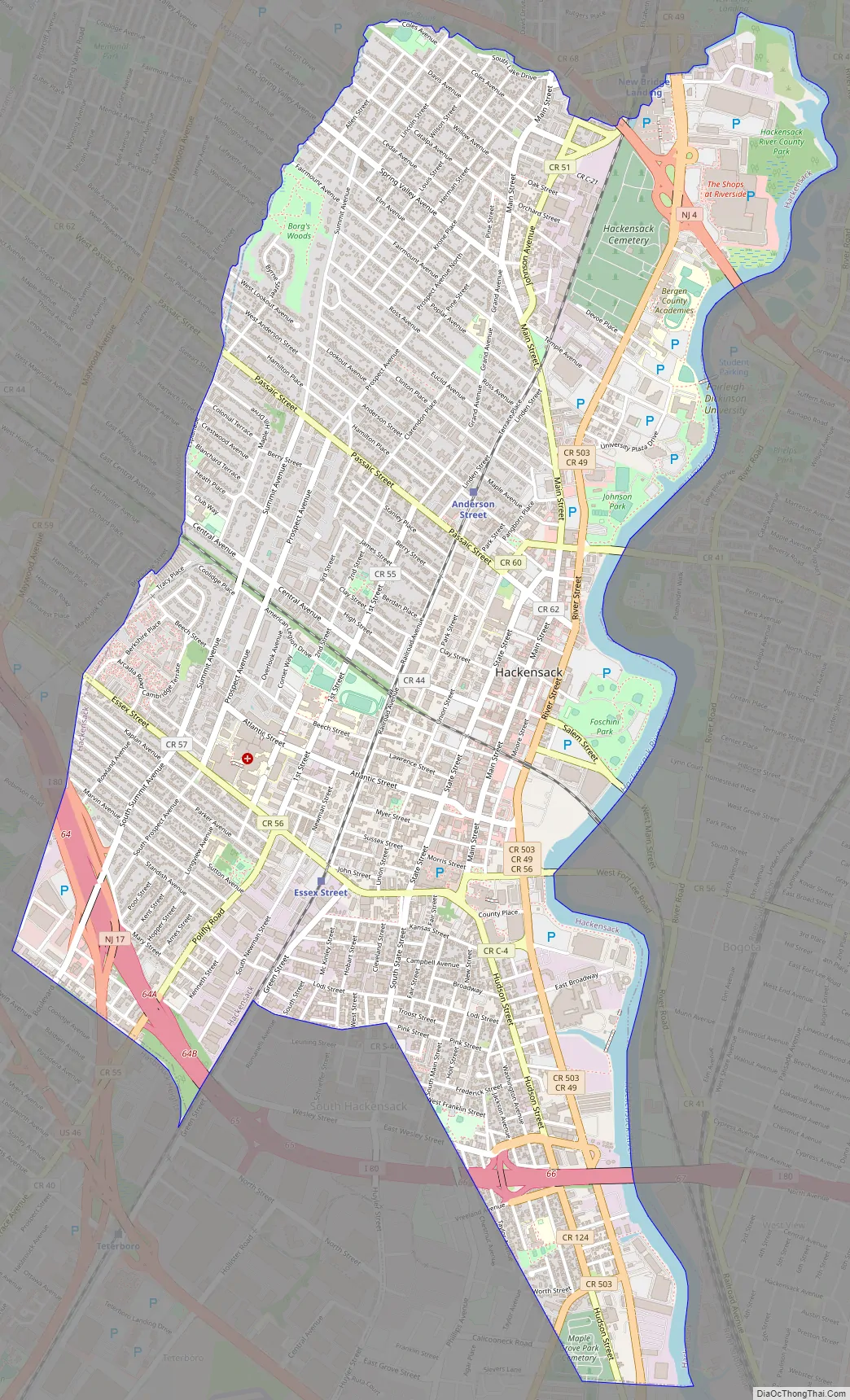
Hackensack Road Map
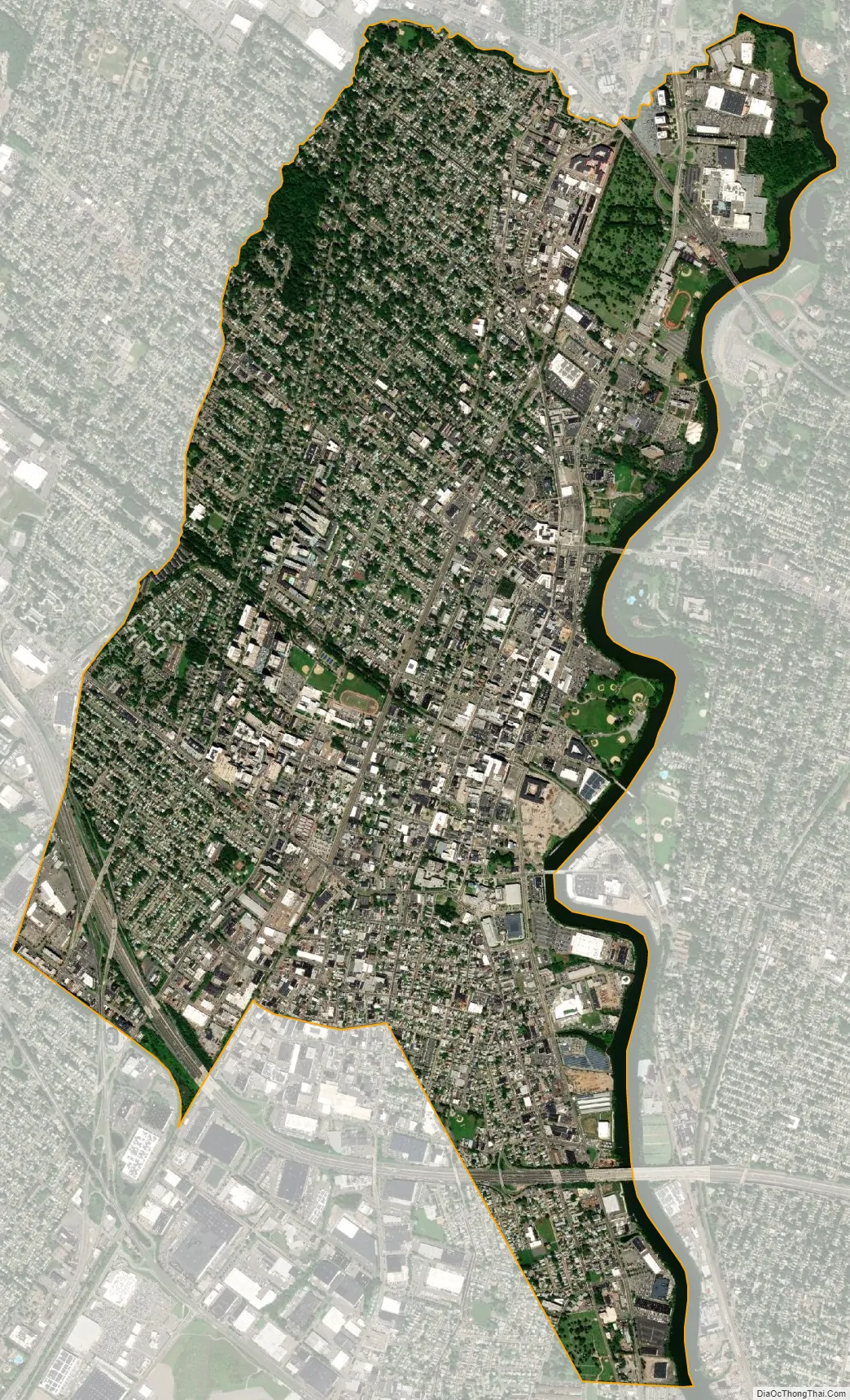
Hackensack city Satellite Map
Geography
According to the United States Census Bureau, the city had a total area of 4.35 square miles (11.27 km), including 4.19 square miles (10.86 km) of land and 0.16 square miles (0.41 km) of water (3.63%).
The city is bordered by the Bergen County municipalities of Bogota, Hasbrouck Heights, Little Ferry, Lodi, Maywood, Paramus, Ridgefield Park, River Edge, South Hackensack, Teaneck and Teterboro.
There are many houses of historic value, and some of these were identified in the 1990 Master Plan. The city does not have any registered historic districts, or any restrictions on preserving the historic facade in any portions of the city. Areas considered suburban single-family residential neighborhoods account for about one-third of the city’s area, mostly along its western side.
Unincorporated communities, localities and place names located partially or completely within the city include Fairmount and North Hackensack.
See also
Map of New Jersey State and its subdivision: Map of other states:- Alabama
- Alaska
- Arizona
- Arkansas
- California
- Colorado
- Connecticut
- Delaware
- District of Columbia
- Florida
- Georgia
- Hawaii
- Idaho
- Illinois
- Indiana
- Iowa
- Kansas
- Kentucky
- Louisiana
- Maine
- Maryland
- Massachusetts
- Michigan
- Minnesota
- Mississippi
- Missouri
- Montana
- Nebraska
- Nevada
- New Hampshire
- New Jersey
- New Mexico
- New York
- North Carolina
- North Dakota
- Ohio
- Oklahoma
- Oregon
- Pennsylvania
- Rhode Island
- South Carolina
- South Dakota
- Tennessee
- Texas
- Utah
- Vermont
- Virginia
- Washington
- West Virginia
- Wisconsin
- Wyoming


