Lavallette is a borough situated on the Jersey Shore, in Ocean County, New Jersey, United States. As of the 2020 United States census, the borough’s population was 1,787, a decrease of 88 (−4.7%) from the 2010 census count of 1,875, which in turn had reflected a decline of 790 (−29.6%) from the 2,665 counted at the 2000 census. Lavallette is situated on the Barnegat Peninsula, a long, narrow barrier peninsula that separates Barnegat Bay from the Atlantic Ocean.
| Name: | Lavallette borough |
|---|---|
| LSAD Code: | 21 |
| LSAD Description: | borough (suffix) |
| State: | New Jersey |
| County: | Ocean County |
| Incorporated: | December 21, 1887 |
| Elevation: | 3 ft (0.9 m) |
| Total Area: | 0.96 sq mi (2.50 km²) |
| Land Area: | 0.82 sq mi (2.11 km²) |
| Water Area: | 0.15 sq mi (0.38 km²) 15.42% |
| Total Population: | 1,787 |
| Population Density: | 2,190.2/sq mi (845.6/km²) |
| ZIP code: | 08735 |
| Area code: | 732 Exchanges: 793, 830, 854 |
| FIPS code: | 3439390 |
| GNISfeature ID: | 885273 |
| Website: | www.lavallette.org |
Online Interactive Map
Click on ![]() to view map in "full screen" mode.
to view map in "full screen" mode.
Lavallette location map. Where is Lavallette borough?


History
Lavallette was incorporated as a borough by an act of the New Jersey Legislature on December 21, 1887, from portions of Dover Township (now Toms River Township), based on the results of a referendum held two days earlier.
Lavallette was named for Elie A. F. La Vallette, one of the first rear admirals appointed in the United States Navy when President Abraham Lincoln created the rank in July 1862, and the father of Albert T. Lavallette, co-founder of the borough.
New Jersey Monthly magazine ranked Lavallette as its 8th best place to live in its 2008 rankings of the “Best Places To Live” in New Jersey.
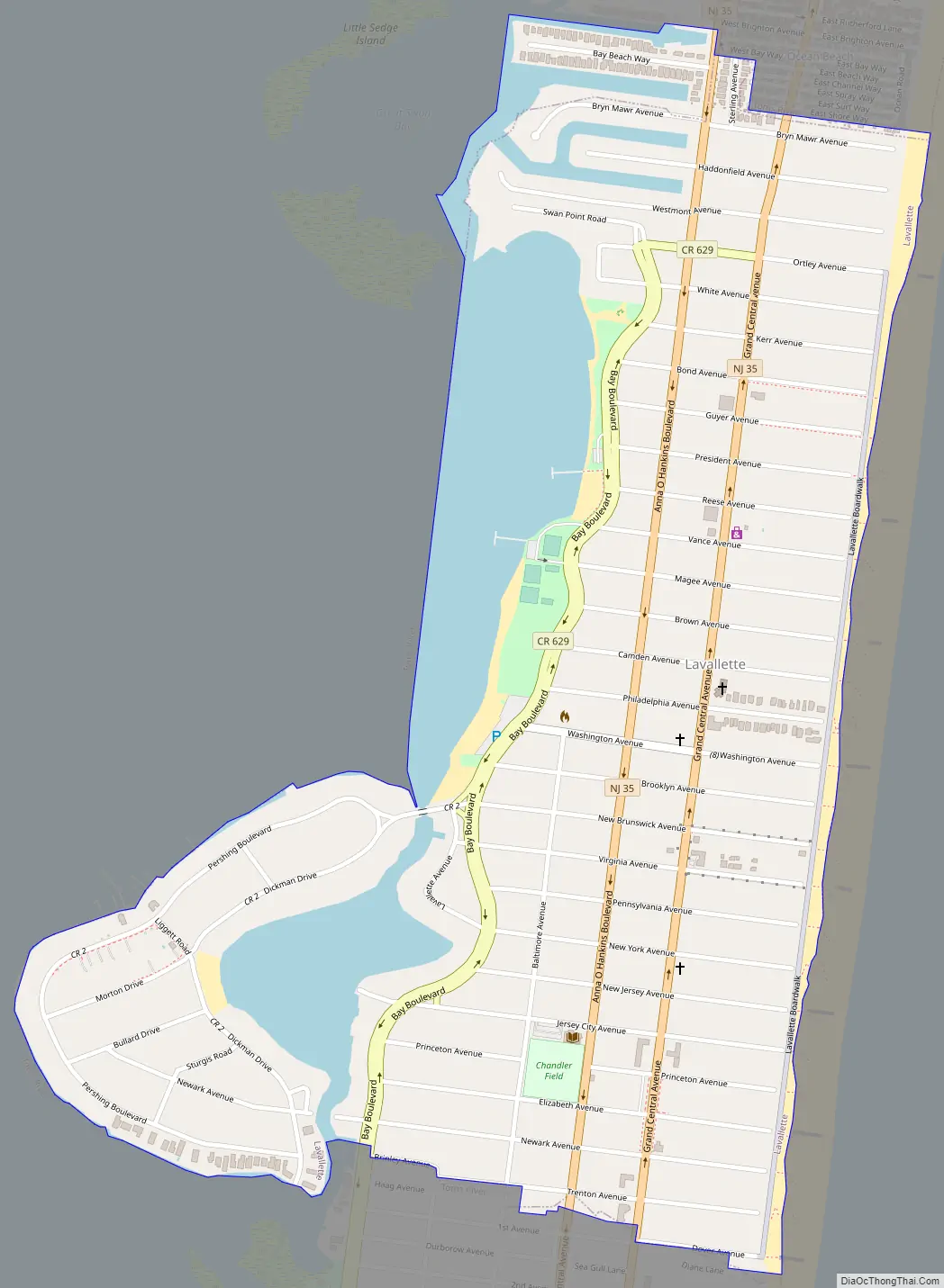
Lavallette Road Map
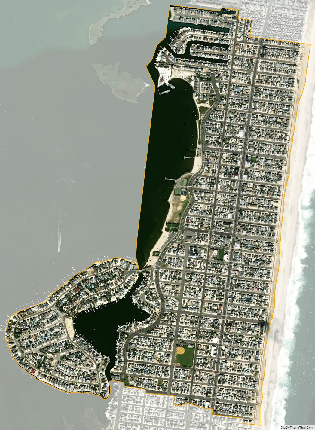
Lavallette city Satellite Map
Geography
According to the United States Census Bureau, the borough had a total area of 0.96 square miles (2.50 km), including 0.82 square miles (2.11 km) of land and 0.15 square miles (0.38 km) of water (15.42%).
The borough borders the Ocean County municipality of Toms River Township.
See also
Map of New Jersey State and its subdivision: Map of other states:- Alabama
- Alaska
- Arizona
- Arkansas
- California
- Colorado
- Connecticut
- Delaware
- District of Columbia
- Florida
- Georgia
- Hawaii
- Idaho
- Illinois
- Indiana
- Iowa
- Kansas
- Kentucky
- Louisiana
- Maine
- Maryland
- Massachusetts
- Michigan
- Minnesota
- Mississippi
- Missouri
- Montana
- Nebraska
- Nevada
- New Hampshire
- New Jersey
- New Mexico
- New York
- North Carolina
- North Dakota
- Ohio
- Oklahoma
- Oregon
- Pennsylvania
- Rhode Island
- South Carolina
- South Dakota
- Tennessee
- Texas
- Utah
- Vermont
- Virginia
- Washington
- West Virginia
- Wisconsin
- Wyoming


