Keyport is a borough in northern Monmouth County, in the U.S. state of New Jersey. A waterfront community located on the Raritan Bay in the Raritan Valley region, the borough is a commuter town of New York City in the New York metropolitan area. As of the 2020 United States census, the borough’s population was 7,204, a decrease of 36 (−0.5%) from the 2010 census count of 7,240, which in turn reflected reflected a decline of 328 (−4.3%) from the 7,568 counted in the 2000 census. Keyport’s nickname is the “Pearl of the Bayshore” or the “Gateway to the Bayshore”.
Keyport was originally formed as a Town on March 17, 1870, from portions of Raritan Township (now Hazlet). On April 2, 1908, the Borough of Keyport was formed, replacing Keyport Town.
Keyport is part of the Bayshore Regional Strategic Plan, an effort by nine municipalities in northern Monmouth County to reinvigorate the area’s economy by emphasizing the traditional downtowns, dense residential neighborhoods, maritime history, and the natural Raritan Bayshore coastline.
| Name: | Keyport borough |
|---|---|
| LSAD Code: | 21 |
| LSAD Description: | borough (suffix) |
| State: | New Jersey |
| County: | Monmouth County |
| Incorporated: | April 2, 1908 |
| Elevation: | 26 ft (8 m) |
| Total Area: | 1.46 sq mi (3.77 km²) |
| Land Area: | 1.38 sq mi (3.58 km²) |
| Water Area: | 0.07 sq mi (0.19 km²) 5.07% |
| Total Population: | 7,204 |
| Population Density: | 5,215.5/sq mi (2,013.7/km²) |
| ZIP code: | 07735 |
| Area code: | 732 |
| FIPS code: | 3436810 |
| GNISfeature ID: | 0885268 |
| Website: | www.keyportonline.com |
Online Interactive Map
Click on ![]() to view map in "full screen" mode.
to view map in "full screen" mode.
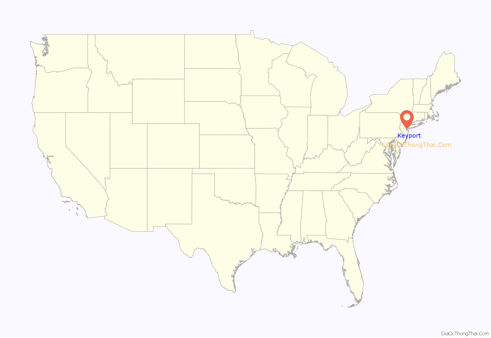
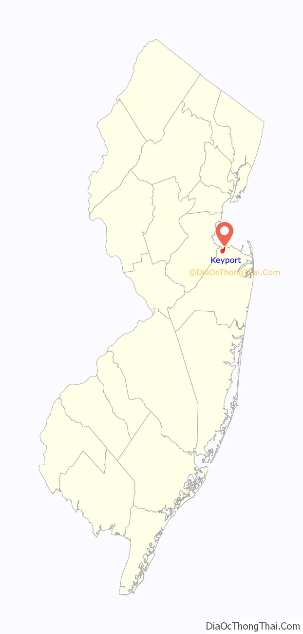
Keyport location map. Where is Keyport borough?
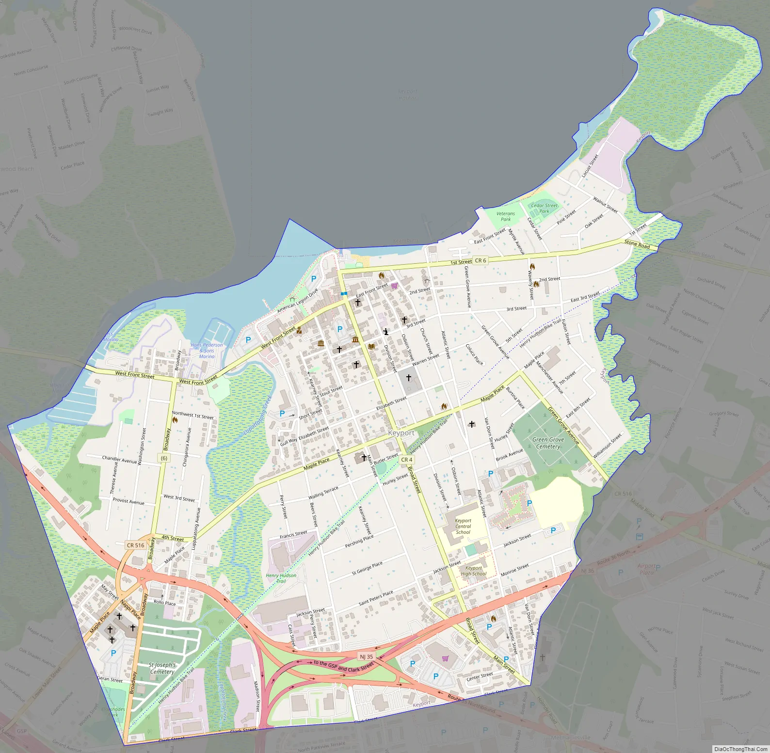
Keyport Road Map
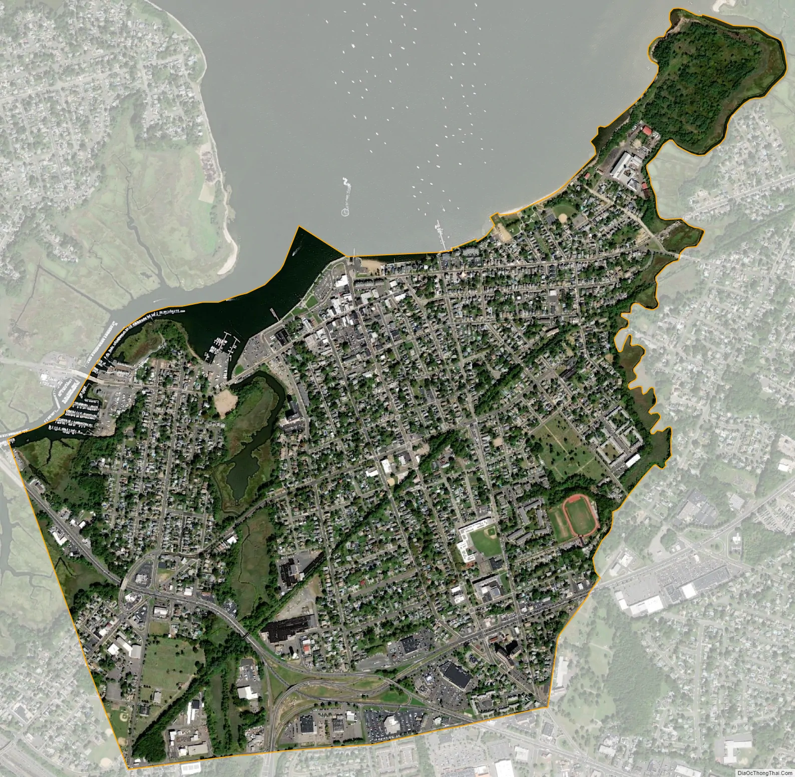
Keyport city Satellite Map
Geography
According to the United States Census Bureau, the borough had a total area of 1.46 square miles (3.77 km), including 1.38 square miles (3.58 km) of land and 0.07 square miles (0.19 km) of water (5.07%).
The borough borders the boroughs of Keansburg (via a maritime boundary) and Union Beach, and the townships of Aberdeen and Hazlet to the northeast, southwest and southeast respectively.
See also
Map of New Jersey State and its subdivision: Map of other states:- Alabama
- Alaska
- Arizona
- Arkansas
- California
- Colorado
- Connecticut
- Delaware
- District of Columbia
- Florida
- Georgia
- Hawaii
- Idaho
- Illinois
- Indiana
- Iowa
- Kansas
- Kentucky
- Louisiana
- Maine
- Maryland
- Massachusetts
- Michigan
- Minnesota
- Mississippi
- Missouri
- Montana
- Nebraska
- Nevada
- New Hampshire
- New Jersey
- New Mexico
- New York
- North Carolina
- North Dakota
- Ohio
- Oklahoma
- Oregon
- Pennsylvania
- Rhode Island
- South Carolina
- South Dakota
- Tennessee
- Texas
- Utah
- Vermont
- Virginia
- Washington
- West Virginia
- Wisconsin
- Wyoming


