Map of Olivet CDP, New Jersey
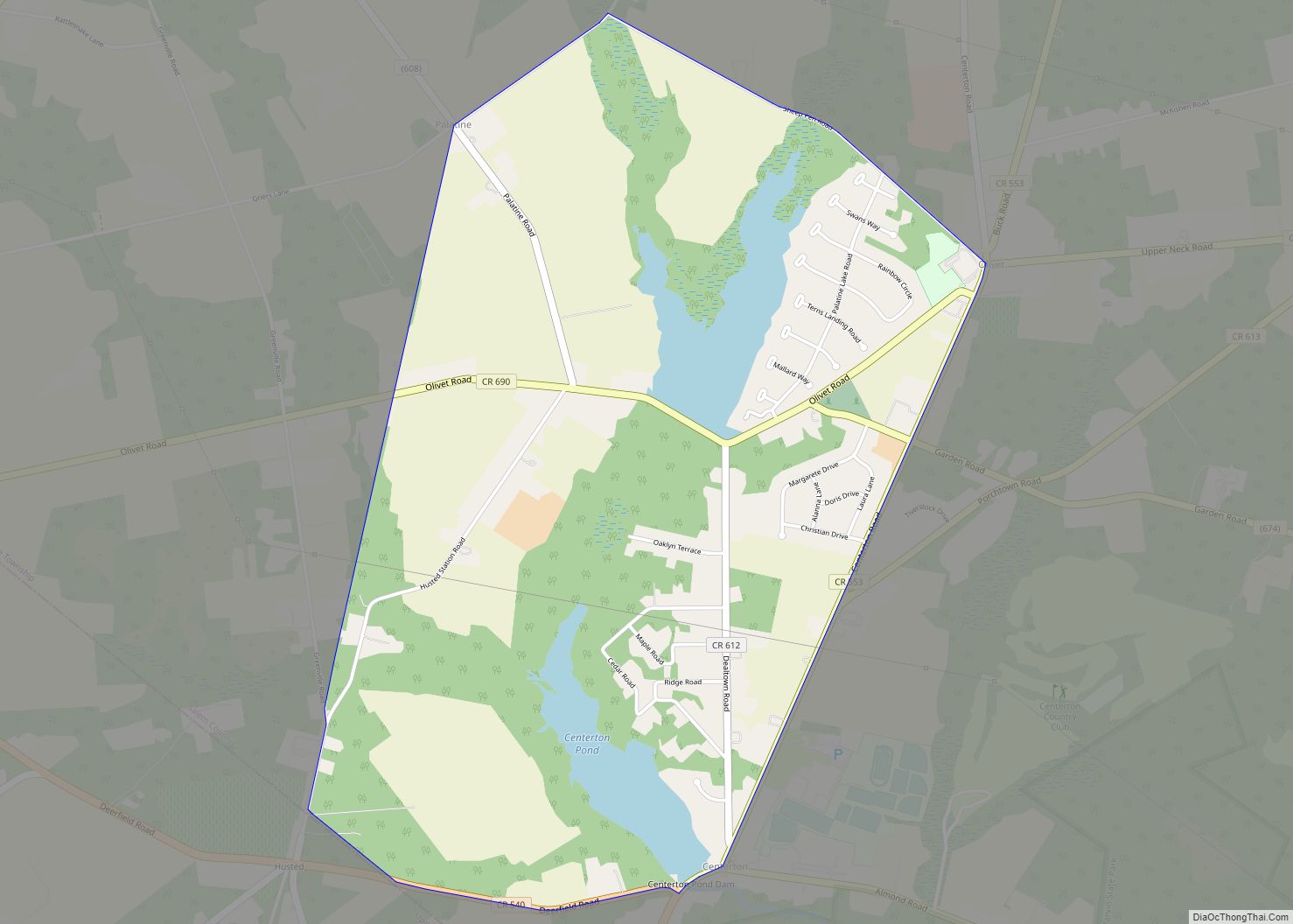
Olivet is an unincorporated community and census-designated place (CDP) located within Pittsgrove Township, in Salem County, New Jersey, United States. As of the 2010 United States Census, the CDP’s population was 1,408. Olivet CDP overview: Name: Olivet CDP LSAD Code: 57 LSAD Description: CDP (suffix) State: New Jersey County: Salem County Elevation: 82 ft (25 m) Total ... Read more
Map of Olivet CDP, New Jersey
Map of Old Tappan borough
Old Tappan (/oʊld təˈpæn/ tə-PAN) is a borough in northern Bergen County, in the U.S. state of New Jersey. As of the 2020 United States census, the borough’s population was 5,888, an increase of 138 (+2.4%) from the 2010 census count of 5,750, which in turn reflected an increase of 268 (+4.9%) from the 5,482 ... Read more
Map of Old Tappan borough
Map of Old Bridge CDP
Old Bridge is a census-designated place (CDP) in Old Bridge Township, in Middlesex County, New Jersey, United States. As of the 2010 United States Census, the CDP’s population was 23,753. Despite the similarity in the name of the CDP and the township, the two are not one and the same, as had been the case ... Read more
Map of Old Bridge CDP
Map of Ogdensburg borough, New Jersey
Ogdensburg is a borough in Sussex County, in the U.S. state of New Jersey. As of the 2020 United States census, the borough’s population was 2,258, a decrease of 152 (−6.3%) from the 2010 census count of 2,410, which in turn reflected a decline of 228 (−8.6%) from the 2,638 counted at the 2000 census. ... Read more
Map of Ogdensburg borough, New Jersey
Map of Oceanport borough
Oceanport is a borough situated in the Jersey Shore region, within Monmouth County, in the U.S. state of New Jersey. As of the 2020 United States census, the borough’s population was 6,150, an increase of 318 (+5.5%) from the 2010 census count of 5,832, which in turn reflected an increase of 25 (+0.4%) from the ... Read more
Map of Oceanport borough
Map of Ocean Grove CDP, New Jersey
Ocean Grove is an unincorporated community and census-designated place (CDP) that is part of Neptune Township, in Monmouth County, in the U.S. state of New Jersey. It had a population of 3,057 at the 2020 United States census. It is located on the Atlantic Ocean’s Jersey Shore, between Asbury Park to the north and Bradley ... Read more
Map of Ocean Grove CDP, New Jersey
Map of Ocean Gate borough
Ocean Gate is a borough in Ocean County, in the U.S. state of New Jersey. As of the 2020 United States census, the borough’s population was 1,932, a decrease of 79 (−3.9%) from the 2010 census count of 2,011, which in turn reflected a decline of 65 (−3.1%) from the 2,076 counted in the 2000 ... Read more
Map of Ocean Gate borough
Map of Ocean City, New Jersey
Ocean City is a city in Cape May County, in the U.S. state of New Jersey. It is the principal city of the Ocean City metropolitan statistical area, which encompasses all of Cape May County, and is part of the Philadelphia–Wilmington–Camden, PA-NJ-DE–MD combined statistical area, also known as the Delaware Valley or Philadelphia metropolitan area. ... Read more
Map of Ocean City, New Jersey
Map of Park Ridge borough, New Jersey
Park Ridge is a borough in Bergen County, in the U.S. state of New Jersey. As of the 2020 United States census, the borough’s population was 8,883, an increase of 238 (+2.8%) from the 2010 census count of 8,645, which in turn reflected a decline of 63 (−0.7%) from the 8,708 counted in the 2000 ... Read more
Map of Park Ridge borough, New Jersey
Map of Paramus borough
Paramus (/pəˈræməs/ pə-RAM-əs) is a borough in the central portion of Bergen County, in the U.S. state of New Jersey. A suburban bedroom community of New York City, Paramus is located 15 to 20 miles (24 to 32 km) northwest of Midtown Manhattan and approximately 8 miles (13 km) west of Upper Manhattan. The Wall Street Journal ... Read more
Map of Paramus borough
Map of Panther Valley CDP
Panther Valley is an unincorporated community and census-designated place (CDP) located within Allamuchy Township, in Warren County, New Jersey, United States. As of the 2010 United States Census, the CDP’s population was 3,327. As of the 2000 United States Census, the area of the current CDP was part of the Allamuchy-Panther Valley CDP, which had ... Read more
Map of Panther Valley CDP
Map of Palmyra borough, New Jersey
Palmyra is a borough in Burlington County, in the U.S. state of New Jersey. As of the 2020 United States census, the borough’s population was 7,438, an increase of 40 (+0.5%) from the 2010 census count of 7,398, which in turn reflected an increase of 307 (+4.3%) from the 7,091 counted in the 2000 census, ... Read more
Map of Palmyra borough, New Jersey