Ocean City is a city in Cape May County, in the U.S. state of New Jersey. It is the principal city of the Ocean City metropolitan statistical area, which encompasses all of Cape May County, and is part of the Philadelphia–Wilmington–Camden, PA-NJ-DE–MD combined statistical area, also known as the Delaware Valley or Philadelphia metropolitan area. It is part of the South Jersey region of the state.
As of the 2020 United States census, the city’s population was 11,229, a decrease of 472 (−4.0%) from the 2010 census count of 11,701, which in turn reflected a decline of 3,677 (−23.9%) from the 15,378 counted in the 2000 census. In summer months, with an influx of tourists and second homeowners, there are estimated to be 115,000 to 130,000 within the city’s borders.
Ocean City originated as a borough by an act of the New Jersey Legislature on May 3, 1884, from portions of Upper Township, based on results from a referendum on April 30, 1884, and was reincorporated as a borough on March 31, 1890. Ocean City was incorporated as a city, its current government form, on March 25, 1897. The city is named for its location on the Atlantic Ocean.
Known as a family-oriented seaside resort, Ocean City has not allowed the sale of alcoholic beverages within its limits since its founding in 1879, offering miles of guarded beaches, a boardwalk that stretches for 2.5 miles (4.0 km), and a downtown shopping and dining district.
Travel Channel rated Ocean City as the Best Family Beach of 2005. It was ranked the third-best beach in New Jersey in the 2008 Top 10 Beaches Contest sponsored by the New Jersey Marine Sciences Consortium. In the 2009 Top 10 Beaches Contest sponsored by NJ.com, Ocean City ranked first.
| Name: | Ocean City city |
|---|---|
| LSAD Code: | 25 |
| LSAD Description: | city (suffix) |
| State: | New Jersey |
| County: | Cape May County |
| Incorporated: | May 3, 1884 (as borough) |
| Elevation: | 7 ft (2 m) |
| Total Area: | 11.55 sq mi (29.93 km²) |
| Land Area: | 6.75 sq mi (17.49 km²) |
| Water Area: | 4.80 sq mi (12.44 km²) 41.87% |
| Total Population: | 11,229 |
| Population Density: | 1,662.8/sq mi (642.0/km²) |
| ZIP code: | 08226 |
| Area code: | 609 Exchanges: 391, 398, 399, 525, 814 |
| FIPS code: | 3454360 |
| GNISfeature ID: | 0885332 |
| Website: | www.ocnj.us |
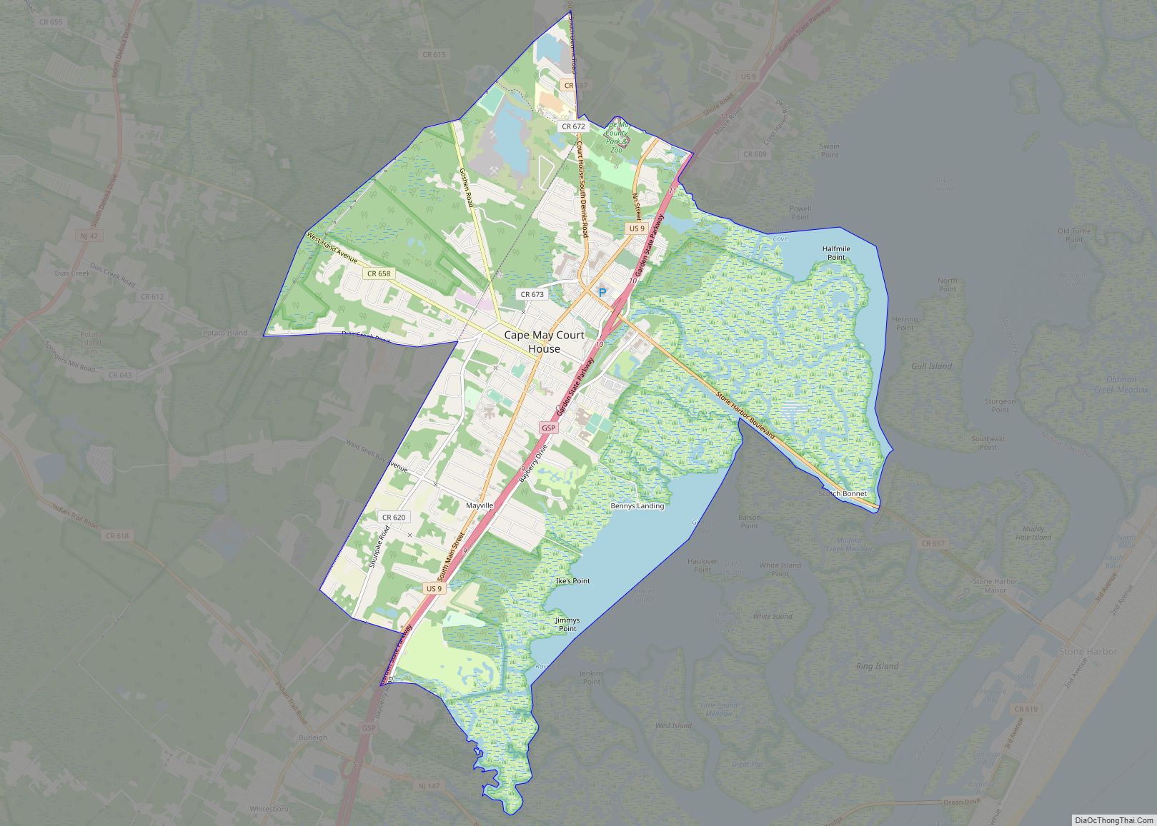
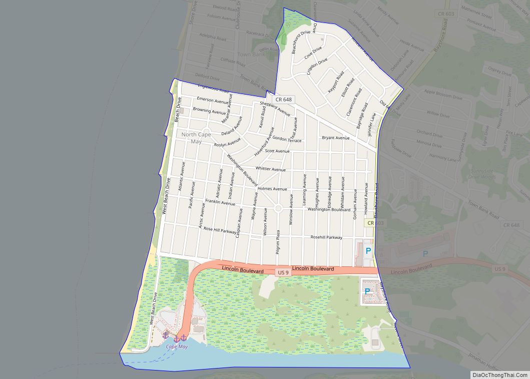
Online Interactive Map
Click on ![]() to view map in "full screen" mode.
to view map in "full screen" mode.
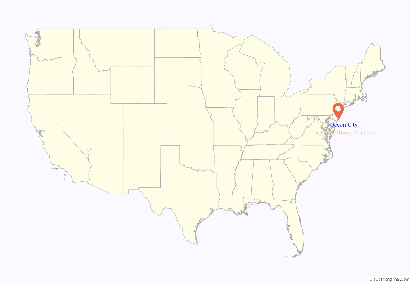
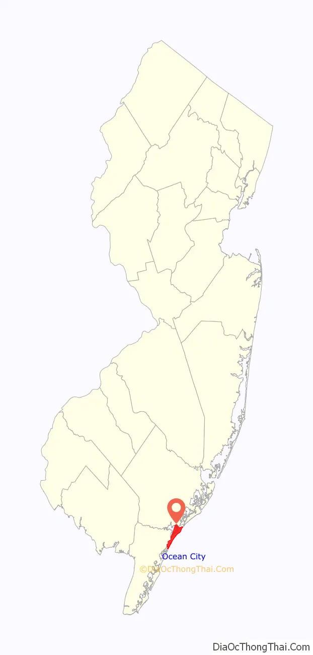
Ocean City location map. Where is Ocean City city?
History
Before Ocean City was established, local Native Americans set up camps on the island for fishing in the summer months. In 1633, Dutch navigator David Pietersz. de Vries referred to “flat sand beaches with low hills between Cape May and Egg Harbor”, possibly the earliest reference to the island that became Ocean City. In 1695, Thomas Budd surveyed the land on behalf of the West Jersey Society. Around 1700, John Peck used the island as a base of operation for storing freshly hunted whales, and subsequently, the land became known as Peck’s Beach. The first record of a house on Peck’s Beach was in 1752. During the 18th century, cattle grazers brought cows to the island, where plentiful trees, weeds, brush, and seagrass provided suitable conditions. Parker Miller was the first permanent resident of Peck’s Beach in 1859.
Originally purchased by the Somers family, the island was formerly named Peck’s Beach, believed to have been given the name for a whaler named John Peck. In 1700, whaler John Peck began using the barrier island as a storage place for freshly caught whales. The island was also used as a cattle-grazing area, and mainlanders would boat over for a picnic or to hunt. On September 10, 1879, four Methodist ministers—Ezra B. Lake, James Lake, S. Wesley Lake, and William Burrell—chose the island as a suitable spot to establish a Christian retreat and camp meeting on the order of Ocean Grove. They met under a tall cedar tree, which stands today in the lobby of the Ocean City Tabernacle. Having chosen the name Ocean City, the founders incorporated the Ocean City Association and laid out streets and lots for cottages, hotels, and businesses. The Ocean City Tabernacle was built between Wesley and Asbury Avenues and between 5th and 6th Streets. Camp meetings were held by the following summer and continue uninterrupted to this day.
In 1881, the first school on the island opened. The first bridge to the island was built in 1883, and the West Jersey Railroad opened in 1884. Based on a referendum on April 30, 1884, the borough of Ocean City was formed from portions of Upper Township, following an act of the New Jersey Legislature on May 3, 1884.
The ship Sindia joined other shipwrecks on the beach on December 15, 1901, on its way to New York City from Kobe, Japan, but has since sunk below the sand. A salvage attempt to retrieve treasures believed to have been on the ship was most recently launched in the 1970s, all of which have been unsuccessful. In 1920, the Chamber of Commerce adopted the slogan “America’s Greatest Family Resort”. A large fire in 1927 caused $1.5 million in damage and led the city to move the boardwalk closer to the ocean, which resulted in the greater potential for damage from saltwater.
Alcohol prohibition
As a result of its religious origins, the sale or public drinking of alcoholic beverages in Ocean City was prohibited. In 1881, the Ocean City Association passed a set of blue laws, which were designed to enforce religious standards. The town banned the manufacturing or sale of alcohol in 1909.
Promoting water instead of drinking alcohol, the Woman’s Christian Temperance Union donated a public fountain, dedicated on Memorial Day in 1915. Despite the prohibition of alcohol within the municipality, illegal saloons operated within Ocean City, and in 1929, prosecutors raided 27 speakeasies.
In 1951, the town banned the consumption of alcohol on the beach and banned all public alcohol consumption in 1958. During the campaign for a 1986 referendum to repeal the blue laws, ads in the local paper suggested that the repeal could be next. In May 2012, 68.8% of voters rejected a ballot initiative for BYOB—bring your own bottle. As of 2016, Ocean City was one of 32 dry towns in New Jersey. Despite the prohibition in the city, 18.3% of adults in the Ocean City metropolitan statistical area (which includes all of Cape May County) drink alcohol heavily or binge drink, the highest percentage of any metro area in the state. USA Today listed Ocean City as the state’s most drunken city on its 2017 list of “The drunkest city in every state”. Additionally, a loophole in the law allows private dining clubs adjacent to restaurants to serve alcohol to members.
Ocean City Road Map
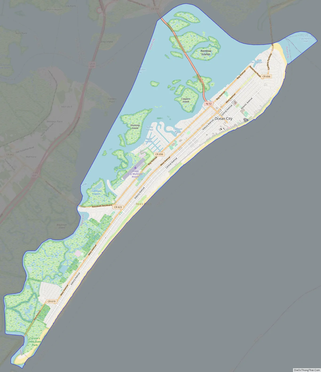
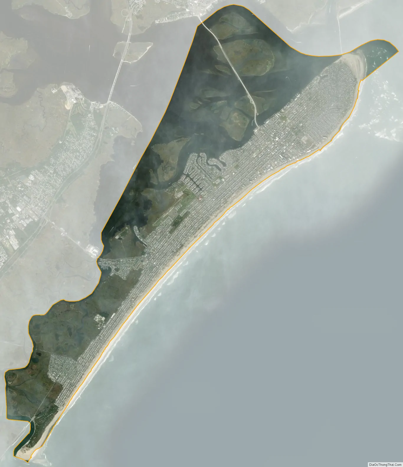
Ocean City city Satellite Map
Geography
According to the U.S. Census Bureau, the city had a total area of 11.56 square miles (29.93 km), including 6.72 square miles (17.39 km) of land and 4.84 square miles (12.53 km) of water (41.87%). The island is about 8-mile (13 km) long. Unincorporated communities, localities and place names located partially or completely within the city include Peck Beach.
Ocean City is situated on a barrier island bordered by the Strathmere section of Upper Township to the south, the Marmora section of Upper Township to the west, and Somers Point and Egg Harbor Township across the Great Egg Harbor Bay to the north. The eastern side of Ocean City borders the Atlantic Ocean.
Since 1951, the beach has been replenished more than 40 times, potentially the most of any beach in the country. This is due to erosion caused by storms, and in an extreme instance of erosion, a $5 million replenishment project in 1982 had largely disappeared within two and a half months. During the 1960s and 1970s, the city owned its own dredge, but ceased replenishment projects when it could not secure permits for dredging the lagoons. Since 1992, the United States Army Corps of Engineers has handled responsibility for beach nourishment projects, periodically adding 1,100,000 cubic yards (840,000 m), roughly every three years, using the shoal area about 5,000 feet (1,500 m) offshore the Great Egg Harbor Inlet. The project and funding was authorized in the Water Resources Development Act of 1986, and the most recent replenishment was completed in December 2017. After Hurricane Sandy in 2012, the Army Corps completed the city’s largest beach replenishment since 1993, adding 1,800,000 cubic yards (1,400,000 m) of sand to replenish the eroded beaches.
Parks
The city utilizes 39% of its land area—1,716 acres (694 ha)—for parks and recreation purposes. This includes about 1,300 acres (530 ha) of protected dunes and wetlands. There are several parks within the confines of Ocean City, including ten playgrounds scattered across the island. There are also a volleyball court, a shuffleboard court, a hockey rink, four baseball fields, four soccer fields, eight basketball courts, and 24 tennis courts.
Across from the Ocean City Airport is the Howard Stainton Wildlife Refuge, a 16 acres (6.5 ha) area of wetlands established in 1997. There are no trails, but there is a viewing platform accessible from Bay Avenue. Adjacent to the airport is the Ocean City Municipal Golf Course, a 12–hole course run by the city and open to the public.
At the southern end of the island is Corson’s Inlet State Park, which was established in 1969 to preserve one of the last undeveloped tracts of land along the oceanfront. The park is accessible by Ocean Drive (Cape May County Route 619), which bisects the park.
See also
Map of New Jersey State and its subdivision: Map of other states:- Alabama
- Alaska
- Arizona
- Arkansas
- California
- Colorado
- Connecticut
- Delaware
- District of Columbia
- Florida
- Georgia
- Hawaii
- Idaho
- Illinois
- Indiana
- Iowa
- Kansas
- Kentucky
- Louisiana
- Maine
- Maryland
- Massachusetts
- Michigan
- Minnesota
- Mississippi
- Missouri
- Montana
- Nebraska
- Nevada
- New Hampshire
- New Jersey
- New Mexico
- New York
- North Carolina
- North Dakota
- Ohio
- Oklahoma
- Oregon
- Pennsylvania
- Rhode Island
- South Carolina
- South Dakota
- Tennessee
- Texas
- Utah
- Vermont
- Virginia
- Washington
- West Virginia
- Wisconsin
- Wyoming