Ocean Grove is an unincorporated community and census-designated place (CDP) that is part of Neptune Township, in Monmouth County, in the U.S. state of New Jersey. It had a population of 3,057 at the 2020 United States census. It is located on the Atlantic Ocean’s Jersey Shore, between Asbury Park to the north and Bradley Beach to the south. Listed on the National Register of Historic Places, Ocean Grove is noted for its abundant examples of Victorian architecture and the Great Auditorium, acclaimed as “the state’s most wondrous wooden structure, soaring and sweeping, alive with the sound of music”.
Ocean Grove was founded in 1869 as an outgrowth of the camp meeting movement in the United States, when a group of Methodist clergymen, led by William B. Osborn and Ellwood H. Stokes, formed the Ocean Grove Camp Meeting Association to develop and operate a summer camp meeting site on the New Jersey seashore. By the early 20th century, the popular Christian meeting ground became known as the “Queen of Religious Resorts.” The community’s land is still owned by the camp meeting association and leased to individual homeowners and businesses. Ocean Grove remains the longest-active camp meeting site in the United States.
| Name: | Ocean Grove CDP |
|---|---|
| LSAD Code: | 57 |
| LSAD Description: | CDP (suffix) |
| State: | New Jersey |
| County: | Monmouth County |
| Elevation: | 16 ft (5 m) |
| Total Area: | 0.42 sq mi (1.10 km²) |
| Land Area: | 0.37 sq mi (0.96 km²) |
| Water Area: | 0.05 sq mi (0.14 km²) 13.05% |
| Total Population: | 3,057 |
| Population Density: | 7,300/sq mi (2,800/km²) |
| ZIP code: | 07756 |
| Area code: | 732 |
| FIPS code: | 3454480 |
| GNISfeature ID: | 02389609 |
| Website: | www.oceangrove.org |
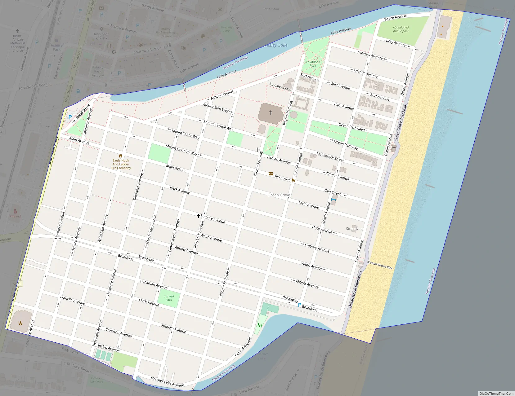
Online Interactive Map
Click on ![]() to view map in "full screen" mode.
to view map in "full screen" mode.
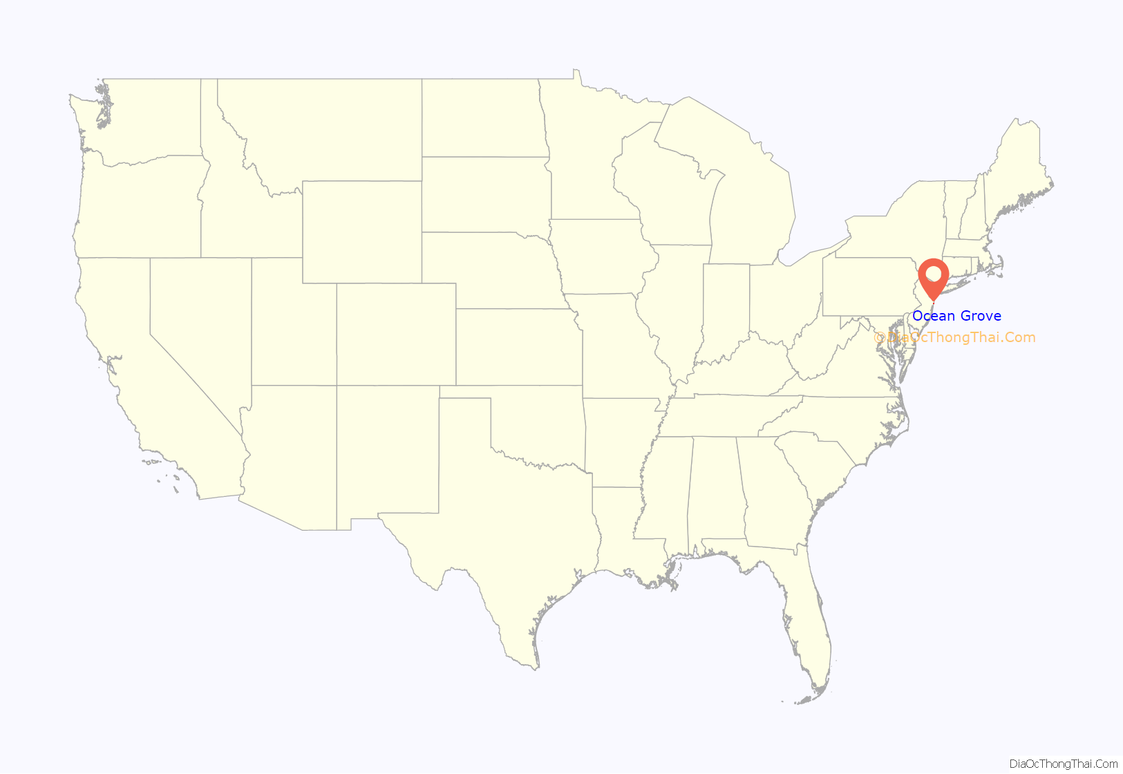
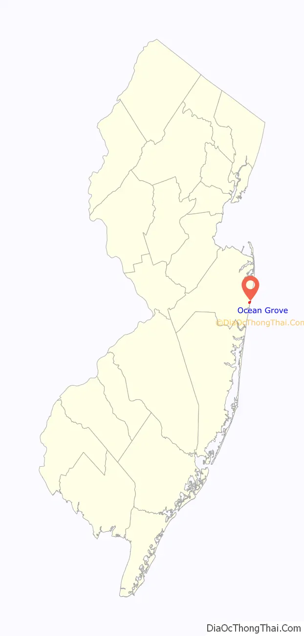
Ocean Grove location map. Where is Ocean Grove CDP?
History
In July, 1869, Reverend W. B. Osborn, Reverend Stokes, and other Methodist ministers camped at a shaded, well-drained spot on New Jersey’s seashore and decided to establish a permanent Christian camp meeting community called “Ocean Grove.” This followed a search of the Jersey Shore for a place not infested with mosquitoes. About twenty tents were pitched that summer. By the following year, the area was laid out into lots and roadways. The lots were leased for 99 years with the Ocean Grove Camp Meeting Association retaining ownership. Residents were expected to follow the strict Methodist social norms of the era which included prohibitions of alcohol, tobacco, cards, dancing, the reading of novels, and even chewing gum. Nine wells were driven in 1870 to provide fresh water. The first was eventually named the “Beersheba” well, for an ancient well used by the Biblical patriarchs Abraham and Isaac. It is still in existence under a photogenic 1881 gazebo, though belatedly connected to the town water system in 1911.
Drawing from the major population centers of New York City and Philadelphia, Ocean Grove soon became a popular destination during the growth of the camp meeting movement in post-Civil War America. Tents and an open-air wooden shelter for speakers, were erected in the 1870s, for the trainloads of visitors arriving by the New York and Long Branch Railroad after 1875. In 1877 alone, 710,000 railroad tickets were sold for the Ocean Grove-Asbury Park train station.
A third, larger auditorium was built in 1880.
As Ocean Grove drew more and more visitors, the facilities were outgrown, and construction of the present Great Auditorium was completed in 1894. Originally designed to accommodate crowds of as many as 10,000 people, the subsequent installation of theater-style cushioned seating in many sections reduced seating capacity to 6,250. It remains Ocean Grove’s most prominent structure and the centerpiece of its summer programs (see more about the Auditorium further down the page). By the early 20th century, said The New York Times in 1986, it was called the “Queen of Religious Resorts … Visitors would travel miles to bask in the Victorian seaside splendor and to attend engaging, extroverted religious ceremonies. Millions of people, tourists and pilgrims both, made the trip to Ocean Grove every summer.” The social disillusionment around 1920 following World War I had a profound effect on Ocean Grove and churchgoing in general. There was a decline in these activities and there was little in the way of new construction in the town after this time. One result was that Ocean Grove became a time capsule of late Victorian and early 20th century architecture.
Until Ocean Grove’s municipal authority was folded into Neptune Township in 1981, it had its own set of unique laws, including one that made it illegal on Sundays to have horses, wagons, then cars on the streets of Ocean Grove. This had a significant effect on the development of a close-knit community. People looking to get away for the weekend typically avoided the Grove (the beach was closed on Sunday, too). That meant the visitors were likely to be coming for a week-long visit or more. Most came to attend programs sponsored by the Camp Meeting.
President Ulysses S. Grant visited Ocean Grove during his time in office and made his last public appearance in this town. Other presidents to speak on the grounds included: James Garfield, William McKinley, Teddy Roosevelt, Woodrow Wilson, and Richard Nixon. Heavyweight boxing champions James J. Corbett and Max Baer and department store magnate F.W. Woolworth were among the celebrities of the day who vacationed in Ocean Grove.
In 1975, Ocean Grove was designated a State and National Historic District as a 19th-century planned urban community. It has the most extensive collection of Victorian and early-20th century architecture in the United States. The Historical Society of Ocean Grove maintains a museum and a restored c. 1884 cottage in addition to offering walking tours.
During the 1960s–1980s, the town declined along with much of the Jersey Shore, and was pejoratively called “Ocean Grave” due to the general air of decrepitude and the elderly population. But beginning in the 1990s, and through 2006, Ocean Grove experienced a dramatic increase in property values and a considerable revival in fortune, particularly with the restoration of older hotel structures, many of which had deteriorated into single room occupancy (“SRO”) quarters. As part of this resurgence, a number of sidewalk cafés and shops along Main Avenue (the main business thoroughfare) now cater to visitors and seasonal residents.
Plans were announced in 2006 for a major new hotel and condominium development on property which has been vacant since the 1970s, when the old North End Hotel – once Ocean Grove’s largest – was damaged by fire and subsequently demolished in 1980. These plans have become controversial though, and in January 2008 the Planning Board of Neptune stated the North End Redevelopment Proposal was “inconsistent with the town’s Master Plan”. On April 13, 2019, the remaining structures on the North End were destroyed by fire leaving the whole area vacant land.
Ocean Grove Road Map
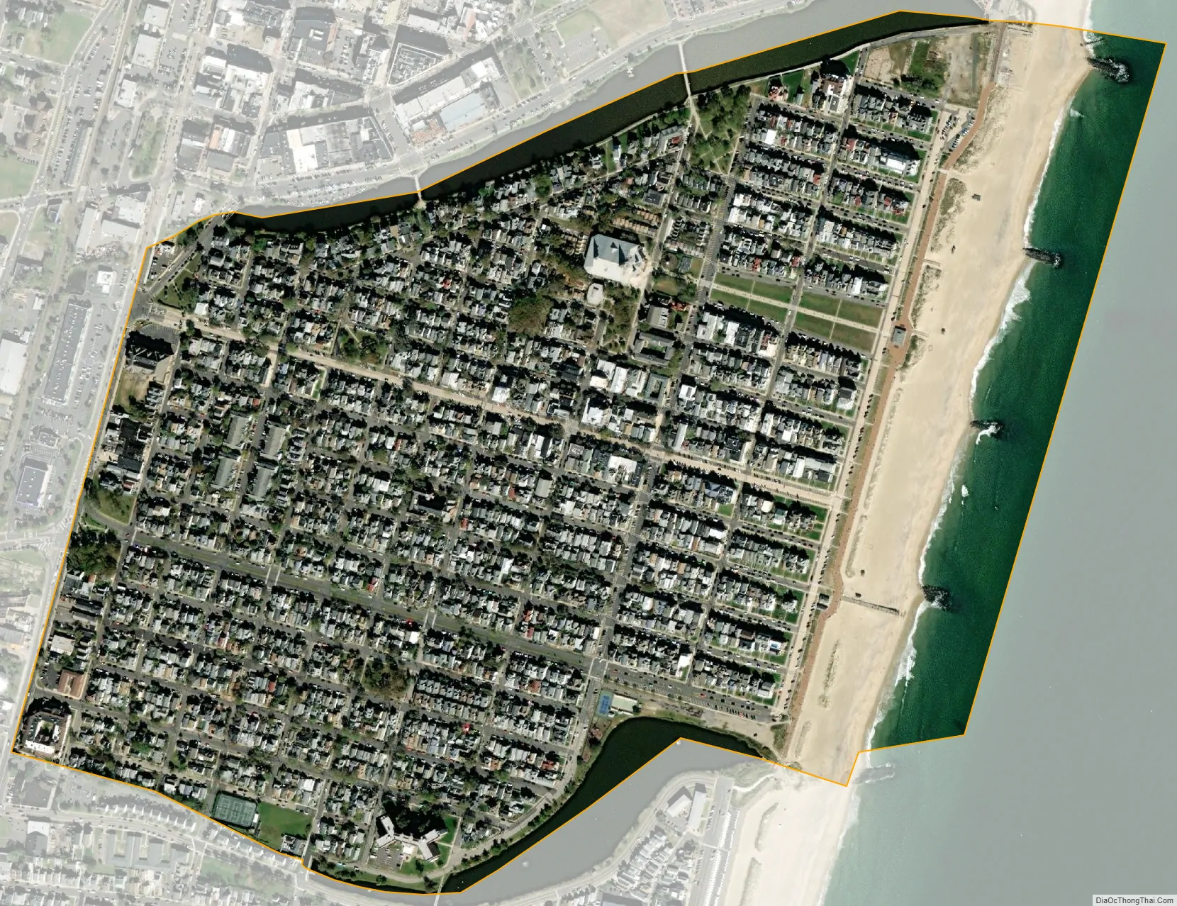
Ocean Grove city Satellite Map
Geography
According to the United States Census Bureau, Ocean Grove had a total area of 0.428 square miles (1.109 km), including 0.372 square miles (0.964 km) of it is land and 0.056 square miles (0.145 km) of water (13.05%) is water.
See also
Map of New Jersey State and its subdivision: Map of other states:- Alabama
- Alaska
- Arizona
- Arkansas
- California
- Colorado
- Connecticut
- Delaware
- District of Columbia
- Florida
- Georgia
- Hawaii
- Idaho
- Illinois
- Indiana
- Iowa
- Kansas
- Kentucky
- Louisiana
- Maine
- Maryland
- Massachusetts
- Michigan
- Minnesota
- Mississippi
- Missouri
- Montana
- Nebraska
- Nevada
- New Hampshire
- New Jersey
- New Mexico
- New York
- North Carolina
- North Dakota
- Ohio
- Oklahoma
- Oregon
- Pennsylvania
- Rhode Island
- South Carolina
- South Dakota
- Tennessee
- Texas
- Utah
- Vermont
- Virginia
- Washington
- West Virginia
- Wisconsin
- Wyoming


