Map of Toms River CDP

Map of Toms River CDP

Toms River is an unincorporated community and census-designated place (CDP) located within and constituting the mainland portion of Toms River Township (formerly Dover Township), in Ocean County, New Jersey, United States. As of the 2020 United States Census, the CDP’s population was 92,830, its highest decennial count ever and an increase of 4,039 (+4.5%) from … Read more

Map of Tinton Falls borough

Map of Tinton Falls borough

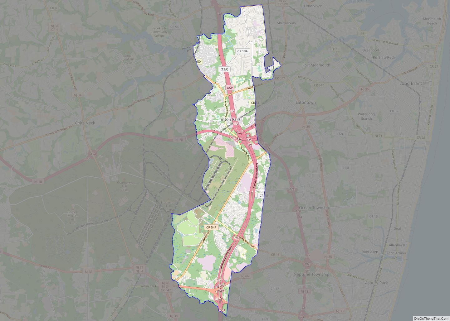
Tinton Falls is a borough in Monmouth County, in the U.S. state of New Jersey. As of the 2020 United States census, the borough’s population was 19,181, an increase of 1,289 (+7.2%) from the 2010 census count of 17,892, which in turn reflected an increase of 2,839 (+18.9%) from the 15,053 counted in the 2000 … Read more

Map of Teterboro borough

Map of Teterboro borough

Teterboro (/ˈtiːtərbəroʊ/ TEE-tər-bər-oh) is a borough in Bergen County, in the U.S. state of New Jersey. As of the 2020 United States census, the borough’s population was 61, a decrease of 6 (−9.0%) from the 2010 census count of 67, which in turn reflected an increase of 49 (+272.2%) from the 18 counted in the … Read more

Map of Tenafly borough

Map of Tenafly borough

Tenafly (/ˈtɛnəflaɪ/) is a borough in Bergen County, in the U.S. state of New Jersey. As of the 2020 United States census, the borough’s population was 15,409, an increase of 921 (+6.4%) from the 2010 census count of 14,488, which in turn reflected an increase of 682 (+4.9%) from the 13,806 counted in the 2000 … Read more

Map of Ten Mile Run CDP

Map of Ten Mile Run CDP

Ten Mile Run is an unincorporated community and census-designated place (CDP) located in Franklin Township, in Somerset County, New Jersey, United States. As of the 2010 United States Census, the CDP’s population was 1,959. Ten Mile Run CDP overview: Name: Ten Mile Run CDP LSAD Code: 57 LSAD Description: CDP (suffix) State: New Jersey County: … Read more

Map of Tavistock borough

Map of Tavistock borough

Tavistock is a borough in Camden County, in the U.S. state of New Jersey. As of the 2020 United States census, the borough’s population was 9, an increase of 4 (+80.0%) from the 2010 census count of 5, which in turn reflected a decline of 19 (−79.2%) from the 24 counted in the 2000 census. … Read more

Map of Upper Stewartsville CDP

Map of Upper Stewartsville CDP

Upper Stewartsville is an unincorporated community and census-designated place (CDP) located within Greenwich Township in Warren County, New Jersey, United States, that was defined as part of the 2010 United States Census. As of the 2010 Census, the CDP’s population was 212. Upper Stewartsville CDP overview: Name: Upper Stewartsville CDP LSAD Code: 57 LSAD Description: … Read more

Map of Upper Saddle River borough

Map of Upper Saddle River borough

Upper Saddle River is a borough in Bergen County, in the U.S. state of New Jersey. As of the 2020 United States census, the borough’s population was 8,353, an increase of 145 (+1.8%) from the 2010 census count of 8,208, which in turn reflected an increase of 467 (+6.0%) from the 7,741 counted in the … Read more

Map of Upper Pohatcong CDP

Map of Upper Pohatcong CDP

Upper Pohatcong is an unincorporated community and census-designated place (CDP) located within Pohatcong Township in Warren County, New Jersey, United States, that was defined as part of the 2010 United States Census. As of the 2010 Census, the CDP’s population was 1,781. Upper Pohatcong CDP overview: Name: Upper Pohatcong CDP LSAD Code: 57 LSAD Description: … Read more

Map of Upper Montclair CDP

Map of Upper Montclair CDP

Upper Montclair is a census-designated place (CDP), unincorporated community and neighborhood within Montclair in Essex County, New Jersey, United States. As of the 2010 United States Census, the population for the CDP was 11,565. The area is served as United States Postal Service ZIP code 07043. It is often misperceived, even by Montclair residents, to … Read more

Map of Union City, New Jersey

Map of Union City, New Jersey

Union City is a city in the northern part of Hudson County, in the U.S. state of New Jersey. As of the 2020 United States census, the city was the state’s 18th-most-populous municipality, with a population of 68,589, an increase of 2,134 (+3.2%) from the 2010 census count of 66,455, which in turn had reflected … Read more

Map of Union Beach borough

Map of Union Beach borough

Union Beach is a borough on the Jersey Shore of Monmouth County, in the U.S. state of New Jersey. As of the 2020 United States census, the borough’s population was 5,723, a decrease of 522 (−8.4%) from the 2010 census count of 6,245, which in turn reflected a decline of 404 (−6.1%) from the 6,649 … Read more