Teterboro (/ˈtiːtərbəroʊ/ TEE-tər-bər-oh) is a borough in Bergen County, in the U.S. state of New Jersey. As of the 2020 United States census, the borough’s population was 61, a decrease of 6 (−9.0%) from the 2010 census count of 67, which in turn reflected an increase of 49 (+272.2%) from the 18 counted in the 2000 census. After being ranked as the fourth-smallest municipality, by population, in New Jersey through the 2010 census, the borough is the third-smallest since the merger of Pine Valley into Pine Hill in 2022.
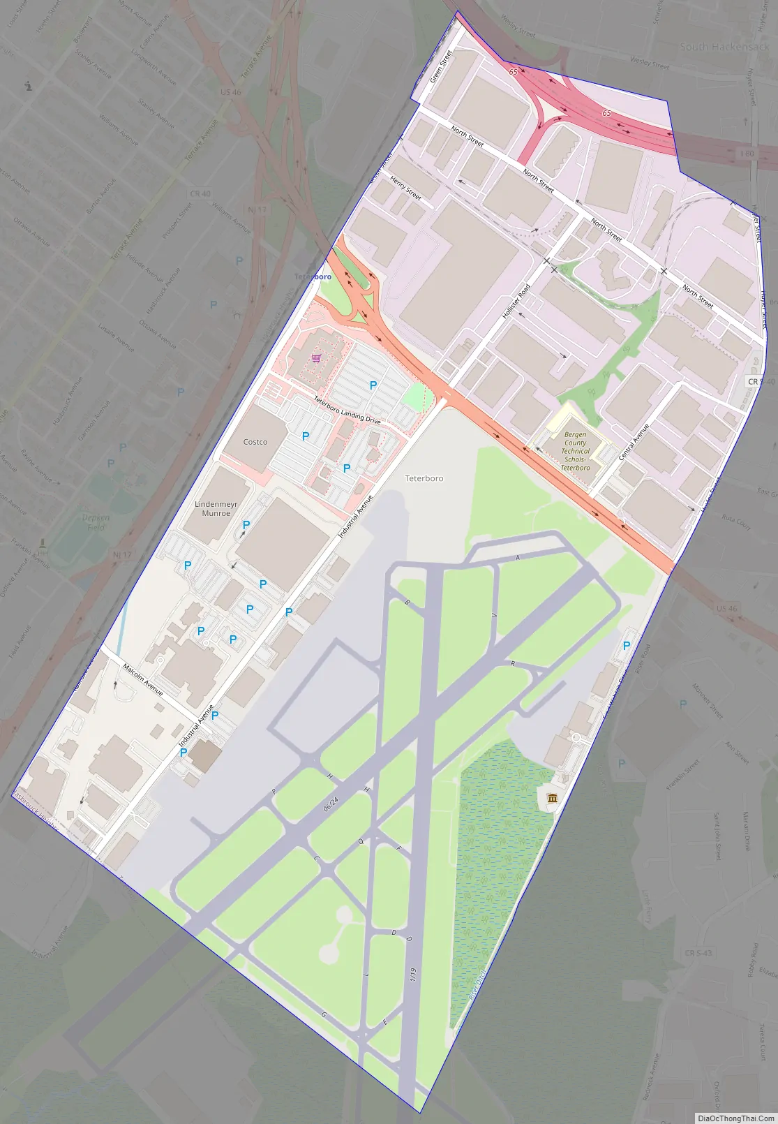
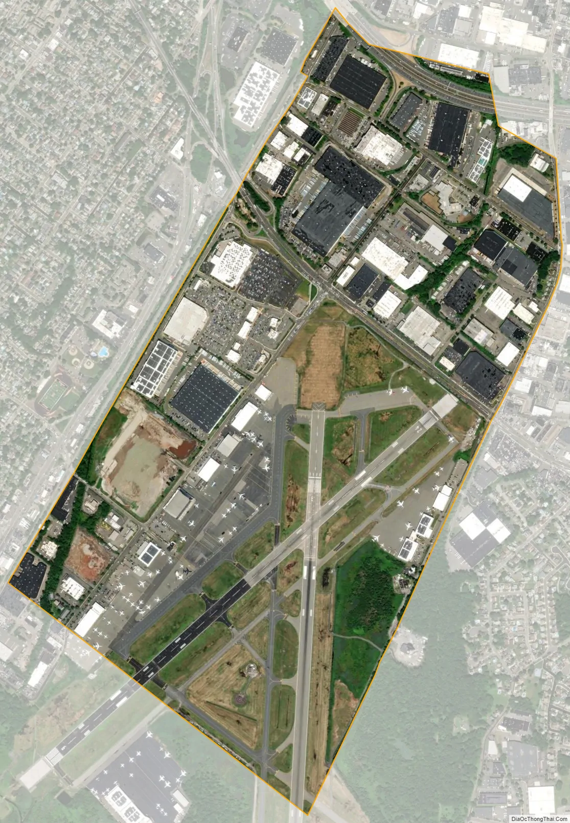
Teterboro is the home of Teterboro Airport (operated by the Port Authority of New York and New Jersey) which takes up a majority of the borough, as well as portions of Hasbrouck Heights and Moonachie.
| Name: | Teterboro borough |
|---|---|
| LSAD Code: | 21 |
| LSAD Description: | borough (suffix) |
| State: | New Jersey |
| County: | Bergen County |
| Incorporated: | March 26, 1917 |
| Elevation: | 7 ft (2 m) |
| Total Area: | 1.11 sq mi (2.88 km²) |
| Land Area: | 1.11 sq mi (2.87 km²) |
| Water Area: | 0.00 sq mi (0.01 km²) 0.36% |
| Total Population: | 61 |
| Population Density: | 55.1/sq mi (21.3/km²) |
| ZIP code: | 07608 |
| Area code: | 201 |
| FIPS code: | 3472480 |
| GNISfeature ID: | 0885418 |
| Website: | www.teterboronj.org |
Online Interactive Map
Click on ![]() to view map in "full screen" mode.
to view map in "full screen" mode.
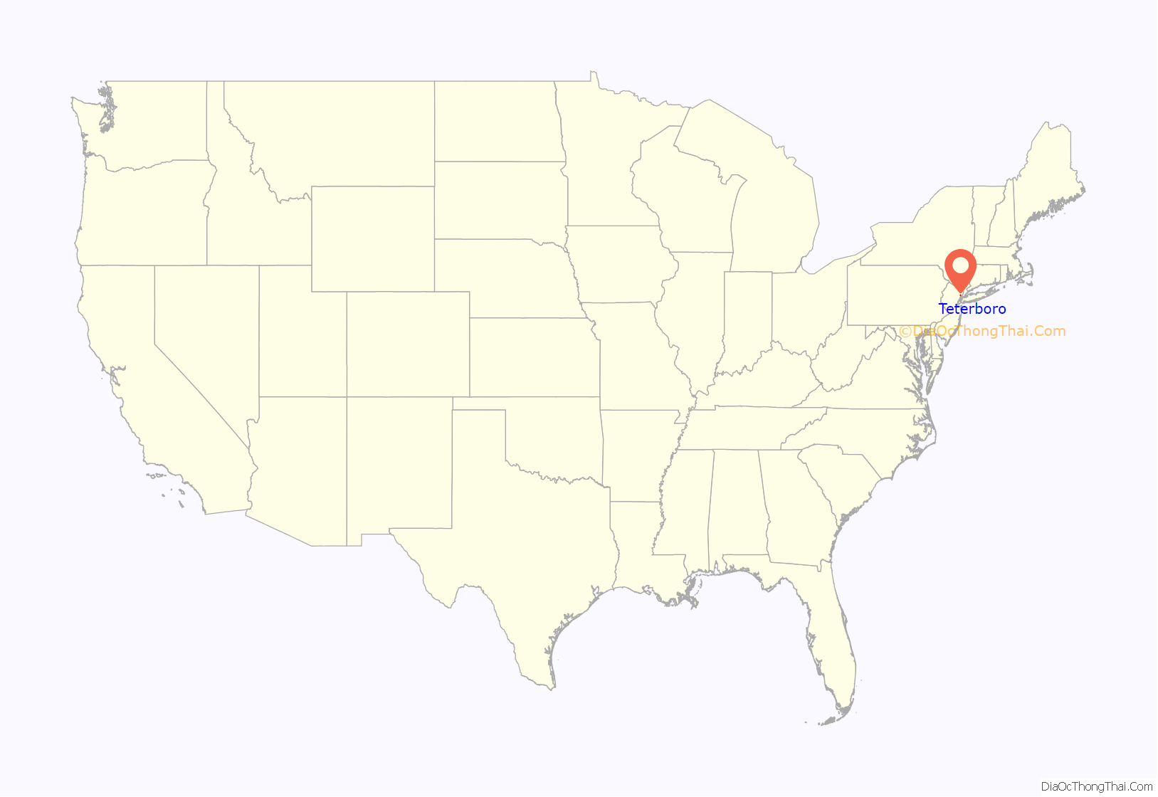
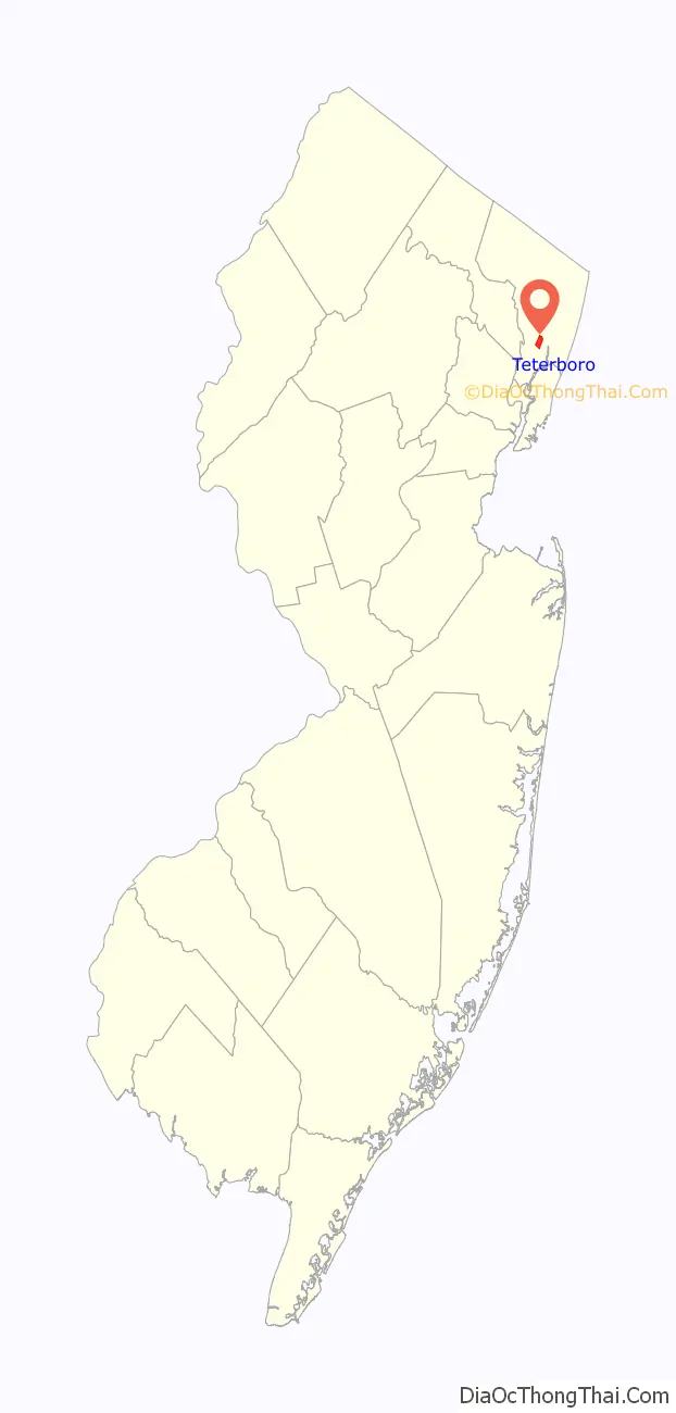
Teterboro location map. Where is Teterboro borough?
History
Teterboro was incorporated on March 26, 1917, from land that was originally part of the boroughs of Moonachie, Little Ferry and Lodi Township. The borough was enlarged on July 5, 1918, by the addition of an area annexed from Hasbrouck Heights. The borough was named for Walter C. Teter, a New York investment banker, who had purchased land in 1917 to build a racetrack and developed a 700-acre (280 ha) site, reclaiming marshland and building an airport and an 18-hole golf course. The name Teterboro was changed on April 14, 1937, to Bendix Borough, but reverted to Teterboro Borough on June 1, 1943.
Throughout the borough’s history, neighboring municipalities, such as Hasbrouck Heights and South Hackensack, have made repeated attempts to dissolve Teterboro, in hopes of absorbing the borough’s ratables (the value of land and buildings which are assessed for property taxes). Some have argued that the population is too small for the borough to justify its own existence. However, all such attempts have met with failure. In July 2010, a bill was introduced in the New Jersey state senate in a renewed effort to divide Teterboro among neighboring towns. The bill, sponsored by Senator Robert M. Gordon and Assemblypersons Connie Wagner and Vincent Prieto, stalled in the state Legislature after its introduction, due to opposition from borough officials, residents, business and land owners, and the neighboring municipalities of Moonachie and Hasbrouck Heights. Legislators attempted to include a 20-year tax abatement within the bill to alleviate the concerns of Teterboro business and property owners who were concerned that taxes could spike if the borough was dissolved. The legality of such an abatement was also called into question.
Teterboro Road Map
Teterboro city Satellite Map
Geography
According to the United States Census Bureau, the borough had a total area of 1.11 square miles (2.88 km), including 1.11 square miles (2.87 km) of land and <0.01 square miles (0.01 km) of water (0.36%).
The borough borders the Bergen County municipalities of Hackensack, Hasbrouck Heights, Little Ferry, Moonachie and South Hackensack.
See also
Map of New Jersey State and its subdivision: Map of other states:- Alabama
- Alaska
- Arizona
- Arkansas
- California
- Colorado
- Connecticut
- Delaware
- District of Columbia
- Florida
- Georgia
- Hawaii
- Idaho
- Illinois
- Indiana
- Iowa
- Kansas
- Kentucky
- Louisiana
- Maine
- Maryland
- Massachusetts
- Michigan
- Minnesota
- Mississippi
- Missouri
- Montana
- Nebraska
- Nevada
- New Hampshire
- New Jersey
- New Mexico
- New York
- North Carolina
- North Dakota
- Ohio
- Oklahoma
- Oregon
- Pennsylvania
- Rhode Island
- South Carolina
- South Dakota
- Tennessee
- Texas
- Utah
- Vermont
- Virginia
- Washington
- West Virginia
- Wisconsin
- Wyoming


