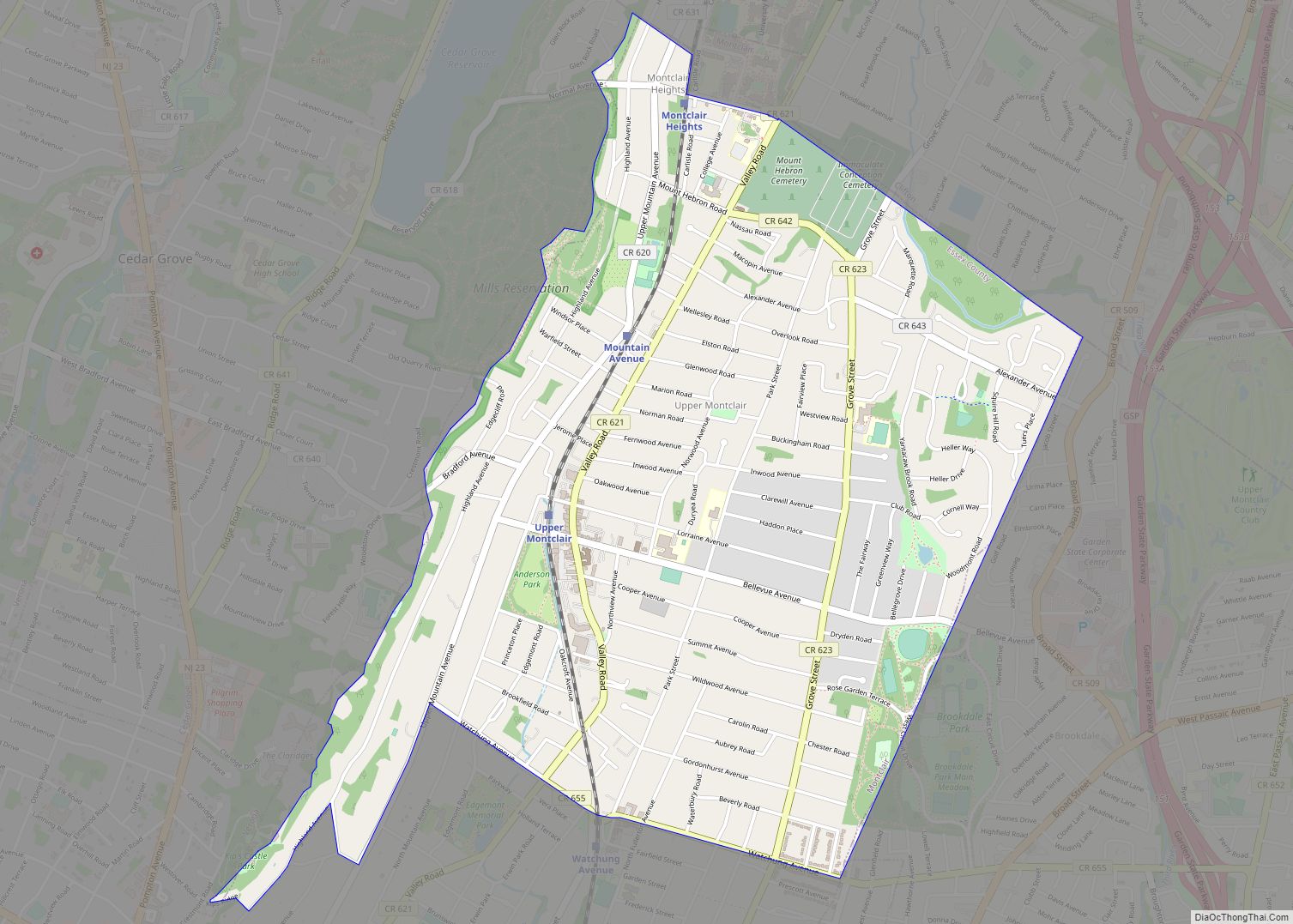
Map of Vernon Valley CDP
Vernon Valley is an unincorporated community and census-designated place (CDP) located in Vernon Township, in Sussex County, New Jersey, United States. As of the 2010 United States Census, the CDP’s population was 1,626. Vernon Valley CDP overview: Name: Vernon Valley CDP LSAD Code: 57 LSAD Description: CDP (suffix) State: New Jersey County: Sussex County Elevation: ... Read more
Map of Vernon Valley CDP
Map of Vernon Center CDP, New Jersey
Vernon Center is an unincorporated community and census-designated place (CDP) located in Vernon Township, in Sussex County, New Jersey, United States. As of the 2010 United States Census, the CDP’s population was 1,713. Vernon Center CDP overview: Name: Vernon Center CDP LSAD Code: 57 LSAD Description: CDP (suffix) State: New Jersey County: Sussex County Elevation: ... Read more
Map of Vernon Center CDP, New Jersey
Map of Ventnor City
Ventnor City is a city situated on the Jersey Shore on Absecon Island, within Atlantic County, in the U.S. state of New Jersey, on the Atlantic Ocean. As of the 2020 United States census, the city’s population was 9,210, a decrease of 1,440 (−13.5%) from the 2010 census count of 10,650, which in turn reflected ... Read more
Map of Ventnor City
Map of Upper Stewartsville CDP
Upper Stewartsville is an unincorporated community and census-designated place (CDP) located within Greenwich Township in Warren County, New Jersey, United States, that was defined as part of the 2010 United States Census. As of the 2010 Census, the CDP’s population was 212. Upper Stewartsville CDP overview: Name: Upper Stewartsville CDP LSAD Code: 57 LSAD Description: ... Read more
Map of Upper Stewartsville CDP
Map of Wanamassa CDP
Wanamassa /wɑːnɑːmæsə/ is an unincorporated community and census-designated place (CDP) within Ocean Township, in Monmouth County, New Jersey, United States. As of the 2010 United States Census, the CDP’s population was 4,532. The community was named for Wanamassa, a Native American leader of the 17th century. Wanamassa CDP overview: Name: Wanamassa CDP LSAD Code: 57 ... Read more
Map of Wanamassa CDP
Map of Wallington borough
Wallington is a borough in Bergen County, in the U.S. state of New Jersey. As of the 2020 United States census, the borough’s population was 11,868, an increase of 533 (+4.7%) from the 2010 census count of 11,335, which in turn reflected a decline of 248 (−2.1%) from the 11,583 counted in the 2000 Census, ... Read more
Map of Wallington borough
Map of Waldwick borough
Waldwick (/ˈwɔːldwɪk/) is a borough in Bergen County, in the U.S. state of New Jersey. As of the 2020 United States census, the borough’s population was 10,058, an increase of 433 (+4.5%) from the 2010 census count of 9,625, which in turn reflected an increase of three people (+0.0%) from the 9,622 counted in the ... Read more
Map of Waldwick borough
Map of Voorhees CDP
Voorhees is an unincorporated community and census-designated place (CDP) located in Franklin Township, in Somerset County, New Jersey, United States. As of the 2010 United States Census, the CDP’s population was 1,959. Voorhees CDP overview: Name: Voorhees CDP LSAD Code: 57 LSAD Description: CDP (suffix) State: New Jersey County: Somerset County Elevation: 125 ft (38 m) Total ... Read more
Map of Voorhees CDP
Map of Vista Center CDP
Vista Center is an unincorporated community and census-designated place (CDP) located within Jackson Township in Ocean County, New Jersey, United States. As of the 2010 United States Census, the CDP’s population was 3,689. Vista Center CDP overview: Name: Vista Center CDP LSAD Code: 57 LSAD Description: CDP (suffix) State: New Jersey County: Ocean County Elevation: ... Read more
Map of Vista Center CDP
Map of Vineland city, New Jersey
Vineland is a city in Cumberland County, in the U.S. state of New Jersey. Bridgeton and Vineland are the two principal cities of the Vineland-Bridgeton metropolitan statistical area, which encompasses those cities and all of Cumberland County for statistical purposes and which constitutes a part of the Delaware Valley (the Philadelphia metro area). The MSA ... Read more
Map of Vineland city, New Jersey
Map of Villas CDP, New Jersey
Villas, also known as the Villas, is an unincorporated community and census-designated place (CDP) located within Lower Township, in Cape May County, in the U.S. state of New Jersey. The locality is also home to the community of Miami Beach. At the 2010 census, the CDP’s population was 9,483. Villas is the site of Blitz’s ... Read more
Map of Villas CDP, New Jersey
Map of Vienna CDP, New Jersey
Vienna is an unincorporated community and census-designated place (CDP) located within Independence Township in Warren County, New Jersey, United States, that was created as part of the 2010 United States Census. As of the 2010 Census, the CDP’s population was 981. Through the 2000 United States Census, the CDP was combined as part of Great ... Read more
Map of Vienna CDP, New Jersey