Victory Gardens is a borough in Morris County, in the U.S. state of New Jersey. As of the 2020 United States census, the borough’s population was 1,582, an increase of 62 (+4.1%) from the 2010 census count of 1,520, which in turn reflected a decline of 26 (−1.7%) from the 1,546 counted in the 2000 census.
Victory Gardens is Morris County’s smallest municipality, measured both by size and population, and its most densely populated. Additionally, the borough is the state’s fourth-smallest municipality by area.
| Name: | Victory Gardens borough |
|---|---|
| LSAD Code: | 21 |
| LSAD Description: | borough (suffix) |
| State: | New Jersey |
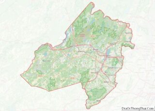
| County: | Morris County |
| Incorporated: | September 18, 1951 |
| Elevation: | 646 ft (197 m) |
| Total Area: | 0.14 sq mi (0.38 km²) |
| Land Area: | 0.14 sq mi (0.38 km²) |
| Water Area: | 0.00 sq mi (0.00 km²) 0.00% |
| Total Population: | 1,582 |
| Population Density: | 10,901.3/sq mi (4,209.0/km²) |
| ZIP code: | 07801 – Dover |
| Area code: | 862/973 and 908 |
| FIPS code: | 3475890 |
| GNISfeature ID: | 0885427 |
| Website: | www.victorygardensnj.gov |
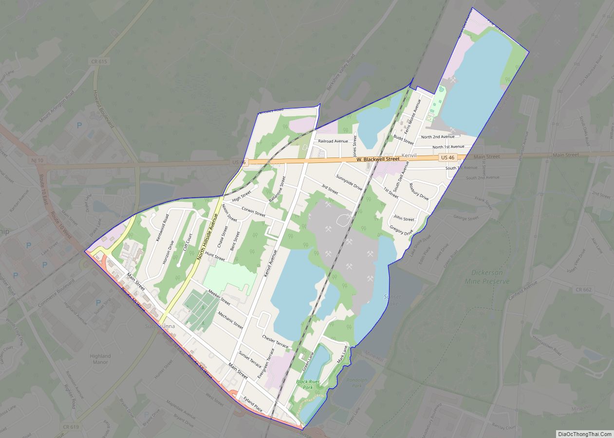
Online Interactive Map
Click on ![]() to view map in "full screen" mode.
to view map in "full screen" mode.
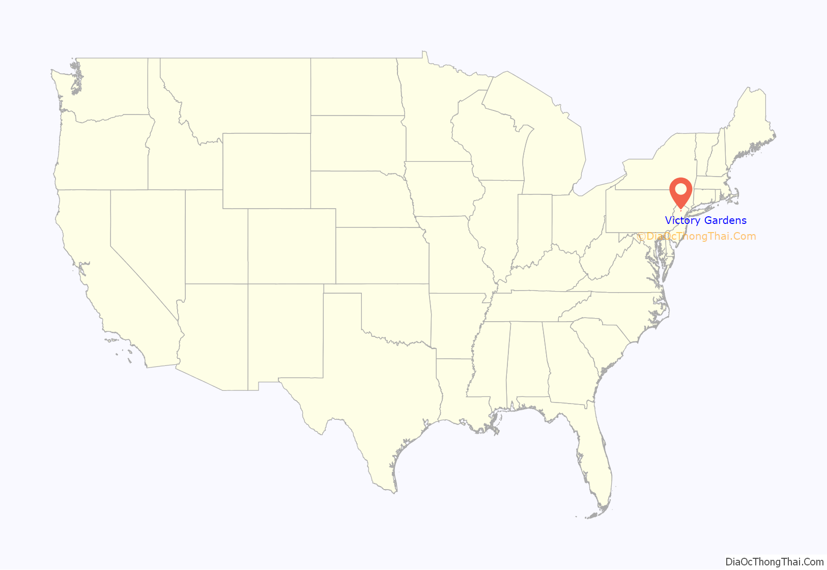
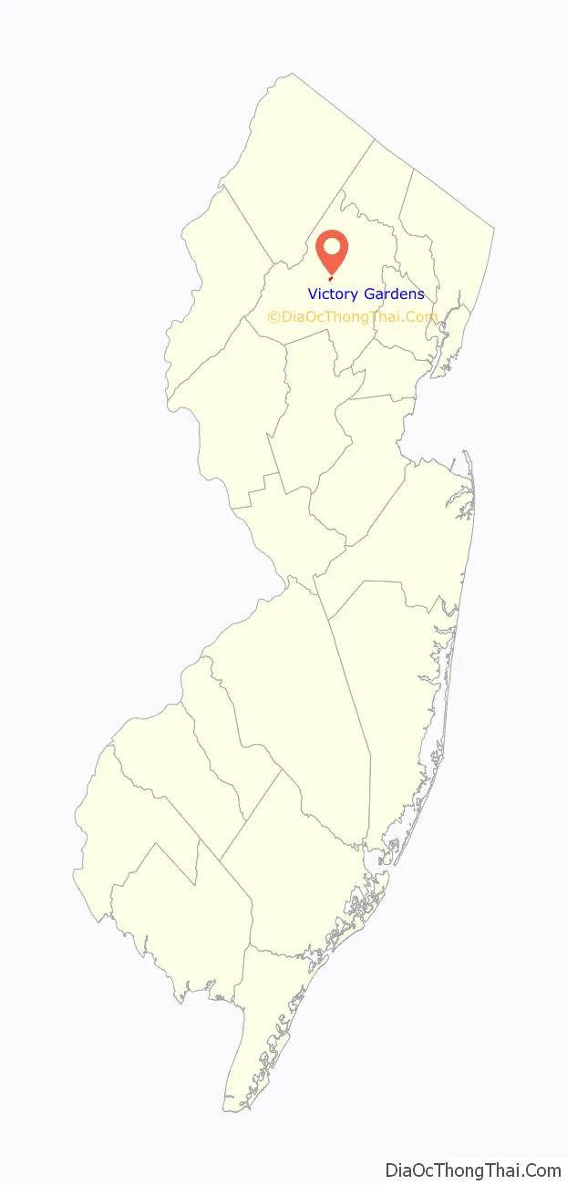
Victory Gardens location map. Where is Victory Gardens borough?
History
The origins of the borough began in 1941, when the federal government acquired 91 acres (370,000 m) in Randolph Township as the site of a 300-unit housing project for war industry employees. The borough’s name is derived from the victory gardens planted at homes and parks during World War II to provide additional supplies of fruits and vegetables. Streets are named for U.S. Presidents.
Randolph Township residents approved a referendum as part of a September 1951 special election in which voters were asked if the township’s Victory Gardens neighborhood should be removed from the township and created as an independent municipality for its 1,300 residents covering 92 acres (37 ha). Residents of other areas of Randolph Township argued that the compensation paid by the federal government for the more than 250 students attending the Randolph Township Schools did not adequately cover the cost of their public education, that the housing and other structures in Victory Gardens was out of compliance with the township’s building and zoning ordinances and that the overwhelming Democratic Party political leanings of residents of Victory Gardens were out of sync with the largely Republican Party township.
Victory Gardens was incorporated as a borough by an act of the New Jersey Legislature on June 20, 1951, from portions of Randolph Township, based on the results of the referendum passed on September 18, 1951.
The small town made news on November 16, 1958, when 262 members of its 297 families participated voluntarily as “refugees” in a civil defense exercise, while other residents of the town — “school boys with Geiger counters, staff men with fancy helmets, girls with typewriters, Explorer Scouts, police and fire crews, medical teams and the dozens who just washed pots and pans and ladled stew” — volunteered to assist. “Those who remained home,” The New York Times wrote, “were restricted in their movements by guards who patrolled the town.”
A project approved in 1973 brought the construction of 184 units of garden apartments on a site covering 12.4 acres (5.0 ha), providing additional rateables and offering permanent housing for an estimated 400 people, that would contrast with the temporary original structures built in the 1940s that had long passed their expected lifespan.
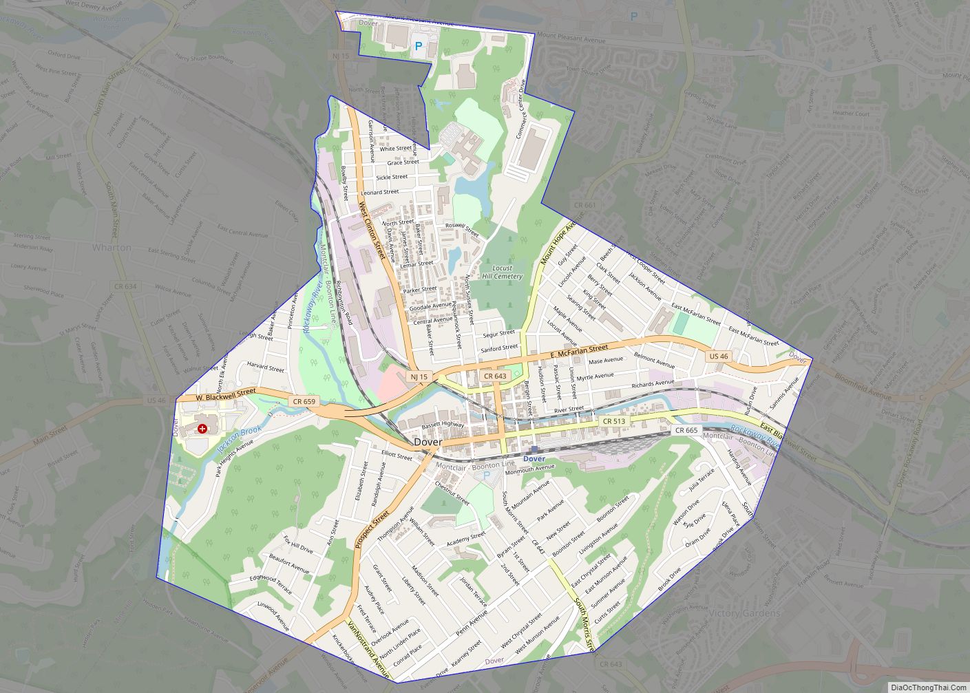
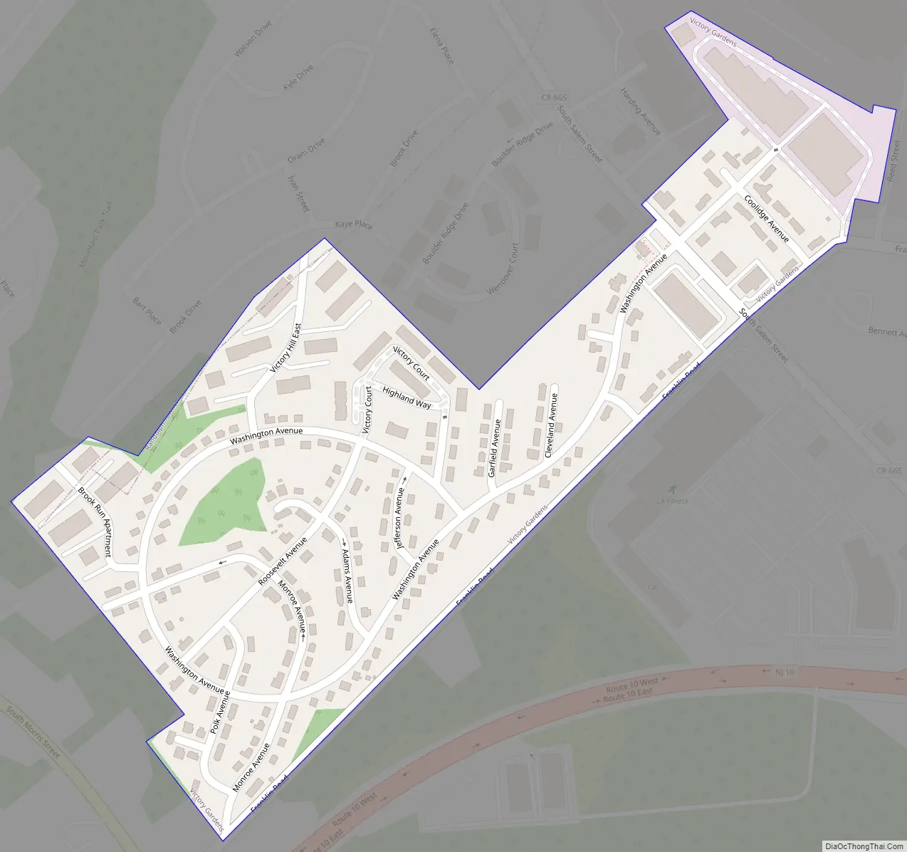
Victory Gardens Road Map
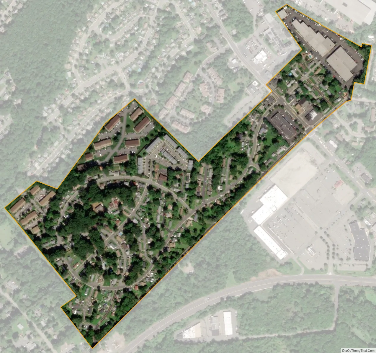
Victory Gardens city Satellite Map
Geography
According to the United States Census Bureau, the borough had a total area of 0.15 square miles (0.38 km), all of which was land.
The borough borders the Morris County municipalities of Dover and Randolph.
See also
Map of New Jersey State and its subdivision: Map of other states:- Alabama
- Alaska
- Arizona
- Arkansas
- California
- Colorado
- Connecticut
- Delaware
- District of Columbia
- Florida
- Georgia
- Hawaii
- Idaho
- Illinois
- Indiana
- Iowa
- Kansas
- Kentucky
- Louisiana
- Maine
- Maryland
- Massachusetts
- Michigan
- Minnesota
- Mississippi
- Missouri
- Montana
- Nebraska
- Nevada
- New Hampshire
- New Jersey
- New Mexico
- New York
- North Carolina
- North Dakota
- Ohio
- Oklahoma
- Oregon
- Pennsylvania
- Rhode Island
- South Carolina
- South Dakota
- Tennessee
- Texas
- Utah
- Vermont
- Virginia
- Washington
- West Virginia
- Wisconsin
- Wyoming