Map of Nelsonville village

Map of Nelsonville village, New York

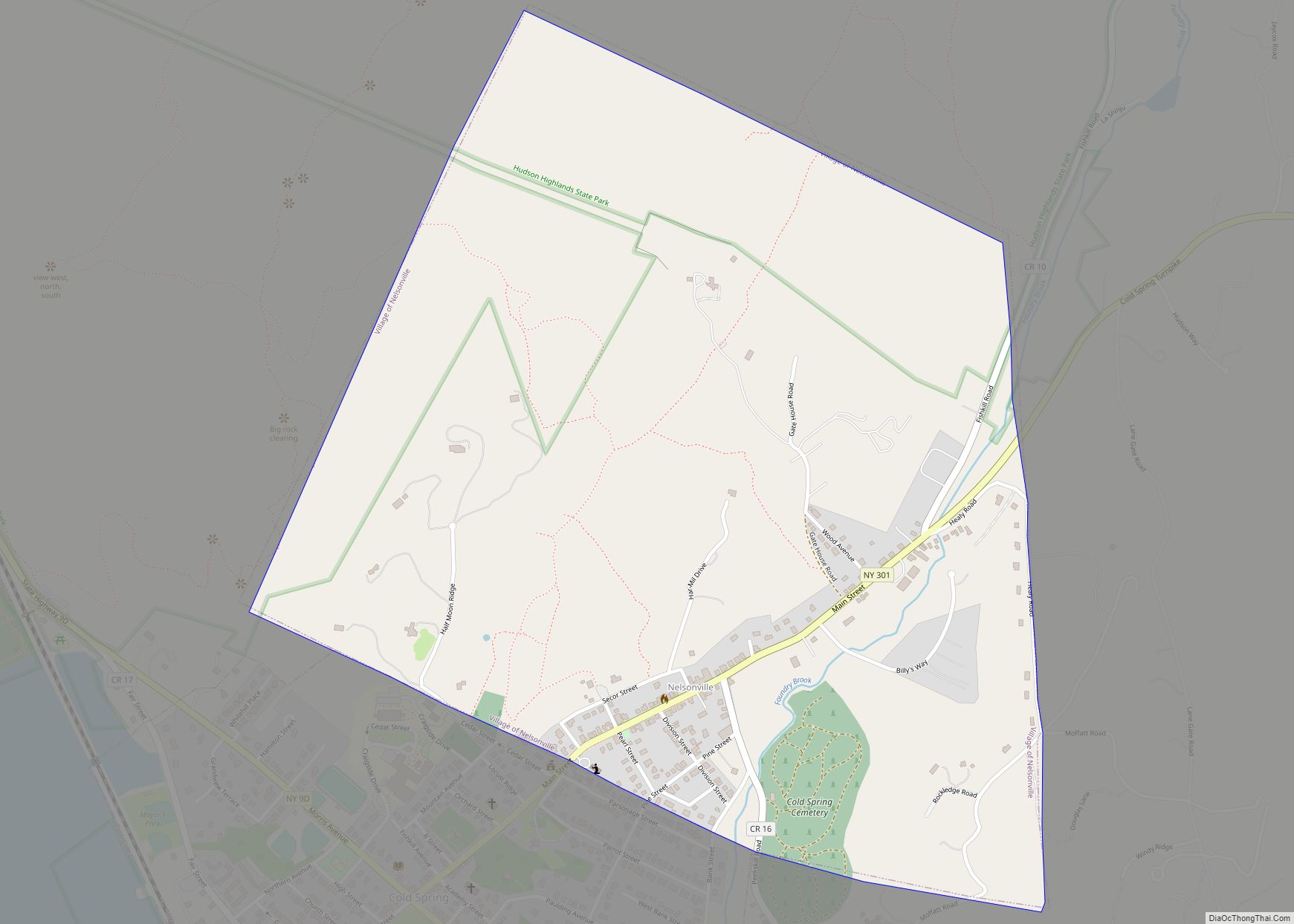
Nelsonville is a village located in the town of Philipstown in Putnam County, New York, United States. The population was 628 at the time of the 2010 census. Nelsonville Lies in the Hudson Highlands directly east of the village of Cold Spring. On Main Street, the border is roughly demarcated by the western property line … Read more

Map of Nelliston village

Map of Nelliston village

Nelliston is a village in Montgomery County, New York, United States. The population was 596 at the 2010 census. The name is from members of the Nellis family. The Village of Nelliston is in the Town of Palatine and is west of Amsterdam. The Erie Canal passes the village. Nelliston village overview: Name: Nelliston village … Read more

Map of Nedrow CDP

Map of Nedrow CDP

Nedrow /ˈnɛdroʊ/ is a hamlet (and census-designated place) located in the town of Onondaga in Onondaga County, New York, United States. The population was 2,244 at the 2010 census. It is a suburb of Syracuse, whose southern border it adjoins. The name “Nedrow” is the founder’s name Worden, spelled backwards. Nedrow CDP overview: Name: Nedrow … Read more

Map of New Hyde Park village

Map of New Hyde Park village

New Hyde Park is a village in the Towns of Hempstead and North Hempstead in Nassau County, on Long Island, in New York, United States. It is the anchor community of the Greater New Hyde Park area. The population was 9,712 at the 2010 census. New Hyde Park village overview: Name: New Hyde Park village … Read more

Map of New Hempstead village

Map of New Hempstead village

New Hempstead is a village in the town of Ramapo, Rockland County, New York, United States. It is located north of New Square, east of Wesley Hills, south of Pomona, and west of New City. The population was 5,132 at the 2010 census. Residents utilize the Spring Valley and New City post offices. New Hempstead … Read more

Map of New Hartford village, New York

Map of New Hartford village, New York

New Hartford is a village in Oneida County, New York, United States. The population was 1,847 at the 2010 census. The name was provided by early settlers from New Hartford, Connecticut. The Village of New Hartford is inside the Town of New Hartford, near the border with Utica. New Hartford village overview: Name: New Hartford … Read more

Map of New City CDP

Map of New City CDP

New City is a hamlet and census-designated place in the town of Clarkstown, Rockland County, New York, United States, part of the New York Metropolitan Area. An affluent suburb of New York City, the hamlet is located 18 miles (29 km) north of the city at its closest point, Riverdale, Bronx. Within Rockland County, New City … Read more

Map of Newfane CDP

Map of Newfane CDP, New York

Newfane is a census-designated place (CDP) in the town of Newfane in Niagara County, New York, United States, along State Route 78. The population was 3,822 at the 2010 census. It is part of the Buffalo–Niagara Falls Metropolitan Statistical Area. Newfane CDP overview: Name: Newfane CDP LSAD Code: 57 LSAD Description: CDP (suffix) State: New … Read more

Map of Newburgh city, New York

Map of Newburgh city, New York

Newburgh is a city in the U.S. state of New York, within Orange County. With a population of 28,856 as of the 2020 census, it is a principal city of the Poughkeepsie–Newburgh–Middletown metropolitan area. Located 60 miles (97 km) north of New York City, and 90 miles (140 km) south of Albany on the Hudson River within … Read more

Map of Newark village, New York

Map of Newark village, New York

Newark is a village in Wayne County, New York, United States, 35 miles (56 km) south east of Rochester and 48 miles (77 km) west of Syracuse. The population was 9,017 at the 2020 census. The Village of Newark is in the south part of the Town of Arcadia and is in the south of Wayne County. … Read more

Map of Newark Valley village

Map of Newark Valley village

Newark Valley is a village in Tioga County, New York, United States. The population was 997 at the 2010 census. It is part of the Binghamton Metropolitan Statistical Area. The village is named after the city of Newark, New Jersey. Newark Valley is in the western part of the Town of Newark Valley and is … Read more

Map of New York Mills village, New York

Map of New York Mills village, New York

New York Mills is a village in Oneida County, New York, United States. The population was 3,327 at the 2010 census. The village of New York Mills is partly in the town of Whitestown and partly in the town of New Hartford. It is a western suburb of the city of Utica. New York Mills … Read more