Map of Old Brookville village
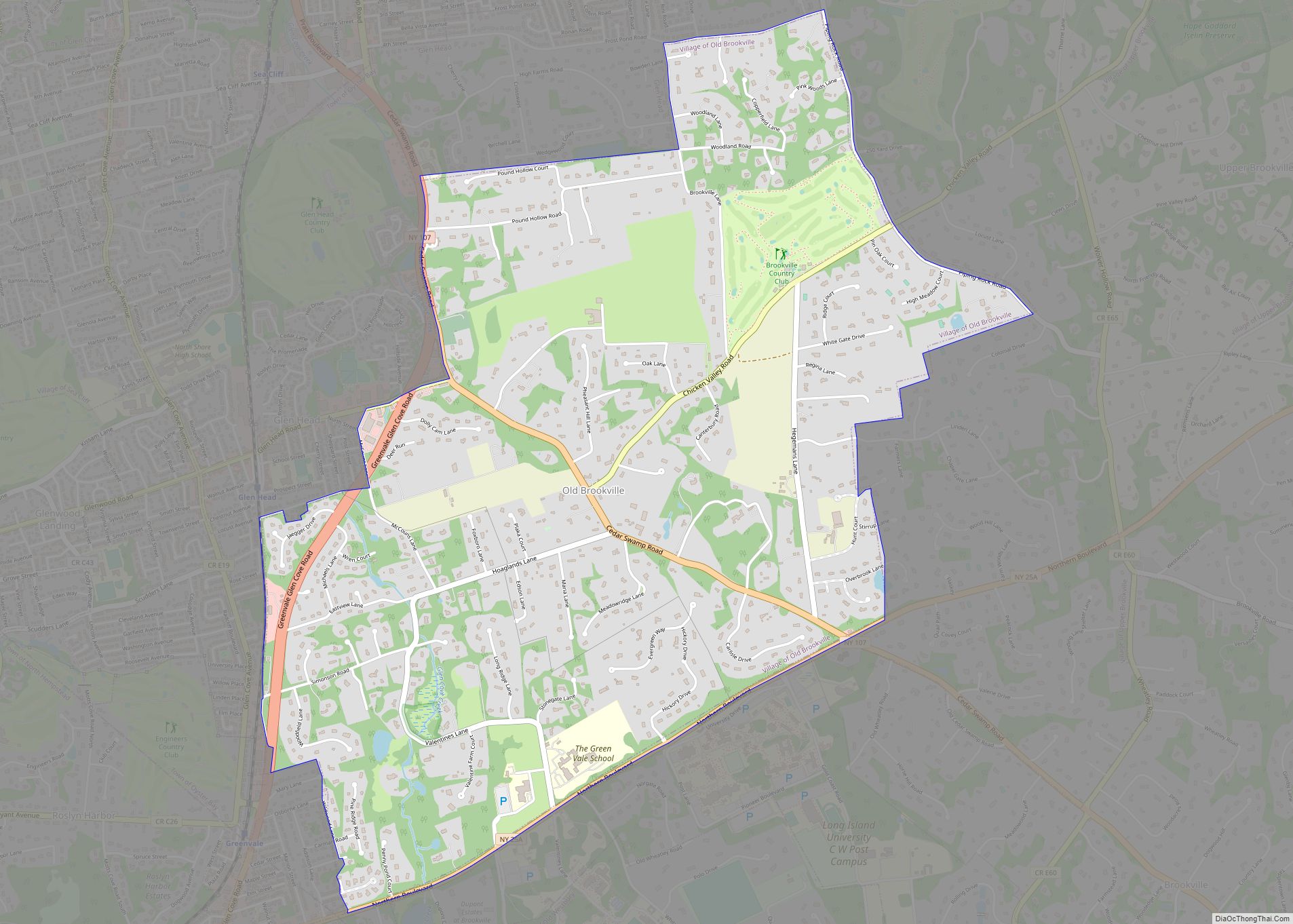
Old Brookville is a village located within the Town of Oyster Bay in Nassau County, on the North Shore of Long Island, in New York, United States. The village population was 2,020 at the time of the 2020 census. It is considered part of the greater Glen Cove area, which is anchored by the City ... Read more
Map of Old Brookville village
Map of Old Bethpage CDP
Old Bethpage is a hamlet and census-designated place (CDP) located on Long Island in the Town of Oyster Bay, Nassau County, New York, United States. The population of the CDP was 5,283 at the 2020 United States Census. It is served by the Old Bethpage Post Office, ZIP code 11804. Old Bethpage and its neighboring ... Read more
Map of Old Bethpage CDP
Map of Olcott CDP
Olcott is a hamlet (and census-designated place) located in the Town of Newfane in Niagara County, New York, United States. As of the 2010 census, this community population was 1,241. Most locals refer to it as Olcott Beach. It is part of the Buffalo–Niagara Falls Metropolitan Statistical Area. Olcott is a lakeside community which is ... Read more
Map of Olcott CDP
Map of Ogdensburg city, New York
Ogdensburg (Mohawk: Kaniatarahòn:tsi) is a city in St. Lawrence County, New York, United States. The population was 10,436 at the 2019 census. In the late 18th century, European-American settlers named the community after American land owner and developer Samuel Ogden. The city is at the northern border of New York at the mouth of the ... Read more
Map of Ogdensburg city, New York
Map of Odessa village, New York
Odessa is a village in Schuyler County, New York, United States. The population was 543 at the 2020 census. The Village of Odessa is in the western side of the Town of Catharine near the town line and is shared with the Town of Montour. Odessa is north of Elmira, New York. Odessa village overview: ... Read more
Map of Odessa village, New York
Map of Oneonta city, New York
Oneonta (/ˌoʊniˈɒntə/ OH-nee-ON-tə) is a city in southern Otsego County, New York, United States. It is one of the northernmost cities of Appalachia. Oneonta is home to the State University of New York at Oneonta and Hartwick College. SUNY Oneonta began as a normal school and a teacher’s college in 1889, and Hartwick College moved ... Read more
Map of Oneonta city, New York
Map of Oneida city, New York
Oneida (/oʊˈnaɪdə/, Oneida: kanaˀalóhaleˀ) is a city in Madison County in the U.S. state of New York. It is located west of Oneida Castle (in Oneida County) and east of Wampsville. The population was 11,390 at the 2010 census. The city, like both Oneida County and the nearby silver and china maker, was named for ... Read more
Map of Oneida city, New York
Map of Ossining village
Ossining /ˈɒsɪnɪŋ/ is a village in Westchester County, New York, United States. The population at the 2020 United States census was 27,551, an increase from 25,060 at the 2010 census. As a village, it is located in the town of Ossining. Ossining village overview: Name: Ossining village LSAD Code: 47 LSAD Description: village (suffix) State: ... Read more
Map of Ossining village
Map of Oriskany village
Oriskany (/ɔːrˈɪskəniː/ or /əˈrɪskəniː/) is a village in Oneida County, New York, United States. The population was 1,400 at the 2010 census. The name is derived from the Iroquois word for “nettles”. The Village of Oriskany is in the Town of Whitestown, southeast of the City of Rome. NY-69 passes through the village, which is ... Read more
Map of Oriskany village
Map of Oriskany Falls village
Oriskany Falls is a village in Oneida County, New York, United States. The population was 732 at the 2010 census. The name is derived from a waterfall on a nearby stream. The Village of Oriskany Falls is in the southeast section of the Town of Augusta and partly overlaps the Town of Marshall. The community ... Read more
Map of Oriskany Falls village
Map of Orient CDP, New York
Orient is a hamlet and census-designated place (CDP) in Suffolk County, Long Island, New York, United States. The CDP’s population was 743 at the 2010 census. Orient and Orient Point are used almost interchangeably. However, Orient Point refers specifically to the physical point at the end of the North Fork of Long Island, while Orient ... Read more
Map of Orient CDP, New York
Map of Orchard Park village
Orchard Park is a village in Erie County, New York, United States. The population was 3,246 at the 2010 census. The name is derived from a description of the local landscape, which abounded with orchards. It is part of the Buffalo–Niagara Falls Metropolitan Statistical Area. The village of Orchard Park lies north of the center ... Read more
Map of Orchard Park village