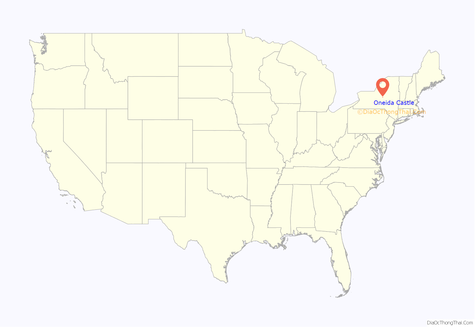
Oneida Castle (Oneida: tkanaˀalóhaleˀ) is a village in Oneida County, New York, United States. The population was 625 at the 2010 census.
The Village of Oneida Castle is in the northwestern corner of the Town of Vernon. Oneida Castle is east of the City of Oneida (located in Madison County) and west of the City of Sherrill in New York State.
| Name: | Oneida Castle village |
|---|---|
| LSAD Code: | 47 |
| LSAD Description: | village (suffix) |
| State: | New York |
| County: | Oneida County |
| Elevation: | 449 ft (137 m) |
| Total Area: | 0.51 sq mi (1.31 km²) |
| Land Area: | 0.51 sq mi (1.31 km²) |
| Water Area: | 0.00 sq mi (0.00 km²) |
| Total Population: | 586 |
| Population Density: | 1,158.10/sq mi (447.16/km²) |
| FIPS code: | 3654848 |
| GNISfeature ID: | 0959364 |
Online Interactive Map
Click on ![]() to view map in "full screen" mode.
to view map in "full screen" mode.
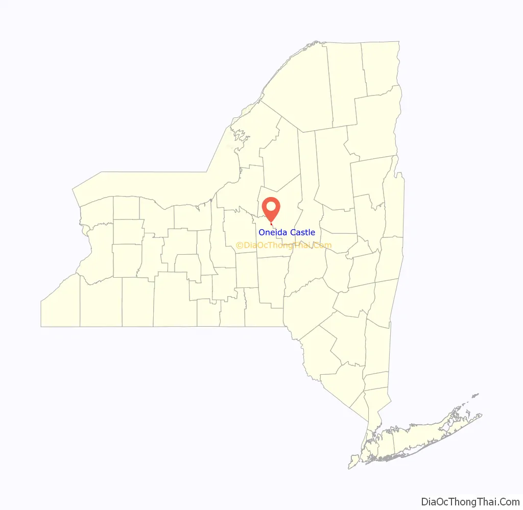
Oneida Castle location map. Where is Oneida Castle village?
History
The village was formerly the site of a major fortified village, Kanonwalohale (written as “tkanaˀalóhaleˀ” modern Oneida Orthography), of the Oneida tribe, one of the original Five Nations of the Iroquois Confederacy. They established it in the beginning of the 18th century, moving from an area where they suffered raids by parties from the French colony of Quebec, which was trying to control their fur trade. The village was surrounded by tall wooden palisades, with a moat bordering this. Dwellings and storage structures were protected inside. Mohawk Joseph Brant led a war party which destroyed the village in July 1780.
Later European-American settlers named the Village of Oneida Castle for this last great village or “castle” of the Oneida people. In the colonial period, Europeans often referred to the major fortified Iroquois villages as “castles” because it was a familiar reference for them for such a settlement; other examples include Seneca Castle and Genesee Castle.
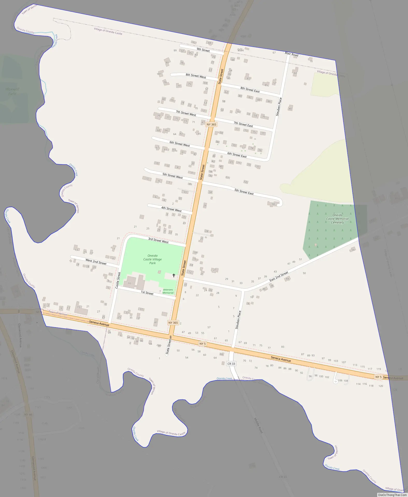
Oneida Castle Road Map
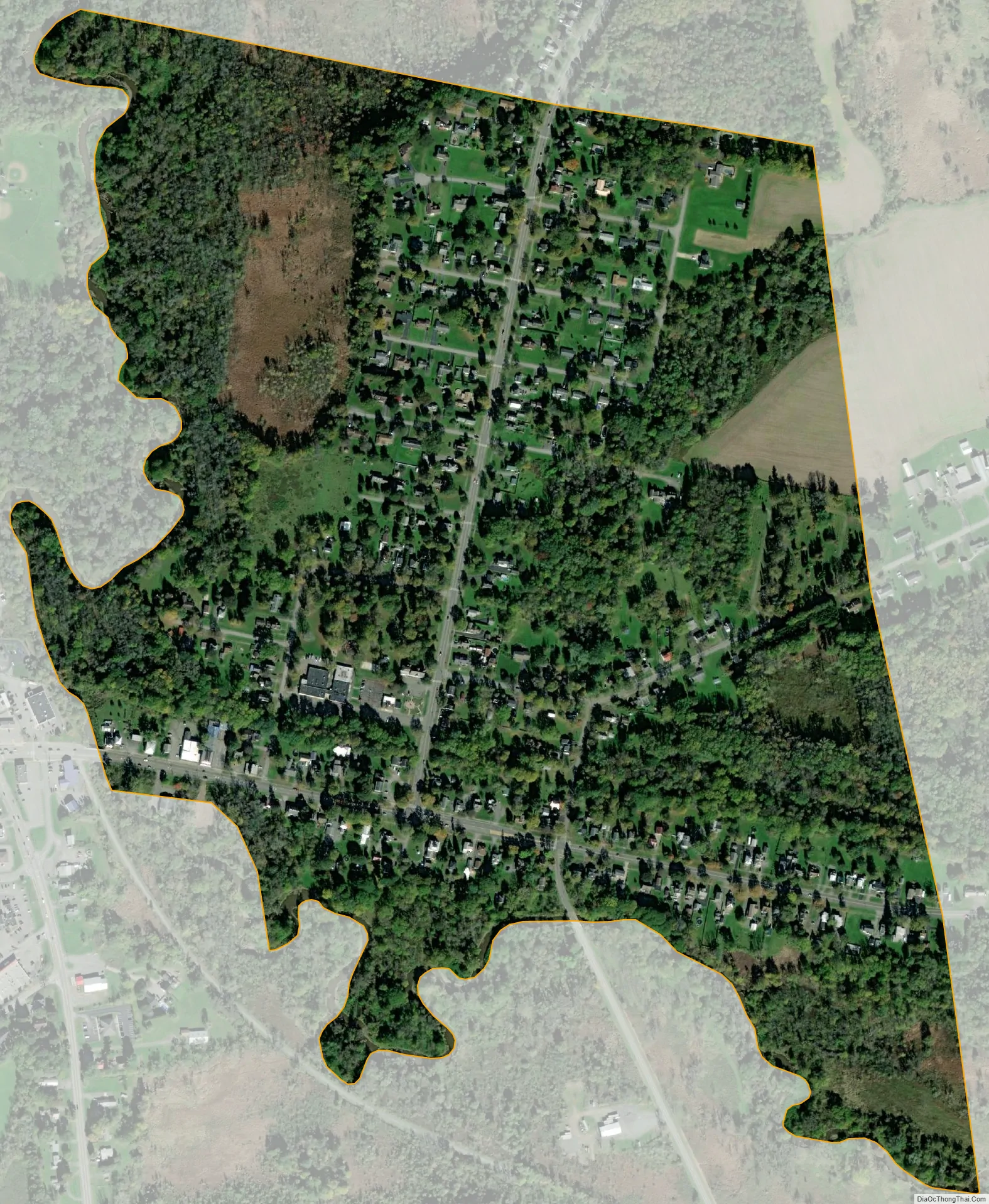
Oneida Castle city Satellite Map
Geography
Oneida Castle is located at 43°4′42″N 75°38′0″W / 43.07833°N 75.63333°W / 43.07833; -75.63333 (43.078335, -75.633383). Oneida Castle is the approximate geographic center of New York State. There have been past attempts to move the state capitol here. According to the United States Census Bureau, the village has a total area of 0.5 square miles (1.3 km), all land.
See also
Map of New York State and its subdivision:- Albany
- Allegany
- Bronx
- Broome
- Cattaraugus
- Cayuga
- Chautauqua
- Chemung
- Chenango
- Clinton
- Columbia
- Cortland
- Delaware
- Dutchess
- Erie
- Essex
- Franklin
- Fulton
- Genesee
- Greene
- Hamilton
- Herkimer
- Jefferson
- Kings
- Lake Ontario
- Lewis
- Livingston
- Madison
- Monroe
- Montgomery
- Nassau
- New York
- Niagara
- Oneida
- Onondaga
- Ontario
- Orange
- Orleans
- Oswego
- Otsego
- Putnam
- Queens
- Rensselaer
- Richmond
- Rockland
- Saint Lawrence
- Saratoga
- Schenectady
- Schoharie
- Schuyler
- Seneca
- Steuben
- Suffolk
- Sullivan
- Tioga
- Tompkins
- Ulster
- Warren
- Washington
- Wayne
- Westchester
- Wyoming
- Yates
- Alabama
- Alaska
- Arizona
- Arkansas
- California
- Colorado
- Connecticut
- Delaware
- District of Columbia
- Florida
- Georgia
- Hawaii
- Idaho
- Illinois
- Indiana
- Iowa
- Kansas
- Kentucky
- Louisiana
- Maine
- Maryland
- Massachusetts
- Michigan
- Minnesota
- Mississippi
- Missouri
- Montana
- Nebraska
- Nevada
- New Hampshire
- New Jersey
- New Mexico
- New York
- North Carolina
- North Dakota
- Ohio
- Oklahoma
- Oregon
- Pennsylvania
- Rhode Island
- South Carolina
- South Dakota
- Tennessee
- Texas
- Utah
- Vermont
- Virginia
- Washington
- West Virginia
- Wisconsin
- Wyoming