Old Bethpage is a hamlet and census-designated place (CDP) located on Long Island in the Town of Oyster Bay, Nassau County, New York, United States. The population of the CDP was 5,283 at the 2020 United States Census. It is served by the Old Bethpage Post Office, ZIP code 11804.
Old Bethpage and its neighboring hamlet, Plainview, share a school system, library, fire department and water district. Law enforcement for the community is provided by the Nassau County Police Department’s Eighth Precinct.
| Name: | Old Bethpage CDP |
|---|---|
| LSAD Code: | 57 |
| LSAD Description: | CDP (suffix) |
| State: | New York |
| County: | Nassau County |
| Elevation: | 174 ft (53 m) |
| Total Area: | 4.17 sq mi (10.80 km²) |
| Land Area: | 4.17 sq mi (10.79 km²) |
| Water Area: | 0.00 sq mi (0.01 km²) |
| Total Population: | 6,403 |
| Population Density: | 1,537.33/sq mi (593.62/km²) |
| ZIP code: | 11804 |
| Area code: | 516 |
| FIPS code: | 3654551 |
| GNISfeature ID: | 0959252 |
Online Interactive Map
Click on ![]() to view map in "full screen" mode.
to view map in "full screen" mode.
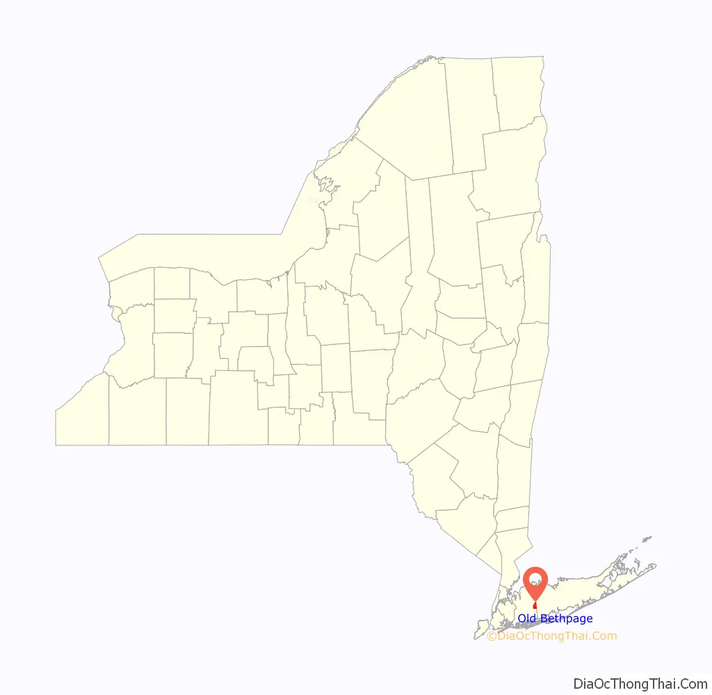
Old Bethpage location map. Where is Old Bethpage CDP?

History
In 1695, Thomas Powell bought about 10,000 acres (40 km) from local Indian tribes, including the Marsapeque, Matinecoc, and Sacatogue, for 140 English pounds. This land, which includes present day Bethpage, East Farmingdale, Farmingdale, Old Bethpage, Plainedge, Plainview, South Farmingdale, and part of Melville, is known as the Bethpage Purchase and is approximately 3.5 miles (5.6 km) east to west and 5 miles (8.0 km) north to south.
Powell called his land Bethphage, because it was situated between two other places on Long Island, Jericho and Jerusalem, just as the biblical town of Bethphage (meaning “house of figs”) was situated between Jericho and Jerusalem. Today, the Long Island place formerly called Jerusalem is known as Wantagh and Island Trees, while the placename Jericho is unaltered. Over time, Bethpage was spelled without the second “H”. Powell’s 14 children split up his purchase and it evolved into several farming communities, and the one in this mostly central part of the purchase retained the name “Bethpage”.
A railroad spur completed in 1873, known as the Bethpage Branch of the Central Railroad of Long Island, ran to a brickworks plant which had opened on what is now Battle Row and Bethpage-Sweet Hollow Road in the 1860s. The railway was built to transport bricks for the construction of Alexander Stewart’s Garden City. For a few years, regularly scheduled passenger traffic also appeared in timetables, with the station being called Bethpage. The line was abandoned in 1942. Remnants of a locomotive turntable can be found in the woods of Bethpage State Park on the east side of Round Swamp Road. The brickyard continued operations under different owners until 1981, with different sections known variously as Bethpage Brickworks, Queens County Brick Manufacturing Company, Post Brick Company, and (after Nassau County split from Queens County in 1899) Nassau Brick Company. The pitted terrain at the brickworks was used in investigations by Grumman for digital mapping of Earth.
In 1908, William Kissam Vanderbilt II began construction of the Long Island Motor Parkway, one of the country’s first highways. Eventually stretching 45 miles (72 km) from Queens to Lake Ronkonkoma, New York, a portion of the parkway ran through Old Bethpage. Street names such as “Vanderbilt Lane”, “Motor Parkway” and “Toll Place” serve as reminders. Segments of the old roadbed and some bridges can still be seen in some places, including Battle Row Campground, Bethpage State Park, and the Old Bethpage Village Restoration.
In 1932, under the auspices of Long Island State Parks Commissioner, Robert Moses, Bethpage State Park, was opened. The park and its 1,400 acres (5.7 km) is almost entirely within the hamlet of Old Bethpage. In 1936, the adjacent hamlet of Central Park changed its name to Bethpage. Following this name change, the hamlet originally called Bethpage resisted suggestions that it merge with the new Bethpage, and got approval from the post office to change its name to Old Bethpage, though it did not have its own post office until 1965. Bethpage State Park remained so named, leading some to mistakenly believe that the park is located mostly in Bethpage.
Old Bethpage was home to at least two grand estates, the Benjamin Franklin Yoakum Estate and the Taliaferro Estate.
- The former estate of railroad tycoon Benjamin F. Yoakum included land in both Old Bethpage and the Lenox Hills neighborhood of Farmingdale Village. It was this estate that was transformed into Bethpage State Park.
- The Taliaferro Estate is now the site of Country Pointe Plainview, located between the split of Old Country Road and Round Swamp Road, and was once home to the Nassau County Sanitarium, a tuberculosis ward. The sanitarium was authorized by the Nassau County Board of Supervisors in 1930, and was completed in the early part of the same decade. As tuberculosis was brought under control, the complex of Georgian style buildings was closed in the 1960s. Following its closure, the facility was given over to mixed use, including the establishment of a drug and alcohol rehabilitation center in 1976, and a branch of the Cornell Cooperative Extension. In 1999, Charles Wang, founder of Computer Associates purchased the 144-acre (0.58 km) property from the county for $23 million. Included in the purchase was 1535 Old Country Road, which housed the corporate offices of the New York Islanders and New York Dragons, both of which were owned by Wang. In addition, the building was home to the Wang-created, Plainview Chinese Cultural Center. In 2015, the Oyster Bay board voted to approve a condominium plan on the same grounds. The land is now known as Country Pointe Plainview and is maintained by Jericho-based Beechwood Homes; the property consists mostly of senior condos and retail space.
In 1960, responding to Nassau County’s rapid suburban expansion, the county announced plans for the development of the Nassau County Fire Service Academy. Located on Winding Road, the academy provides training to all Nassau County fire departments.
Old Bethpage Road Map
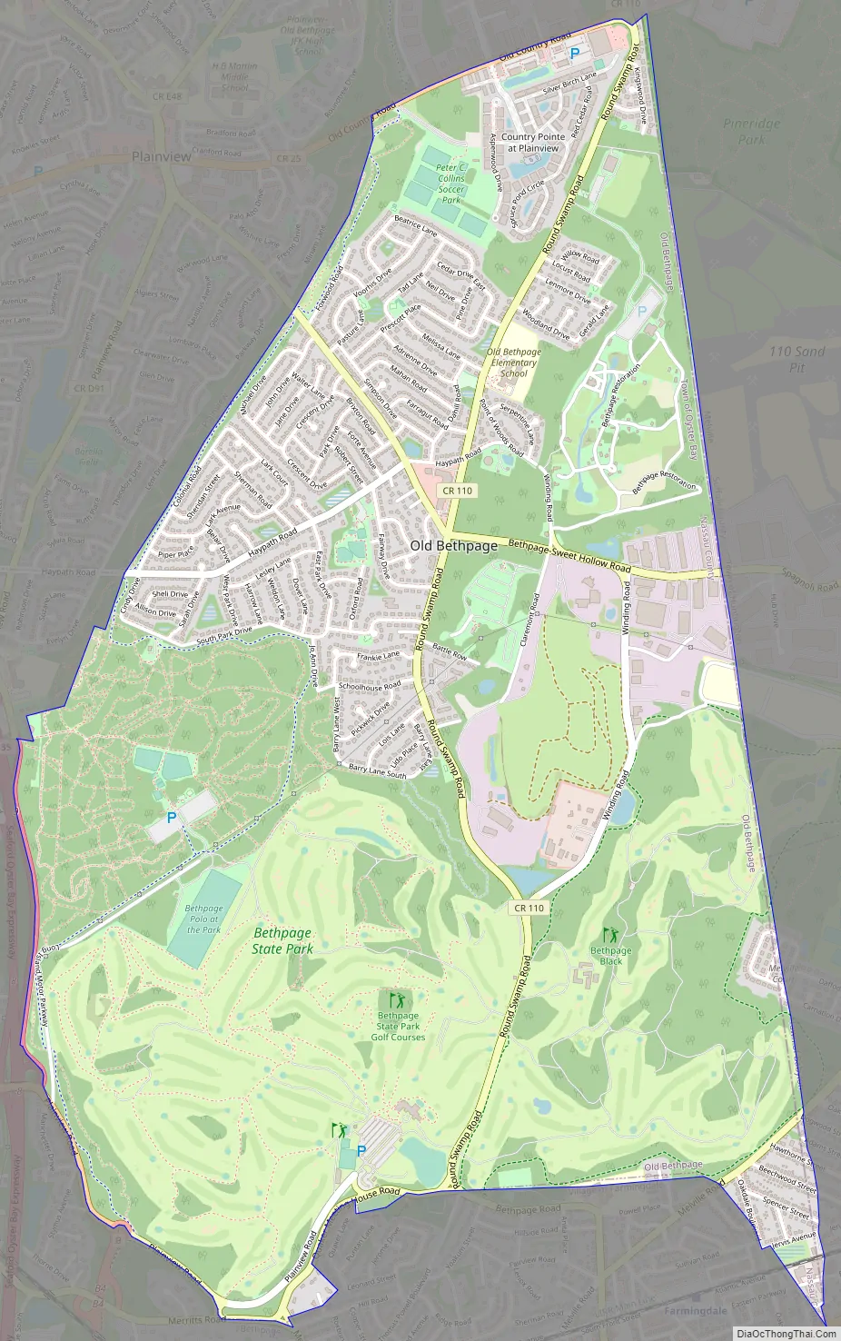
Old Bethpage city Satellite Map

Geography
Old Bethpage is located at 40°45′43″N 73°27′16″W / 40.76194°N 73.45444°W / 40.76194; -73.45444 (40.761819, -73.454544). For the 2000 Census, the boundaries of the CDP were enlarged beyond those of the 1990 census.
According to the United States Census Bureau, Old Bethpage has a total area of 4.1 square miles (11 km), all land. Although Plainview, at 5.7 square miles (15 km) is 40% larger, its population is approximately five times that of Old Bethpage because significant portions of Old Bethpage consist of parks and undeveloped property, including, Bethpage State Park, the Old Bethpage Village Restoration and Battle Row Campground.
See also
Map of New York State and its subdivision:- Albany
- Allegany
- Bronx
- Broome
- Cattaraugus
- Cayuga
- Chautauqua
- Chemung
- Chenango
- Clinton
- Columbia
- Cortland
- Delaware
- Dutchess
- Erie
- Essex
- Franklin
- Fulton
- Genesee
- Greene
- Hamilton
- Herkimer
- Jefferson
- Kings
- Lake Ontario
- Lewis
- Livingston
- Madison
- Monroe
- Montgomery
- Nassau
- New York
- Niagara
- Oneida
- Onondaga
- Ontario
- Orange
- Orleans
- Oswego
- Otsego
- Putnam
- Queens
- Rensselaer
- Richmond
- Rockland
- Saint Lawrence
- Saratoga
- Schenectady
- Schoharie
- Schuyler
- Seneca
- Steuben
- Suffolk
- Sullivan
- Tioga
- Tompkins
- Ulster
- Warren
- Washington
- Wayne
- Westchester
- Wyoming
- Yates
- Alabama
- Alaska
- Arizona
- Arkansas
- California
- Colorado
- Connecticut
- Delaware
- District of Columbia
- Florida
- Georgia
- Hawaii
- Idaho
- Illinois
- Indiana
- Iowa
- Kansas
- Kentucky
- Louisiana
- Maine
- Maryland
- Massachusetts
- Michigan
- Minnesota
- Mississippi
- Missouri
- Montana
- Nebraska
- Nevada
- New Hampshire
- New Jersey
- New Mexico
- New York
- North Carolina
- North Dakota
- Ohio
- Oklahoma
- Oregon
- Pennsylvania
- Rhode Island
- South Carolina
- South Dakota
- Tennessee
- Texas
- Utah
- Vermont
- Virginia
- Washington
- West Virginia
- Wisconsin
- Wyoming


