Map of Tuckahoe CDP

Map of Tuckahoe CDP, New York

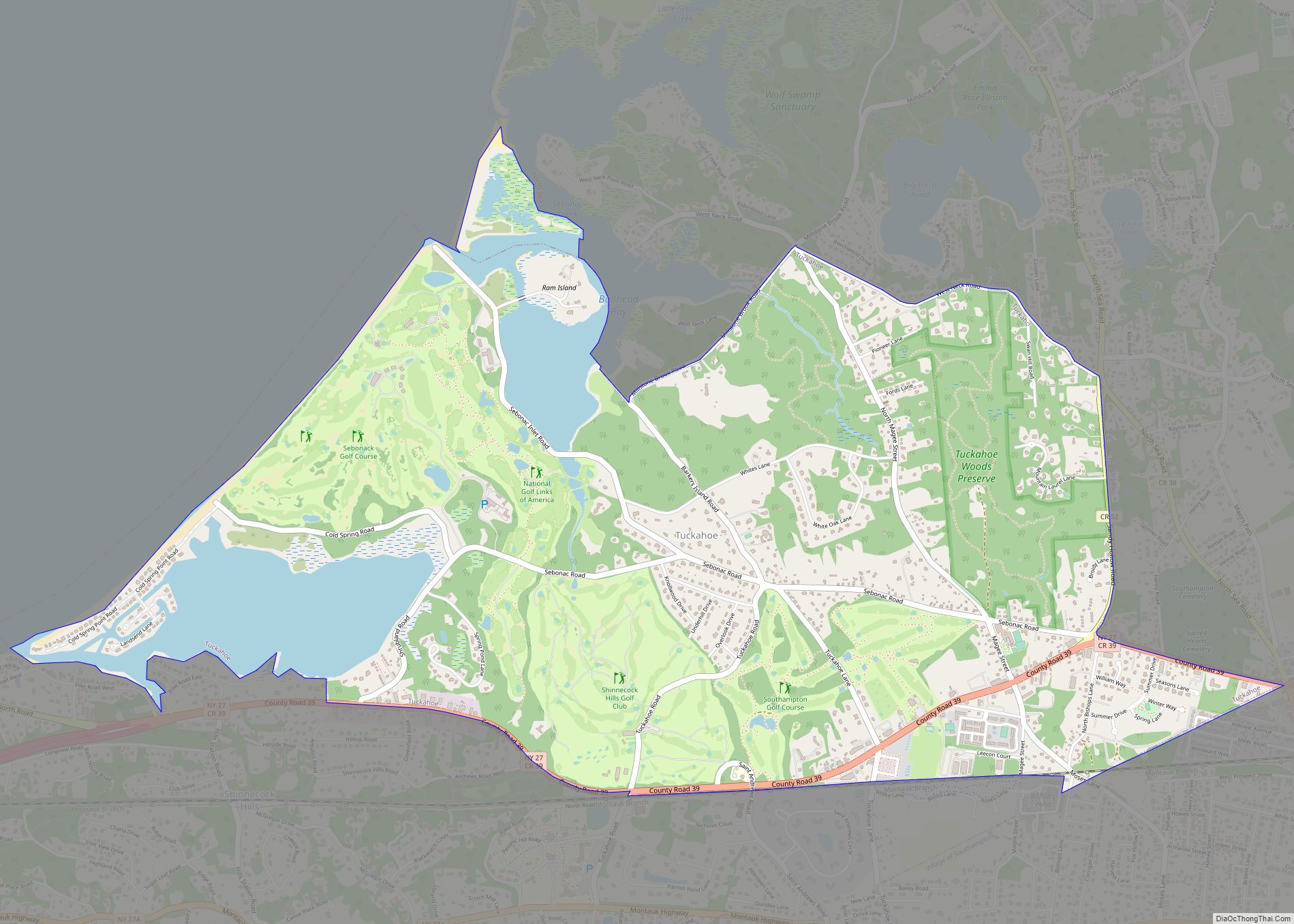
Tuckahoe is a hamlet and census-designated place (CDP) in the Town of Southampton, Suffolk County, New York, United States. The population was 1,373 at the 2010 census. Tuckahoe CDP overview: Name: Tuckahoe CDP LSAD Code: 57 LSAD Description: CDP (suffix) State: New York County: Suffolk County Elevation: 49 ft (15 m) Total Area: 4.74 sq mi (12.27 km²) Land Area: … Read more

Map of Trumansburg village

Map of Trumansburg village

Trumansburg is a village in Tompkins County, New York, United States. The population was 1,797 at the 2010 census. The name incorporates a misspelling of the surname of the founder, Abner Treman. The Tremans spelled their surname several different ways; “Truman,” however, was not one of them. The village’s application for a post office established … Read more

Map of Troy city, New York

Map of Troy city, New York

Troy is a city in the U.S. state of New York and the county seat of Rensselaer County. The city is located on the western edge of Rensselaer County and on the eastern bank of the Hudson River. Troy has close ties to the nearby cities of Albany and Schenectady, forming a region popularly called … Read more

Map of Tribes Hill CDP

Map of Tribes Hill CDP

Tribes Hill is a census-designated place (CDP) located in the Towns of Mohawk (80%) and Amsterdam (20%) in Montgomery County, New York, United States. The population was 1,003 at the 2010 census. One theory is the name is based on this location having been a gathering spot for the Mohawk nation, the dominant Iroquois tribe … Read more

Map of Unadilla village, New York

Map of Unadilla village, New York

Unadilla is a village located in the Town of Unadilla in Otsego County, New York, United States. The population was 1,128 at the 2010 census. The Village of Unadilla is located in the southern part of the town, southwest of Oneonta. The community refers to itself as “The Village Beautiful.” Unadilla village overview: Name: Unadilla … Read more

Map of Tuxedo Park village

Map of Tuxedo Park village

Tuxedo Park is a village in Orange County, New York, United States. Its population was 645 at the 2020 census. It is part of the Poughkeepsie–Newburgh–Middletown metropolitan area as well as the larger New York metropolitan area. Its name is derived from an indigenous Lenape word of the Munsee language, tucsedo or p’tuxseepu, which is … Read more

Map of Tuscarora CDP

Map of Tuscarora CDP, New York

Tuscarora is a hamlet and census-designated place in the town of Mount Morris, Livingston County, New York, United States. Its population was 74 as of the 2010 census. Tuscarora CDP overview: Name: Tuscarora CDP LSAD Code: 57 LSAD Description: CDP (suffix) State: New York County: Livingston County Elevation: 750 ft (230 m) Total Area: 0.09 sq mi (0.24 km²) Land … Read more

Map of Valatie village

Map of Valatie village

Valatie (/vəˈleɪʃə/; və-LAY-shə) is a village with several waterfalls in Columbia County, New York, United States. The population was 1,819 at the 2010 census. The village is at the center of the town of Kinderhook on US 9. Valatie village overview: Name: Valatie village LSAD Code: 47 LSAD Description: village (suffix) State: New York County: … Read more

Map of Vails Gate CDP

Map of Vails Gate CDP

Vails Gate is a hamlet (and census-designated place) in Orange County, New York, United States. The population was 3,368 at the 2020 census. It is part of the Poughkeepsie–Newburgh–Middletown, NY Metropolitan Statistical Area as well as the larger New York–Newark–Bridgeport, NY-NJ–CT–PA Combined Statistical Area. Vails Gate is in the southern part of the Town of … Read more

Map of Utica city, New York

Map of Utica city, New York

Utica (/ˈjuːtɪkə/ (listen)) is a city in the Mohawk Valley and the county seat of Oneida County, New York, United States. The tenth-most-populous city in New York State, its population was 65,283 in the 2020 U.S. Census. Located on the Mohawk River at the foot of the Adirondack Mountains, it is approximately 95 mi (153 km) west-northwest … Read more

Map of Upper Nyack village

Map of Upper Nyack village

Upper Nyack is a village incorporated in 1872 in the town of Clarkstown, Rockland County, New York, United States. It is located north of the village of Nyack, east of Valley Cottage, south of Rockland Lake State Park, and west of the Hudson River. The population was 2,063 at the 2010 census. Upper Nyack has … Read more

Map of Upper Brookville village

Map of Upper Brookville village

Upper Brookville is a village located within the Town of Oyster Bay in Nassau County, on the North Shore of Long Island, in New York, United States. The population was 1,698 at the 2010 census. It is considered part of the greater Glen Cove area, which is anchored by the City of Glen Cove. Upper … Read more