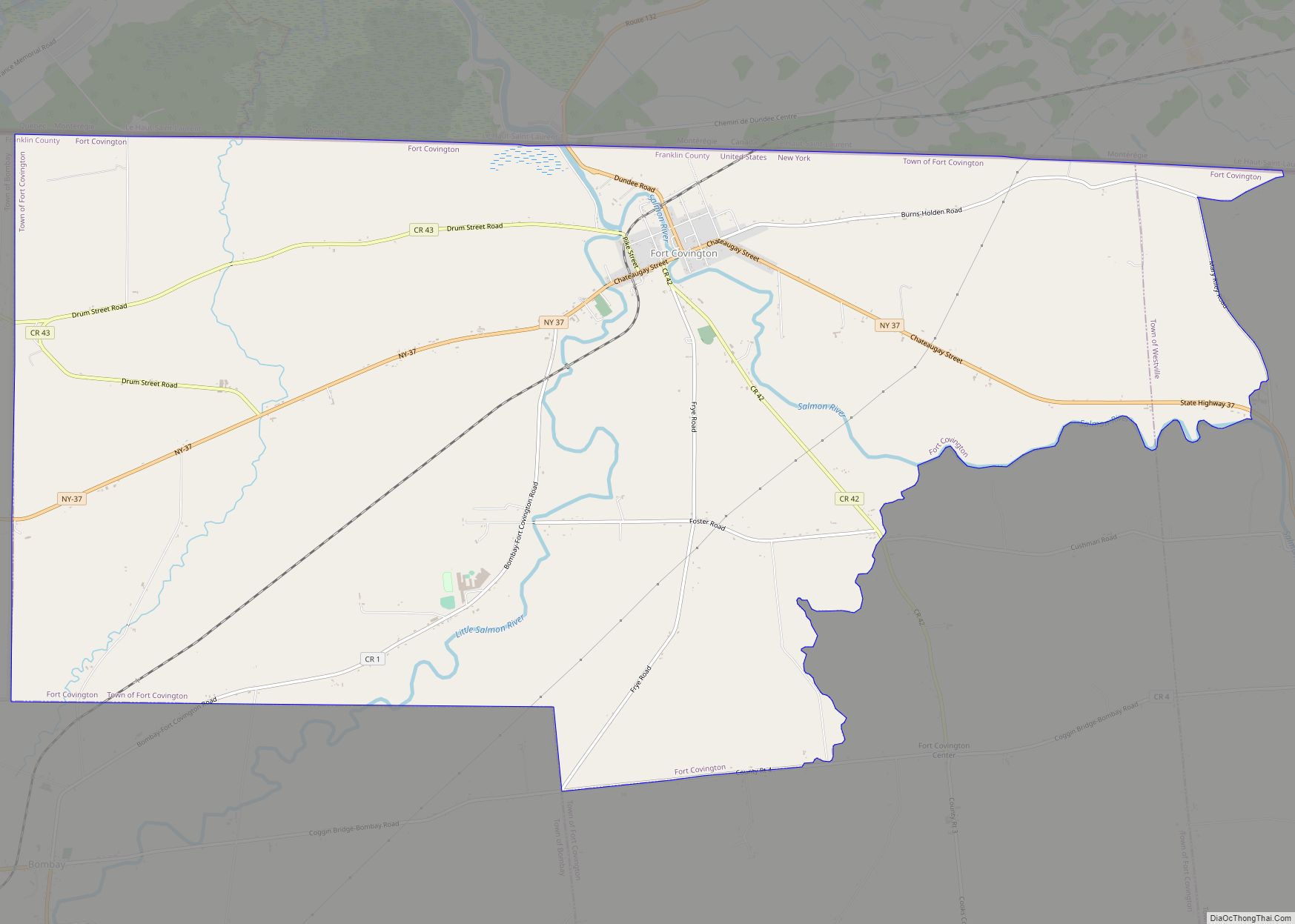
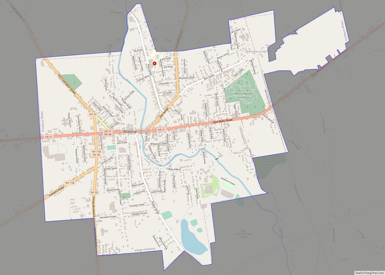
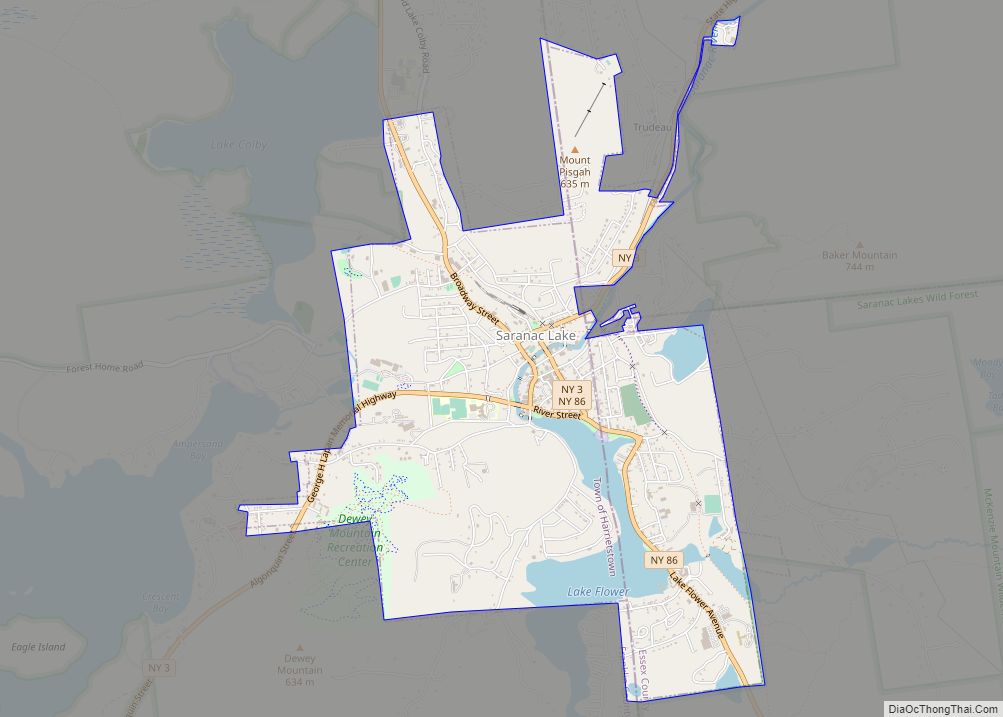
Tupper Lake is a village in Franklin County, New York, United States. The population was 3,282 at the 2020 census. The village is located within the boundaries of the Adirondack Park, west of Lake Placid. Along with nearby Saranac Lake, these three villages make up what is known as the Tri-Lakes region.
The village of Tupper Lake is in the town of Tupper Lake, called Altamont before 2004. The town and the village are in the southwestern part of the county. It is named for 11,000-acre Tupper Lake, two miles south of the village.
The Wild Center, a 54,000 square feet (5,000 m) natural history center, is on a 31 acres (130,000 m) campus. The Adirondack Sky Center & Observatory is on the north side of town.
| Name: | Tupper Lake village |
|---|---|
| LSAD Code: | 47 |
| LSAD Description: | village (suffix) |
| State: | New York |
| County: | Franklin County |
| Elevation: | 1,545 ft (471 m) |
| Total Area: | 2.14 sq mi (5.53 km²) |
| Land Area: | 2.09 sq mi (5.42 km²) |
| Water Area: | 0.04 sq mi (0.11 km²) |
| Total Population: | 3,282 |
| Population Density: | 1,569.58/sq mi (605.94/km²) |
| ZIP code: | 12986 |
| Area code: | 518 |
| FIPS code: | 3675671 |
| GNISfeature ID: | 977539 |
| Website: | www.tupperlakeny.gov |
Online Interactive Map
Click on ![]() to view map in "full screen" mode.
to view map in "full screen" mode.
Tupper Lake location map. Where is Tupper Lake village?


History
Settlement began circa 1844. The village was settled during the town’s lumber production period and grew after it gained railroad service (see below). The early village was composed of two parts, Tupper Lake proper and Faust. The town, for a time, held the distinction as the top lumber producer in the state.
The great fire of 1899 burned more than 169 structures in the village, two-thirds of them homes. The modern village grew out of this destruction and added all the amenities of a modern community earlier than many other villages in the state. Tupper had its own department store and synagogue, and its sprawling railway yards, driven by the lumber trade, made it a hub for the surrounding Adirondack communities.
Railroad service from Herkimer, NY through Tupper Lake (to Malone, Montreal and Lake Placid) began in 1892 with the opening of the Mohawk and Malone Railway. (For the complete subsequent railroad history to 2021, see Wikipedia articles on this early railroad and on the Adirondack Railroad). After a total lapse of service from 1981 through 2021, the Adirondack Railroad plans to return tourist passenger service from Utica to Tupper Lake (108 miles), its new northern terminus, in 2022.
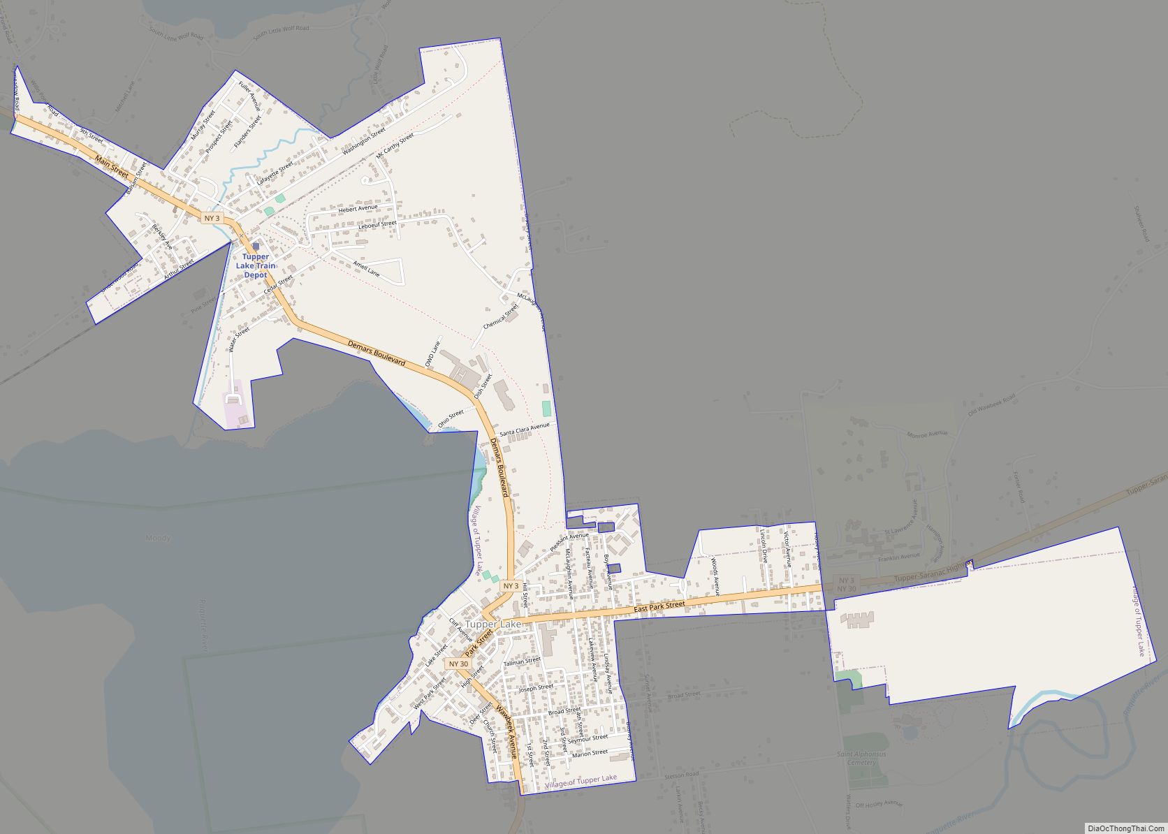
Tupper Lake Road Map
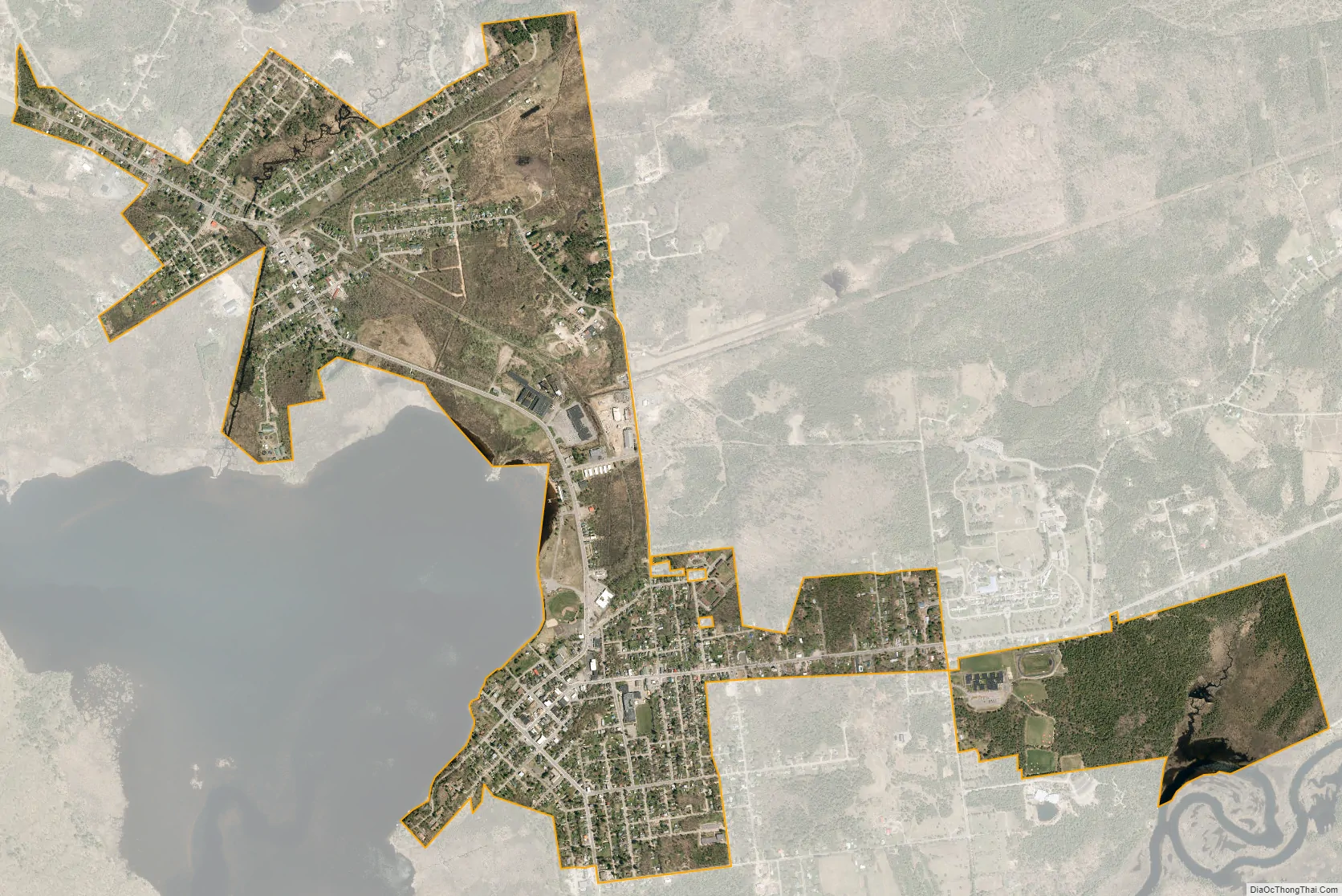
Tupper Lake city Satellite Map
Geography
The village of Tupper Lake is located near the center of the town of Tupper Lake at 44°14′00″N 74°27′57″W / 44.233210°N 74.465720°W / 44.233210; -74.465720, on the east shore of Raquette Pond, the northern end of the Tupper Lake water body. According to the United States Census Bureau, the village has a total area of 2.1 square miles (5.5 km), of which 2.1 square miles (5.4 km) is land and 0.04 square miles (0.1 km), or 2.06%, is water.
New York State Route 3 and New York State Route 30 intersect at the village. NY 3 leads west 94 miles (151 km) to Watertown, and NY 30 leads south 120 miles (190 km) to Amsterdam on the Mohawk River. The two highways lead east out of Tupper Lake together, with NY 30 eventually turning north towards Malone, 58 miles (93 km) from Tupper Lake, and NY 3 continuing east 21 miles (34 km) to Saranac Lake.
The Raquette River flows past the south side of the village, entering Tupper Lake/Raquette Pond. The river continues northwest out of the Adirondacks through Potsdam, eventually joining the St. Lawrence River northeast of Massena.
See also
Map of New York State and its subdivision:- Albany
- Allegany
- Bronx
- Broome
- Cattaraugus
- Cayuga
- Chautauqua
- Chemung
- Chenango
- Clinton
- Columbia
- Cortland
- Delaware
- Dutchess
- Erie
- Essex
- Franklin
- Fulton
- Genesee
- Greene
- Hamilton
- Herkimer
- Jefferson
- Kings
- Lake Ontario
- Lewis
- Livingston
- Madison
- Monroe
- Montgomery
- Nassau
- New York
- Niagara
- Oneida
- Onondaga
- Ontario
- Orange
- Orleans
- Oswego
- Otsego
- Putnam
- Queens
- Rensselaer
- Richmond
- Rockland
- Saint Lawrence
- Saratoga
- Schenectady
- Schoharie
- Schuyler
- Seneca
- Steuben
- Suffolk
- Sullivan
- Tioga
- Tompkins
- Ulster
- Warren
- Washington
- Wayne
- Westchester
- Wyoming
- Yates
- Alabama
- Alaska
- Arizona
- Arkansas
- California
- Colorado
- Connecticut
- Delaware
- District of Columbia
- Florida
- Georgia
- Hawaii
- Idaho
- Illinois
- Indiana
- Iowa
- Kansas
- Kentucky
- Louisiana
- Maine
- Maryland
- Massachusetts
- Michigan
- Minnesota
- Mississippi
- Missouri
- Montana
- Nebraska
- Nevada
- New Hampshire
- New Jersey
- New Mexico
- New York
- North Carolina
- North Dakota
- Ohio
- Oklahoma
- Oregon
- Pennsylvania
- Rhode Island
- South Carolina
- South Dakota
- Tennessee
- Texas
- Utah
- Vermont
- Virginia
- Washington
- West Virginia
- Wisconsin
- Wyoming