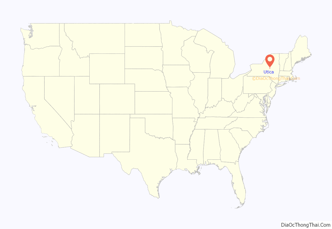
Utica (/ˈjuːtɪkə/ (listen)) is a city in the Mohawk Valley and the county seat of Oneida County, New York, United States. The tenth-most-populous city in New York State, its population was 65,283 in the 2020 U.S. Census. Located on the Mohawk River at the foot of the Adirondack Mountains, it is approximately 95 mi (153 km) west-northwest of Albany, 55 mi (89 km) east of Syracuse and 240 mi (386 km) northwest of New York City. Utica and the nearby city of Rome anchor the Utica–Rome Metropolitan Statistical Area comprising all of Oneida and Herkimer Counties.
Formerly a river settlement inhabited by the Mohawk Nation of the Iroquois Confederacy, Utica attracted European-American settlers from New England during and after the American Revolution. In the 19th century, immigrants strengthened its position as a layover city between Albany and Syracuse on the Erie and Chenango Canals and the New York Central Railroad. During the 19th and 20th centuries, the city’s infrastructure contributed to its success as a manufacturing center and defined its role as a worldwide hub for the textile industry. Utica’s 20th-century political corruption and organized crime gave it the nickname “Sin City”.
Like other Rust Belt cities, Utica underwent an economic downturn throughout the mid-20th century. The downturn consisted of industrial decline due to offshoring and the closure of textile mills, population loss caused by the relocation of jobs and businesses to suburbs and to Syracuse, and poverty associated with socioeconomic stress and a depressed tax base. With its low cost of living, the city has become a melting pot for refugees from war-torn countries around the world, encouraging growth for its colleges and universities, cultural institutions and economy.
| Name: | Utica city |
|---|---|
| LSAD Code: | 25 |
| LSAD Description: | city (suffix) |
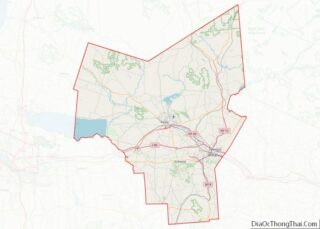
| State: | New York |
| County: | Oneida County |
| Elevation: | 456 ft (139 m) |
| Land Area: | 16.72 sq mi (43.31 km²) |
| Water Area: | 0.26 sq mi (0.66 km²) |
| Population Density: | 3,904.02/sq mi (1,507.33/km²) |
| ZIP code: | 13501-13505, 13599 |
| Area code: | 315 |
| FIPS code: | 3676540 |
| GNISfeature ID: | 0968324 |
| Website: | cityofutica.com |
Online Interactive Map
Click on ![]() to view map in "full screen" mode.
to view map in "full screen" mode.
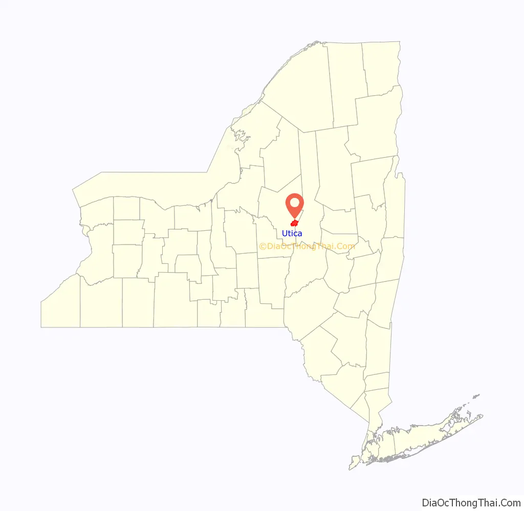
Utica location map. Where is Utica city?
History
Iroquois (Haudenosaunee) and colonial settlement
Utica was established on the site of Old Fort Schuyler, built by American colonists for defense in 1758 during the French and Indian War, the North American front of the Seven Years’ War against France. Prior to construction of the fort, the Mohawk, Onondaga and Oneida nations of the Iroquois (Haudenosaunee) Confederacy had controlled this area southeast of the Great Lakes region as early as 4000 BC. The Mohawk were the largest and most powerful nation in the eastern and lower Mohawk Valley. Colonists had a long-standing fur trade with the Mohawk, in exchange for firearms and rum. The Iroquois nations’ dominating presence in the region prevented the Province of New York from expanding past the middle of the Mohawk Valley until after the American victory in the Revolutionary War. Following the war several Iroquois nations were forced to cede lands to New York: British allies due to defeat and American allies in exchange for post-war shelter and supplies which were necessary following the brutal fighting.
The land housing Old Fort Schuyler was part of a 20,000-acre (81 km) portion of marshland granted by King George II to New York governor William Cosby on January 2, 1734. Since the fort was located near several trails (including the Great Indian Warpath), its position—on a bend at a shallow portion of the Mohawk River—made it an important fording point. The Mohawk call the bend Unundadages (“around the hill”), a name that now appears on the city’s seal.
During the American Revolutionary War, border raids from British-allied Iroquois tribes harried the settlers on the frontier. George Washington ordered Sullivan’s Expedition, Rangers, to enter Central New York and suppress the Iroquois threat. More than 40 Iroquois villages were destroyed along with their winter stores, causing starvation. In the aftermath of the war, numerous colonial settlers migrated into the region of New York from New England, especially Connecticut.
In 1794 a state road, Genesee Road, was built from Utica west to the Genesee River. That year a contract was awarded to the Mohawk Turnpike and Bridge Company to extend the road northeast to Albany, and in 1798 it was extended. The Seneca Turnpike was key to Utica’s development, replacing a worn footpath with a paved road. The village became a rest and supply area along the Mohawk River for goods and the many people moving through Western New York to and from the Great Lakes.
The boundaries of the village of Utica were defined in an act passed by the New York State Legislature on April 3, 1798. Utica expanded its borders in subsequent 1805 and 1817 charters. On April 5, 1805, the village’s eastern and western boundaries were expanded, and on April 7, 1817, Utica separated from Whitestown on its west. After completion of the Erie Canal in 1825, the city’s growth was stimulated again.
The municipal charter was passed by the state legislature on February 13, 1832. In 1845 the United States Census ranked Utica as the 29th-largest in the country (with 20,000 residents, more than the populations of Chicago, Detroit or Cleveland.)
Industry and trade
Utica’s location on the Erie and Chenango canals encouraged industrial development, allowing the transport of anthracite coal from northeastern Pennsylvania for local manufacturing and distribution. Utica’s economy centered around the manufacture of furniture, heavy machinery, textiles and lumber. The combined effects of the Embargo Act of 1807 and local investment enabled further expansion of the textile industry.
In addition to the canals, transport in Utica was bolstered by railroads running through the city. The first was the Mohawk and Hudson Rail Road, which became the Utica and Schenectady Railroad in 1833. Its 78 mi (126 km) connection between Schenectady and Utica was developed in 1836 from the right-of-way previously used by the Mohawk and Hudson River railway. Later lines, such as the Syracuse and Utica Railroad, merged with the Utica and Schenectady to form the New York Central Railroad, which originated as a 19th-century forest railway of the Adirondacks.
In the early 1800s, William Williams, and his partner published Utica’s first newspaper, The Utica Club, from their printing shop on Genesee Street. In 1817 Williams also published Utica’s first directory.
Abolitionism
During the 1850s, Utica aided more than 650 fugitive slaves; it played a major role as a station in the Underground Railroad. The city was on a slave escape route from the Southern Tier to Canada by way of Albany, Syracuse, or Rochester. The route, used by Harriet Tubman to travel to Buffalo, guided slaves to pass through Utica on the New York Central Railroad right-of-way en route to Canada. Utica was the locus for Methodist preacher Orange Scott’s antislavery sermons during the 1830s and 1840s, and Scott formed an abolitionist group there in 1843. Beriah Green organized the 1835 initial meeting of the New York Anti-Slavery Society in Utica, which was disrupted by an anti-abolitionist mob led by local congressman Samuel Beardsley and other “prominent citizens”. (It adjourned to Gerrit Smith’s home in nearby Peterboro, New York.)
20th century to present
The early 20th century brought rail advances to Utica, with the New York Central electrifying 49 mi (79 km) of track from the city to Syracuse in 1907 for its West Shore interurban line. In 1902, the Utica and Mohawk Valley Railway connected Rome to Little Falls with a 37.5 mi (60.4 km) electrified line through Utica.
In 1919, two-thirds of employed Uticans worked in the textile industry. The textile industry in the Northern United States declined rapidly following World War I, as mills relocated to the Southern United States. Textiles remained the leading industry in Utica through 1947, employing a little less than a quarter of workers. Through the 1940s and 1950s, local politicians lobbied for modern industry to come to Utica, and General Electric, Chicago Pneumatic, Bendix Aviation, and Univac among others established factories in Utica. Utica College and Mohawk Valley Community College were founded to provide skilled workers, and Oneida County Airport was built to provide transport. The city also underwent a residential expansion and modernization. This time period is sometimes called the “loom to boom” era.
By the 1950s, Utica was known as “Sin City” because of the extent of its corruption at the hands of the Democratic Party political machine. During the late 1920s, trucker Rufus Elefante rose to power although he never ran for office. Originally a Republican, Elefante’s power was enhanced by support from New York governor Franklin D. Roosevelt. Utica newspapers the Observer-Dispatch and Utica Daily Press were awarded the 1959 Pulitzer Prize for Public Service for their investigations of local corruption. Organized crime in Utica peaked in the 1950s, with a resurgence in the late 1970s. The indictment of local associates of the Buffalo crime family in 1989 is regarded as the end of the Mafia in Utica.
Waves of Italian, Irish, Polish and Lebanese Maronite immigrants worked in the city’s industries in the early part of the 20th century. Strongly affected by the deindustrialization that took place in other Rust Belt cities, Utica suffered a major reduction in manufacturing activity during the second half of the 20th century. The remaining textile mills continued to be undercut by competitors in the South. The 1954 opening of the New York State Thruway (which bypassed the city) and declines in activity on the Erie Canal and railroads throughout the United States also contributed to a poor local economy. During the 1980s and 1990s, major employers such as General Electric and Lockheed Martin closed plants in Utica and Syracuse.
City jobs were moved to the towns and villages around Utica during the suburbanization of the postwar period. This led to the expansion of the nearby town of New Hartford and the village of Whitesboro. Utica’s lack of quality academic and educational choices, when compared to Syracuse, under an hour away, contributed to its decline in local businesses and jobs as some economic activity moved to Syracuse during the 1990s. Utica’s population fell while population in the county increased, reflecting a statewide trend of decreasing urban populations outside New York City. Residents who remain in the city struggle to handle poverty issues stemming from social and economic conditions caused partially by a smaller tax base; this adversely affects schools and public services. Despite the city’s economic decline, it has benefited from a low cost of living, attracting immigrants and refugees from around the world. Utica became home to Bosnians following the Bosnian War, Burmese Buddhist monks after the Saffron Revolution, and Afghans after the Fall of Kabul.
In 2010, Utica, the focus of local, regional and statewide economic-revitalization efforts, developed its first comprehensive master plan in more than a half-century.
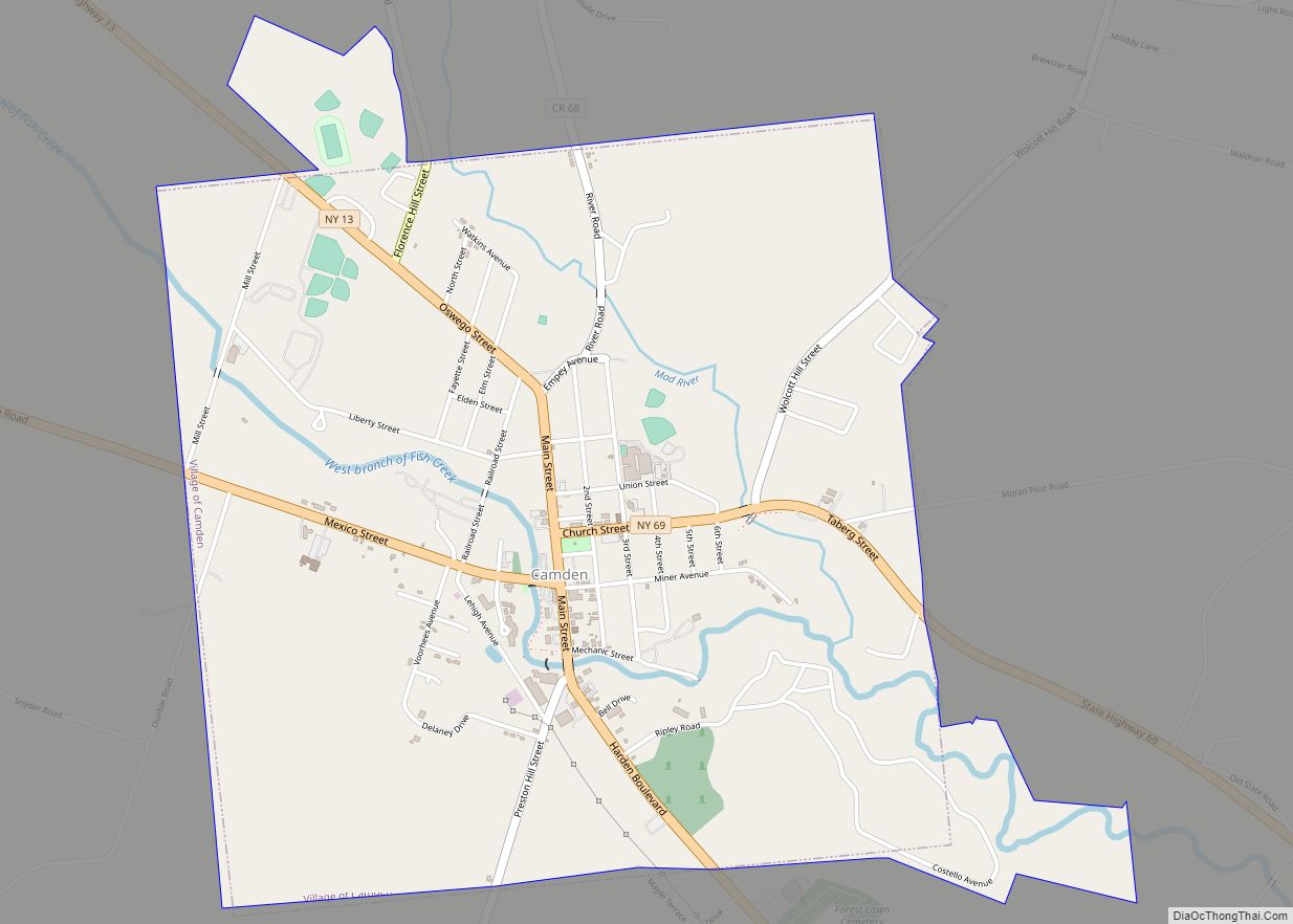
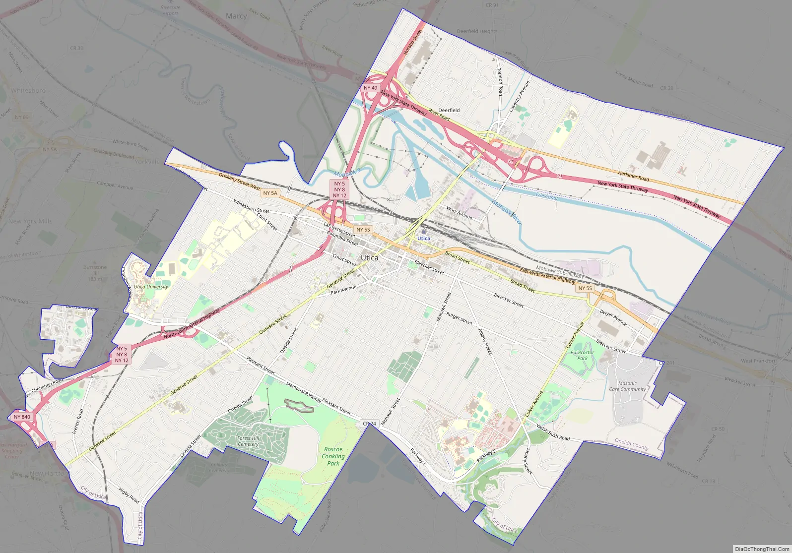
Utica Road Map
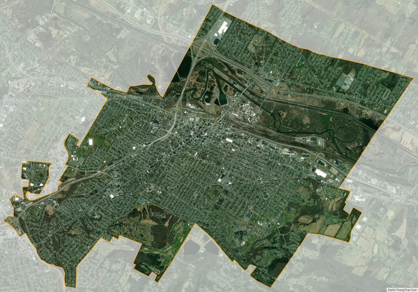
Utica city Satellite Map
Geography
According to the United States Census Bureau, Utica has a total area of 17.02 sq mi (44.1 km)—16.76 sq mi (43.4 km) of land and 0.26 sq mi (0.67 km) (1.52 percent) of water. The city is located at New York’s geographic center, adjacent to the western border of Herkimer County, and at the southwestern base of the Adirondack Mountains. Utica and its suburbs are bound by the Allegheny Plateau in the south and the Adirondack Mountains in the north, and the city is 456 ft (139 m) above sea level; this region is known as the Mohawk Valley. The city is 90 mi (145 km) west-northwest of Albany and 45 mi (72 km) east of Syracuse.
Topography
The city’s Mohawk name, Unundadages (“around the hill”) refers to a bend in the Mohawk River that flows around the city’s elevated position as seen from the Deerfield Hills in the north. The Erie Canal and Mohawk River pass through northern Utica; northwest of downtown is the Utica Marsh, a group of cattail wetlands between the Erie Canal and Mohawk River (partially in the town of Marcy) with a variety of animals, plants and birds. During the 1850s, plank roads were built through the marshland surrounding the city. Utica’s suburbs have more hills and cliffs than the city. Located where the Mohawk Valley forms a wide floodplain, the city has a generally sloping, flat topography.
Cityscape
Utica’s architecture features many styles that are also visible in comparable areas of Buffalo, Rochester and Syracuse, including Greek Revival, Italianate, French Renaissance, Gothic Revival and Neoclassical. The modernist 1972 Utica State Office Building, at 17 floors and 227 ft (69 m), is the city’s tallest.
Streets laid out when Utica was a village had more irregularities than those built later in the 19th and 20th centuries. As a result of the city’s location (adjacent to the Mohawk River), many streets parallel the river, so they do not run strictly east–west or north–south. Remnants of Utica’s early electric-rail systems can be seen in the West and South neighborhoods, where the rails were set into the streets.
Neighborhoods
Utica’s neighborhoods have historically been defined by their residents, allowing them to develop their own individuality. Racial and ethnic groups, social and economic separation and the development of infrastructure and new means of transportation have shaped neighborhoods, with groups shifting between them as a result.
West Utica (or the West Side) was historically home to German, Irish and Polish immigrants. The Corn Hill neighborhood in the city center had a significant Jewish population. East Utica (or the East Side) is a cultural and political center dominated by Italian immigrants. North of downtown is the Triangle neighborhood, formerly home to the city’s African American and Jewish populations. Neighborhoods formerly dominated by one or more groups saw other groups arrive, such as Bosnians and Latin Americans in former Italian neighborhoods and the historically Welsh neighborhood of Corn Hill. Bagg Commemorative Park and Bagg’s Square West (Utica’s historic centers) are in the northeastern portion of downtown, with Genesee Street on the west and Oriskany Street on the south.
Historic places
The following are listed on the National Register of Historic Places:
- Alexander Pirnie Federal Building
- Byington Mill (Frisbie & Stansfield Knitting Company)
- Calvary Episcopal Church
- Roscoe Conkling House
- Doyle Hardware Building
- First Baptist Church of Deerfield
- First Presbyterian Church
- Fort Schuyler Club Building
- Globe Woolen Company Mills
- Grace Church
- John C. Hieber Building
- Hurd & Fitzgerald Building
- Lower Genesee Street Historic District
- Memorial Church of the Holy Cross
- Millar-Wheeler House
- Munson-Williams-Proctor Arts Institute
- New Century Club
- Rutger-Steuben Park Historic District
- St. Joseph’s Church
- Stanley Theater
- Tabernacle Baptist Church
- Union Station
- Uptown Theatre
- Utica Armory
- Utica Daily Press Building
- Utica Parks and Parkway Historic District
- Utica Public Library
- Utica State Hospital
- Gen. John G. Weaver House
- Forest Hill Cemetery
Climate
Utica has a humid continental climate (or warm-summer climate: Köppen Dfb) with four distinct seasons, characterized by cold winters and temperate summers. Summer high temperatures range from 77–81 °F (25–27 °C). The city is in USDA plant hardiness zone 5a, and native vegetation can tolerate temperatures from −10 to −20 °F (−23 to −29 °C).
Winters are cold and snowy; Utica receives lake-effect snow from Lake Erie and Lake Ontario. Utica is colder on average than other Great Lakes cities because of its location in a valley and susceptibility to north winds; temperatures in the single digits or below zero Fahrenheit are not uncommon on winter nights. Annual precipitation (based on a 30-year average from 1981 to 2010) is 45.7 in (116 cm), falling on an average of 175 days.
See also
Map of New York State and its subdivision:- Albany
- Allegany
- Bronx
- Broome
- Cattaraugus
- Cayuga
- Chautauqua
- Chemung
- Chenango
- Clinton
- Columbia
- Cortland
- Delaware
- Dutchess
- Erie
- Essex
- Franklin
- Fulton
- Genesee
- Greene
- Hamilton
- Herkimer
- Jefferson
- Kings
- Lake Ontario
- Lewis
- Livingston
- Madison
- Monroe
- Montgomery
- Nassau
- New York
- Niagara
- Oneida
- Onondaga
- Ontario
- Orange
- Orleans
- Oswego
- Otsego
- Putnam
- Queens
- Rensselaer
- Richmond
- Rockland
- Saint Lawrence
- Saratoga
- Schenectady
- Schoharie
- Schuyler
- Seneca
- Steuben
- Suffolk
- Sullivan
- Tioga
- Tompkins
- Ulster
- Warren
- Washington
- Wayne
- Westchester
- Wyoming
- Yates
- Alabama
- Alaska
- Arizona
- Arkansas
- California
- Colorado
- Connecticut
- Delaware
- District of Columbia
- Florida
- Georgia
- Hawaii
- Idaho
- Illinois
- Indiana
- Iowa
- Kansas
- Kentucky
- Louisiana
- Maine
- Maryland
- Massachusetts
- Michigan
- Minnesota
- Mississippi
- Missouri
- Montana
- Nebraska
- Nevada
- New Hampshire
- New Jersey
- New Mexico
- New York
- North Carolina
- North Dakota
- Ohio
- Oklahoma
- Oregon
- Pennsylvania
- Rhode Island
- South Carolina
- South Dakota
- Tennessee
- Texas
- Utah
- Vermont
- Virginia
- Washington
- West Virginia
- Wisconsin
- Wyoming