Map of Hendersonville city

Map of Hendersonville city, North Carolina

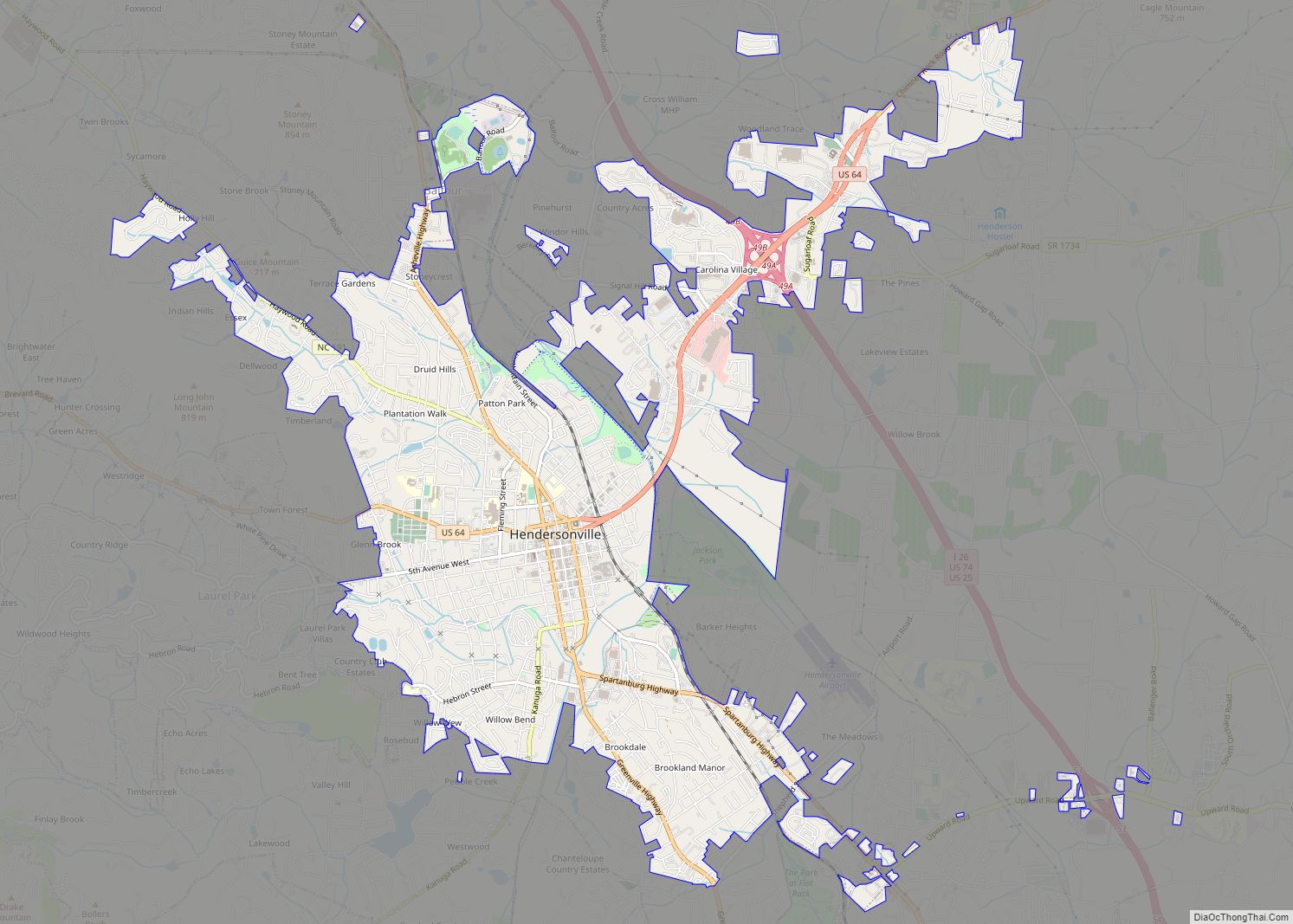
Hendersonville is a city in Henderson County, North Carolina, United States. It is 22 miles (35 km) south of Asheville and is the county seat of Henderson County. Like the county, the city is named for 19th-century North Carolina Supreme Court Chief Justice Leonard Henderson. The population was 13,137 at the 2010 census and was estimated … Read more

Map of Henderson city, North Carolina

Map of Henderson city, North Carolina

Henderson is a city and the county seat of Vance County, North Carolina, United States. The population was 15,060 at the 2020 census. Henderson city overview: Name: Henderson city LSAD Code: 25 LSAD Description: city (suffix) State: North Carolina County: Vance County Elevation: 505 ft (154 m) Total Area: 8.63 sq mi (22.35 km²) Land Area: 8.62 sq mi (22.34 km²) Water Area: … Read more

Map of Hemby Bridge town

Map of Hemby Bridge town

Hemby Bridge is a town in Union County, North Carolina, United States. The population was 1,615 at the 2020 Census. Hemby Bridge town overview: Name: Hemby Bridge town LSAD Code: 43 LSAD Description: town (suffix) State: North Carolina County: Union County Elevation: 663 ft (202 m) Total Area: 2.33 sq mi (6.04 km²) Land Area: 2.29 sq mi (5.93 km²) Water Area: 0.04 sq mi … Read more

Map of Hays CDP, North Carolina

Map of Hays CDP, North Carolina

Hays is a census-designated place (CDP) in Wilkes County, North Carolina, United States. The population was 1,595 at the 2020 census. North Wilkes High School, one of Wilkes County’s four public high schools, is located in Hays. Hays CDP overview: Name: Hays CDP LSAD Code: 57 LSAD Description: CDP (suffix) State: North Carolina County: Wilkes … Read more

Map of Hayesville town, North Carolina

Map of Hayesville town, North Carolina

Hayesville is a town in Clay County, North Carolina, United States. The population was 311 at the 2010 census. It is the county seat of Clay County. Hayesville town overview: Name: Hayesville town LSAD Code: 43 LSAD Description: town (suffix) State: North Carolina County: Clay County Elevation: 1,893 ft (577 m) Total Area: 0.64 sq mi (1.65 km²) Land Area: … Read more

Map of Haw River town

Map of Haw River town

Haw River is a town in Alamance County, North Carolina, United States. It is part of the Burlington, North Carolina Metropolitan Statistical Area. As of the 2010 census the population was 2,298. Haw River town overview: Name: Haw River town LSAD Code: 43 LSAD Description: town (suffix) State: North Carolina County: Alamance County Elevation: 564 ft … Read more

Map of Havelock city, North Carolina

Map of Havelock city, North Carolina

Havelock is a city in Craven County, North Carolina, United States. The population was 20,735 at the 2010 census. The city is home to Marine Corps Air Station Cherry Point, the world’s largest Marine Corps air station, and home to the 2nd Marine Aircraft Wing. Havelock is part of the New Bern Metropolitan Statistical Area. … Read more

Map of Hatteras CDP

Map of Hatteras CDP

Hatteras CDP overview: Name: Hatteras CDP LSAD Code: 57 LSAD Description: CDP (suffix) State: North Carolina County: Dare County FIPS code: 3730100 Online Interactive Map Hatteras online map. Source: Basemap layers from Google Map, Open Street Map (OSM), Arcgisonline, Wmflabs. Boundary Data from Database of Global Administrative Areas. Hatteras location map. Where is Hatteras CDP? … Read more

Map of Hassell town

Map of Hassell town

Hassell is a town in Martin County, North Carolina, United States. The population was 84 at the 2010 census. Hassell town overview: Name: Hassell town LSAD Code: 43 LSAD Description: town (suffix) State: North Carolina County: Martin County Elevation: 79 ft (24 m) Total Area: 0.27 sq mi (0.69 km²) Land Area: 0.27 sq mi (0.69 km²) Water Area: 0.00 sq mi (0.00 km²) Total Population: … Read more

Map of Harrisburg town, North Carolina

Map of Harrisburg town, North Carolina

Harrisburg, a northeastern suburb of Charlotte, is a city in Cabarrus County, North Carolina, United States. The population was estimated to be 16,576 as of 1 July 2019. Harrisburg town overview: Name: Harrisburg town LSAD Code: 43 LSAD Description: town (suffix) State: North Carolina County: Cabarrus County Incorporated: 1973 Elevation: 643 ft (196 m) Total Area: 11.47 sq mi (29.70 km²) Land … Read more

Map of Hobgood town

Map of Hobgood town

Hobgood is a town in Halifax County, North Carolina, United States. As of the 2010 census, the town had a total population of 348. It is part of the Roanoke Rapids, North Carolina Micropolitan Statistical Area. Hobgood town overview: Name: Hobgood town LSAD Code: 43 LSAD Description: town (suffix) State: North Carolina County: Halifax County … Read more

Map of Hillsborough town, North Carolina

Map of Hillsborough town, North Carolina

The town of Hillsborough is the county seat of Orange County, North Carolina, United States and is located along the Eno River. The population was 6,087 in 2010, but it grew rapidly to 9,660 by 2020. Its name was unofficially shortened to “Hillsboro” during the 19th century. In the late 1960s, residents voted to change … Read more