Henderson is a city and the county seat of Vance County, North Carolina, United States. The population was 15,060 at the 2020 census.
| Name: | Henderson city |
|---|---|
| LSAD Code: | 25 |
| LSAD Description: | city (suffix) |
| State: | North Carolina |
| County: | Vance County |
| Elevation: | 505 ft (154 m) |
| Total Area: | 8.63 sq mi (22.35 km²) |
| Land Area: | 8.62 sq mi (22.34 km²) |
| Water Area: | 0.01 sq mi (0.01 km²) |
| Total Population: | 15,060 |
| Population Density: | 1,746.29/sq mi (674.21/km²) |
| ZIP code: | 27536-27537 |
| Area code: | 252 |
| FIPS code: | 3730660 |
| GNISfeature ID: | 0986608 |
| Website: | henderson.nc.gov |
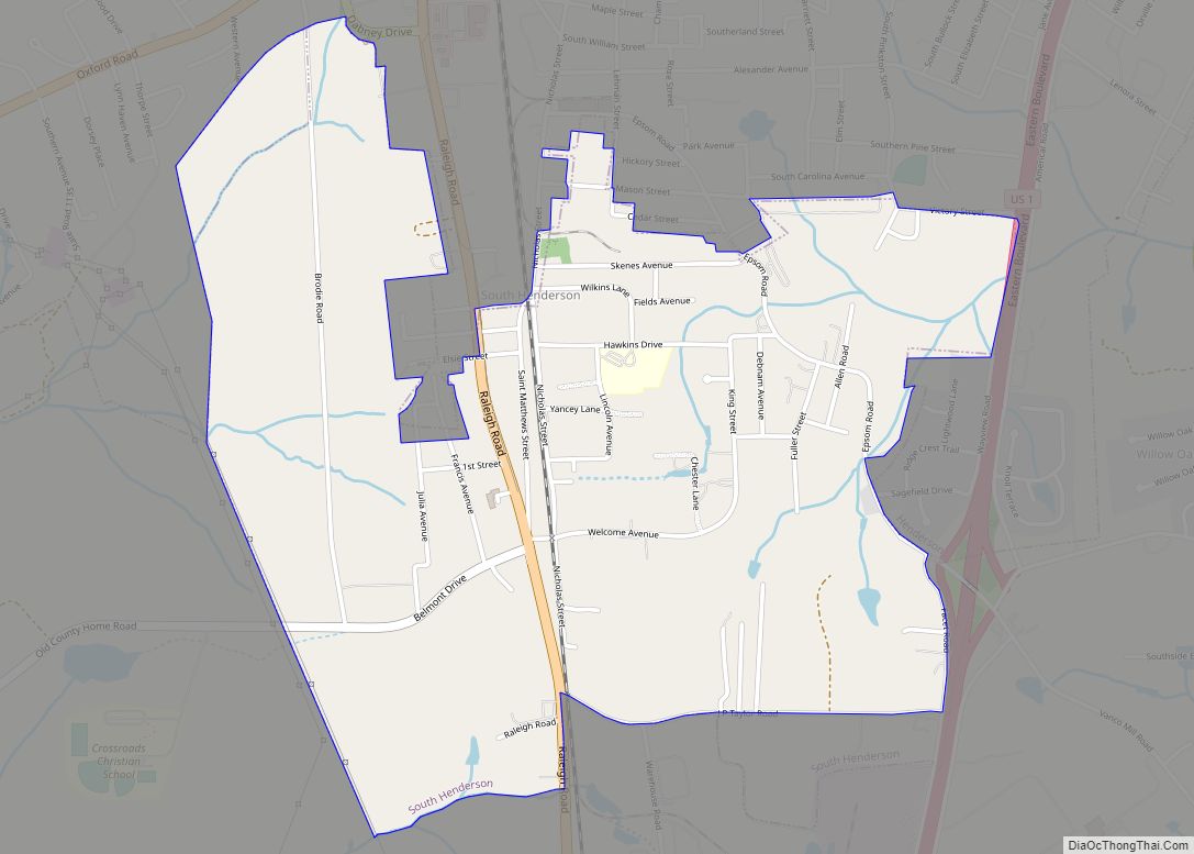
Online Interactive Map
Click on ![]() to view map in "full screen" mode.
to view map in "full screen" mode.
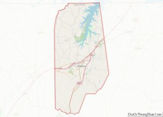
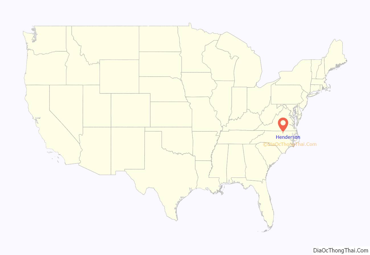
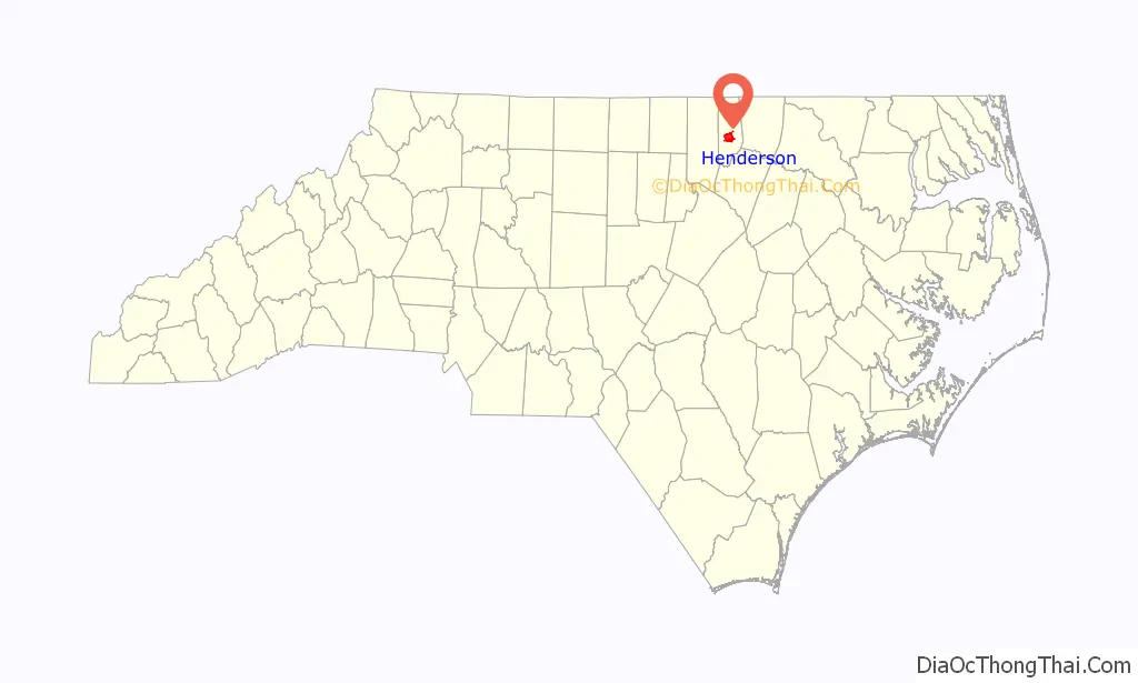
Henderson location map. Where is Henderson city?
History
The city was named in honor of former North Carolina Supreme Court Chief Justice Leonard Henderson, who lived nearby and was a friend of early settler Lewis Reavis. Henderson was officially chartered by the North Carolina General Assembly in 1841.
Prior to the creation of Vance County in 1881, Henderson was located in far eastern Granville County.
Ashland, Henderson Central Business Historic District, Henderson Fire Station and Municipal Building, Library and Laboratory Building-Henderson Institute, Mistletoe Villa, Maria Parham Hospital, Daniel Stone Plank House, Vance County Courthouse, West End School, Zollicoffer’s Law Office, and Barker House are listed on the National Register of Historic Places.
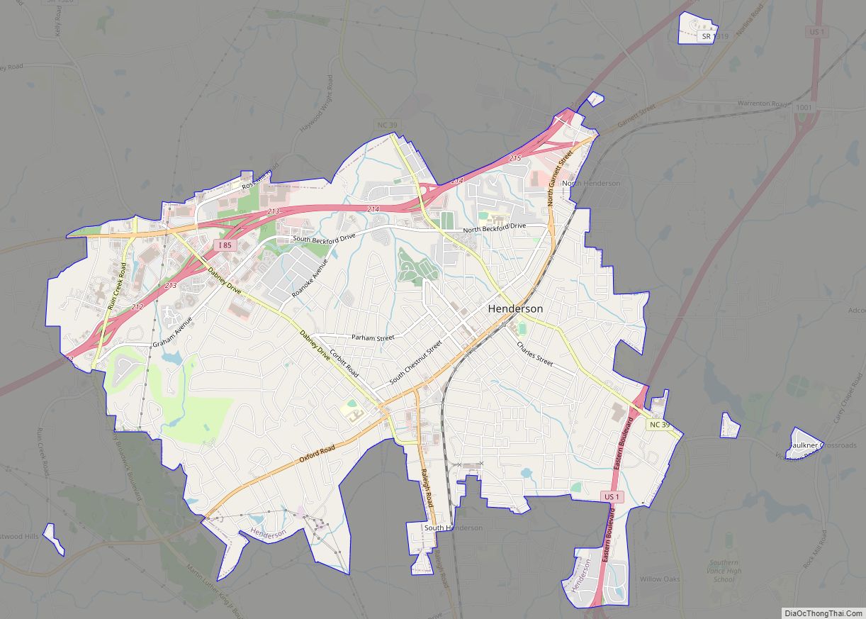
Henderson Road Map
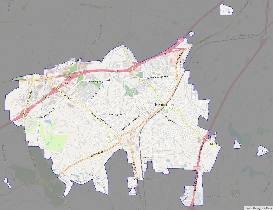
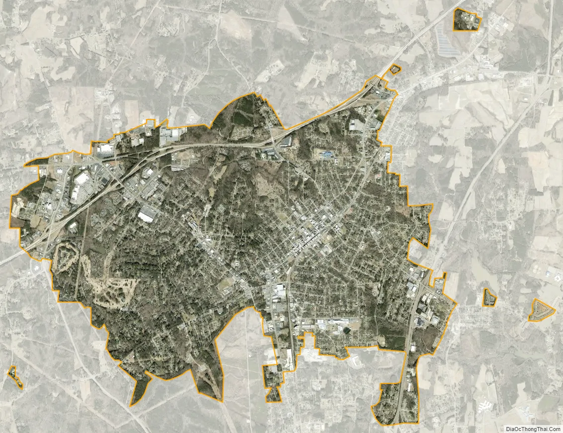
Henderson city Satellite Map
Geography
According to the United States Census Bureau, the city has a total area of 8.2 square miles (21 km), of which 8.2 square miles (21 km) is land and 0.12% is water.
Henderson benefits from its location near Interstate 85 and U.S. 1. Highway 39 also runs through Henderson.
See also
Map of North Carolina State and its subdivision:- Alamance
- Alexander
- Alleghany
- Anson
- Ashe
- Avery
- Beaufort
- Bertie
- Bladen
- Brunswick
- Buncombe
- Burke
- Cabarrus
- Caldwell
- Camden
- Carteret
- Caswell
- Catawba
- Chatham
- Cherokee
- Chowan
- Clay
- Cleveland
- Columbus
- Craven
- Cumberland
- Currituck
- Dare
- Davidson
- Davie
- Duplin
- Durham
- Edgecombe
- Forsyth
- Franklin
- Gaston
- Gates
- Graham
- Granville
- Greene
- Guilford
- Halifax
- Harnett
- Haywood
- Henderson
- Hertford
- Hoke
- Hyde
- Iredell
- Jackson
- Johnston
- Jones
- Lee
- Lenoir
- Lincoln
- Macon
- Madison
- Martin
- McDowell
- Mecklenburg
- Mitchell
- Montgomery
- Moore
- Nash
- New Hanover
- Northampton
- Onslow
- Orange
- Pamlico
- Pasquotank
- Pender
- Perquimans
- Person
- Pitt
- Polk
- Randolph
- Richmond
- Robeson
- Rockingham
- Rowan
- Rutherford
- Sampson
- Scotland
- Stanly
- Stokes
- Surry
- Swain
- Transylvania
- Tyrrell
- Union
- Vance
- Wake
- Warren
- Washington
- Watauga
- Wayne
- Wilkes
- Wilson
- Yadkin
- Yancey
- Alabama
- Alaska
- Arizona
- Arkansas
- California
- Colorado
- Connecticut
- Delaware
- District of Columbia
- Florida
- Georgia
- Hawaii
- Idaho
- Illinois
- Indiana
- Iowa
- Kansas
- Kentucky
- Louisiana
- Maine
- Maryland
- Massachusetts
- Michigan
- Minnesota
- Mississippi
- Missouri
- Montana
- Nebraska
- Nevada
- New Hampshire
- New Jersey
- New Mexico
- New York
- North Carolina
- North Dakota
- Ohio
- Oklahoma
- Oregon
- Pennsylvania
- Rhode Island
- South Carolina
- South Dakota
- Tennessee
- Texas
- Utah
- Vermont
- Virginia
- Washington
- West Virginia
- Wisconsin
- Wyoming