Harrisburg, a northeastern suburb of Charlotte, is a city in Cabarrus County, North Carolina, United States. The population was estimated to be 16,576 as of 1 July 2019.
| Name: | Harrisburg town |
|---|---|
| LSAD Code: | 43 |
| LSAD Description: | town (suffix) |
| State: | North Carolina |
| County: | Cabarrus County |
| Incorporated: | 1973 |
| Elevation: | 643 ft (196 m) |
| Total Area: | 11.47 sq mi (29.70 km²) |
| Land Area: | 11.47 sq mi (29.70 km²) |
| Water Area: | 0.00 sq mi (0.00 km²) |
| Total Population: | 18,967 |
| Population Density: | 1,653.91/sq mi (638.55/km²) |
| ZIP code: | 28075 |
| Area code: | 704, 980 |
| FIPS code: | 3729800 |
| GNISfeature ID: | 1020631 |
| Website: | www.harrisburgnc.org |
Online Interactive Map
Click on ![]() to view map in "full screen" mode.
to view map in "full screen" mode.
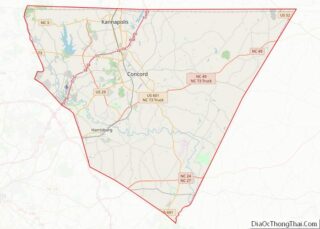
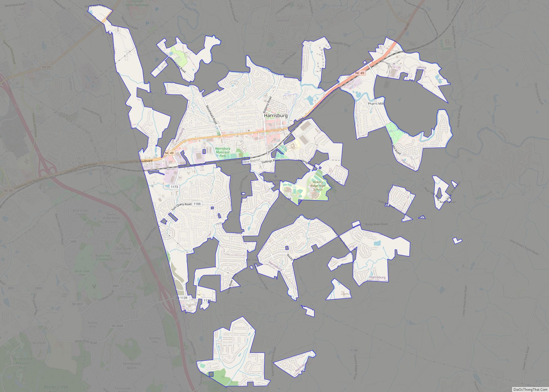
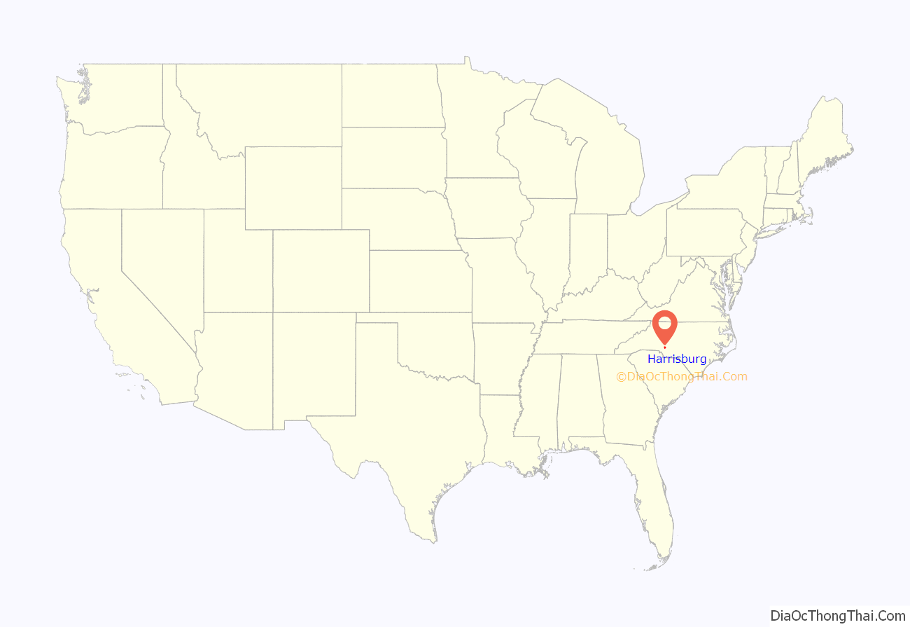
Harrisburg location map. Where is Harrisburg town?

Harrisburg Road Map

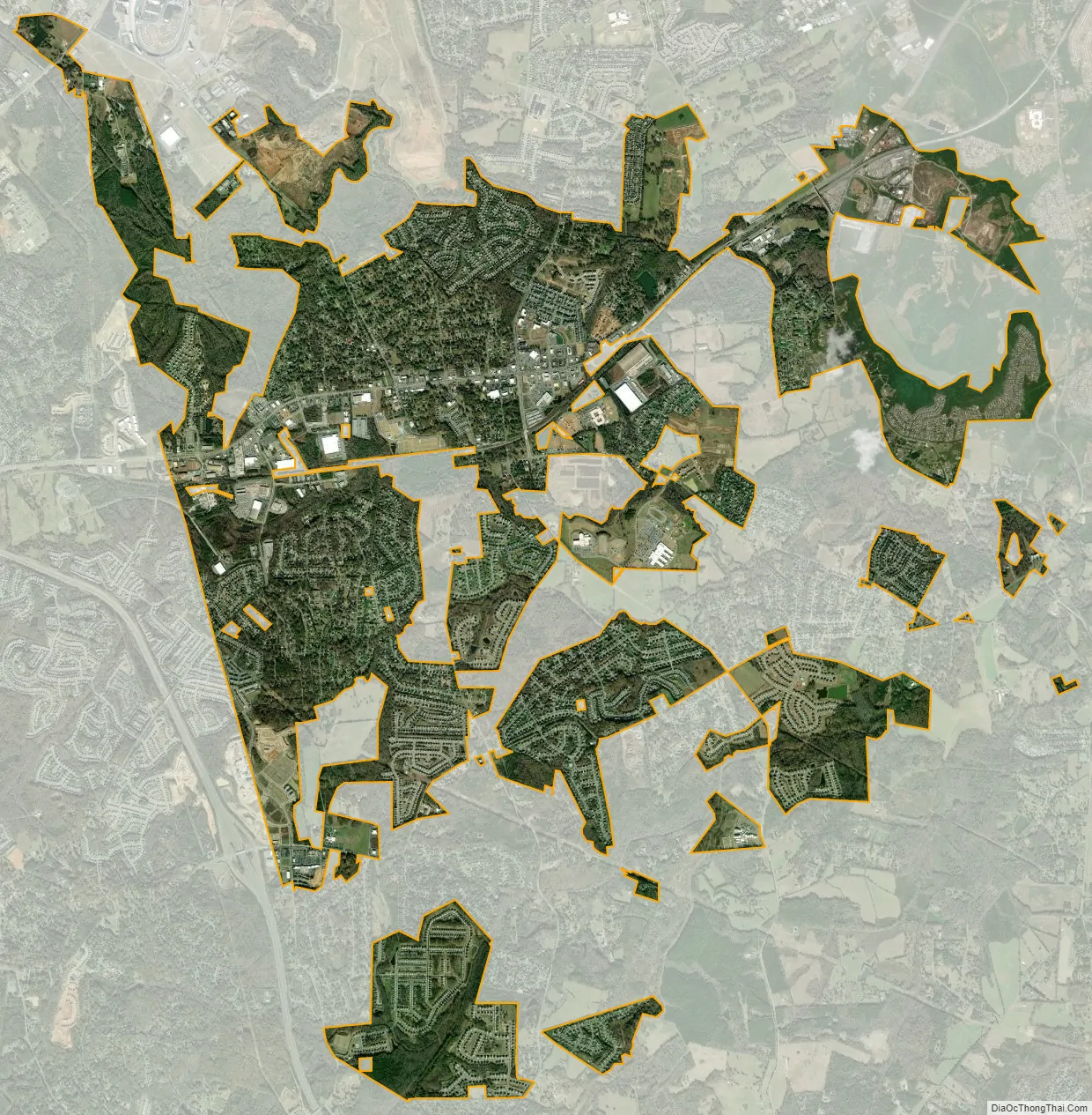
Harrisburg city Satellite Map
Geography
Harrisburg is located in southwestern Cabarrus County at 35°19′20″N 80°39′12″W / 35.32222°N 80.65333°W / 35.32222; -80.65333 (35.322295, -80.653331). It is bordered to the north by Concord and to the west by Charlotte in Mecklenburg County.
North Carolina Highway 49 passes through the center of Harrisburg, leading northeast 57 miles (92 km) to Asheboro and southwest 13 miles (21 km) to the center of Charlotte. Charlotte Motor Speedway is 3 miles (5 km) north of the center of town, within the Concord city limits.
The City of Harrisburg has a total area of 11.15 sq miles, all land.
See also
Map of North Carolina State and its subdivision:- Alamance
- Alexander
- Alleghany
- Anson
- Ashe
- Avery
- Beaufort
- Bertie
- Bladen
- Brunswick
- Buncombe
- Burke
- Cabarrus
- Caldwell
- Camden
- Carteret
- Caswell
- Catawba
- Chatham
- Cherokee
- Chowan
- Clay
- Cleveland
- Columbus
- Craven
- Cumberland
- Currituck
- Dare
- Davidson
- Davie
- Duplin
- Durham
- Edgecombe
- Forsyth
- Franklin
- Gaston
- Gates
- Graham
- Granville
- Greene
- Guilford
- Halifax
- Harnett
- Haywood
- Henderson
- Hertford
- Hoke
- Hyde
- Iredell
- Jackson
- Johnston
- Jones
- Lee
- Lenoir
- Lincoln
- Macon
- Madison
- Martin
- McDowell
- Mecklenburg
- Mitchell
- Montgomery
- Moore
- Nash
- New Hanover
- Northampton
- Onslow
- Orange
- Pamlico
- Pasquotank
- Pender
- Perquimans
- Person
- Pitt
- Polk
- Randolph
- Richmond
- Robeson
- Rockingham
- Rowan
- Rutherford
- Sampson
- Scotland
- Stanly
- Stokes
- Surry
- Swain
- Transylvania
- Tyrrell
- Union
- Vance
- Wake
- Warren
- Washington
- Watauga
- Wayne
- Wilkes
- Wilson
- Yadkin
- Yancey
- Alabama
- Alaska
- Arizona
- Arkansas
- California
- Colorado
- Connecticut
- Delaware
- District of Columbia
- Florida
- Georgia
- Hawaii
- Idaho
- Illinois
- Indiana
- Iowa
- Kansas
- Kentucky
- Louisiana
- Maine
- Maryland
- Massachusetts
- Michigan
- Minnesota
- Mississippi
- Missouri
- Montana
- Nebraska
- Nevada
- New Hampshire
- New Jersey
- New Mexico
- New York
- North Carolina
- North Dakota
- Ohio
- Oklahoma
- Oregon
- Pennsylvania
- Rhode Island
- South Carolina
- South Dakota
- Tennessee
- Texas
- Utah
- Vermont
- Virginia
- Washington
- West Virginia
- Wisconsin
- Wyoming