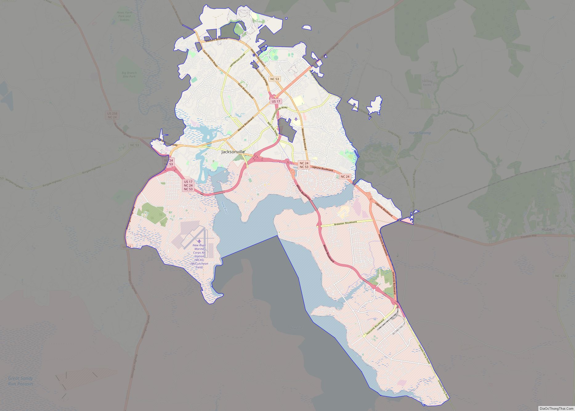
Map of Kannapolis city

Map of Kannapolis city

Kannapolis (/kəˈnæpəlɪs/) is a city in Cabarrus and Rowan counties, in the U.S. state of North Carolina, northwest of Concord and northeast of Charlotte and is a suburb in the Charlotte metropolitan area. The city of Kannapolis was incorporated in 1984. The population was 53,114 at the 2020 census, which makes Kannapolis the 19th largest … Read more

Map of Jonesville town, North Carolina

Map of Jonesville town, North Carolina

Jonesville, originally called Allen’s Settlement, is the oldest town in Yadkin County, North Carolina, United States. The population was 2,285 at the 2010 census. The town grew by nearly 800 residents in 2001 when it merged with neighboring Arlington. Recognized as the Heart of the Yadkin Valley, Jonesville is a gateway to the Blue Ridge … Read more

Map of Kingstown town, North Carolina

Map of Kingstown town, North Carolina

Kingstown is a town in Cleveland County, North Carolina, United States. The population was 681 at the 2010 census. Kingstown town overview: Name: Kingstown town LSAD Code: 43 LSAD Description: town (suffix) State: North Carolina County: Cleveland County Elevation: 925 ft (282 m) Total Area: 1.76 sq mi (4.56 km²) Land Area: 1.76 sq mi (4.56 km²) Water Area: 0.00 sq mi (0.00 km²) Total Population: … Read more

Map of Kings Mountain city

Map of Kings Mountain city

Kings Mountain is a small suburban city within the Charlotte metropolitan area in Cleveland and Gaston counties, North Carolina, United States. Most of the city is in Cleveland County, with a small eastern portion in Gaston County. The population was 10,296 at the 2010 census. Kings Mountain city overview: Name: Kings Mountain city LSAD Code: … Read more

Map of Kings Grant CDP

Map of Kings Grant CDP

Kings Grant is a census-designated place (CDP) in New Hanover County, North Carolina, United States. The population was 8,113 at the 2010 census, up from 7,738 in 2000. It is part of the Wilmington Metropolitan Statistical Area. Kings Grant CDP overview: Name: Kings Grant CDP LSAD Code: 57 LSAD Description: CDP (suffix) State: North Carolina … Read more

Map of King city

Map of King city, North Carolina

King is a city in Stokes and Forsyth counties, North Carolina, United States. The population was 7,096 at the 2020 census. King is part of the Piedmont Triad metropolitan area, located 15 miles northwest of Winston-Salem. Dairi-O, a local fast food restaurant, is one of the cities staples. Around since the 1950’s, it has grown … Read more

Map of Kill Devil Hills town

Map of Kill Devil Hills town

Kill Devil Hills is a town in Dare County, North Carolina, United States. The population was 7,633 at the 2020 census, up from 6,683 in 2010. It is the most populous settlement in both Dare County and on the Outer Banks of North Carolina. The Kill Devil Hills Micropolitan Statistical Area is part of the … Read more

Map of Kernersville town

Map of Kernersville town

Kernersville is a town in Forsyth County and the largest suburb of Winston-Salem. The town is located in the U.S. state of North Carolina. A small portion of the town is also in Guilford County. The population was 26,481 at the 2020 census, up from 23,123 in 2010. Kernersville is located at the center of … Read more

Map of Kenly town

Map of Kenly town

Kenly is a town in Johnston and Wilson counties in the U.S. state of North Carolina. It was named for John R. Kenly, Northern Division Superintendent of the Atlantic Coast Line Railroad, who later became president of the railroad in 1913. The population was 1,339 at the 2010 census, down from 1,569 in 2000. Kenly … Read more

Map of Kenansville town

Map of Kenansville town

Kenansville is a town in Duplin County, North Carolina, United States. Its population was 855 at the 2010 census. It is the county seat of Duplin County. The town was named for James Kenan, a member of the North Carolina Senate, whose family home Liberty Hall Plantation is in Kenansville. Kenansville town overview: Name: Kenansville … Read more

Map of Kelly CDP

Map of Kelly CDP, North Carolina

Kelly is a census-designated place (CDP) in Bladen County, North Carolina, United States. The population was 544 at the 2010 census. Kelly CDP overview: Name: Kelly CDP LSAD Code: 57 LSAD Description: CDP (suffix) State: North Carolina County: Bladen County Elevation: 23 ft (7 m) Total Area: 11.59 sq mi (30.02 km²) Land Area: 11.59 sq mi (30.02 km²) Water Area: 0.00 sq mi (0.00 km²) … Read more

Map of Kelford town

Map of Kelford town

Kelford is a town in Bertie County, North Carolina, United States. The population was 251 at the 2010 census. Kelford town overview: Name: Kelford town LSAD Code: 43 LSAD Description: town (suffix) State: North Carolina County: Bertie County Elevation: 89 ft (27 m) Total Area: 0.48 sq mi (1.25 km²) Land Area: 0.48 sq mi (1.25 km²) Water Area: 0.00 sq mi (0.00 km²) Total Population: … Read more