Kings Mountain is a small suburban city within the Charlotte metropolitan area in Cleveland and Gaston counties, North Carolina, United States. Most of the city is in Cleveland County, with a small eastern portion in Gaston County. The population was 10,296 at the 2010 census.
| Name: | Kings Mountain city |
|---|---|
| LSAD Code: | 25 |
| LSAD Description: | city (suffix) |
| State: | North Carolina |
| County: | Cleveland County, Gaston County |
| Elevation: | 1,007 ft (307 m) |
| Total Area: | 13.97 sq mi (36.19 km²) |
| Land Area: | 13.76 sq mi (35.65 km²) |
| Water Area: | 0.21 sq mi (0.54 km²) |
| Total Population: | 11,142 |
| Population Density: | 809.50/sq mi (312.55/km²) |
| ZIP code: | 28086 |
| Area code: | 704 |
| FIPS code: | 3735880 |
| GNISfeature ID: | 0988003 |
| Website: | www.cityofkm.com |
Online Interactive Map
Click on ![]() to view map in "full screen" mode.
to view map in "full screen" mode.
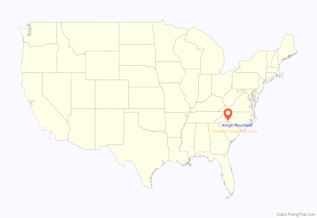
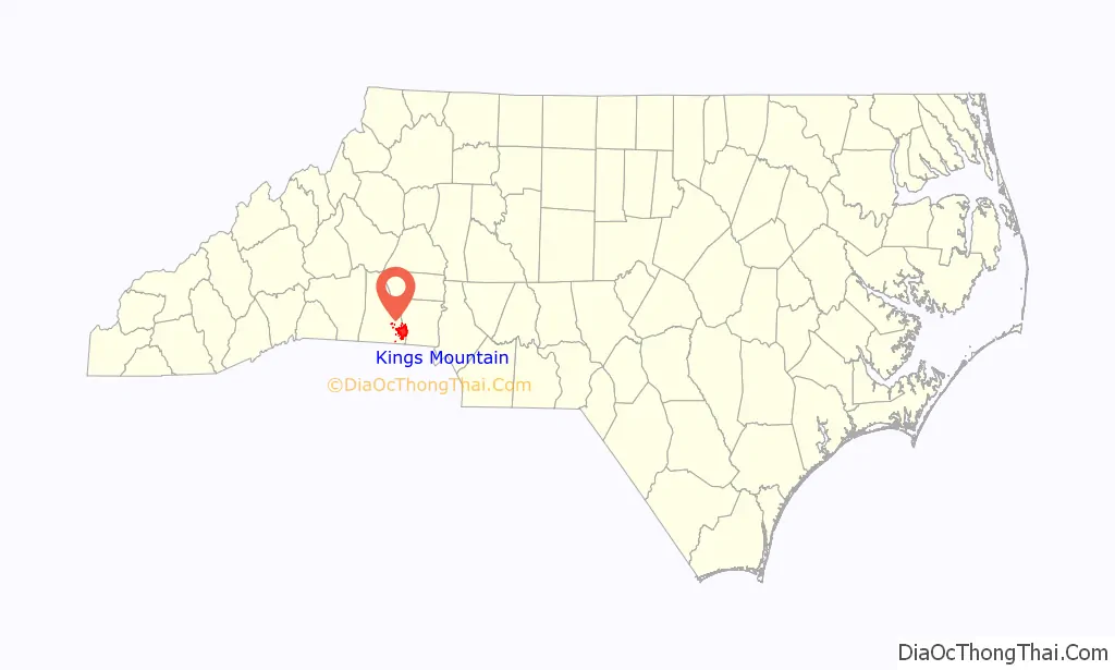
Kings Mountain location map. Where is Kings Mountain city?
History
Originally the settlement was called White Plains, but the city was incorporated on October 16, 1874, and the name was changed. It was decided that “Kings Mountain” would be a more appropriate name since the community was close to the site of the historic 1780 Battle of Kings Mountain in York County, South Carolina, a turning point in the American Revolutionary War.
The Battle of Kings Mountain was proclaimed as “the turning point of the American Revolution” by Thomas Jefferson. Liberty Mountain, a play performed at the local theater, recounts the events of the battle. The downtown area is home to the museum, police station, and the Mauney Memorial Library.
The Central School Historic District, King Street Overhead Bridge, Margrace Mill Village Historic District, Jacob S. Mauney Memorial Library and Teacher’s Home, Southern Railway Company Overhead Bridge, and West End Historic District are listed on the National Register of Historic Places.
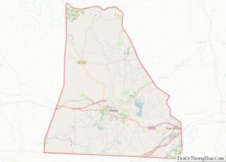
Kings Mountain Road Map
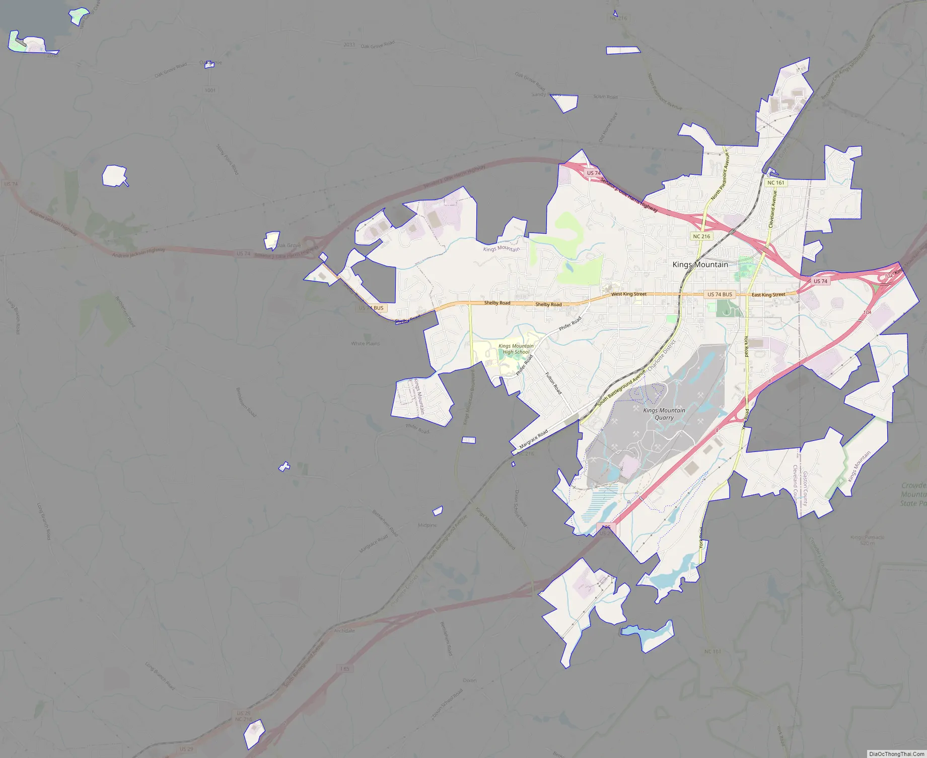
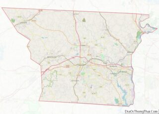
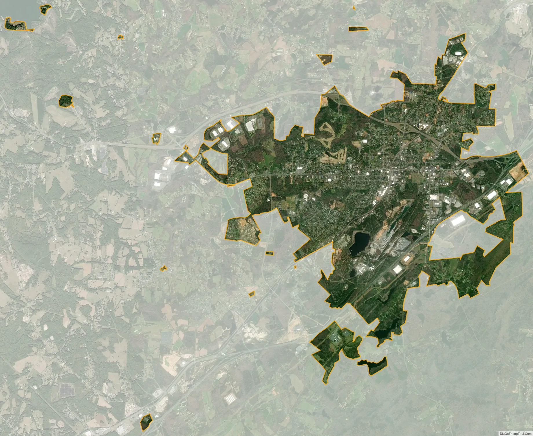
Kings Mountain city Satellite Map
Geography
Kings Mountain is located at 35°14′39″N 81°20′33″W / 35.24417°N 81.34250°W / 35.24417; -81.34250 (35.244105, -81.342544). It lies 30 miles (48 km) west of Charlotte along Interstate 85. Gaffney, South Carolina, is 21 miles (34 km) to the southwest along I-85.
According to the United States Census Bureau, the city has a total area of 12.6 square miles (32.6 km), of which 12.3 square miles (31.9 km) is land and 0.23 square miles (0.6 km), or 1.98%, is covered with water.
Kings Pinnacle is a small mountain located at the southeastern point of the city. Standing at 1,705 feet, it is the highest point in the Kings Mountain Belt of monadnock formations. It is one of the two mountains in Crowders Mountain State Park, where cleared trails lead to the pinnacle.
See also
Map of North Carolina State and its subdivision:- Alamance
- Alexander
- Alleghany
- Anson
- Ashe
- Avery
- Beaufort
- Bertie
- Bladen
- Brunswick
- Buncombe
- Burke
- Cabarrus
- Caldwell
- Camden
- Carteret
- Caswell
- Catawba
- Chatham
- Cherokee
- Chowan
- Clay
- Cleveland
- Columbus
- Craven
- Cumberland
- Currituck
- Dare
- Davidson
- Davie
- Duplin
- Durham
- Edgecombe
- Forsyth
- Franklin
- Gaston
- Gates
- Graham
- Granville
- Greene
- Guilford
- Halifax
- Harnett
- Haywood
- Henderson
- Hertford
- Hoke
- Hyde
- Iredell
- Jackson
- Johnston
- Jones
- Lee
- Lenoir
- Lincoln
- Macon
- Madison
- Martin
- McDowell
- Mecklenburg
- Mitchell
- Montgomery
- Moore
- Nash
- New Hanover
- Northampton
- Onslow
- Orange
- Pamlico
- Pasquotank
- Pender
- Perquimans
- Person
- Pitt
- Polk
- Randolph
- Richmond
- Robeson
- Rockingham
- Rowan
- Rutherford
- Sampson
- Scotland
- Stanly
- Stokes
- Surry
- Swain
- Transylvania
- Tyrrell
- Union
- Vance
- Wake
- Warren
- Washington
- Watauga
- Wayne
- Wilkes
- Wilson
- Yadkin
- Yancey
- Alabama
- Alaska
- Arizona
- Arkansas
- California
- Colorado
- Connecticut
- Delaware
- District of Columbia
- Florida
- Georgia
- Hawaii
- Idaho
- Illinois
- Indiana
- Iowa
- Kansas
- Kentucky
- Louisiana
- Maine
- Maryland
- Massachusetts
- Michigan
- Minnesota
- Mississippi
- Missouri
- Montana
- Nebraska
- Nevada
- New Hampshire
- New Jersey
- New Mexico
- New York
- North Carolina
- North Dakota
- Ohio
- Oklahoma
- Oregon
- Pennsylvania
- Rhode Island
- South Carolina
- South Dakota
- Tennessee
- Texas
- Utah
- Vermont
- Virginia
- Washington
- West Virginia
- Wisconsin
- Wyoming