Map of Littleton town, North Carolina

Map of Littleton town, North Carolina

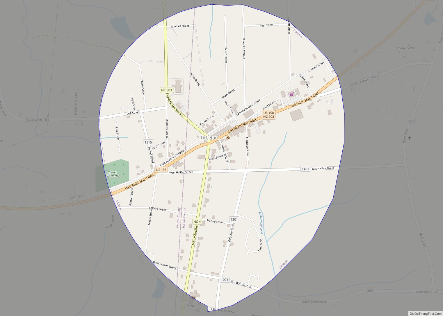
Littleton is a town in Halifax County, North Carolina, United States. The population was 674 at the 2010 census. It is part of the Roanoke Rapids, North Carolina Micropolitan Statistical Area. Littleton town overview: Name: Littleton town LSAD Code: 43 LSAD Description: town (suffix) State: North Carolina County: Halifax County Elevation: 387 ft (118 m) Total Area: … Read more

Map of Linden town, North Carolina

Map of Linden town, North Carolina

Linden is a town in Cumberland County, North Carolina, United States. The population was 130 at the 2010 census, the mayor is Frances Collier. Linden town overview: Name: Linden town LSAD Code: 43 LSAD Description: town (suffix) State: North Carolina County: Cumberland County Elevation: 112 ft (34 m) Total Area: 0.55 sq mi (1.42 km²) Land Area: 0.55 sq mi (1.42 km²) Water … Read more

Map of Lincolnton city, North Carolina

Map of Lincolnton city, North Carolina

Lincolnton is a city in Lincoln County, North Carolina, United States within the Charlotte metropolitan area. The population was 10,486 at the 2010 census. Lincolnton is northwest of Charlotte, on the South Fork of the Catawba River. The city is the county seat of Lincoln County, and is the only legally incorporated municipality which is … Read more

Map of Lillington town

Map of Lillington town

Lillington is a town in Harnett County, North Carolina, United States. Its population was 3,194 at the 2010 census, and was 4,735 in the 2020 census. It is the county seat of Harnett County. Lillington is a part of the Dunn micropolitan area, which is also a part of the greater Raleigh–Durham–Cary combined statistical area … Read more

Map of Lucama town

Map of Lucama town

Lucama is a town in Wilson County, North Carolina, United States. The population was 1,108 at the 2010 census. Lucama town overview: Name: Lucama town LSAD Code: 43 LSAD Description: town (suffix) State: North Carolina County: Wilson County Elevation: 131 ft (40 m) Total Area: 0.61 sq mi (1.57 km²) Land Area: 0.61 sq mi (1.57 km²) Water Area: 0.00 sq mi (0.00 km²) Total Population: … Read more

Map of Lowgap CDP

Map of Lowgap CDP

Lowgap CDP overview: Name: Lowgap CDP LSAD Code: 57 LSAD Description: CDP (suffix) State: North Carolina County: Surry County FIPS code: 3739540 Online Interactive Map Lowgap online map. Source: Basemap layers from Google Map, Open Street Map (OSM), Arcgisonline, Wmflabs. Boundary Data from Database of Global Administrative Areas. Lowgap location map. Where is Lowgap CDP? … Read more

Map of Maiden town

Map of Maiden town

Maiden is a town in Catawba and Lincoln counties in the U.S. state of North Carolina. The population was 3,310 at the 2010 census. Maiden was the first public high school in the state with an observatory and is currently home to an Apple iCloud Data Center, covering 500,000 square feet (46,000 m). In May 2012, … Read more

Map of Magnolia town, North Carolina

Map of Magnolia town, North Carolina

Magnolia is a town in Duplin County, North Carolina, United States. The population was 939 at the 2010 census. Magnolia town overview: Name: Magnolia town LSAD Code: 43 LSAD Description: town (suffix) State: North Carolina County: Duplin County Elevation: 138 ft (42 m) Total Area: 1.07 sq mi (2.77 km²) Land Area: 1.07 sq mi (2.77 km²) Water Area: 0.00 sq mi (0.00 km²) Total Population: … Read more

Map of Maggie Valley town

Map of Maggie Valley town

Maggie Valley is a town in Haywood County, North Carolina, United States. The population was 1,150 at the 2010 census. A popular tourist destination, it is home to Cataloochee Ski Area and the former Ghost Town in the Sky amusement park. Maggie Valley is part of the Asheville Metropolitan Statistical Area. The community gets its … Read more

Map of Madison town, North Carolina

Map of Madison town, North Carolina

Madison is a town located in Rockingham County, North Carolina. At the 2020 census, the town had a total population of 2,132. Madison is part of the Greensboro-High Point Metropolitan Statistical Area of the Piedmont Triad metro region. It was home to the corporate headquarters of Remington Arms until 2020, when the company was made … Read more

Map of Macon town, North Carolina

Map of Macon town, North Carolina

Macon is a town located in Warren County, North Carolina, United States. As of the 2010 census, the town had a total population of 119. It is named for Nathaniel Macon, long-time Speaker of the U.S. House of Representatives. Macon town overview: Name: Macon town LSAD Code: 43 LSAD Description: town (suffix) State: North Carolina … Read more

Map of Macclesfield town

Map of Macclesfield town

Macclesfield is a town in Edgecombe County, North Carolina, United States. It is part of the Rocky Mount, North Carolina Metropolitan Statistical Area. The population was 471 at the 2010 census. Macclesfield town overview: Name: Macclesfield town LSAD Code: 43 LSAD Description: town (suffix) State: North Carolina County: Edgecombe County Elevation: 95 ft (29 m) Total Area: … Read more