Lumberton is a city in Robeson County, North Carolina, United States. As of 2020, its population was 19,025. It is the seat of Robeson County’s government.
Located in southern North Carolina’s Inner Banks region, Lumberton is located on the Lumber River. It was founded in 1787 by John Willis, an officer in the American Revolution. This was developed as a shipping point for lumber used by the Navy, and logs were guided downriver to Georgetown, South Carolina. Most of the town’s growth took place after World War II.
| Name: | Lumberton city |
|---|---|
| LSAD Code: | 25 |
| LSAD Description: | city (suffix) |
| State: | North Carolina |
| County: | Robeson County |
| Elevation: | 131 ft (40 m) |
| Total Area: | 17.84 sq mi (46.20 km²) |
| Land Area: | 17.76 sq mi (46.00 km²) |
| Water Area: | 0.08 sq mi (0.20 km²) |
| Total Population: | 19,025 |
| Population Density: | 1,071.29/sq mi (413.62/km²) |
| ZIP code: | 28358-28360 |
| FIPS code: | 3739700 |
| GNISfeature ID: | 0989128 |
| Website: | www.ci.lumberton.nc.us |
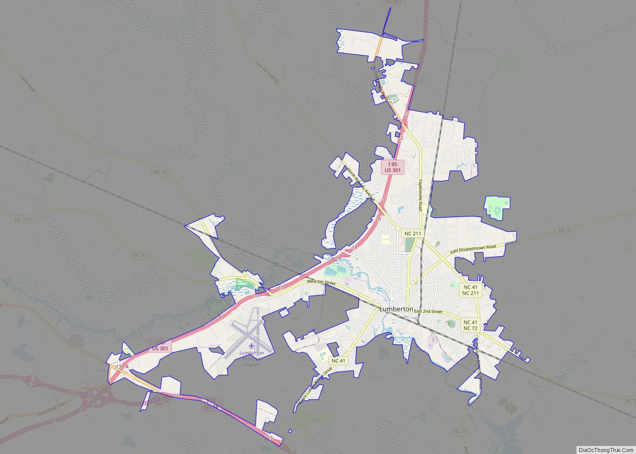
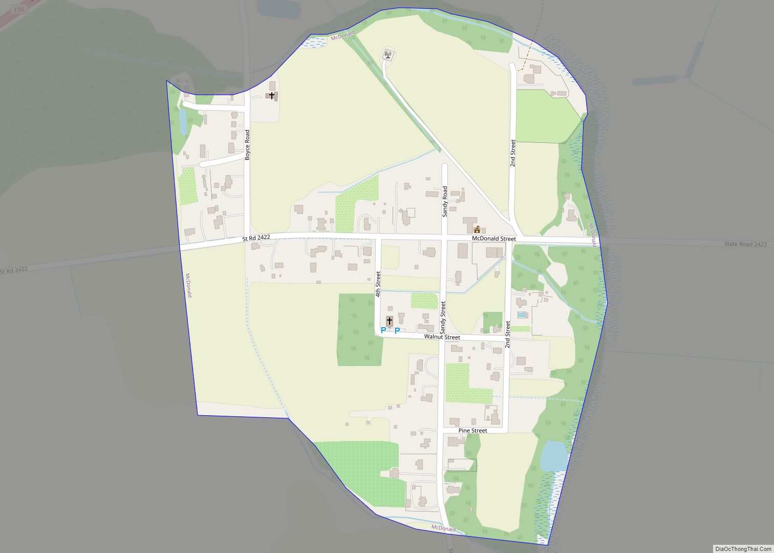
Online Interactive Map
Click on ![]() to view map in "full screen" mode.
to view map in "full screen" mode.
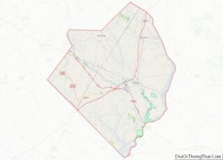
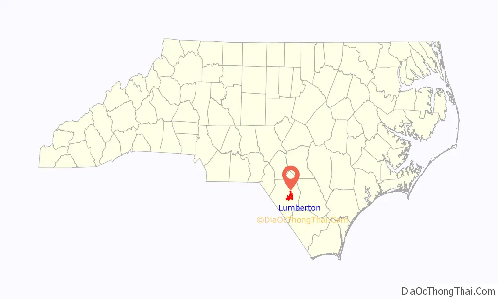
Lumberton location map. Where is Lumberton city?

History
Robeson County, North Carolina, was formed in 1787. General John Willis, owner of the Red Banks plantation, lobbied to have the county’s new seat of government located on his land. The site of Lumberton was chosen due to its central location in the county, proximity to a reliable ford of the Lumber River, and as it was where several roads intersected. Willis turned over 170 acres, which were surveyed and disbursed in a lottery held under the auspices of the county court on August 14, 1787. As the site was heavily forested, trees were felled to make way for a courthouse, business and residential lots, streets, a commons, and a public square. The first courthouse was a wooden residence sold by Willis to the county and moved into place after the land was clear. Lumberton was formally created by an act of the North Carolina General Assembly on November 3, 1788, which granted the town a charter and the power to levy taxes. The community was named in homage to the Lumber River.
Aside from the courthouse, the first buildings in Lumberton were a handful of brick structures built near the river, which included a hotel, stores, and warehouses, which were stocked by goods sent up the river from Georgetown, South Carolina. The community’s first school was established by Willis in 1791. The town had a post office by 1796. It was formally incorporated in 1852 and granted a municipal government with a mayor and a board of commissioners. The town was connected by rail with Wilmington in 1860, which reduced its reliance on river trade from Georgetown. Much of the business district was burnt down in a fire in 1870 and another in 1876.
For four seasons, 1947–50, Lumberton fielded a professional minor-league baseball team in the Tobacco State League. Affiliated with the Chicago Cubs, the team was known as the Lumberton Cubs in 1947 and ’48, and the Lumberton Auctioneers in 1949 and ’50.
In 1970, Lumberton was named an All-American City, presented by the National Civic League. Many businesses left the downtown in the mid-1970s. A 1988 hostage crisis at the offices of The Robesonian and the 1993 murder of James R. Jordan Sr. nearby generated a negative national image for the city. In 1995, the city won the All-American City award a second time.
In 2016, Robeson County was impacted by Hurricane Matthew, leading to record flooding in Lumberton. In 2018, the county was struck by Hurricane Florence, which broke the flooding record. As a result of extensive damage to homes, entire streets in south and west Lumberton were left abandoned.
The Baker Sanatorium, Luther Henry Caldwell House, Carolina Theatre, Humphrey-Williams Plantation, Lumberton Commercial Historic District, Planters Building, Robeson County Agricultural Building, Alfred Rowland House, and US Post Office-Lumberton are listed on the National Register of Historic Places.
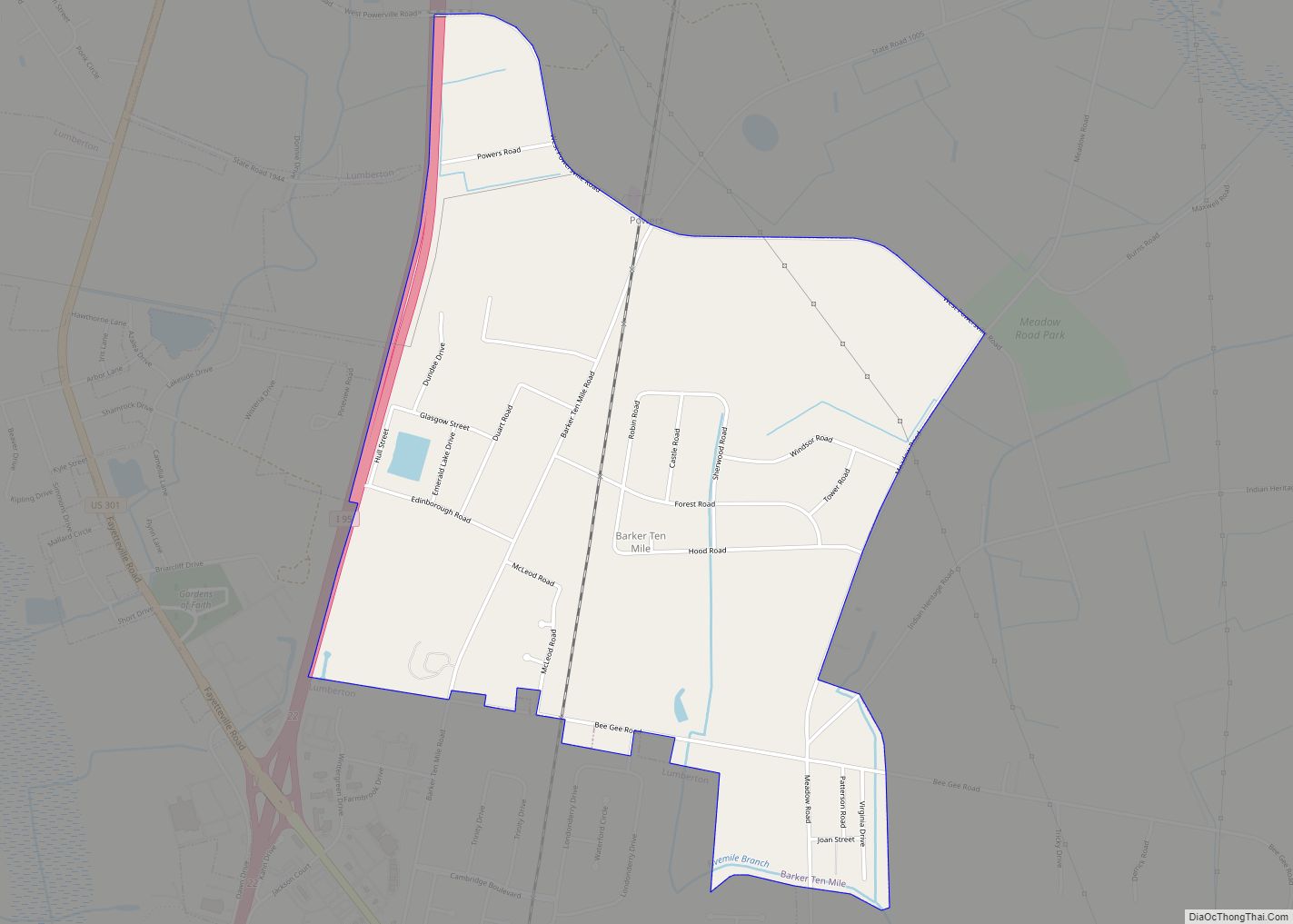
Lumberton Road Map

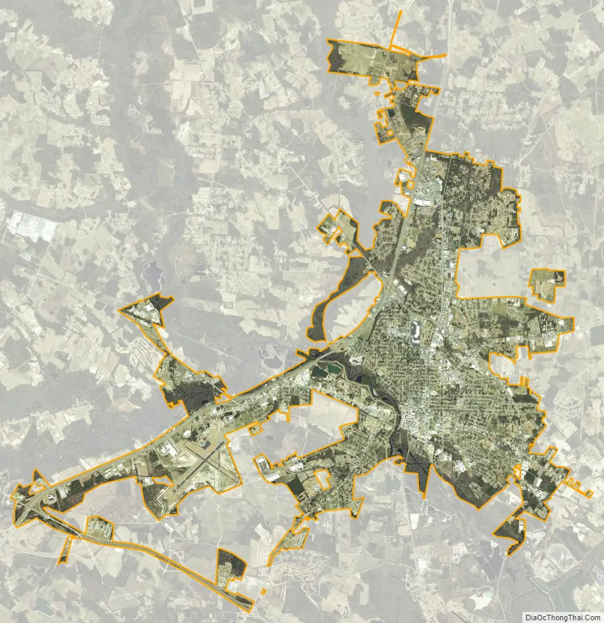
Lumberton city Satellite Map
Geography
Lumberton is located at 34°37′38″N 79°00′43″W / 34.627239°N 79.011947°W / 34.627239; -79.011947. The town lies within the Carolina Border Belt, a regional network of tobacco markets and warehouses along both sides of the North Carolina-South Carolina border.
According to the United States Census Bureau, the city has a total area of 15.8 square miles (40.9 km), of which 0.1 sq mi (0.2 km) (0.44%) is covered by water.
Lumberton is located on the Lumber River in the state’s Coastal Plains region. The Lumber River State Park, 115 miles (185 km) of natural and scenic waterway, flows through Lumberton.
Lumberton is served by Interstate 95 and Interstate 74.
See also
Map of North Carolina State and its subdivision:- Alamance
- Alexander
- Alleghany
- Anson
- Ashe
- Avery
- Beaufort
- Bertie
- Bladen
- Brunswick
- Buncombe
- Burke
- Cabarrus
- Caldwell
- Camden
- Carteret
- Caswell
- Catawba
- Chatham
- Cherokee
- Chowan
- Clay
- Cleveland
- Columbus
- Craven
- Cumberland
- Currituck
- Dare
- Davidson
- Davie
- Duplin
- Durham
- Edgecombe
- Forsyth
- Franklin
- Gaston
- Gates
- Graham
- Granville
- Greene
- Guilford
- Halifax
- Harnett
- Haywood
- Henderson
- Hertford
- Hoke
- Hyde
- Iredell
- Jackson
- Johnston
- Jones
- Lee
- Lenoir
- Lincoln
- Macon
- Madison
- Martin
- McDowell
- Mecklenburg
- Mitchell
- Montgomery
- Moore
- Nash
- New Hanover
- Northampton
- Onslow
- Orange
- Pamlico
- Pasquotank
- Pender
- Perquimans
- Person
- Pitt
- Polk
- Randolph
- Richmond
- Robeson
- Rockingham
- Rowan
- Rutherford
- Sampson
- Scotland
- Stanly
- Stokes
- Surry
- Swain
- Transylvania
- Tyrrell
- Union
- Vance
- Wake
- Warren
- Washington
- Watauga
- Wayne
- Wilkes
- Wilson
- Yadkin
- Yancey
- Alabama
- Alaska
- Arizona
- Arkansas
- California
- Colorado
- Connecticut
- Delaware
- District of Columbia
- Florida
- Georgia
- Hawaii
- Idaho
- Illinois
- Indiana
- Iowa
- Kansas
- Kentucky
- Louisiana
- Maine
- Maryland
- Massachusetts
- Michigan
- Minnesota
- Mississippi
- Missouri
- Montana
- Nebraska
- Nevada
- New Hampshire
- New Jersey
- New Mexico
- New York
- North Carolina
- North Dakota
- Ohio
- Oklahoma
- Oregon
- Pennsylvania
- Rhode Island
- South Carolina
- South Dakota
- Tennessee
- Texas
- Utah
- Vermont
- Virginia
- Washington
- West Virginia
- Wisconsin
- Wyoming