Louisburg is a town in Franklin County, North Carolina, United States. As of the 2020 census, the town population was 3,064. It is the county seat of Franklin County. The town is located approximately 29 miles northeast of the state capital, Raleigh, and located about 31 miles south of the Virginia border. It is also the home of Louisburg College, the oldest two-year coeducational college in the United States.
| Name: | Louisburg town |
|---|---|
| LSAD Code: | 43 |
| LSAD Description: | town (suffix) |
| State: | North Carolina |
| County: | Franklin County |
| Elevation: | 220 ft (70 m) |
| Total Area: | 2.96 sq mi (7.67 km²) |
| Land Area: | 2.96 sq mi (7.66 km²) |
| Water Area: | 0.00 sq mi (0.01 km²) |
| Total Population: | 3,064 |
| Population Density: | 1,036.19/sq mi (400.01/km²) |
| ZIP code: | 27549 |
| Area code: | 919 and 984 |
| FIPS code: | 3739360 |
| GNISfeature ID: | 0989040 |
| Website: | townoflouisburg.org |
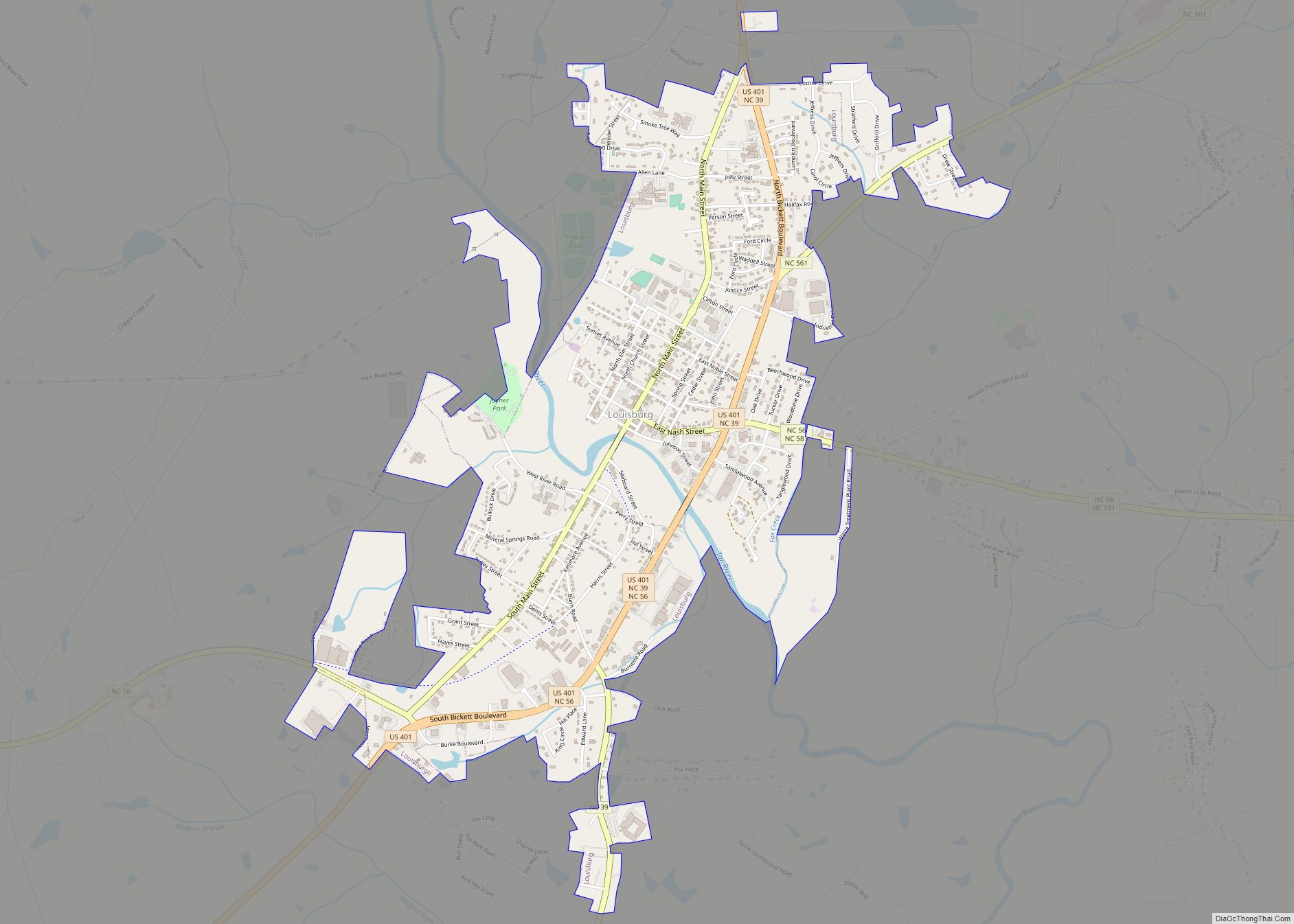
Online Interactive Map
Click on ![]() to view map in "full screen" mode.
to view map in "full screen" mode.
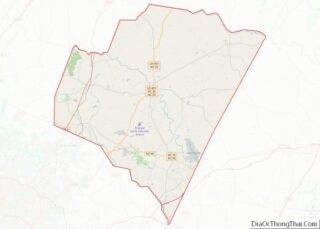
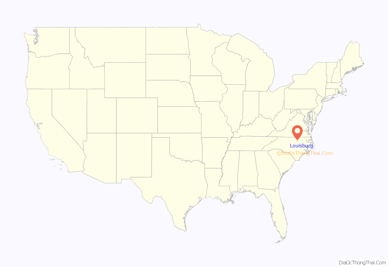
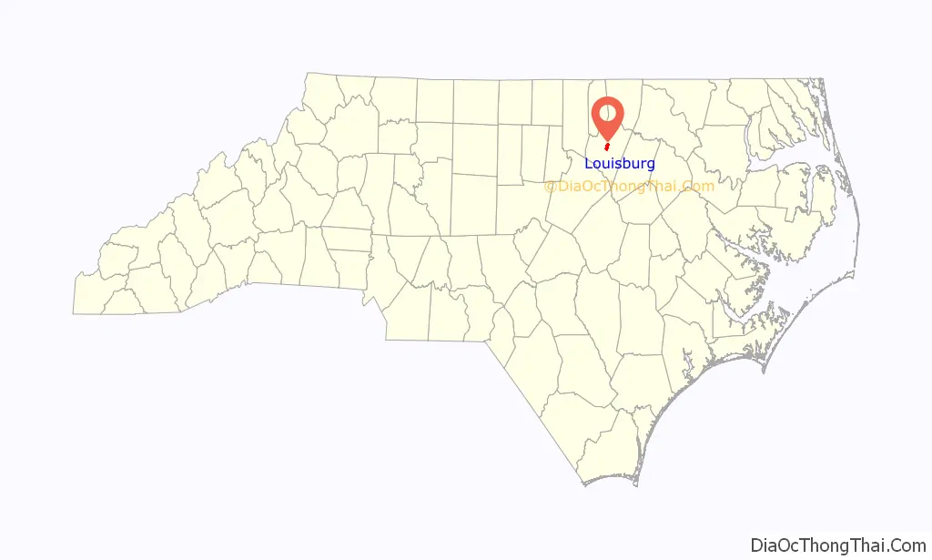
Louisburg location map. Where is Louisburg town?
History
Louisburg was established in 1779 and named in honor of King Louis XVI of France, who was aiding the American Revolution at the time. Louisburg was established on land purchased for the erection of a courthouse.
In June 1965, the local newspaper and radio station publicized the names and addresses of African-American families who had applied to attend white schools in Franklin County. The families were attacked on numerous occasions by white extremists, who fired into their homes or destroyed their cars. In the summer of 1966, a series of cross burnings were perpetrated by the Ku Klux Klan in Franklin County, including one in front of the County Board of Education in Louisburg.
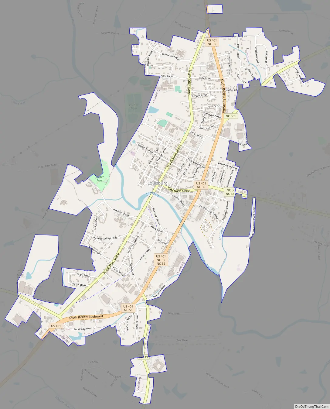
Louisburg Road Map
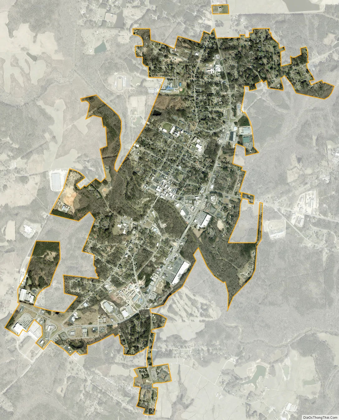
Louisburg city Satellite Map
Geography
According to the United States Census Bureau, the town has a total area of 2.8 square miles (7.3 km), all land.
Climate
Like the rest of eastern North Carolina, Louisburg has a humid subtropical climate (Köppen climate classification Cfa), with cool to mild winters and hot, humid summers. Rainfall – which is mainly produced by afternoon thunderstorms – is highest in the summer months. Snowfall is light and infrequent, with an average of 1.7 inches (4.32 cm) per year.
See also
Map of North Carolina State and its subdivision:- Alamance
- Alexander
- Alleghany
- Anson
- Ashe
- Avery
- Beaufort
- Bertie
- Bladen
- Brunswick
- Buncombe
- Burke
- Cabarrus
- Caldwell
- Camden
- Carteret
- Caswell
- Catawba
- Chatham
- Cherokee
- Chowan
- Clay
- Cleveland
- Columbus
- Craven
- Cumberland
- Currituck
- Dare
- Davidson
- Davie
- Duplin
- Durham
- Edgecombe
- Forsyth
- Franklin
- Gaston
- Gates
- Graham
- Granville
- Greene
- Guilford
- Halifax
- Harnett
- Haywood
- Henderson
- Hertford
- Hoke
- Hyde
- Iredell
- Jackson
- Johnston
- Jones
- Lee
- Lenoir
- Lincoln
- Macon
- Madison
- Martin
- McDowell
- Mecklenburg
- Mitchell
- Montgomery
- Moore
- Nash
- New Hanover
- Northampton
- Onslow
- Orange
- Pamlico
- Pasquotank
- Pender
- Perquimans
- Person
- Pitt
- Polk
- Randolph
- Richmond
- Robeson
- Rockingham
- Rowan
- Rutherford
- Sampson
- Scotland
- Stanly
- Stokes
- Surry
- Swain
- Transylvania
- Tyrrell
- Union
- Vance
- Wake
- Warren
- Washington
- Watauga
- Wayne
- Wilkes
- Wilson
- Yadkin
- Yancey
- Alabama
- Alaska
- Arizona
- Arkansas
- California
- Colorado
- Connecticut
- Delaware
- District of Columbia
- Florida
- Georgia
- Hawaii
- Idaho
- Illinois
- Indiana
- Iowa
- Kansas
- Kentucky
- Louisiana
- Maine
- Maryland
- Massachusetts
- Michigan
- Minnesota
- Mississippi
- Missouri
- Montana
- Nebraska
- Nevada
- New Hampshire
- New Jersey
- New Mexico
- New York
- North Carolina
- North Dakota
- Ohio
- Oklahoma
- Oregon
- Pennsylvania
- Rhode Island
- South Carolina
- South Dakota
- Tennessee
- Texas
- Utah
- Vermont
- Virginia
- Washington
- West Virginia
- Wisconsin
- Wyoming