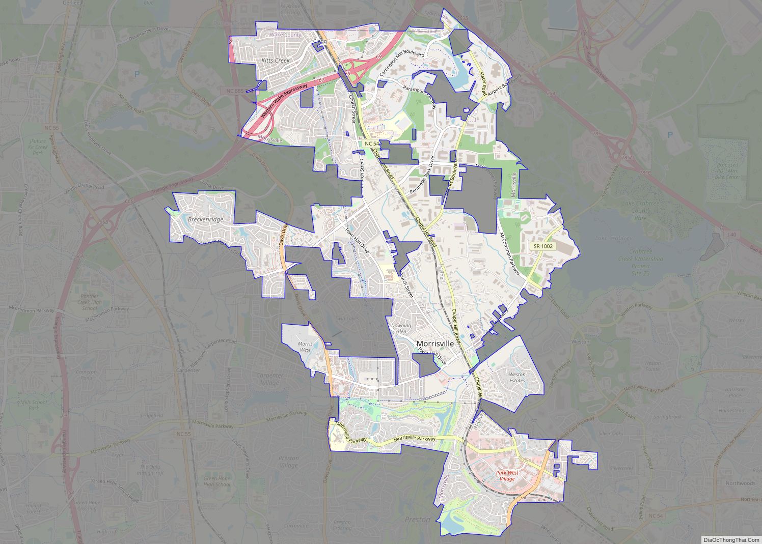
Map of Moravian Falls CDP

Map of Moravian Falls CDP

Moravian Falls (formerly, Petersburg and Forks of the Road) is a census-designated place (CDP) in Wilkes County, North Carolina, United States. The population was 1,802 as of the 2020 census. Moravian Falls CDP overview: Name: Moravian Falls CDP LSAD Code: 57 LSAD Description: CDP (suffix) State: North Carolina County: Wilkes County Elevation: 1,194 ft (364 m) Total … Read more

Map of Mooresville town, North Carolina

Map of Mooresville town, North Carolina

Mooresville is a town located in the southwestern section of Iredell County, North Carolina, United States, and is a part of the fast-growing Charlotte metropolitan area. The population was 50,193 at the 2020 United States Census, making it the largest municipality in Iredell County. It is located approximately 25 miles (40 km) north of Charlotte. Mooresville … Read more

Map of Mooresboro town

Map of Mooresboro town

Mooresboro is a town in Cleveland County, North Carolina, United States. The population was 311 at the 2010 census. Mooresboro town overview: Name: Mooresboro town LSAD Code: 43 LSAD Description: town (suffix) State: North Carolina County: Cleveland County Elevation: 935 ft (285 m) Total Area: 1.77 sq mi (4.58 km²) Land Area: 1.77 sq mi (4.58 km²) Water Area: 0.00 sq mi (0.00 km²) Total Population: … Read more

Map of Montreat town

Map of Montreat town

Montreat is a town in Buncombe County, North Carolina, United States. The population was 723 at the 2010 census. It is part of the Asheville Metropolitan Statistical Area. The town is best known for Montreat Conference Center, Montreat College, and for having been the home of the evangelist Billy Graham (1918 – 2018) and his … Read more

Map of Moyock CDP

Map of Moyock CDP

Moyock /ˈmoʊjɒk/ is an unincorporated community and census-designated place (CDP) in Currituck County, North Carolina, United States. As of the 2010 census it had a population of 3,759. Moyock CDP overview: Name: Moyock CDP LSAD Code: 57 LSAD Description: CDP (suffix) State: North Carolina County: Currituck County Elevation: 5 ft (2 m) Total Area: 10.52 sq mi (27.26 km²) Land … Read more

Map of Mountain View CDP, North Carolina

Map of Mountain View CDP, North Carolina

Mountain View CDP overview: Name: Mountain View CDP LSAD Code: 57 LSAD Description: CDP (suffix) State: North Carolina County: Catawba County FIPS code: 3744770 Online Interactive Map Mountain View online map. Source: Basemap layers from Google Map, Open Street Map (OSM), Arcgisonline, Wmflabs. Boundary Data from Database of Global Administrative Areas. Mountain View location map. … Read more

Map of Mountain Home CDP, North Carolina

Map of Mountain Home CDP, North Carolina

Mountain Home is an unincorporated community and census-designated place (CDP) in Henderson County, North Carolina, United States. The population was 3,622 at the 2010 census, up from 2,169 in 2000. It is part of the Asheville Metropolitan Statistical Area. Mountain Home CDP overview: Name: Mountain Home CDP LSAD Code: 57 LSAD Description: CDP (suffix) State: … Read more

Map of Mount Pleasant town, North Carolina

Map of Mount Pleasant town, North Carolina

Mount Pleasant is a town located in eastern Cabarrus County, North Carolina, United States. As of the 2010 census, the town population was 1,652. The town center is located at the crossroads of Mount Pleasant Road and North Carolina Highway 73. NC Highway 49 skirts the town to the north on its way from Charlotte … Read more

Map of Mount Olive town, North Carolina

Map of Mount Olive town, North Carolina

Mount Olive is a town in Duplin and Wayne counties in the U.S. state of North Carolina. The population was 4,589 at the 2010 census. It is included in the Goldsboro, North Carolina Metropolitan Statistical Area. The town is home to the Mt. Olive Pickle Company and the University of Mount Olive. Mount Olive town … Read more

Map of Mount Holly city

Map of Mount Holly city

Mount Holly is a small suburban city in northeastern Gaston County, North Carolina, United States. The city is situated just west of the Catawba River, north of Interstate 85, south of North Carolina State Highway 16, and west of Charlotte. The population was 17,703 at the 2020 census, up from 13,656 in 2010. Mount Holly … Read more

Map of Murraysville CDP

Map of Murraysville CDP

Murraysville is a census-designated place (CDP) in New Hanover County, North Carolina, United States. The population was 14,215 at the 2010 census, up from 7,279 in 2000. It is part of the Wilmington Metropolitan Statistical Area. Murraysville CDP overview: Name: Murraysville CDP LSAD Code: 57 LSAD Description: CDP (suffix) State: North Carolina County: New Hanover … Read more

Map of Murphy town, North Carolina

Map of Murphy town, North Carolina

Murphy is a town in and the county seat of Cherokee County, North Carolina, United States. It is situated at the confluence of the Hiwassee and Valley rivers. It is the westernmost county seat in the state of North Carolina, approximately 360 miles (580 km) from the state capital in Raleigh. The population of Murphy was … Read more