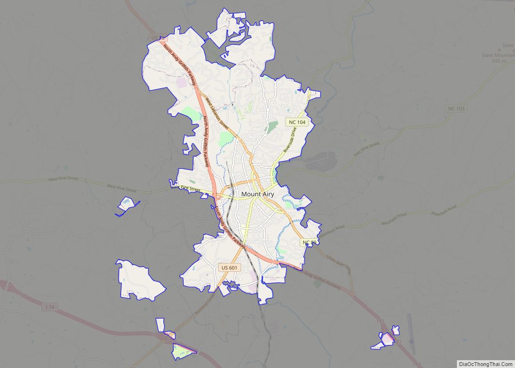
Mount Airy /ˈmaʊntəri/ is a city in Surry County, North Carolina, United States. As of the 2020 census, the city population was 10,611.
| Name: | Mount Airy city |
|---|---|
| LSAD Code: | 25 |
| LSAD Description: | city (suffix) |
| State: | North Carolina |
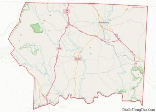
| County: | Surry County |
| Incorporated: | 1885 |
| Elevation: | 1,115 ft (340 m) |
| Total Area: | 11.86 sq mi (30.73 km²) |
| Land Area: | 11.72 sq mi (30.35 km²) |
| Water Area: | 0.15 sq mi (0.38 km²) |
| Total Population: | 10,676 |
| Population Density: | 911.15/sq mi (351.81/km²) |
| ZIP code: | 27030-27031 |
| Area code: | 336 |
| FIPS code: | 3744800 |
| GNISfeature ID: | 0990306 |
| Website: | http://www.mountairy.org/ |
Online Interactive Map
Click on ![]() to view map in "full screen" mode.
to view map in "full screen" mode.
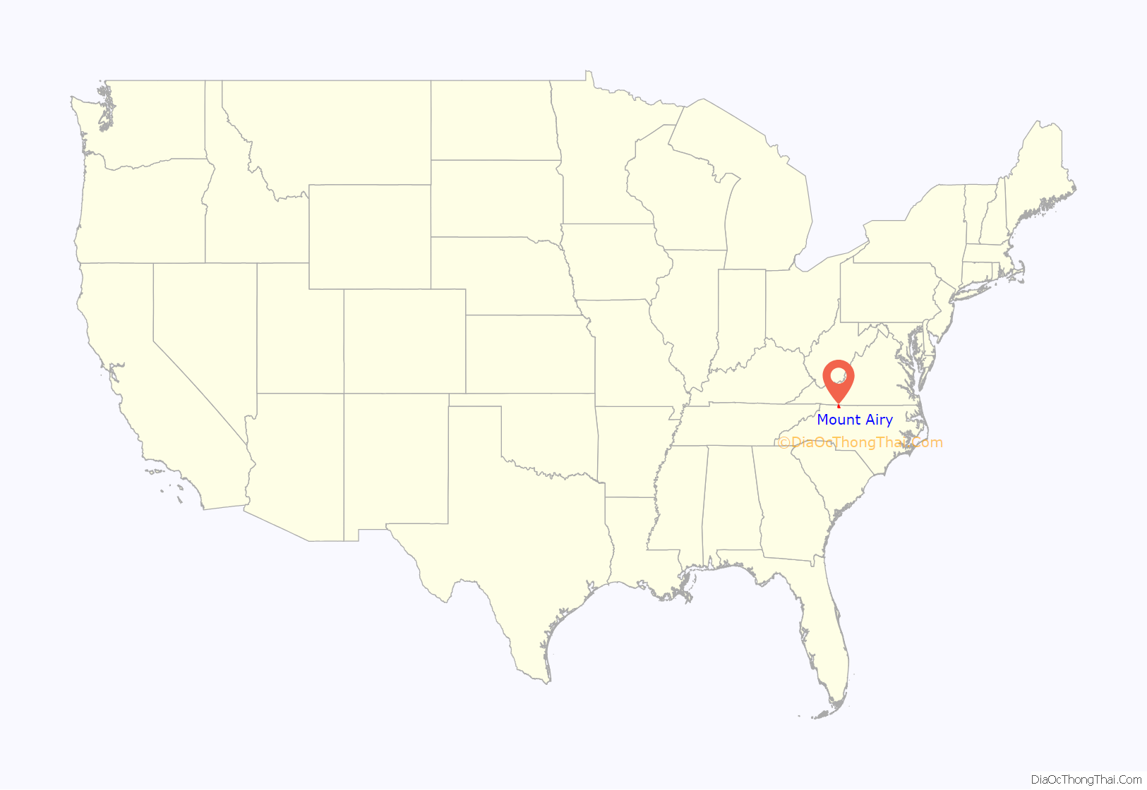
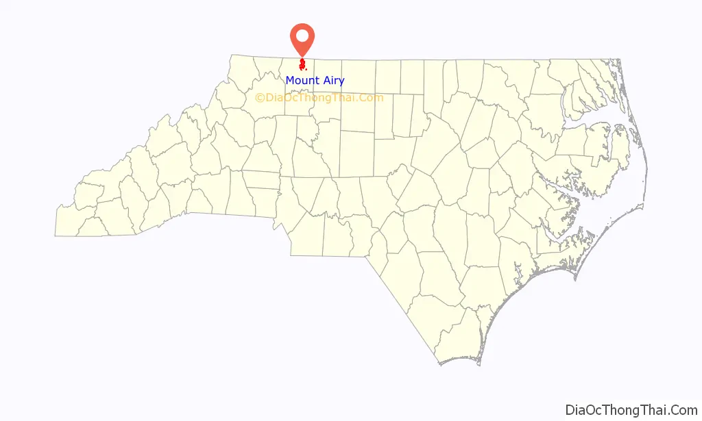
Mount Airy location map. Where is Mount Airy city?
History
Mount Airy was settled in the 1750s as a stagecoach stop on the road between Winston-Salem, North Carolina and Galax, Virginia. It was named for a nearby plantation. Mount Airy was incorporated in 1885. The city’s official seal was established in 1977, which depicts major industries that are home to Mount Airy including: furniture, textiles, and the granite quarry. In 1994, Mount Airy was named an All American City.
The W. F. Carter House, William Carter House, Edgar Harvey Hennis House, William Alfred Moore House, Mount Airy Historic District, North Carolina Granite Corporation Quarry Complex, Renfro Mill, and Trinity Episcopal Church are listed on the National Register of Historic Places.
Mount Airy Road Map
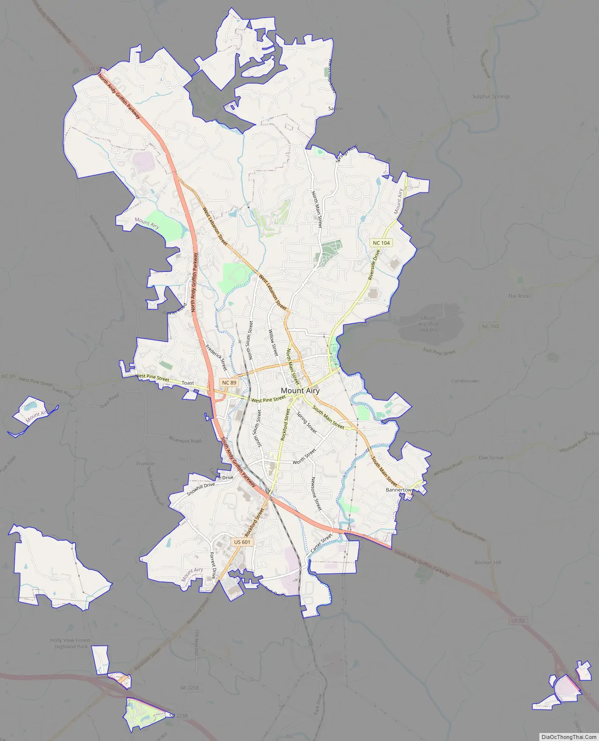
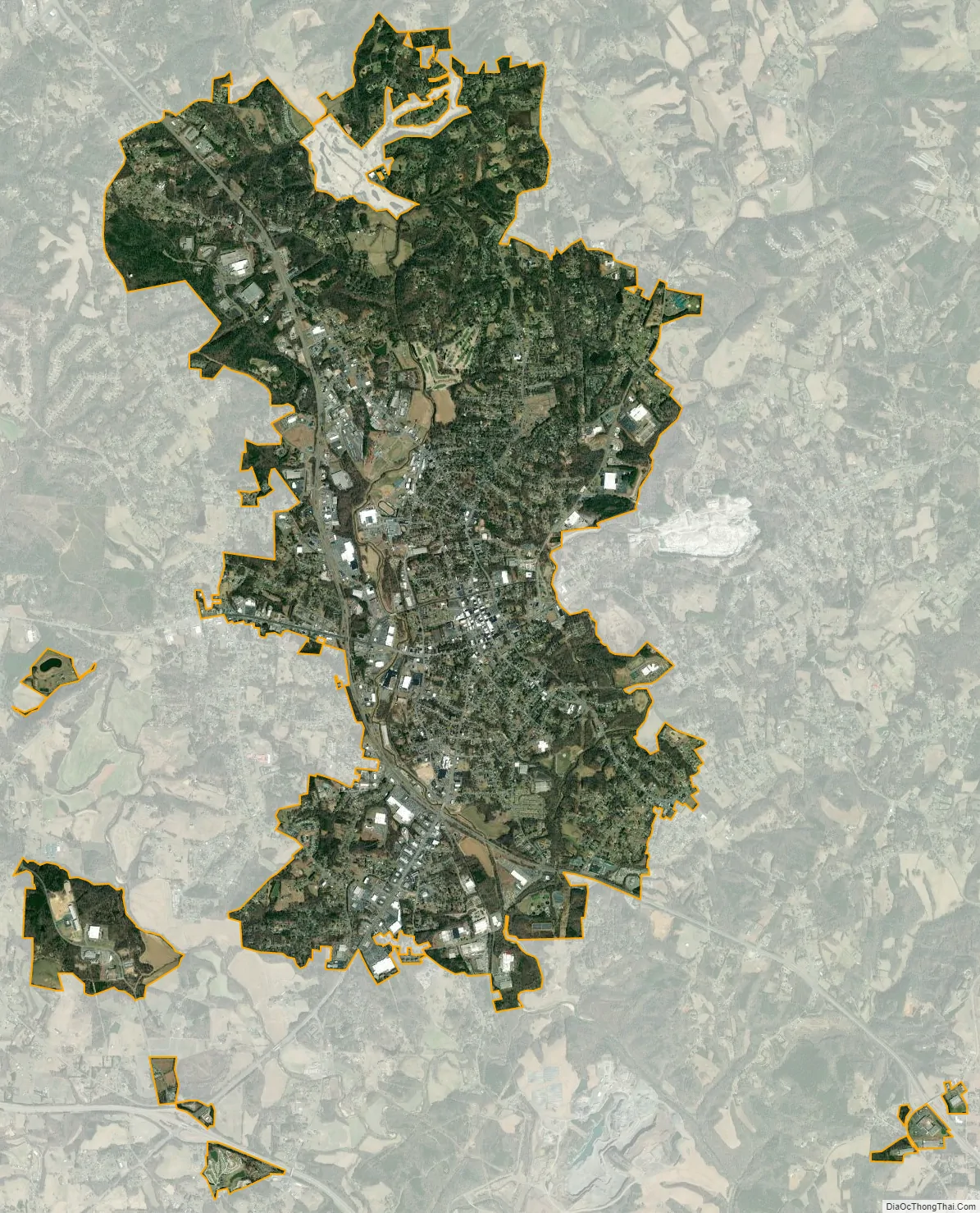
Mount Airy city Satellite Map
Geography
Mount Airy is located at 36°30′N 80°37′W / 36.500°N 80.617°W / 36.500; -80.617 (36.5006, −80.6093), along the Ararat River, about 5 km (3 mi) south of the Virginia state line. The United States Census Bureau states the city has a total area of 8.4 square miles (22 km), all land. The city is located at the foothills of the Blue Ridge Mountains, approximately 14 miles from the Blue Ridge Parkway. It has a humid subtropical climate (Cfa) and the hardiness zone is 7a.
See also
Map of North Carolina State and its subdivision:- Alamance
- Alexander
- Alleghany
- Anson
- Ashe
- Avery
- Beaufort
- Bertie
- Bladen
- Brunswick
- Buncombe
- Burke
- Cabarrus
- Caldwell
- Camden
- Carteret
- Caswell
- Catawba
- Chatham
- Cherokee
- Chowan
- Clay
- Cleveland
- Columbus
- Craven
- Cumberland
- Currituck
- Dare
- Davidson
- Davie
- Duplin
- Durham
- Edgecombe
- Forsyth
- Franklin
- Gaston
- Gates
- Graham
- Granville
- Greene
- Guilford
- Halifax
- Harnett
- Haywood
- Henderson
- Hertford
- Hoke
- Hyde
- Iredell
- Jackson
- Johnston
- Jones
- Lee
- Lenoir
- Lincoln
- Macon
- Madison
- Martin
- McDowell
- Mecklenburg
- Mitchell
- Montgomery
- Moore
- Nash
- New Hanover
- Northampton
- Onslow
- Orange
- Pamlico
- Pasquotank
- Pender
- Perquimans
- Person
- Pitt
- Polk
- Randolph
- Richmond
- Robeson
- Rockingham
- Rowan
- Rutherford
- Sampson
- Scotland
- Stanly
- Stokes
- Surry
- Swain
- Transylvania
- Tyrrell
- Union
- Vance
- Wake
- Warren
- Washington
- Watauga
- Wayne
- Wilkes
- Wilson
- Yadkin
- Yancey
- Alabama
- Alaska
- Arizona
- Arkansas
- California
- Colorado
- Connecticut
- Delaware
- District of Columbia
- Florida
- Georgia
- Hawaii
- Idaho
- Illinois
- Indiana
- Iowa
- Kansas
- Kentucky
- Louisiana
- Maine
- Maryland
- Massachusetts
- Michigan
- Minnesota
- Mississippi
- Missouri
- Montana
- Nebraska
- Nevada
- New Hampshire
- New Jersey
- New Mexico
- New York
- North Carolina
- North Dakota
- Ohio
- Oklahoma
- Oregon
- Pennsylvania
- Rhode Island
- South Carolina
- South Dakota
- Tennessee
- Texas
- Utah
- Vermont
- Virginia
- Washington
- West Virginia
- Wisconsin
- Wyoming