Murfreesboro is a town in Hertford County, North Carolina, United States. The population was 2,835 at the 2010 census. The town is home to Chowan University.
| Name: | Murfreesboro town |
|---|---|
| LSAD Code: | 43 |
| LSAD Description: | town (suffix) |
| State: | North Carolina |
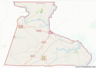
| County: | Hertford County |
| Elevation: | 85 ft (26 m) |
| Total Area: | 2.32 sq mi (6.01 km²) |
| Land Area: | 2.27 sq mi (5.88 km²) |
| Water Area: | 0.05 sq mi (0.13 km²) |
| Total Population: | 2,619 |
| Population Density: | 1,153.74/sq mi (445.48/km²) |
| ZIP code: | 27855 |
| Area code: | 252 |
| FIPS code: | 3745640 |
| GNISfeature ID: | 1021587 |
| Website: | www.townofmurfreesboro.com |
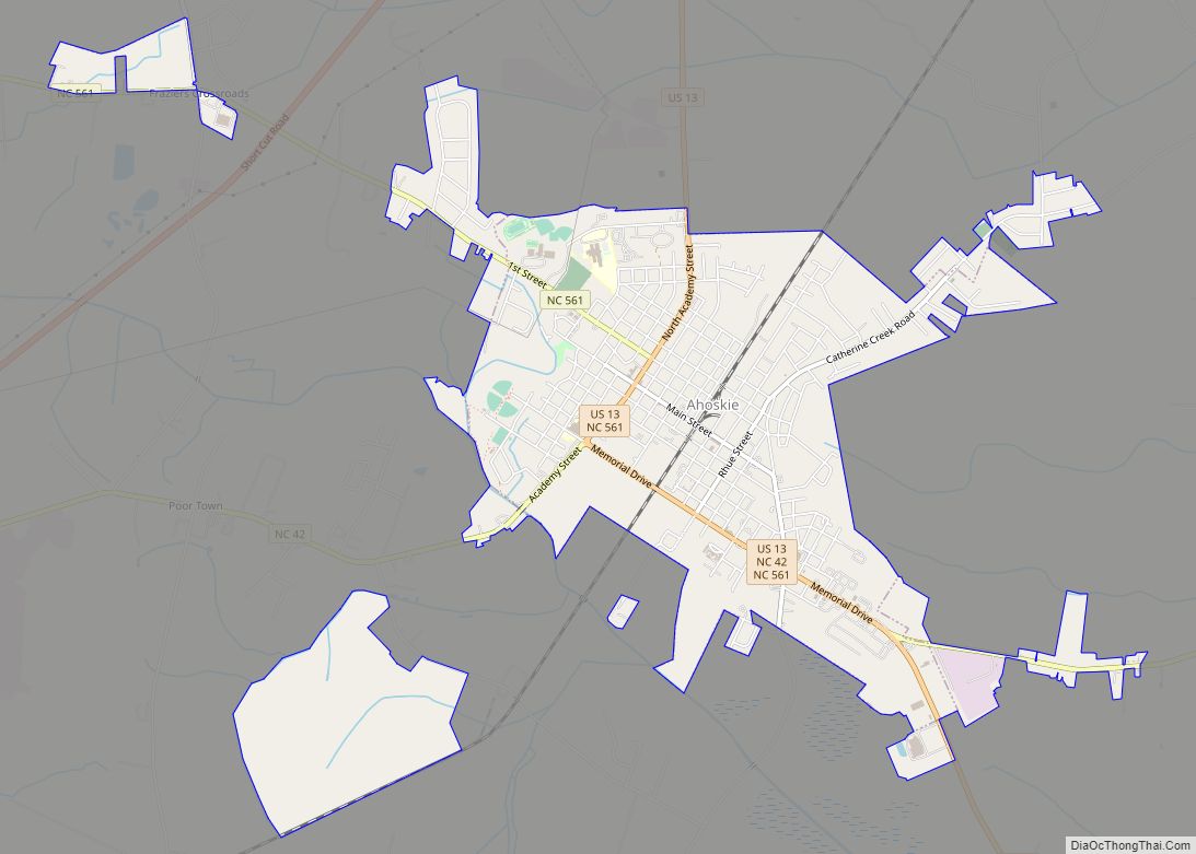
Online Interactive Map
Click on ![]() to view map in "full screen" mode.
to view map in "full screen" mode.
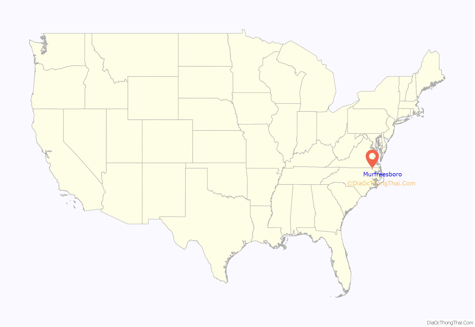
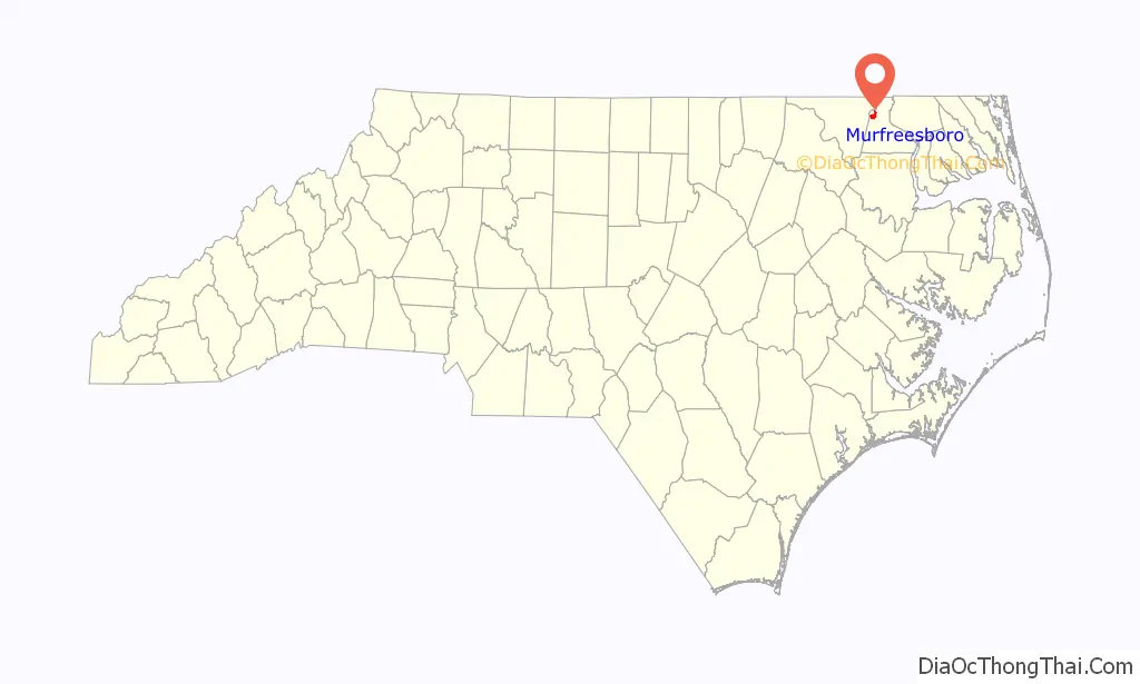
Murfreesboro location map. Where is Murfreesboro town?
History
Before European settlement
The first recorded inhabitants of the area were Native Americans from the Nottoway, Meherrin and Chowanoke tribes.
The first European known to visit the area was John White of the Roanoke Colony in the 16th century. It was also visited by an expedition from Jamestown, Virginia, in the 17th century.
The last native inhabitants, the Chowanoke, were expelled after warring with the English in 1675 and 1676. After that, they were moved to a reservation east of the Chowan River in what is now Gates County.
Colonial era to the American Revolution
The first known deed to property in the area is a land grant dated November 5, 1714, made to Henry Wheeler for a tract on the Meherrin River which included what is now Murfreesboro. Several other transactions quickly followed, and in 1735 Joseph Parker founded the Meherrin Church. It is the second-oldest Baptist church in North Carolina (now known as Meherrin Baptist Church).
On May 27, 1746, James Jordon Scott sold 150 acres (0.61 km) on the Meherrin River (part of Wheeler’s original grant) to an Irish immigrant, William Murfree from Nansemond County, Virginia. On December 12, 1754, the General Assembly designated Murfree’s Landing as a King’s Landing, where imports and exports would be inspected by a representative of the King.
Revolution to the American Civil War
On July 17, 1781, British forces led by Banastre Tarleton and Tarleton’s Raiders attacked Maney’s Neck near Murfree’s Landing. William Murfree’s son, Hardy Murfree, led a local militia that repulsed the attack at Skinner’s Bridge.
William Murfree contributed 97 acres (39 ha) of land surrounding Murfree’s Landing in 1787 to the growing settlement to form a town. The town was chartered by the General Assembly and renamed Murfreesboro on January 6, 1787. This act also provided for the establishment of a public dock, as the town was located at the northernmost point of navigation on the Meherrin River.
Murfreesboro was designated by the US Congress in 1790 as an official port of entry, and the customs records indicate a profitable three-cornered trade with New England and the West Indies.
In 1809, the Hertford Academy was established in Murfreesboro, opening in 1811 for male students. In 1814, Harriet Sketchly and Martha Sketchly arrived and expanded the female department of the academy considerably. By 1849, it was renamed as the Chowan Baptist Female Institute, the forerunner of Chowan University.
In 1831 Murfreesboro was among towns that sent armed forces (these were led by Captain Solon Borland) to Southampton County, Virginia, to quell Nat Turner’s slave rebellion. As a result of these events, Virginia and North Carolina reduced the rights of free blacks, prohibiting education of both free blacks and slaves.
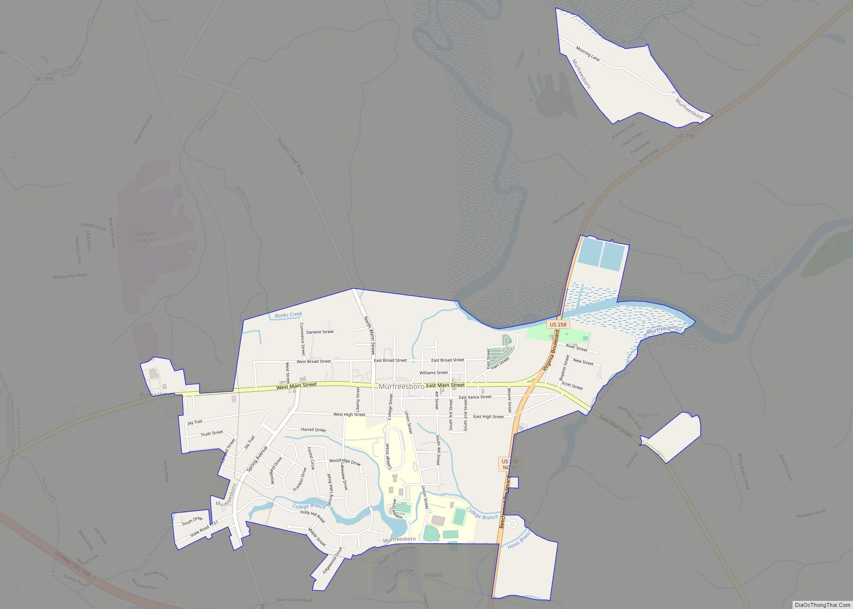
Murfreesboro Road Map

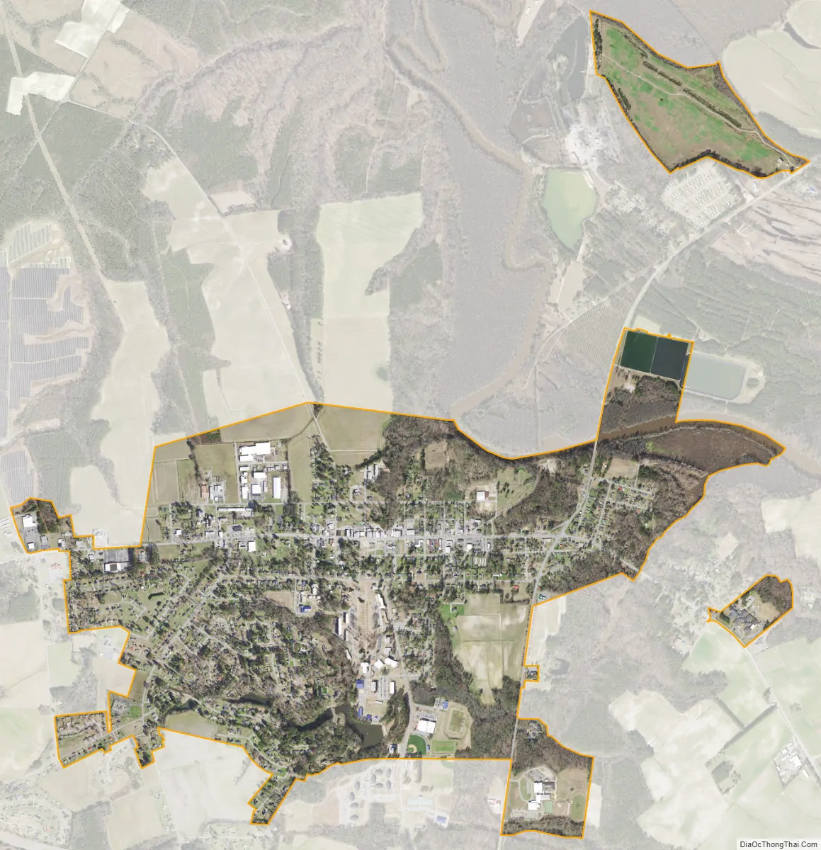
Murfreesboro city Satellite Map
Geography
Murfreesboro is located in northwestern Hertford County at 36°26′28″N 77°5′49″W / 36.44111°N 77.09694°W / 36.44111; -77.09694 (36.440983, -77.096901), on high ground south of the Meherrin River. U.S. Route 258 runs through the eastern end of the town, and U.S. Route 158 bypasses the town to the south. US-258 leads southwest 51 miles (82 km) to Tarboro and northeast 21 miles (34 km) to Franklin, Virginia, while US-158 leads east 10 miles (16 km) to Winton, the Hertford county seat, and west 37 miles (60 km) to Roanoke Rapids.
According to the United States Census Bureau, the town has a total area of 2.3 square miles (5.9 km), of which 2.2 square miles (5.8 km) are land and 0.04 square miles (0.1 km), or 2.27%, are water.
Climate
See also
Map of North Carolina State and its subdivision:- Alamance
- Alexander
- Alleghany
- Anson
- Ashe
- Avery
- Beaufort
- Bertie
- Bladen
- Brunswick
- Buncombe
- Burke
- Cabarrus
- Caldwell
- Camden
- Carteret
- Caswell
- Catawba
- Chatham
- Cherokee
- Chowan
- Clay
- Cleveland
- Columbus
- Craven
- Cumberland
- Currituck
- Dare
- Davidson
- Davie
- Duplin
- Durham
- Edgecombe
- Forsyth
- Franklin
- Gaston
- Gates
- Graham
- Granville
- Greene
- Guilford
- Halifax
- Harnett
- Haywood
- Henderson
- Hertford
- Hoke
- Hyde
- Iredell
- Jackson
- Johnston
- Jones
- Lee
- Lenoir
- Lincoln
- Macon
- Madison
- Martin
- McDowell
- Mecklenburg
- Mitchell
- Montgomery
- Moore
- Nash
- New Hanover
- Northampton
- Onslow
- Orange
- Pamlico
- Pasquotank
- Pender
- Perquimans
- Person
- Pitt
- Polk
- Randolph
- Richmond
- Robeson
- Rockingham
- Rowan
- Rutherford
- Sampson
- Scotland
- Stanly
- Stokes
- Surry
- Swain
- Transylvania
- Tyrrell
- Union
- Vance
- Wake
- Warren
- Washington
- Watauga
- Wayne
- Wilkes
- Wilson
- Yadkin
- Yancey
- Alabama
- Alaska
- Arizona
- Arkansas
- California
- Colorado
- Connecticut
- Delaware
- District of Columbia
- Florida
- Georgia
- Hawaii
- Idaho
- Illinois
- Indiana
- Iowa
- Kansas
- Kentucky
- Louisiana
- Maine
- Maryland
- Massachusetts
- Michigan
- Minnesota
- Mississippi
- Missouri
- Montana
- Nebraska
- Nevada
- New Hampshire
- New Jersey
- New Mexico
- New York
- North Carolina
- North Dakota
- Ohio
- Oklahoma
- Oregon
- Pennsylvania
- Rhode Island
- South Carolina
- South Dakota
- Tennessee
- Texas
- Utah
- Vermont
- Virginia
- Washington
- West Virginia
- Wisconsin
- Wyoming