Montreat is a town in Buncombe County, North Carolina, United States. The population was 723 at the 2010 census. It is part of the Asheville Metropolitan Statistical Area. The town is best known for Montreat Conference Center, Montreat College, and for having been the home of the evangelist Billy Graham (1918 – 2018) and his wife Ruth Bell Graham (1920 – 2007).
| Name: | Montreat town |
|---|---|
| LSAD Code: | 43 |
| LSAD Description: | town (suffix) |
| State: | North Carolina |
| County: | Buncombe County |
| Elevation: | 2,615 ft (797 m) |
| Total Area: | 2.73 sq mi (7.07 km²) |
| Land Area: | 2.73 sq mi (7.06 km²) |
| Water Area: | 0.00 sq mi (0.01 km²) |
| Total Population: | 901 |
| Population Density: | 330.28/sq mi (127.54/km²) |
| ZIP code: | 28757 |
| Area code: | 828 |
| FIPS code: | 3744100 |
| GNISfeature ID: | 1021518 |
| Website: | www.townofmontreat.org |
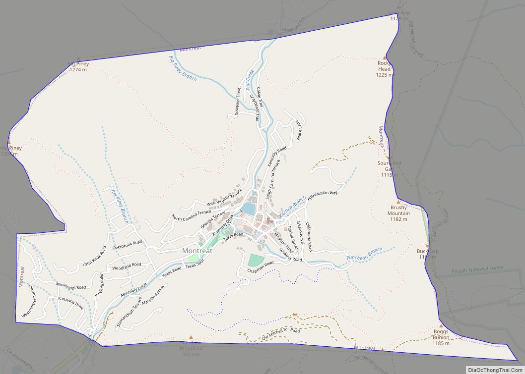
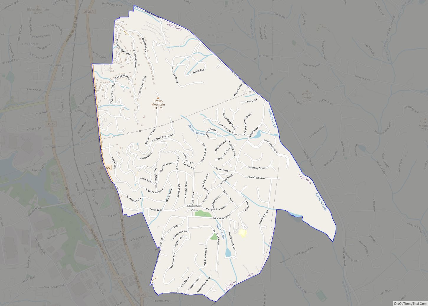
Online Interactive Map
Click on ![]() to view map in "full screen" mode.
to view map in "full screen" mode.
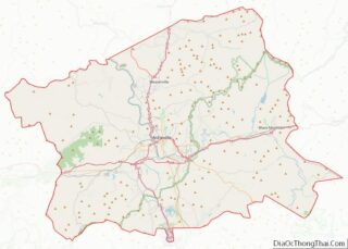
Montreat location map. Where is Montreat town?


History
The town of Montreat was incorporated as a North Carolina township in 1967. Much of the property in the area is still owned by the Mountain Retreat Association, formed in 1897 by John Collins, a Congregationalist minister from Connecticut. Funding for the retreat’s creation was secured from candy manufacturer and philanthropist John S. Huyler, founder of Huyler’s. The name of Montreat is a portmanteau of the words “Mountain” and “Retreat”. In 1907 control of the Mountain Retreat Association (MRA) passed to the Presbyterian Church in the US, and for many years Montreat has been host to religious conferences, mainly Presbyterian, organized through the MRA. Significant organizations in the contemporary town of Montreat, in addition to the Mountain Retreat Association, include Montreat Presbyterian Church: PC(USA), Montreat College (founded in 1916), and Christ Community Church, EPC (formerly Montreat Presbyterian Church).
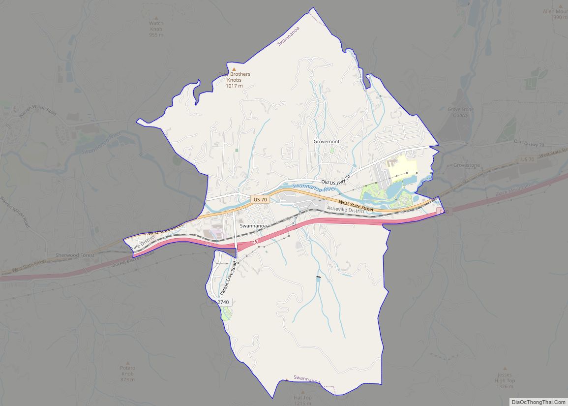
Montreat Road Map

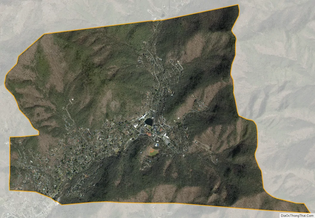
Montreat city Satellite Map
Geography
Montreat is located in eastern Buncombe County at 35°38′44″N 82°18′2″W / 35.64556°N 82.30056°W / 35.64556; -82.30056 (35.645590, -82.300434). Its eastern border is the county line, with McDowell County to the east. The town is located in the valley of Flat Creek and is surrounded by mountains on three sides. The only road access is via North Carolina Highway 9, which leads southwest 2 miles (3 km) to the town of Black Mountain.
According to the United States Census Bureau, Montreat has a total area of 2.7 square miles (7.1 km).
See also
Map of North Carolina State and its subdivision:- Alamance
- Alexander
- Alleghany
- Anson
- Ashe
- Avery
- Beaufort
- Bertie
- Bladen
- Brunswick
- Buncombe
- Burke
- Cabarrus
- Caldwell
- Camden
- Carteret
- Caswell
- Catawba
- Chatham
- Cherokee
- Chowan
- Clay
- Cleveland
- Columbus
- Craven
- Cumberland
- Currituck
- Dare
- Davidson
- Davie
- Duplin
- Durham
- Edgecombe
- Forsyth
- Franklin
- Gaston
- Gates
- Graham
- Granville
- Greene
- Guilford
- Halifax
- Harnett
- Haywood
- Henderson
- Hertford
- Hoke
- Hyde
- Iredell
- Jackson
- Johnston
- Jones
- Lee
- Lenoir
- Lincoln
- Macon
- Madison
- Martin
- McDowell
- Mecklenburg
- Mitchell
- Montgomery
- Moore
- Nash
- New Hanover
- Northampton
- Onslow
- Orange
- Pamlico
- Pasquotank
- Pender
- Perquimans
- Person
- Pitt
- Polk
- Randolph
- Richmond
- Robeson
- Rockingham
- Rowan
- Rutherford
- Sampson
- Scotland
- Stanly
- Stokes
- Surry
- Swain
- Transylvania
- Tyrrell
- Union
- Vance
- Wake
- Warren
- Washington
- Watauga
- Wayne
- Wilkes
- Wilson
- Yadkin
- Yancey
- Alabama
- Alaska
- Arizona
- Arkansas
- California
- Colorado
- Connecticut
- Delaware
- District of Columbia
- Florida
- Georgia
- Hawaii
- Idaho
- Illinois
- Indiana
- Iowa
- Kansas
- Kentucky
- Louisiana
- Maine
- Maryland
- Massachusetts
- Michigan
- Minnesota
- Mississippi
- Missouri
- Montana
- Nebraska
- Nevada
- New Hampshire
- New Jersey
- New Mexico
- New York
- North Carolina
- North Dakota
- Ohio
- Oklahoma
- Oregon
- Pennsylvania
- Rhode Island
- South Carolina
- South Dakota
- Tennessee
- Texas
- Utah
- Vermont
- Virginia
- Washington
- West Virginia
- Wisconsin
- Wyoming