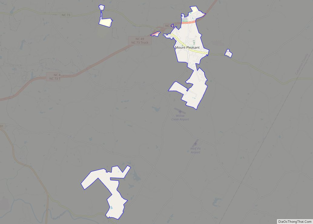
Mount Pleasant is a town located in eastern Cabarrus County, North Carolina, United States. As of the 2010 census, the town population was 1,652. The town center is located at the crossroads of Mount Pleasant Road and North Carolina Highway 73. NC Highway 49 skirts the town to the north on its way from Charlotte to Asheboro. The town is an important reference point along the road between Charlotte, the largest city in the Carolinas, and Raleigh, the North Carolina state capital. The town is also an important point on NC Highway 73 between Concord and Albemarle.
| Name: | Mount Pleasant town |
|---|---|
| LSAD Code: | 43 |
| LSAD Description: | town (suffix) |
| State: | North Carolina |
| County: | Cabarrus County |
| Elevation: | 650 ft (198 m) |
| Total Area: | 3.59 sq mi (9.31 km²) |
| Land Area: | 3.59 sq mi (9.31 km²) |
| Water Area: | 0.00 sq mi (0.00 km²) |
| Total Population: | 1,671 |
| Population Density: | 465.07/sq mi (179.56/km²) |
| ZIP code: | 28124 |
| Area code: | 704 980 |
| FIPS code: | 3745140 |
| GNISfeature ID: | 0990517 |
| Website: | www.townofmountpleasantnc.org |
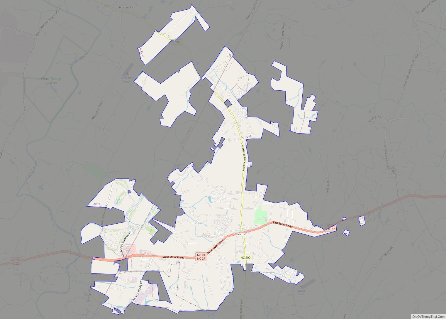
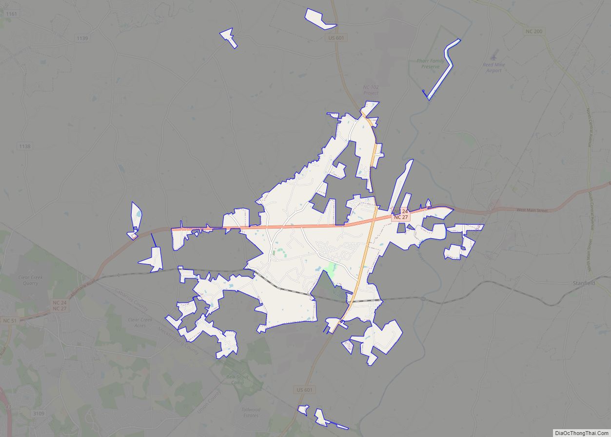
Online Interactive Map
Click on ![]() to view map in "full screen" mode.
to view map in "full screen" mode.
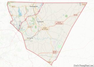
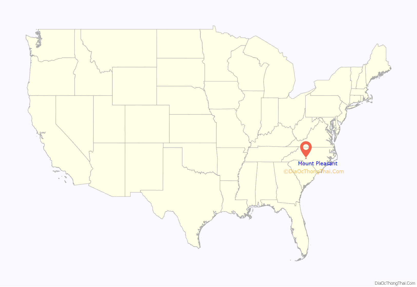
Mount Pleasant location map. Where is Mount Pleasant town?

History
The First Congregational Church, Lentz Hotel, Mount Pleasant Collegiate Institute Historic District, and Mount Pleasant Historic District are listed on the National Register of Historic Places.
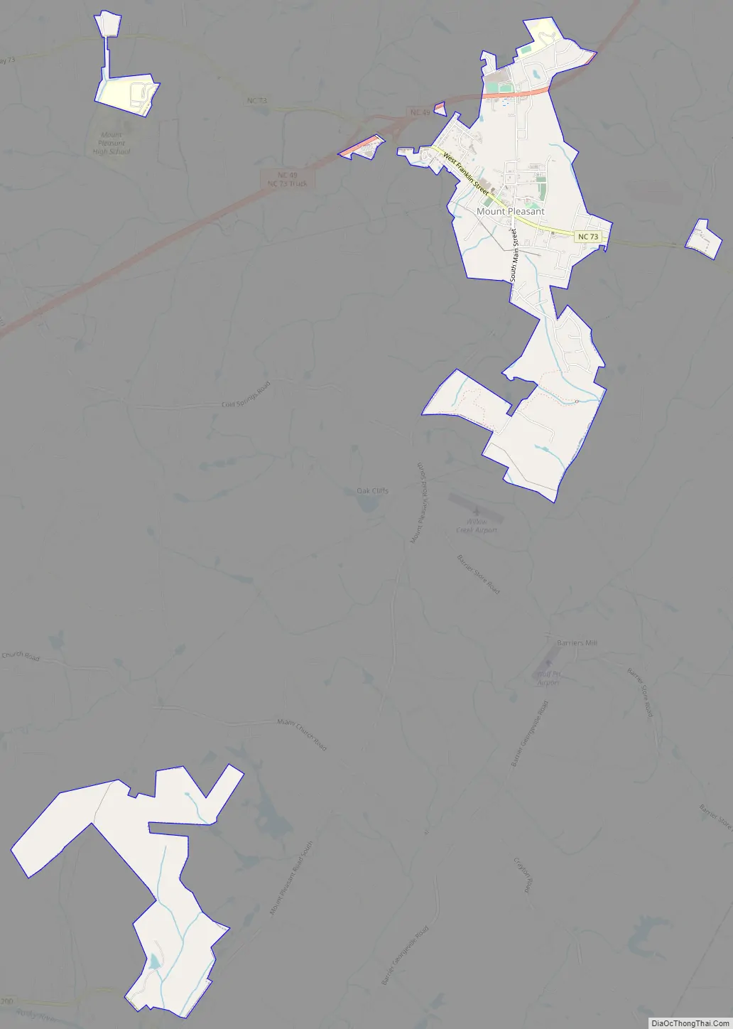
Mount Pleasant Road Map
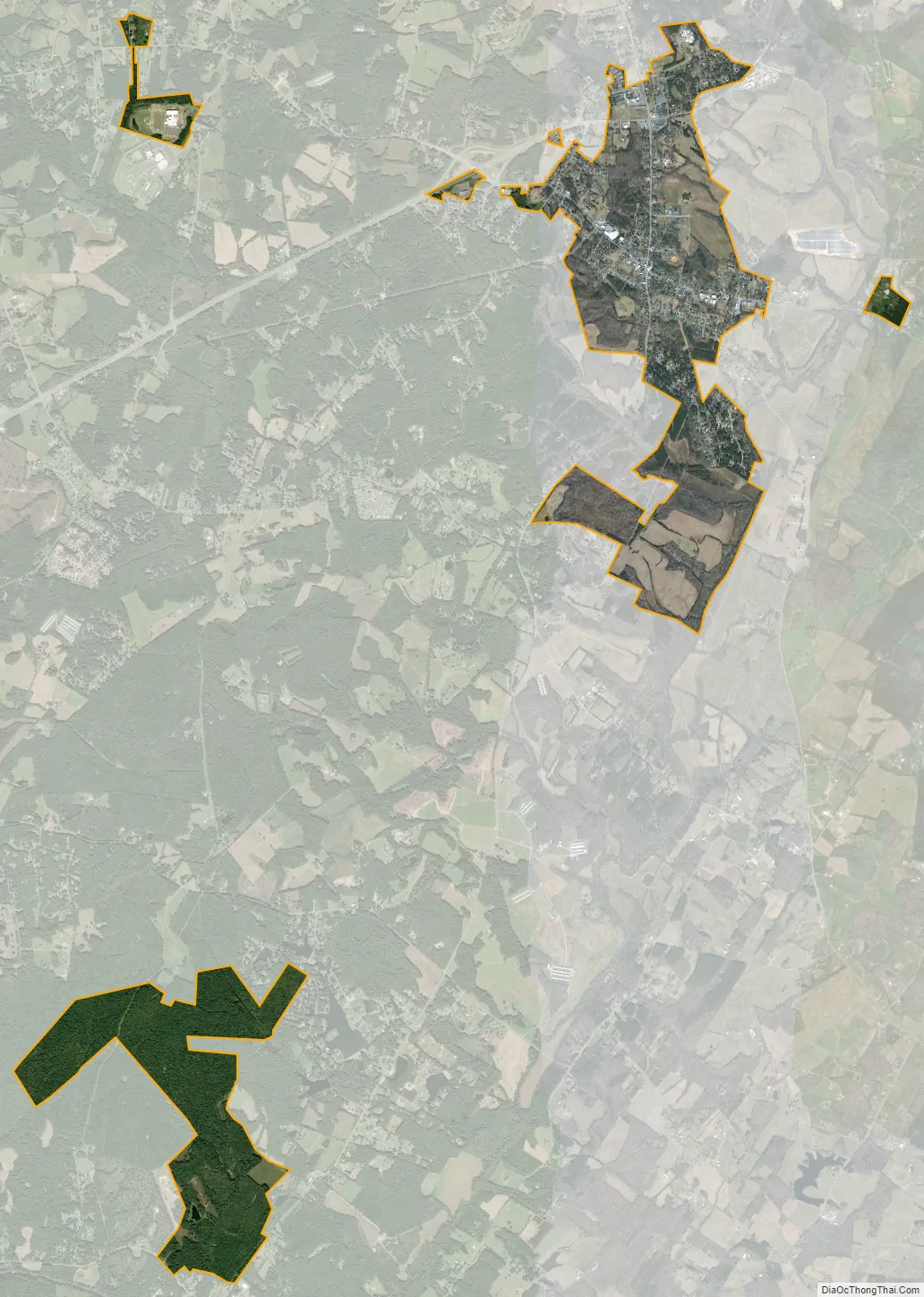
Mount Pleasant city Satellite Map
Geography
Mount Pleasant is located in eastern Cabarrus County at 35°24′13″N 80°26′8″W / 35.40361°N 80.43556°W / 35.40361; -80.43556 (35.403734, -80.435478).
According to the United States Census Bureau, the town has a total area of 3.3 square miles (8.6 km), all land.
See also
Map of North Carolina State and its subdivision:- Alamance
- Alexander
- Alleghany
- Anson
- Ashe
- Avery
- Beaufort
- Bertie
- Bladen
- Brunswick
- Buncombe
- Burke
- Cabarrus
- Caldwell
- Camden
- Carteret
- Caswell
- Catawba
- Chatham
- Cherokee
- Chowan
- Clay
- Cleveland
- Columbus
- Craven
- Cumberland
- Currituck
- Dare
- Davidson
- Davie
- Duplin
- Durham
- Edgecombe
- Forsyth
- Franklin
- Gaston
- Gates
- Graham
- Granville
- Greene
- Guilford
- Halifax
- Harnett
- Haywood
- Henderson
- Hertford
- Hoke
- Hyde
- Iredell
- Jackson
- Johnston
- Jones
- Lee
- Lenoir
- Lincoln
- Macon
- Madison
- Martin
- McDowell
- Mecklenburg
- Mitchell
- Montgomery
- Moore
- Nash
- New Hanover
- Northampton
- Onslow
- Orange
- Pamlico
- Pasquotank
- Pender
- Perquimans
- Person
- Pitt
- Polk
- Randolph
- Richmond
- Robeson
- Rockingham
- Rowan
- Rutherford
- Sampson
- Scotland
- Stanly
- Stokes
- Surry
- Swain
- Transylvania
- Tyrrell
- Union
- Vance
- Wake
- Warren
- Washington
- Watauga
- Wayne
- Wilkes
- Wilson
- Yadkin
- Yancey
- Alabama
- Alaska
- Arizona
- Arkansas
- California
- Colorado
- Connecticut
- Delaware
- District of Columbia
- Florida
- Georgia
- Hawaii
- Idaho
- Illinois
- Indiana
- Iowa
- Kansas
- Kentucky
- Louisiana
- Maine
- Maryland
- Massachusetts
- Michigan
- Minnesota
- Mississippi
- Missouri
- Montana
- Nebraska
- Nevada
- New Hampshire
- New Jersey
- New Mexico
- New York
- North Carolina
- North Dakota
- Ohio
- Oklahoma
- Oregon
- Pennsylvania
- Rhode Island
- South Carolina
- South Dakota
- Tennessee
- Texas
- Utah
- Vermont
- Virginia
- Washington
- West Virginia
- Wisconsin
- Wyoming