Map of Steele city, North Dakota
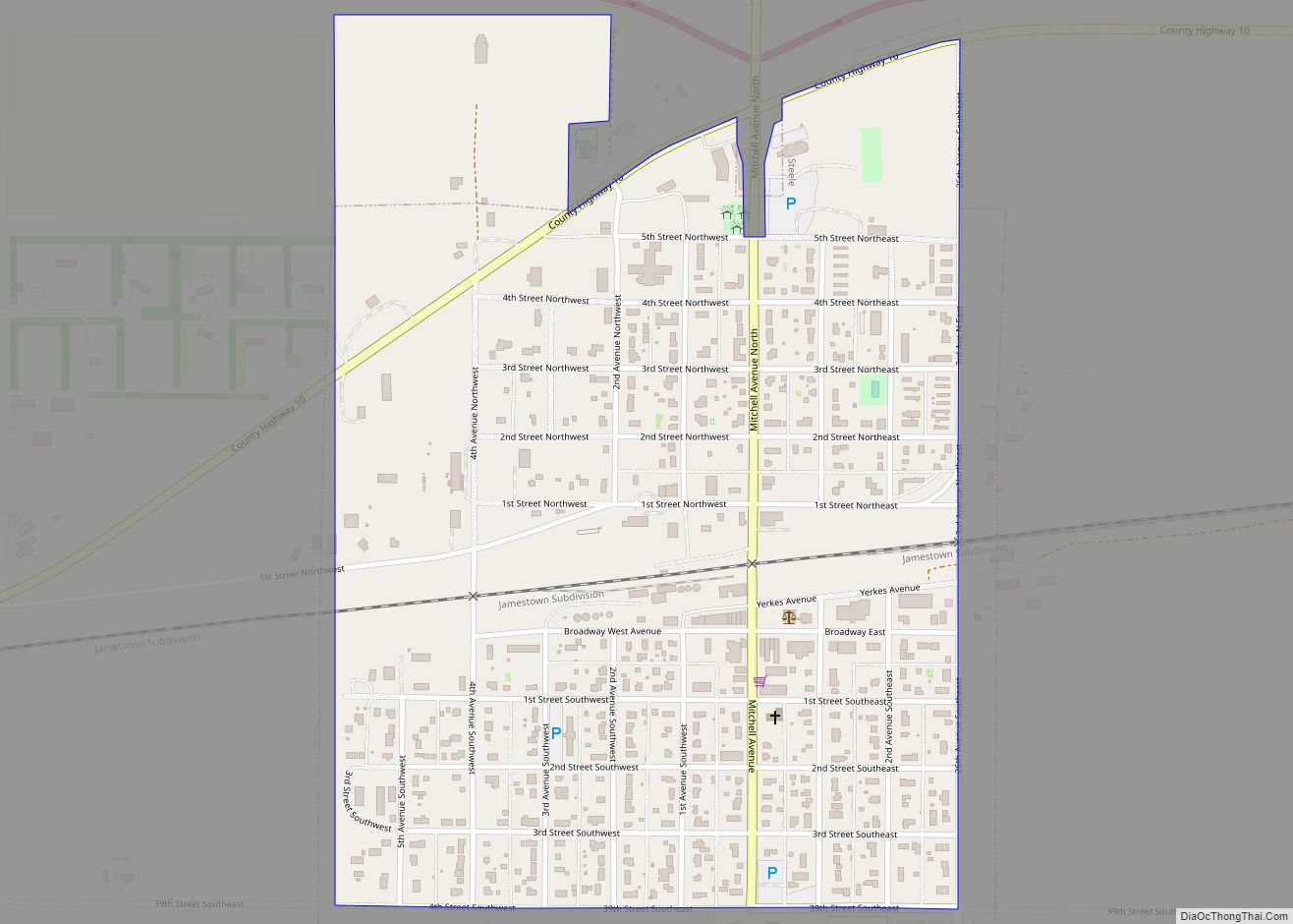
Steele is a city in Kidder County, North Dakota, United States. It is the county seat of Kidder County. The population was 665 at the 2020 census. Although they bear the same name, the city of Steele is not in Steele County. Steele city overview: Name: Steele city LSAD Code: 25 LSAD Description: city (suffix) ... Read more
Map of Steele city, North Dakota
Map of Starkweather city
Starkweather is a city in Ramsey County, North Dakota, United States. The population was 100 at the 2020 census. Starkweather was founded in 1902. Starkweather city overview: Name: Starkweather city LSAD Code: 25 LSAD Description: city (suffix) State: North Dakota County: Ramsey County Founded: 1902 Elevation: 1,496 ft (456 m) Total Area: 0.13 sq mi (0.34 km²) Land Area: 0.13 sq mi ... Read more
Map of Starkweather city
Map of Stanton city, North Dakota
Stanton is a city in Mercer County, North Dakota, United States. It is the county seat of Mercer County. The population was 368 at the 2020 census. Stanton was founded in 1883 and became the county seat when Mercer County organized in 1884. Stanton is home to the Knife River Indian Villages National Historic Site, ... Read more
Map of Stanton city, North Dakota
Map of Stanley city, North Dakota
Stanley is a city in Mountrail County, North Dakota, United States. It is the county seat of Mountrail County. The population was 2,579 at the 2020 census, making it the 20th largest city in North Dakota. Stanley was founded in 1902. The town’s economy is heavily connected to the nearby oil-rich Bakken Formation. Stanley city ... Read more
Map of Stanley city, North Dakota
Map of St. Thomas city, North Dakota
St. Thomas is a city in Pembina County, North Dakota, United States. The population was 323 at the 2020 census. The city, located in the Red River Valley region. St. Thomas city overview: Name: St. Thomas city LSAD Code: 25 LSAD Description: city (suffix) State: North Dakota County: Pembina County Founded: 1881 Elevation: 840 ft (256 m) ... Read more
Map of St. Thomas city, North Dakota
Map of St. John city, North Dakota
St. John is a city in Rolette County, North Dakota, United States. The population was 322 at the 2020 census. St. John city overview: Name: St. John city LSAD Code: 25 LSAD Description: city (suffix) State: North Dakota County: Rolette County Founded: 1882 Elevation: 1,949 ft (594 m) Total Area: 0.44 sq mi (1.14 km²) Land Area: 0.44 sq mi (1.14 km²) Water ... Read more
Map of St. John city, North Dakota
Map of Springbrook city, North Dakota
Springbrook is a city in Williams County, North Dakota, United States. The population was 37 at the 2020 census. It is also spelled Spring Brook. Springbrook city overview: Name: Springbrook city LSAD Code: 25 LSAD Description: city (suffix) State: North Dakota County: Williams County Elevation: 2,070 ft (631 m) Total Area: 0.37 sq mi (0.97 km²) Land Area: 0.37 sq mi (0.97 km²) ... Read more
Map of Springbrook city, North Dakota
Map of Spiritwood CDP
Spiritwood is a census-designated place (CDP) in eastern Stutsman County, North Dakota, United States. An unincorporated community, it was designated as part of the U.S. Census Bureau’s Participant Statistical Areas Program on March 31, 2010. It was not counted separately during the 2000 census, but was included in the 2010 census, where a population of ... Read more
Map of Spiritwood CDP
Map of Sutton CDP, North Dakota
Sutton is a census-designated place in western Griggs County, North Dakota, United States. An unincorporated community, it was designated as part of the U.S. Census Bureau’s Participant Statistical Areas Program on March 31, 2010. It was not counted separately during the 2000 Census, but was included in the 2010 Census, where a population of 17 ... Read more
Map of Sutton CDP, North Dakota
Map of Surrey city
Surrey is a town in Ward County, North Dakota, United States. The population was 1,357 at the 2020 census. Official incorporation of Surrey occurred in 1951. The city is part of the Minot Micropolitan Statistical Area. Surrey city overview: Name: Surrey city LSAD Code: 25 LSAD Description: city (suffix) State: North Dakota County: Ward County ... Read more
Map of Surrey city
Map of Tower City, North Dakota
Tower City is a city in Barnes and Cass counties in the State of North Dakota. The population was 268 at the 2020 census. Tower City city overview: Name: Tower City city LSAD Code: 25 LSAD Description: city (suffix) State: North Dakota County: Barnes County, Cass County Elevation: 1,171 ft (357 m) Total Area: 2.05 sq mi (5.31 km²) Land ... Read more
Map of Tower City, North Dakota
Map of Tolna city
Tolna is a city in Nelson County, North Dakota, United States. The population was 136 at the 2020 census. Tolna was founded in 1906. In February 2019, resident Brian Nelson, who is an antique collector, was featured on “American Pickers” on the History Channel. Tolna city overview: Name: Tolna city LSAD Code: 25 LSAD Description: ... Read more
Map of Tolna city