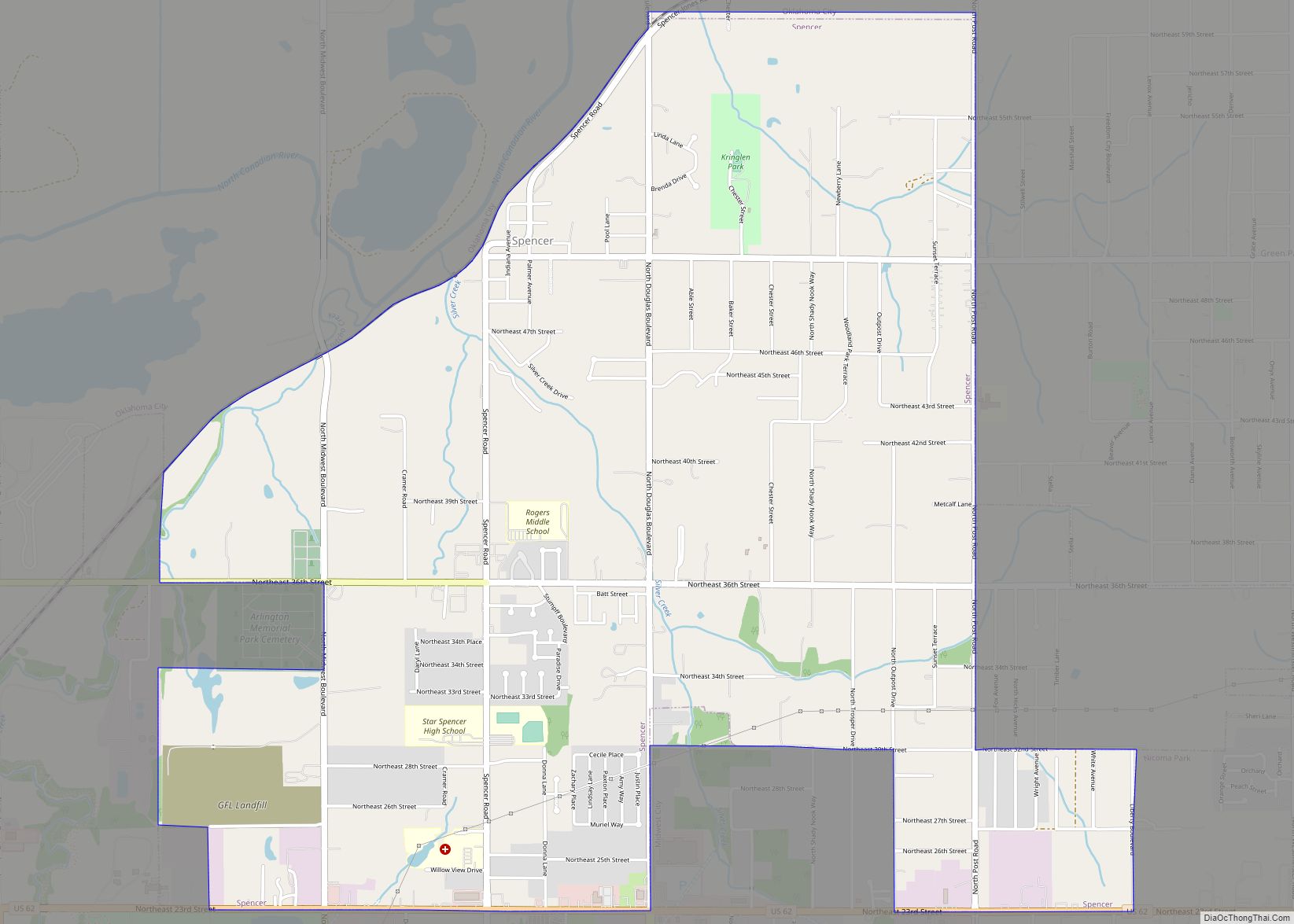
Map of Spavinaw town

Map of Spavinaw town

Spavinaw is a town in Mayes County, Oklahoma, United States. The population was 437 at the 2010 census, a decline of 22.4 percent from the figure of 563 recorded in 2000. The town is best known as the birthplace of baseball player Mickey Mantle. It is also notable for the nearby Lake Spavinaw, the principal … Read more

Map of Spaulding town, Oklahoma

Map of Spaulding town, Oklahoma

Spaulding is a town in Hughes County, Oklahoma, United States. Although it was initially established at the turn of the 20th century, it did not incorporate as a town until 1978. The population was 178 at the 2010 census, up from 62 in 2000, when the town’s area was approximately one-third of its 2010 area. … Read more

Map of Sparks town, Oklahoma

Map of Sparks town, Oklahoma

Sparks is a town in Lincoln County, Oklahoma, United States. The population was 169 at the 2010 census, a 23.4 percent gain from the figure of 137 in 2000. The center of population of Oklahoma is located in Sparks [1]. Sparks town overview: Name: Sparks town LSAD Code: 43 LSAD Description: town (suffix) State: Oklahoma … Read more

Map of Steely Hollow CDP

Map of Steely Hollow CDP

Steely Hollow is an unincorporated area and census-designated place (CDP) in Cherokee County, Oklahoma, United States. The population was 206 at the 2010 census. Steely Hollow CDP overview: Name: Steely Hollow CDP LSAD Code: 57 LSAD Description: CDP (suffix) State: Oklahoma County: Cherokee County Total Area: 4.78 sq mi (12.39 km²) Land Area: 4.77 sq mi (12.36 km²) Water Area: 0.01 sq mi … Read more

Map of Stringtown town

Map of Stringtown town

Stringtown is a town in Atoka County, Oklahoma, United States. The population was 410 at the 2010 census, an increase of 3.5 percent from the figure of 396 recorded in 2000. It is the second largest town in Atoka County. The town is notable for the Mack H. Alford Correctional Center, a medium-security prison operated … Read more

Map of Stratford town, Oklahoma

Map of Stratford town, Oklahoma

Stratford is a town in Garvin County, Oklahoma, United States. Prior to Oklahoma statehood in 1907, the town existed under different names and was in the Chickasaw Nation in a geographic region known as Indian Territory. Peach orchards abound in and around the town. The population was 1,525 at the 2010 census. Stratford town overview: … Read more

Map of Strang town, Oklahoma

Map of Strang town, Oklahoma

Strang is a town in Mayes County, Oklahoma, United States. The population was 100 at the 2000 census. Strang town overview: Name: Strang town LSAD Code: 43 LSAD Description: town (suffix) State: Oklahoma County: Mayes County Elevation: 663 ft (202 m) Total Area: 0.28 sq mi (0.73 km²) Land Area: 0.28 sq mi (0.73 km²) Water Area: 0.00 sq mi (0.00 km²) Total Population: 64 Population … Read more

Map of Stoney Point CDP

Map of Stoney Point CDP

Stony Point is a census-designated place (CDP) in Sequoyah County, Oklahoma, United States. It is part of the Fort Smith, Arkansas-Oklahoma Metropolitan Statistical Area. The population was 177 at the 2000 census. Stoney Point CDP overview: Name: Stoney Point CDP LSAD Code: 57 LSAD Description: CDP (suffix) State: Oklahoma County: Sequoyah County Total Area: 22.72 sq mi … Read more

Map of Stonewall town, Oklahoma

Map of Stonewall town, Oklahoma

Stonewall is a town in Pontotoc County, Oklahoma, United States. Named for Confederate General Stonewall Jackson, the settlement’s post office was established in December, 1874. Stonewall town overview: Name: Stonewall town LSAD Code: 43 LSAD Description: town (suffix) State: Oklahoma County: Pontotoc County Elevation: 702 ft (214 m) Total Area: 0.47 sq mi (1.23 km²) Land Area: 0.47 sq mi (1.23 km²) Water … Read more

Map of Stilwell city

Map of Stilwell city

Stilwell is a city and county seat of Adair County, Oklahoma, United States. The population was 3,700 as of the 2020 U.S. census, a decline of 6.7 percent from the 3,949 population recorded in 2010. The Oklahoma governor and legislature proclaimed Stilwell as the “Strawberry Capital of the World” in 1949, but the role of … Read more

Map of Stillwater city, Oklahoma

Map of Stillwater city, Oklahoma

Stillwater is the tenth-largest city in the U.S. state of Oklahoma. It is the county seat of Payne County, Oklahoma. It is located in north-central Oklahoma at the intersection of U.S. Route 177 and State Highway 51. As of the 2020 census, the city population was 48,394. The Stillwater Micropolitan Statistical Area had a population … Read more

Map of Stigler city

Map of Stigler city

Stigler is a city in and county seat of Haskell County, Oklahoma. The population was 2,685 at the time of the 2010 census, down from 2,731 recorded in 2000. Stigler city overview: Name: Stigler city LSAD Code: 25 LSAD Description: city (suffix) State: Oklahoma County: Haskell County Elevation: 574 ft (176 m) Total Area: 2.74 sq mi (7.09 km²) Land … Read more