Stigler is a city in and county seat of Haskell County, Oklahoma. The population was 2,685 at the time of the 2010 census, down from 2,731 recorded in 2000.
| Name: | Stigler city |
|---|---|
| LSAD Code: | 25 |
| LSAD Description: | city (suffix) |
| State: | Oklahoma |
| County: | Haskell County |
| Elevation: | 574 ft (176 m) |
| Total Area: | 2.74 sq mi (7.09 km²) |
| Land Area: | 2.70 sq mi (6.99 km²) |
| Water Area: | 0.04 sq mi (0.10 km²) |
| Total Population: | 2,703 |
| Population Density: | 1,000.74/sq mi (386.42/km²) |
| ZIP code: | 74462 |
| Area code: | 539/918 |
| FIPS code: | 4070250 |
| GNISfeature ID: | 1098537 |
| Website: | www.stiglerok.net |
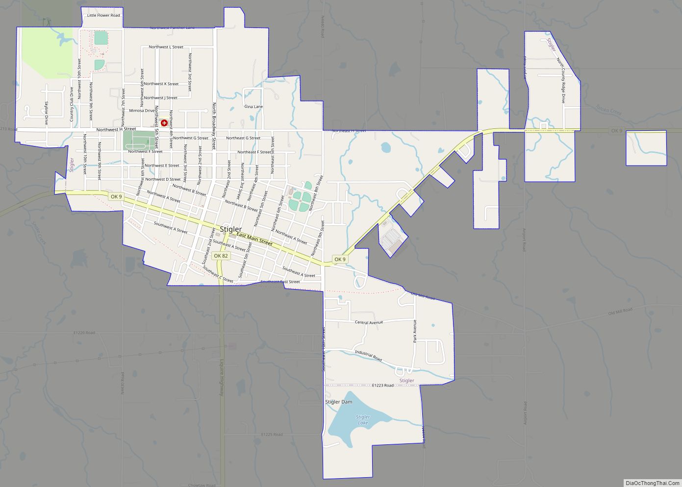
Online Interactive Map
Click on ![]() to view map in "full screen" mode.
to view map in "full screen" mode.
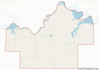
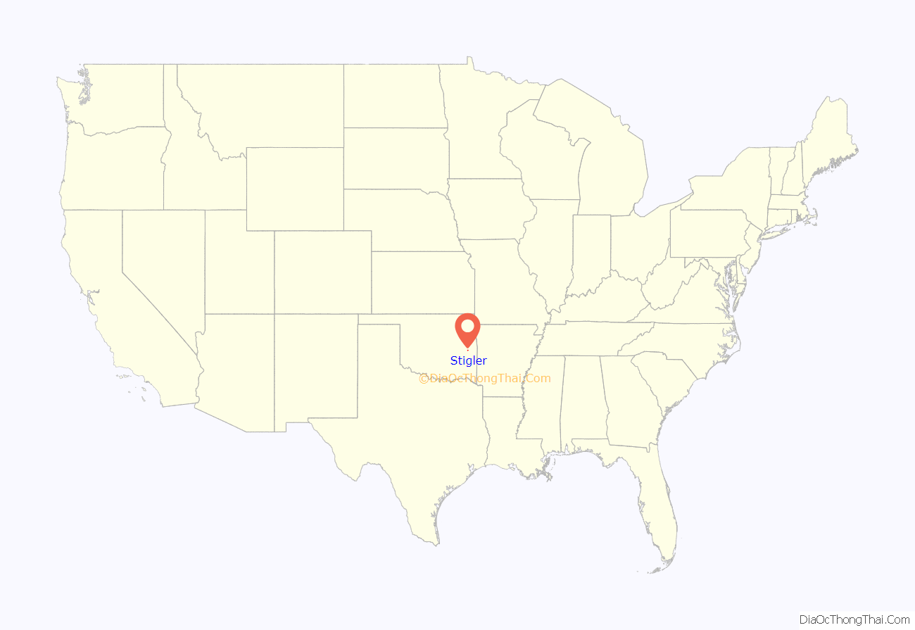
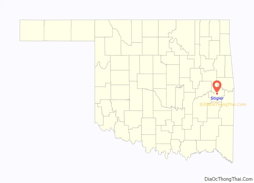
Stigler location map. Where is Stigler city?
History
At the time of its founding, Newman, later Stigler, was located in Sans Bois County, a part of the Moshulatubbee District of the Choctaw Nation in Indian Territory. A post office was established at Newman, Indian Territory on April 30, 1892. The community was named for Dr. Martin W. Newman, a pioneer and physician.
Joseph Stigler is said to have founded the town in 1889. He was familiar with the area, as earlier he had served as a deputy marshal under federal judge Isaac Parker, whose court in Fort Smith, Arkansas, had jurisdiction over Indian Territory. The post office name was changed to Stigler on May 3, 1893 by the U.S. Post Office Service, because the former name caused some confusion with the town of Norman.
The Midland Valley Railroad was constructed to Stigler in 1904, which attracted more settlers and more types of businesses. By the following year, the town had become incorporated. At statehood in 1907, Stigler was named as the county seat of newly created Haskell County.
Stigler is home to the Haskell County Courthouse. In the late 20th century, the county court was known for having installed marble plaques inscribed with the Ten Commandments and the Mayflower Compact on the front lawn of the courthouse. (See Separation of church and state in the United States.) In the seventh commandment, the word “adultery” was misspelled as “adultry”. Opponents sued for the commandments to be removed, arguing that the installation was unconstitutional and violated the principle of the separation of church and state in the United States. The court agreed and ordered the Commandments removed from the lawn. However, it was only moved over about 20 feet and is basically still on the lawn of the courthouse.
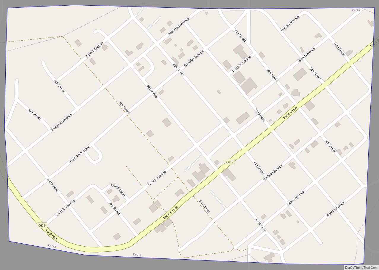
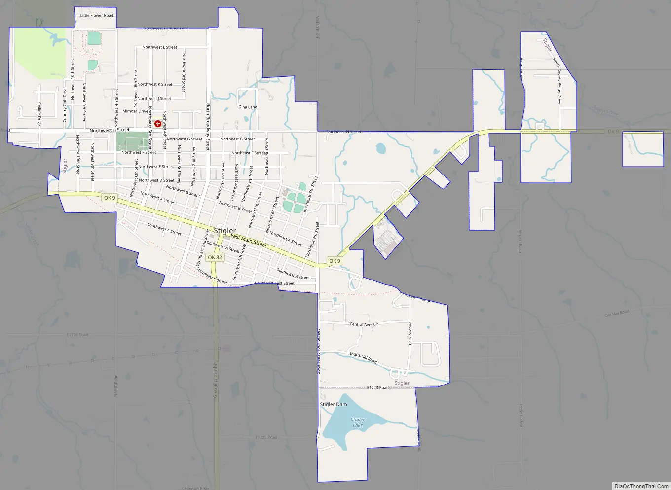
Stigler Road Map
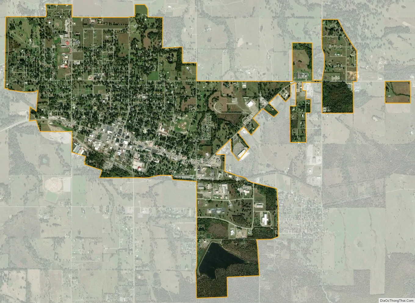
Stigler city Satellite Map
Geography
Stigler is located in central Haskell County at 35°15′23″N 95°7′27″W / 35.25639°N 95.12417°W / 35.25639; -95.12417 (35.256357, -95.124105). Oklahoma State Highway 9 is the city’s Main Street, and leads east 12 miles (19 km) to Keota and west 6 miles (9.7 km) to Whitefield. Oklahoma State Highway 82 leads south from Stigler 11 miles (18 km) to Lequire. Muskogee is 43 miles (69 km) to the north, and Fort Smith, Arkansas is 49 miles (79 km) to the east.
According to the United States Census Bureau, Stigler has a total area of 2.6 square miles (6.8 km), of which 0.04 square miles (0.1 km), or 1.42%, are water.
See also
Map of Oklahoma State and its subdivision:- Adair
- Alfalfa
- Atoka
- Beaver
- Beckham
- Blaine
- Bryan
- Caddo
- Canadian
- Carter
- Cherokee
- Choctaw
- Cimarron
- Cleveland
- Coal
- Comanche
- Cotton
- Craig
- Creek
- Custer
- Delaware
- Dewey
- Ellis
- Garfield
- Garvin
- Grady
- Grant
- Greer
- Harmon
- Harper
- Haskell
- Hughes
- Jackson
- Jefferson
- Johnston
- Kay
- Kingfisher
- Kiowa
- Latimer
- Le Flore
- Lincoln
- Logan
- Love
- Major
- Marshall
- Mayes
- McClain
- McCurtain
- McIntosh
- Murray
- Muskogee
- Noble
- Nowata
- Okfuskee
- Oklahoma
- Okmulgee
- Osage
- Ottawa
- Pawnee
- Payne
- Pittsburg
- Pontotoc
- Pottawatomie
- Pushmataha
- Roger Mills
- Rogers
- Seminole
- Sequoyah
- Stephens
- Texas
- Tillman
- Tulsa
- Wagoner
- Washington
- Washita
- Woods
- Woodward
- Alabama
- Alaska
- Arizona
- Arkansas
- California
- Colorado
- Connecticut
- Delaware
- District of Columbia
- Florida
- Georgia
- Hawaii
- Idaho
- Illinois
- Indiana
- Iowa
- Kansas
- Kentucky
- Louisiana
- Maine
- Maryland
- Massachusetts
- Michigan
- Minnesota
- Mississippi
- Missouri
- Montana
- Nebraska
- Nevada
- New Hampshire
- New Jersey
- New Mexico
- New York
- North Carolina
- North Dakota
- Ohio
- Oklahoma
- Oregon
- Pennsylvania
- Rhode Island
- South Carolina
- South Dakota
- Tennessee
- Texas
- Utah
- Vermont
- Virginia
- Washington
- West Virginia
- Wisconsin
- Wyoming