Stillwater is the tenth-largest city in the U.S. state of Oklahoma. It is the county seat of Payne County, Oklahoma. It is located in north-central Oklahoma at the intersection of U.S. Route 177 and State Highway 51. As of the 2020 census, the city population was 48,394. The Stillwater Micropolitan Statistical Area had a population of 78,399 according to the 2012 census estimate. Stillwater was part of the first Oklahoma Land Run held on April 22, 1889, when the Unassigned Lands were opened for settlement and became the core of the new Oklahoma Territory. The city charter was adopted on August 24, 1889, and operates under a council-manager government system.
Stillwater has a diverse economy with a foundation in aerospace, agribusiness, biotechnology, optoelectronics, printing and publishing, and software and standard manufacturing. Stillwater is home to the main campus of Oklahoma State University (the city’s largest employer) as well as Northern Oklahoma College – Stillwater, Meridian Technology Center, and the Oklahoma Department of Career and Technology Education. The city is also home to the National Wrestling Hall of Fame and Museum.
| Name: | Stillwater city |
|---|---|
| LSAD Code: | 25 |
| LSAD Description: | city (suffix) |
| State: | Oklahoma |
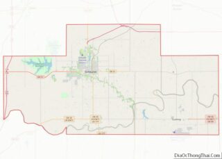
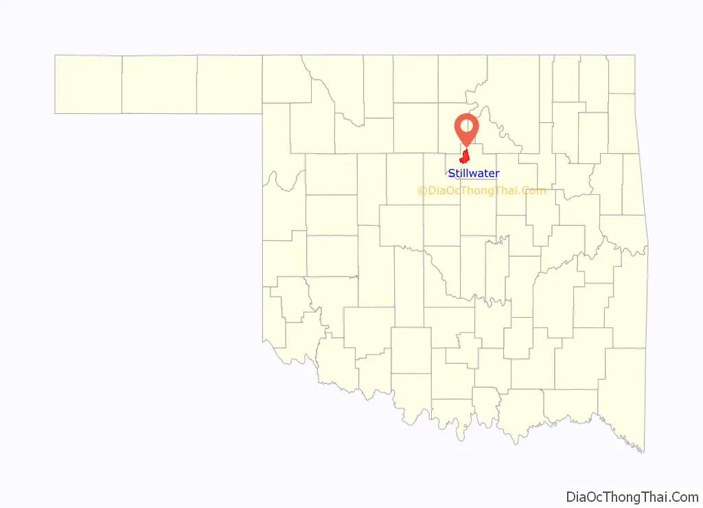
| County: | Payne County |
| Incorporated: | 1884 |
| Elevation: | 896 ft (273 m) |
| Total Area: | 30.30 sq mi (78.49 km²) |
| Land Area: | 29.79 sq mi (77.15 km²) |
| Water Area: | 0.51 sq mi (1.33 km²) |
| Total Population: | 48,394 |
| Population Density: | 1,624.50/sq mi (627.23/km²) |
| ZIP code: | 74074–74078 |
| Area code: | 405/572 |
| FIPS code: | 4070300 |
| Website: | stillwater.org |
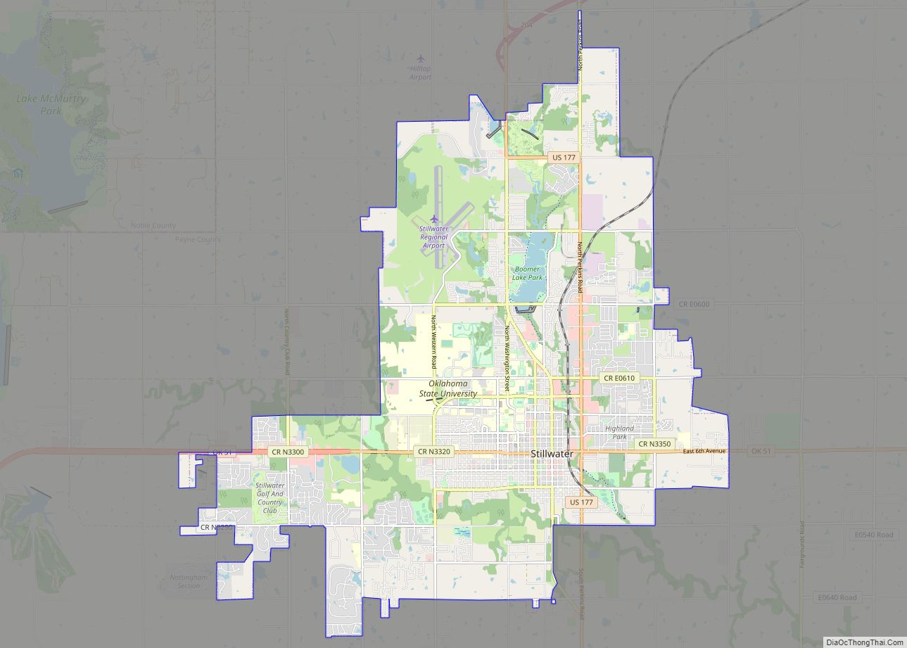
Online Interactive Map
Click on ![]() to view map in "full screen" mode.
to view map in "full screen" mode.
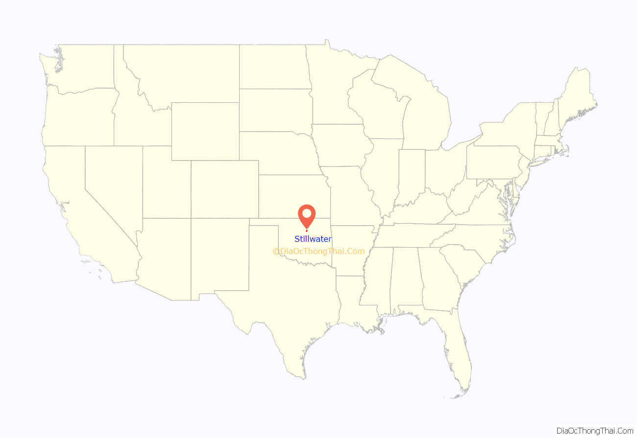
Stillwater location map. Where is Stillwater city?
History
The north-central region of Oklahoma became part of the United States with the Louisiana Purchase in 1803. In 1832, author and traveler Washington Irving provided the first recorded description of the area around Stillwater in his book A Tour on the Prairies. He wrote of “a glorious prairie spreading out beneath the golden beams of an autumnal sun. The deep and frequent traces of buffalo, showed it to be a one of their favorite grazing grounds.”
According to one legend, local Native American tribes — Ponca, Kiowa, Osage, Pawnee — called the creek “Still Water” because the water was always still. A second legend states that cattlemen driving herds from Texas to railways back east always found water “still there”. A third legend holds that David L. Payne walked up to Stillwater Creek and said, “This town should be named Still Water”. Members of the board thought he was crazy, but the name stuck.
Stillwater Creek received its official name in 1884 when William L. Couch established his “boomer colony” on its banks. While the creek itself was tranquil, the next few years saw turmoil as pioneers sought free, fertile land and soldiers held them off while complicated legal issues and land titles with Creek and Seminole tribes were hashed out. On April 22, 1889, the cannons fired signaling the first Land Run that opened up the Unassigned Lands of the Oklahoma Territory, which included Stillwater. By the end of the day, 240 acres (0.97 km) had been claimed and designated as Stillwater Township and a tent city with a population numbering 300 had sprung up on the prairie. The Encyclopedia of Oklahoma History and Culture simply says that the name officially became Stillwater only when the post office opened on May 28, 1889.
On Christmas Eve, 1890, the legislature of Oklahoma Territory passed a bill certifying Stillwater as the land grant college site. In 1894, Oklahoma Agricultural and Mechanical College held a dedication of its first brick building, Assembly Building, later known as Old Central. Between 1889 and statehood, Stillwater grew. By statehood in 1907, downtown Stillwater was home to more than 50 buildings including several banks, churches, grocery stores, hotels, and department stores.
The first newspaper was the Stillwater Gazette; telephone and gas service arrived in 1899; and the Eastern Oklahoma Railroad arrived in 1900.
The population in 1917 was 3,000 and by World War II it had grown to more than 10,000. During the war, town leaders’ aim was to convert Oklahoma A&M into a war training center. They succeeded in creating 12 training units that involved bringing nearly 40,000 service men and women to Stillwater. The WAVES (Women’s Accepted for Volunteer Emergency Service) was the largest with 10,000 participants. Quonset huts were dotted across town and barracks occupied the site where Stillwater Medical Center and the CareerTech headquarters are now. This vast operation tided the city through the war and served as a base for a healthy economy in the postwar period. In 1952, the Industrial Foundation was established and its trustees worked to bring new industry to town: Moore Plant in 1966, Swan Hose in 1968, Mercury Marine in 1973, National Standard plant in 1988, World Color Press in 1974 and Armstrong World Industries, Inc. in 1988. The census of 2000, the population was 39,065; however, the population was adjusted to 46,156 in 2009.
It was one of the 100 Best Places to Live in 2010, according to CNN Money Magazine.
Stillwater Road Map
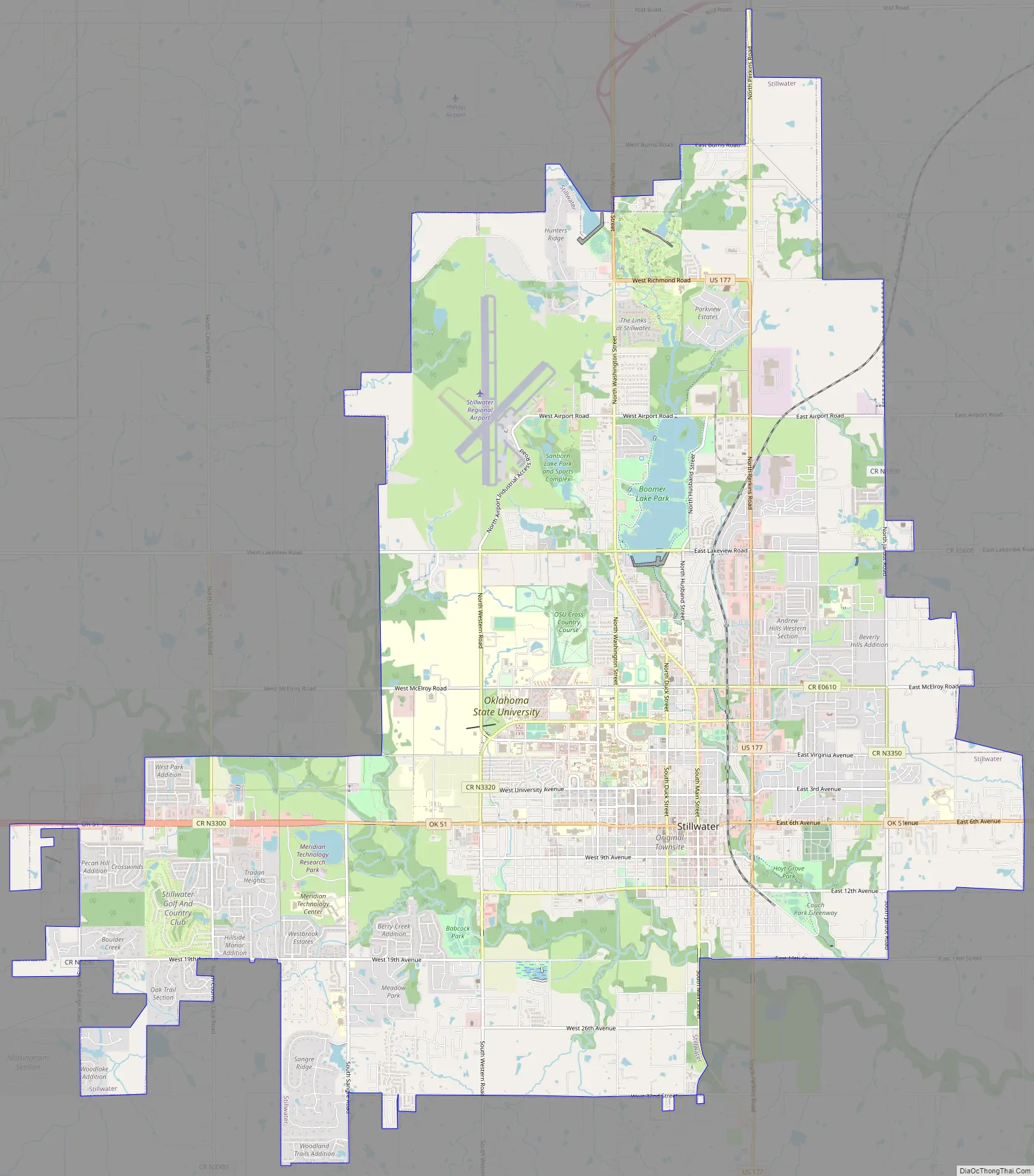
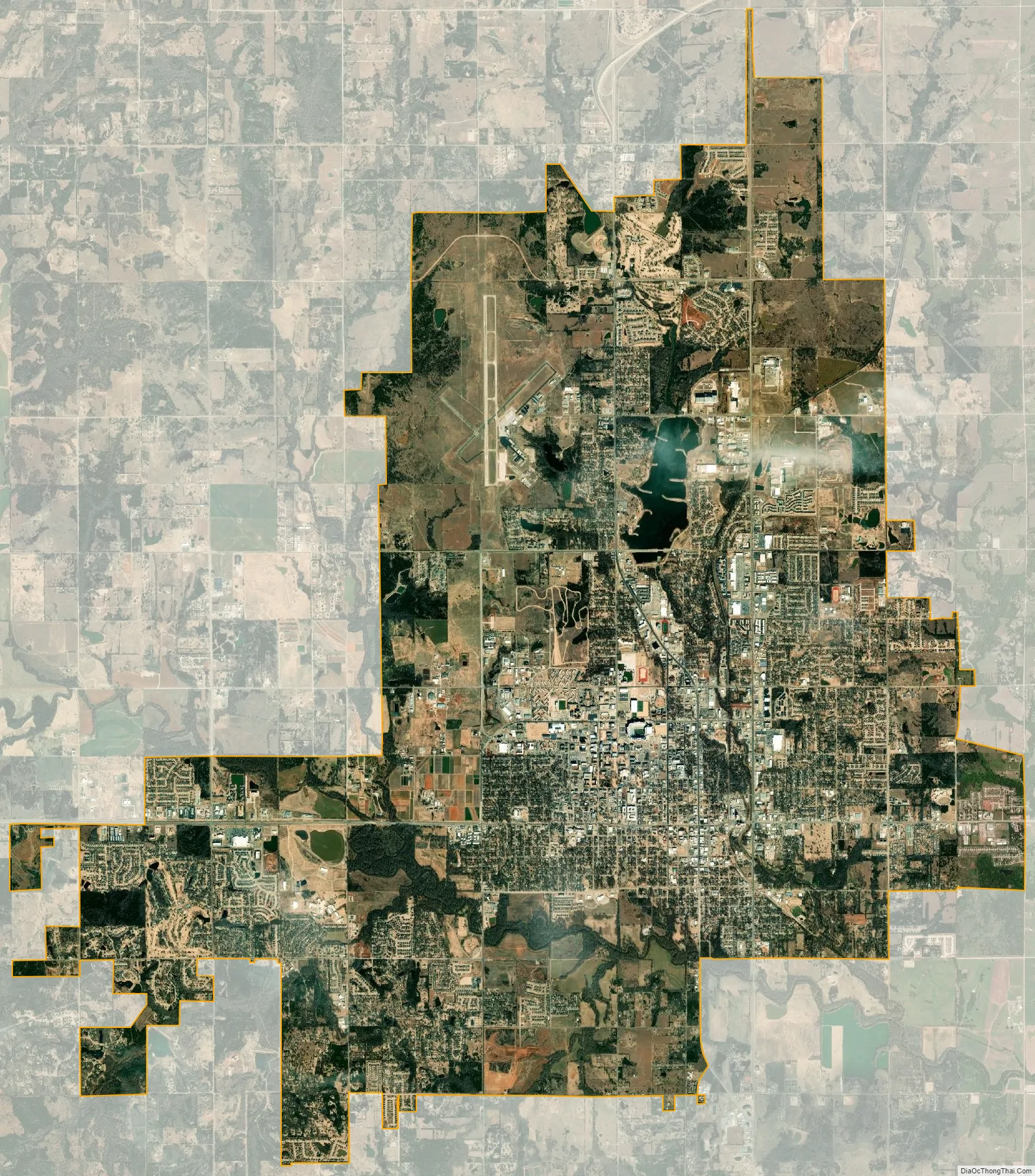
Stillwater city Satellite Map
Geography
Stillwater is located 60 miles (97 km) north-northeast of downtown Oklahoma City and 63 miles (101 km) directly west of downtown Tulsa by road. According to the United States Census Bureau, the city has a total area of 28.3 square miles (73.3 km), of which 27.9 square miles (72.1 km) is land and 0.5 square mile (1.2 km) (1.62%) is water.
Climate
Stillwater has a humid subtropical climate, and is located in the area popularly known as “Tornado Alley”. During peak storm season in the spring, tornado watches and warnings are frequent, with sirens sounding to warn townsfolk to hurry to shelters when necessary. Summers are sunny, hot, and humid, with the temperature reaching or exceeding 100 (38 °C) ten times annually on average. Winters are generally sunny, mild, and dry, with an average January high temperature of 47 °F and an average annual snowfall of 7.5 inches (19.1 cm).
The highest recorded temperature was 115 °F (46 °C) on August 11, 1936, and the lowest recorded temperature was −19 °F (−28 °C) on February 13–14, 1905 and February 4, 1996.
See also
Map of Oklahoma State and its subdivision:- Adair
- Alfalfa
- Atoka
- Beaver
- Beckham
- Blaine
- Bryan
- Caddo
- Canadian
- Carter
- Cherokee
- Choctaw
- Cimarron
- Cleveland
- Coal
- Comanche
- Cotton
- Craig
- Creek
- Custer
- Delaware
- Dewey
- Ellis
- Garfield
- Garvin
- Grady
- Grant
- Greer
- Harmon
- Harper
- Haskell
- Hughes
- Jackson
- Jefferson
- Johnston
- Kay
- Kingfisher
- Kiowa
- Latimer
- Le Flore
- Lincoln
- Logan
- Love
- Major
- Marshall
- Mayes
- McClain
- McCurtain
- McIntosh
- Murray
- Muskogee
- Noble
- Nowata
- Okfuskee
- Oklahoma
- Okmulgee
- Osage
- Ottawa
- Pawnee
- Payne
- Pittsburg
- Pontotoc
- Pottawatomie
- Pushmataha
- Roger Mills
- Rogers
- Seminole
- Sequoyah
- Stephens
- Texas
- Tillman
- Tulsa
- Wagoner
- Washington
- Washita
- Woods
- Woodward
- Alabama
- Alaska
- Arizona
- Arkansas
- California
- Colorado
- Connecticut
- Delaware
- District of Columbia
- Florida
- Georgia
- Hawaii
- Idaho
- Illinois
- Indiana
- Iowa
- Kansas
- Kentucky
- Louisiana
- Maine
- Maryland
- Massachusetts
- Michigan
- Minnesota
- Mississippi
- Missouri
- Montana
- Nebraska
- Nevada
- New Hampshire
- New Jersey
- New Mexico
- New York
- North Carolina
- North Dakota
- Ohio
- Oklahoma
- Oregon
- Pennsylvania
- Rhode Island
- South Carolina
- South Dakota
- Tennessee
- Texas
- Utah
- Vermont
- Virginia
- Washington
- West Virginia
- Wisconsin
- Wyoming