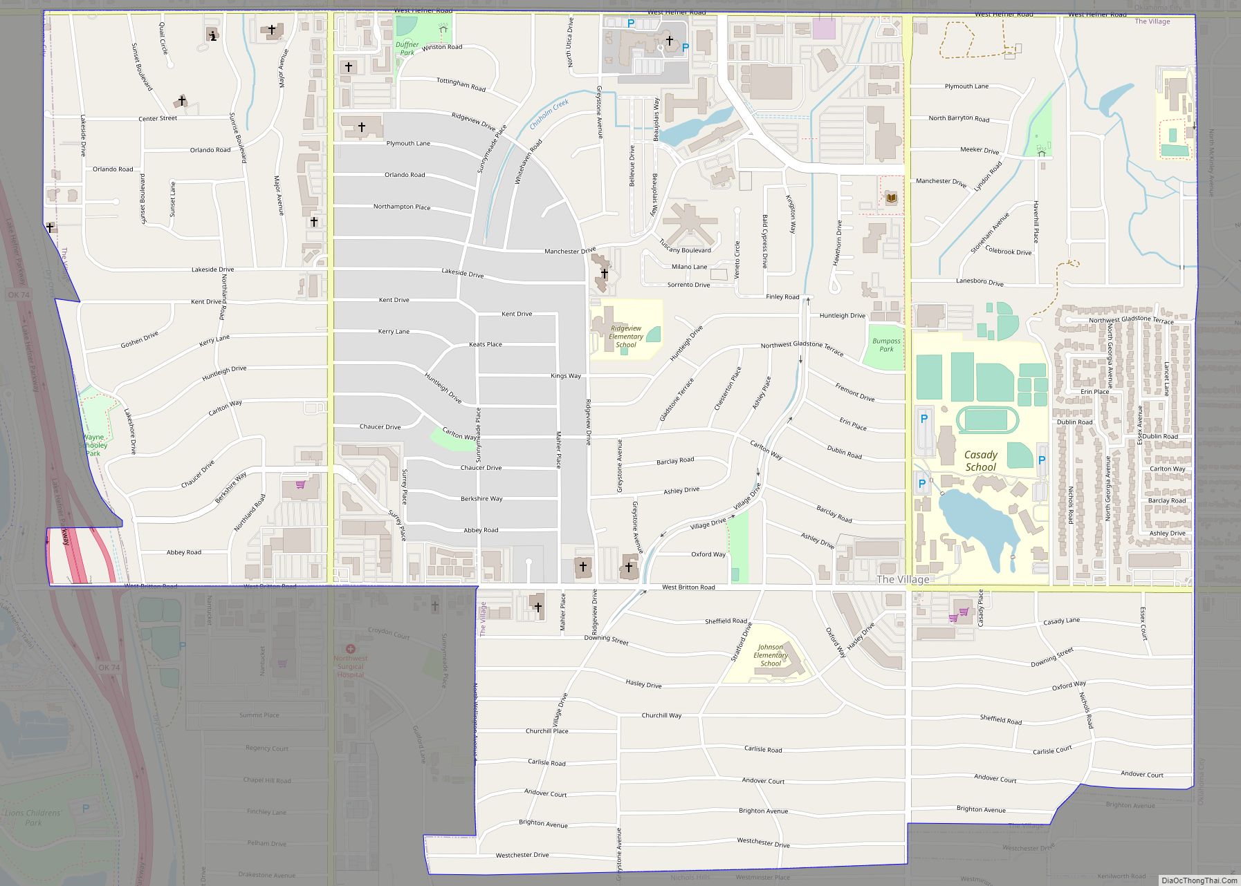
Map of Texola town

Map of Texola town

Texola is a town in Beckham County, Oklahoma, United States. The population was 36 at the 2010 census. Texola town overview: Name: Texola town LSAD Code: 43 LSAD Description: town (suffix) State: Oklahoma County: Beckham County Elevation: 2,146 ft (654 m) Total Area: 0.61 sq mi (1.59 km²) Land Area: 0.61 sq mi (1.59 km²) Water Area: 0.00 sq mi (0.00 km²) Total Population: 43 Population … Read more

Map of Texhoma town

Map of Texhoma town, Oklahoma

Texhoma is a town in Texas County, Oklahoma, United States. The population was 856 at the 2020 census. Texhoma is a divided city with the Texas–Oklahoma state border separating the town from Texhoma, Texas. The name of the town is a portmanteau of Texas and Oklahoma. Founded around the Rock Island Railroad laying tracks through … Read more

Map of Texanna CDP

Map of Texanna CDP

Texanna is a census-designated place (CDP) in McIntosh County, Oklahoma, United States. The population was 2,083 at the 2000 census. Established in District 12 of the old Indian Territory, its post office existed from June 27, 1888 until July 16, 1940. Texanna’s population in the 1905 Territorial Census was 200. It is said to have … Read more

Map of Terral town

Map of Terral town

Terral is an agricultural town in Jefferson County, Oklahoma, United States. The population was 382 at the 2010 census, a decline of 1.01 percent from the figure of 386 in 2000. Terral town overview: Name: Terral town LSAD Code: 43 LSAD Description: town (suffix) State: Oklahoma County: Jefferson County Elevation: 846 ft (258 m) Total Area: 0.43 sq mi … Read more

Map of Terlton town

Map of Terlton town

Terlton is a town in Pawnee County, Oklahoma, United States. It is located one-half mile south of US 412/US 64 on Terlton Road and County Road E0570. The population was 106 at the 2010 census, a gain of 24.7 percent over the figure of 85 in 2000. Terlton town overview: Name: Terlton town LSAD Code: … Read more

Map of Teresita CDP

Map of Teresita CDP

Teresita is an unincorporated community and census-designated place (CDP) in Cherokee County, Oklahoma, United States. The population was 159 at the 2010 census. Teresita CDP overview: Name: Teresita CDP LSAD Code: 57 LSAD Description: CDP (suffix) State: Oklahoma County: Cherokee County Total Area: 9.74 sq mi (25.23 km²) Land Area: 9.74 sq mi (25.23 km²) Water Area: 0.00 sq mi (0.00 km²) Total Population: … Read more

Map of Tiawah CDP

Map of Tiawah CDP

Tiawah is a census-designated place (CDP) in Rogers County, Oklahoma, United States. The population was 189 at the 2010 census, a 13.9 percent gain over the figure of 166 recorded in 2000. It was built on the St. Louis, Iron Mountain, & Southern Railway line running from Coffeyville, Kansas, to Fort Smith, Arkansas. The post … Read more

Map of Thomas city

Map of Thomas city, Oklahoma

Thomas is a city in Custer County, Oklahoma, United States. The population was 1,181 at the 2010 census. Thomas city overview: Name: Thomas city LSAD Code: 25 LSAD Description: city (suffix) State: Oklahoma County: Custer County Elevation: 1,794 ft (547 m) Total Area: 1.15 sq mi (2.98 km²) Land Area: 1.15 sq mi (2.98 km²) Water Area: 0.00 sq mi (0.00 km²) Total Population: 1,143 Population … Read more

Map of Turpin CDP

Map of Turpin CDP

Turpin is a small unincorporated community and census-designated place in Beaver County, Oklahoma, United States. The post office was established April 8, 1925. As of the 2010 census, the community had a population of 467. Turpin CDP overview: Name: Turpin CDP LSAD Code: 57 LSAD Description: CDP (suffix) State: Oklahoma County: Beaver County Elevation: 2,750 ft … Read more

Map of Turley CDP

Map of Turley CDP

Turley is a census-designated place (CDP) in Tulsa County, Oklahoma, United States. The population was 2,756 at the 2010 census, a loss of 14.7 percent from the figure of 3,231 recorded in 2000. Turley CDP overview: Name: Turley CDP LSAD Code: 57 LSAD Description: CDP (suffix) State: Oklahoma County: Tulsa County Elevation: 636 ft (194 m) Total … Read more

Map of Tupelo city, Oklahoma

Map of Tupelo city, Oklahoma

Tupelo is a city in Coal County, Oklahoma, United States. The population was 329 at the 2010 census. Tupelo city overview: Name: Tupelo city LSAD Code: 25 LSAD Description: city (suffix) State: Oklahoma County: Coal County Elevation: 689 ft (210 m) Total Area: 0.41 sq mi (1.08 km²) Land Area: 0.41 sq mi (1.08 km²) Water Area: 0.00 sq mi (0.00 km²) Total Population: 327 Population … Read more

Map of Tullahassee town

Map of Tullahassee town

Tullahassee is a town in Wagoner County, Oklahoma, United States. The population was 106 in both the 2010 and the 2000 censuses. It was the location of Tullahassee Mission, an Indian boarding school that burned in 1880. Because their population in the community had declined, the Muscogee Creek gave the school to Creek Freedmen, paying … Read more