Thackerville is a town in Love County, Oklahoma, United States. It is located near the Texas state border. The population was 445 at the 2010 census.
| Name: | Thackerville town |
|---|---|
| LSAD Code: | 43 |
| LSAD Description: | town (suffix) |
| State: | Oklahoma |
| County: | Love County |
| Elevation: | 866 ft (264 m) |
| Total Area: | 2.25 sq mi (5.83 km²) |
| Land Area: | 2.24 sq mi (5.80 km²) |
| Water Area: | 0.01 sq mi (0.03 km²) |
| Total Population: | 400 |
| Population Density: | 178.57/sq mi (68.94/km²) |
| ZIP code: | 73459 |
| Area code: | 580 |
| FIPS code: | 4073200 |
| GNISfeature ID: | 1098830 |
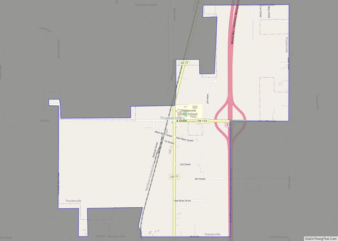
Online Interactive Map
Click on ![]() to view map in "full screen" mode.
to view map in "full screen" mode.
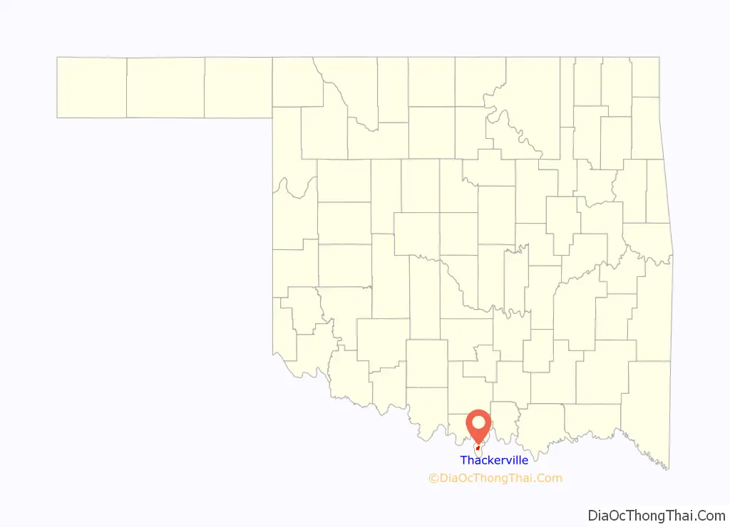
Thackerville location map. Where is Thackerville town?

History
Thackerville was founded in the mid-19th century. The community is named after Zacariah Thacker, a pioneer from Arkansas. It is believed that he was headed for the Amarillo, Texas area, but he camped one night at Wolf Hollow Creek in Indian Territory and remained there until his death a few years later. Thacker befriended some of the local Indians and together they farmed a very productive corn crop. Before long, many people began settling in the area.
After Thacker’s death in 1887, the community relocated from its original site near where Wolf Creek enters the Red River, to its present location. The main reason behind the move was to be closer to the Atchison, Topeka, and Santa Fe Railway. A depot was constructed and the first grocery store, built by Oce McCage, opened across from it. Soon after, a school, churches, and a post office were constructed. Thackerville had a dirt main street with board walks that connected store porches.
Court records filed in the United States Court, Southern District, in Indian Territory at Ardmore indicate that citizens of the community petitioned to incorporate Thackerville under Arkansas law on October 15, 1898. At that time, approximately 175 people lived in the community. On July 5, 1899, Thackerville was officially incorporated into Indian Territory by Judge Hosea Townsend.
At the time of its founding, Thackerville was located in Pickens County, Chickasaw Nation.
U.S. Highway 77 was established from the Red River through Thackerville in 1926. At that time, the town moved to each side of the highway, which became the new “main” street in the community. Thackerville’s population fluctuated throughout the remainder of the 20th century, reaching a low of 178 in 1950 and peaking at 431 in 1980.
Thackerville is the location of the WinStar World Casino, operated by the Chickasaw Nation.
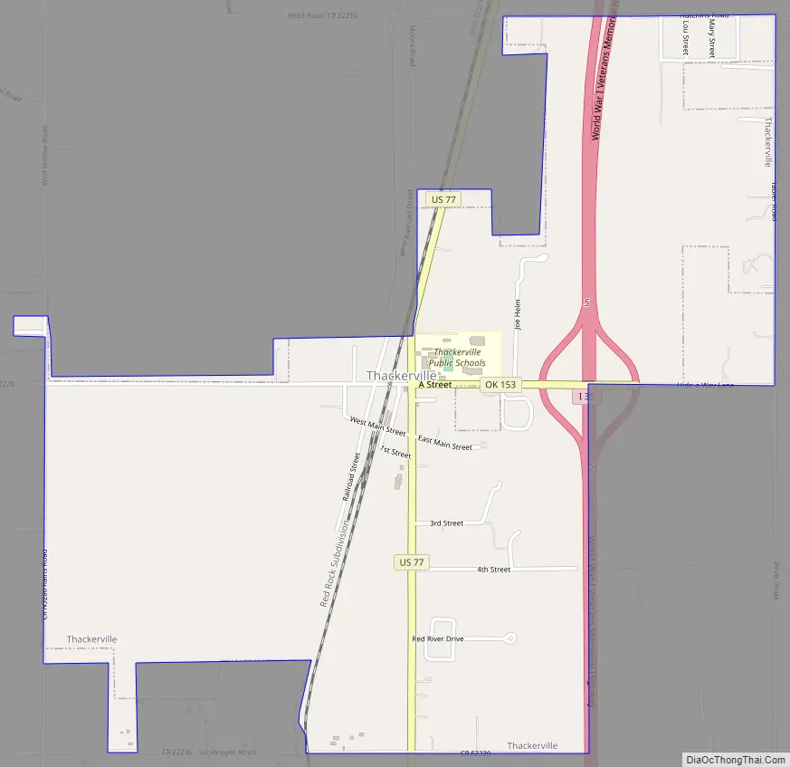
Thackerville Road Map
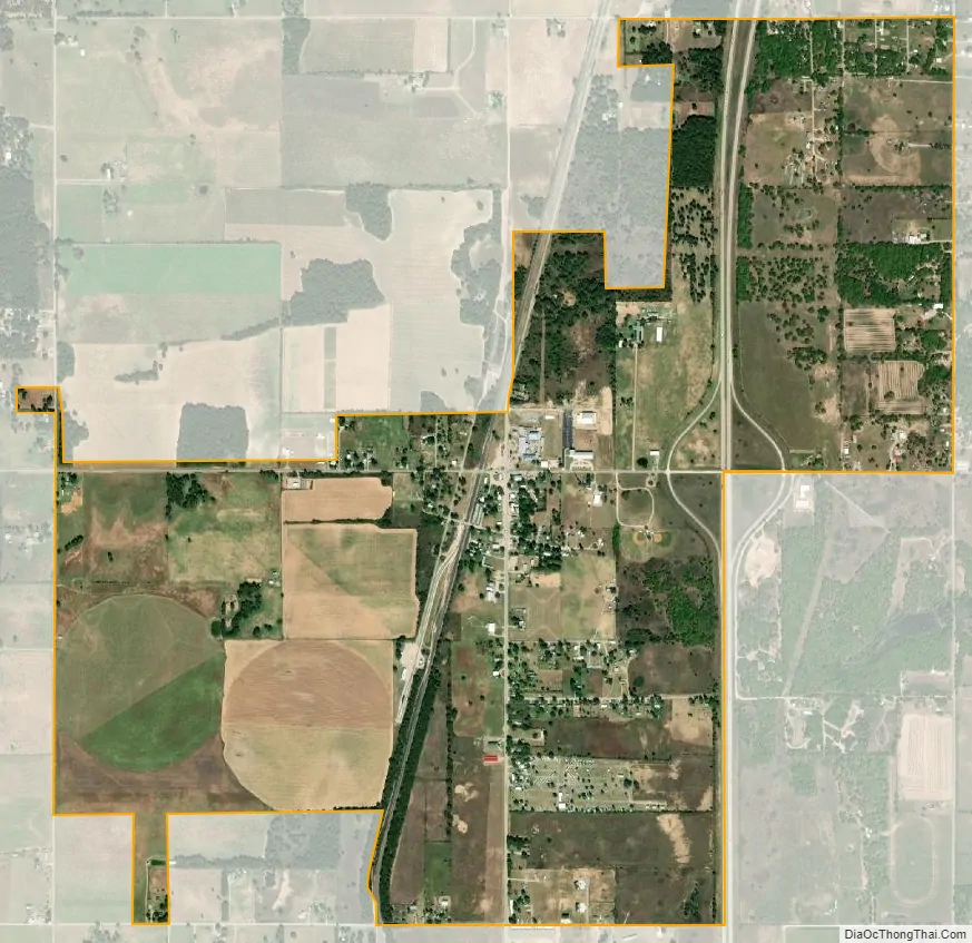
Thackerville city Satellite Map
Geography
Thackerville is located at 33°47′45″N 97°8′37″W / 33.79583°N 97.14361°W / 33.79583; -97.14361 (33.795874, -97.143677). It is situated near the intersection of U.S. Highway 77 and State Highway 153, five miles north of the Texas state line and ten miles south of Marietta in south central Love County. Interstate 35 passes through town, putting Thackerville on the main route between Oklahoma City and Dallas/Ft. Worth.
According to the United States Census Bureau, the town has a total area of 2.1 square miles (5.4 km), all land.
See also
Map of Oklahoma State and its subdivision:- Adair
- Alfalfa
- Atoka
- Beaver
- Beckham
- Blaine
- Bryan
- Caddo
- Canadian
- Carter
- Cherokee
- Choctaw
- Cimarron
- Cleveland
- Coal
- Comanche
- Cotton
- Craig
- Creek
- Custer
- Delaware
- Dewey
- Ellis
- Garfield
- Garvin
- Grady
- Grant
- Greer
- Harmon
- Harper
- Haskell
- Hughes
- Jackson
- Jefferson
- Johnston
- Kay
- Kingfisher
- Kiowa
- Latimer
- Le Flore
- Lincoln
- Logan
- Love
- Major
- Marshall
- Mayes
- McClain
- McCurtain
- McIntosh
- Murray
- Muskogee
- Noble
- Nowata
- Okfuskee
- Oklahoma
- Okmulgee
- Osage
- Ottawa
- Pawnee
- Payne
- Pittsburg
- Pontotoc
- Pottawatomie
- Pushmataha
- Roger Mills
- Rogers
- Seminole
- Sequoyah
- Stephens
- Texas
- Tillman
- Tulsa
- Wagoner
- Washington
- Washita
- Woods
- Woodward
- Alabama
- Alaska
- Arizona
- Arkansas
- California
- Colorado
- Connecticut
- Delaware
- District of Columbia
- Florida
- Georgia
- Hawaii
- Idaho
- Illinois
- Indiana
- Iowa
- Kansas
- Kentucky
- Louisiana
- Maine
- Maryland
- Massachusetts
- Michigan
- Minnesota
- Mississippi
- Missouri
- Montana
- Nebraska
- Nevada
- New Hampshire
- New Jersey
- New Mexico
- New York
- North Carolina
- North Dakota
- Ohio
- Oklahoma
- Oregon
- Pennsylvania
- Rhode Island
- South Carolina
- South Dakota
- Tennessee
- Texas
- Utah
- Vermont
- Virginia
- Washington
- West Virginia
- Wisconsin
- Wyoming