Map of White Water CDP

Map of White Water CDP

White Water is a census-designated place (CDP) in Delaware County, Oklahoma, United States. The population was 80 at the 2010 census. White Water CDP overview: Name: White Water CDP LSAD Code: 57 LSAD Description: CDP (suffix) State: Oklahoma County: Delaware County Elevation: 1,025 ft (312 m) Total Area: 1.20 sq mi (3.11 km²) Land Area: 1.20 sq mi (3.11 km²) Water Area: 0.00 sq mi … Read more

Map of White Oak CDP, Oklahoma

Map of White Oak CDP, Oklahoma

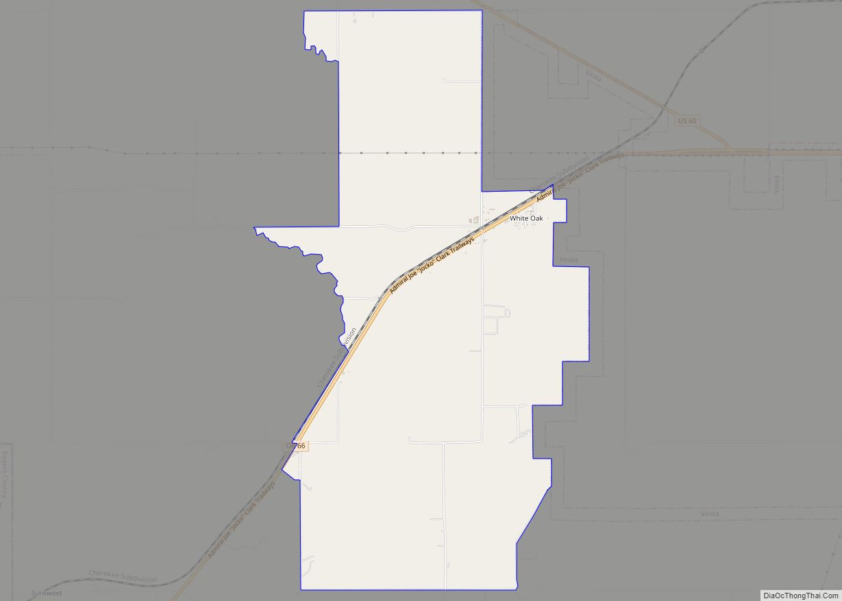
White Oak is an unincorporated community and census-designated place (CDP) in Craig County, Oklahoma, United States, along State Highway 66, approximately one mile (1.6 km) west of that road’s eastern terminus with U.S. Route 60. The community had a post office from October 14, 1898 until October 31, 1957. As of the 2010 census, the White … Read more

Map of Wewoka city

Map of Wewoka city

Wewoka is a city in Seminole County, Oklahoma, United States. The population was 3,271 at the 2020 census. It is the county seat of Seminole County. Founded by a freedman, John Coheia, and Black Seminoles in January, 1849, Wewoka is the capital of the Seminole Nation of Oklahoma. Wewoka city overview: Name: Wewoka city LSAD … Read more

Map of Wetumka city

Map of Wetumka city

Wetumka is a city in northern Hughes County, Oklahoma, United States. The population was 1,282 at the 2010 census, a decline of 11.7 percent from the figure of 1,451 recorded in 2000. First settled by the Muscogee Creek after removal in the 1830s, they named it for their ancestral town of Wetumpka, in Alabama. Wetumka … Read more

Map of Westville town, Oklahoma

Map of Westville town, Oklahoma

Westville is a town in Adair County, Oklahoma, located in the foothills of the Ozark Mountains. Westville lies at the junction of U.S. Highways 59 and 62, and approximately 13 miles north of Stilwell, the county seat. Westville town overview: Name: Westville town LSAD Code: 43 LSAD Description: town (suffix) State: Oklahoma County: Adair County … Read more

Map of Westport town, Oklahoma

Map of Westport town, Oklahoma

Westport is a town in Pawnee County, Oklahoma, United States. The population was 298 at the 2010 census, a gain of 12.9 percent over the figure of 264 in 2000. Westport town overview: Name: Westport town LSAD Code: 43 LSAD Description: town (suffix) State: Oklahoma County: Pawnee County Elevation: 883 ft (269 m) Total Area: 8.66 sq mi (22.44 km²) … Read more

Map of West Siloam Springs town

Map of West Siloam Springs town

West Siloam Springs is a town in Delaware County, Oklahoma, United States. The population was 846 at the 2010 census, a 3.5 percent decrease from the figure of 877 recorded in 2000. A bedroom community for Siloam Springs, Arkansas, it is notable for its Cherokee casino, and is the closest town to Natural Falls State … Read more

Map of West Peavine CDP

Map of West Peavine CDP

West Peavine is a census-designated place (CDP) in Adair County, Oklahoma, United States. The population was 218 at the 2010 census. West Peavine CDP overview: Name: West Peavine CDP LSAD Code: 57 LSAD Description: CDP (suffix) State: Oklahoma County: Adair County Total Area: 7.86 sq mi (20.35 km²) Land Area: 7.80 sq mi (20.19 km²) Water Area: 0.06 sq mi (0.16 km²) Total Population: … Read more

Map of Wister town

Map of Wister town

Wister is a town in Le Flore County, Oklahoma, United States. It is part of the Fort Smith metropolitan area. The population was 1,102 at the 2010 census. Wister is named for Gutman G. Wister, an official with the Choctaw, Oklahoma and Gulf Railroad. Wister town overview: Name: Wister town LSAD Code: 43 LSAD Description: … Read more

Map of Winchester town, Oklahoma

Map of Winchester town, Oklahoma

Winchester is a town in Okmulgee County, Oklahoma, United States. The population was 516 at the 2010 census, an increase of 21.7 percent from the figure of 424 recorded in 2000. It is a recently built residential community, having incorporated February 18, 1974. This is not to be confused with the old settlement of Winchester … Read more

Map of Wilson city, Oklahoma

Map of Wilson city, Oklahoma

Wilson is a town in Carter County, Oklahoma, United States. The population was 1,724 at the 2010 census. It is part of the Ardmore, Oklahoma Micropolitan Statistical Area. It is home to one of the oldest Assemblies of God churches in Oklahoma, the Wilson Assembly of God Church. Wilson city overview: Name: Wilson city LSAD … Read more

Map of Willow town, Oklahoma

Map of Willow town, Oklahoma

Willow is a town in Greer County, Oklahoma, United States. The population was 149 at the 2010 census. Willow town overview: Name: Willow town LSAD Code: 43 LSAD Description: town (suffix) State: Oklahoma County: Greer County Elevation: 1,742 ft (531 m) Total Area: 0.26 sq mi (0.68 km²) Land Area: 0.26 sq mi (0.68 km²) Water Area: 0.00 sq mi (0.00 km²) Total Population: 119 Population … Read more