Map of Enterprise city, Oregon
Enterprise is a city in and the county seat of Wallowa County, Oregon, United States. The population was 1,940 in the 2010 census. Enterprise city overview: Name: Enterprise city LSAD Code: 25 LSAD Description: city (suffix) State: Oregon County: Wallowa County Incorporated: 1889 Elevation: 3,757 ft (1,145 m) Total Area: 1.47 sq mi (3.80 km²) Land Area: 1.47 sq mi (3.80 km²) Water ... Read more
Map of Enterprise city, Oregon
Map of Fort Hill CDP
Fort Hill is an unincorporated community in Polk and Yamhill counties in Oregon, United States. It is located about a mile east of Spirit Mountain Casino on Oregon Route 22 near the South Yamhill River. For statistical purposes, the United States Census Bureau has defined Fort Hill as a census-designated place (CDP). The census definition ... Read more
Map of Fort Hill CDP
Map of Forest Grove city
Forest Grove is a city in Washington County, Oregon, United States, 25 miles (40 km) west of Portland. Originally a small farm town, it is now primarily a commuter town in the Portland metro area. Settled in the 1840s, the town was platted in 1850, then incorporated in 1872, making it the first city in Washington ... Read more
Map of Forest Grove city
Map of Foots Creek CDP
Foots Creek is an unincorporated community and census-designated place (CDP) in Jackson County, in the U.S. state of Oregon. It lies along Oregon Route 99 near the mouth of Foots Creek, where it empties into the Rogue River. Interstate 5 and Valley of the Rogue State Park are on the side of the river opposite ... Read more
Map of Foots Creek CDP
Map of Florence city, Oregon
Florence is a coastal city in Lane County, in the U.S. state of Oregon. It lies at the mouth of the Siuslaw River on the Pacific Ocean and about midway between Newport and Coos Bay along U.S. Route 101. As of the 2020 census, the city had a total population of 8,921. Florence city overview: ... Read more
Map of Florence city, Oregon
Map of Falls City, Oregon
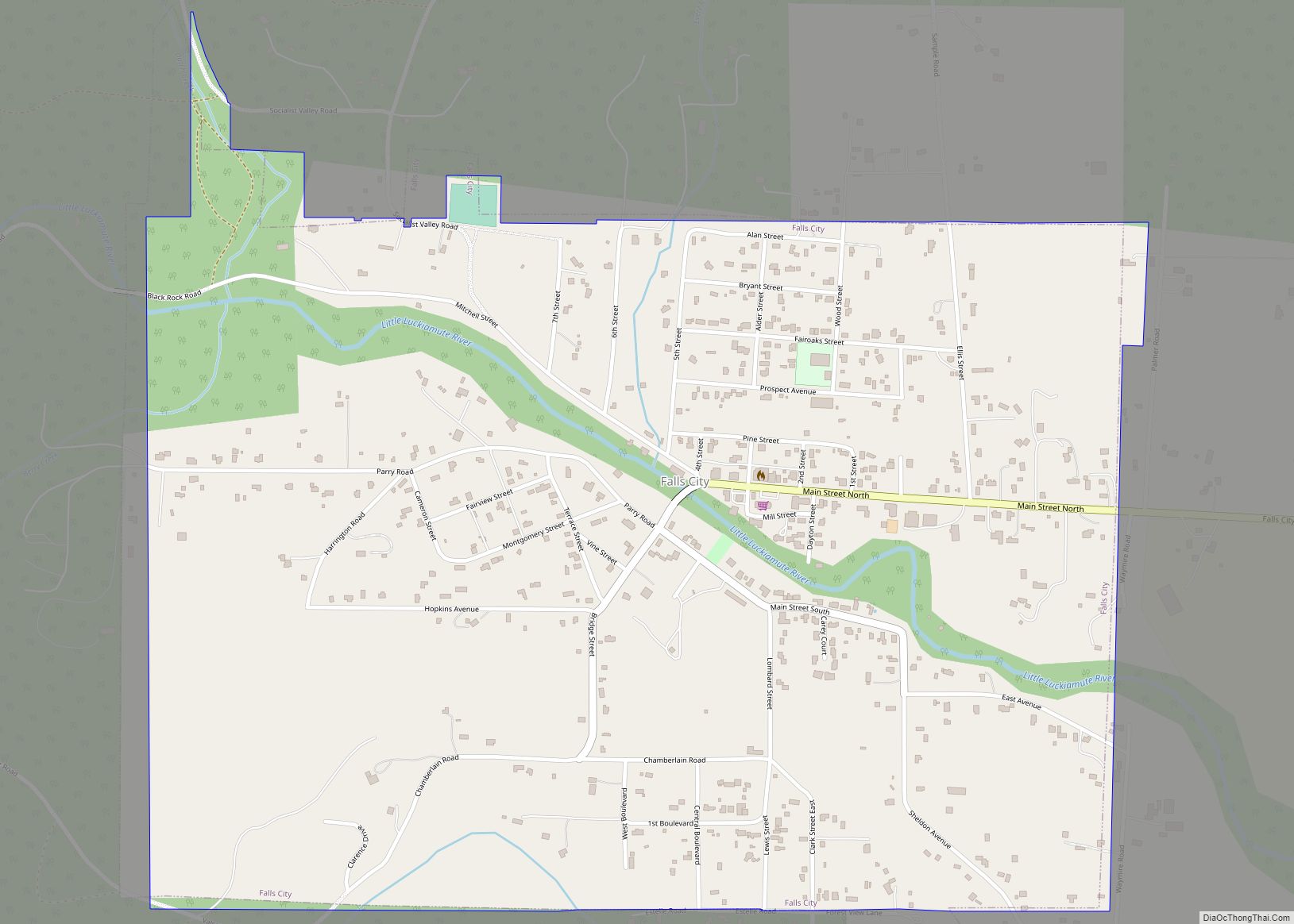
Falls City is a city in Polk County, Oregon, United States. The population was 1,051 at the 2020 census. It is part of the Salem Metropolitan Statistical Area. Falls City city overview: Name: Falls City city LSAD Code: 25 LSAD Description: city (suffix) State: Oregon County: Polk County Incorporated: 1893 Elevation: 370 ft (112.8 m) Total Area: ... Read more
Map of Falls City, Oregon
Map of Gladstone city, Oregon
Gladstone is a city located in Clackamas County, Oregon, United States. The population was 12,017 at the 2020 census. Gladstone is an approximately 4-square-mile (10 km) suburban community, 12 miles (19 km) south of Portland, the largest city in Oregon, and located at the confluence of the Clackamas and Willamette rivers. Gladstone has held several important cultural ... Read more
Map of Gladstone city, Oregon
Map of Gervais city
Gervais /ˈdʒərvɪs/ is a city in Marion County, Oregon, United States. The population was 2,595 at the 2020 census. It is part of the Salem Metropolitan Statistical Area. Gervais city overview: Name: Gervais city LSAD Code: 25 LSAD Description: city (suffix) State: Oregon County: Marion County Incorporated: 1874 Elevation: 184 ft (56.1 m) Total Area: 0.41 sq mi (1.06 km²) ... Read more
Map of Gervais city
Map of Gearhart city
Gearhart is a city in Clatsop County, Oregon, United States. The population was 1,462 at the 2010 census. Gearhart city overview: Name: Gearhart city LSAD Code: 25 LSAD Description: city (suffix) State: Oregon County: Clatsop County Incorporated: 1918 Elevation: 16 ft (4.9 m) Total Area: 1.88 sq mi (4.86 km²) Land Area: 1.85 sq mi (4.79 km²) Water Area: 0.03 sq mi (0.06 km²) Total Population: ... Read more
Map of Gearhart city
Map of Gates city, Oregon
Gates is a city on the border of Linn and Marion counties in Oregon, United States. The population was 548 at the 2020 census. The greater part of Gates’ population is in Marion County and the city is primarily under Marion County’s jurisdiction. The Marion County portion of Gates is part of the Salem Metropolitan ... Read more
Map of Gates city, Oregon
Map of Gaston city, Oregon
Gaston is a city in Washington County, Oregon, United States. Located between Forest Grove to the north and Yamhill to the south, the city straddles Oregon Route 47 and borders the Tualatin River. Named after railroad executive Joseph Gaston, its population was 637 as of the 2010 census. Gaston city overview: Name: Gaston city LSAD ... Read more
Map of Gaston city, Oregon
Map of Garibaldi city
Garibaldi (/ˌɡærɪˈbɔːldi/ GARR-ib-AWL-dee) is a city in Tillamook County, in the U.S. state of Oregon. The population was 830 at the 2020 census. Garibaldi city overview: Name: Garibaldi city LSAD Code: 25 LSAD Description: city (suffix) State: Oregon County: Tillamook County Incorporated: 1946 Elevation: 22 ft (6.7 m) Total Area: 1.37 sq mi (3.54 km²) Land Area: 0.99 sq mi (2.55 km²) Water ... Read more
Map of Garibaldi city