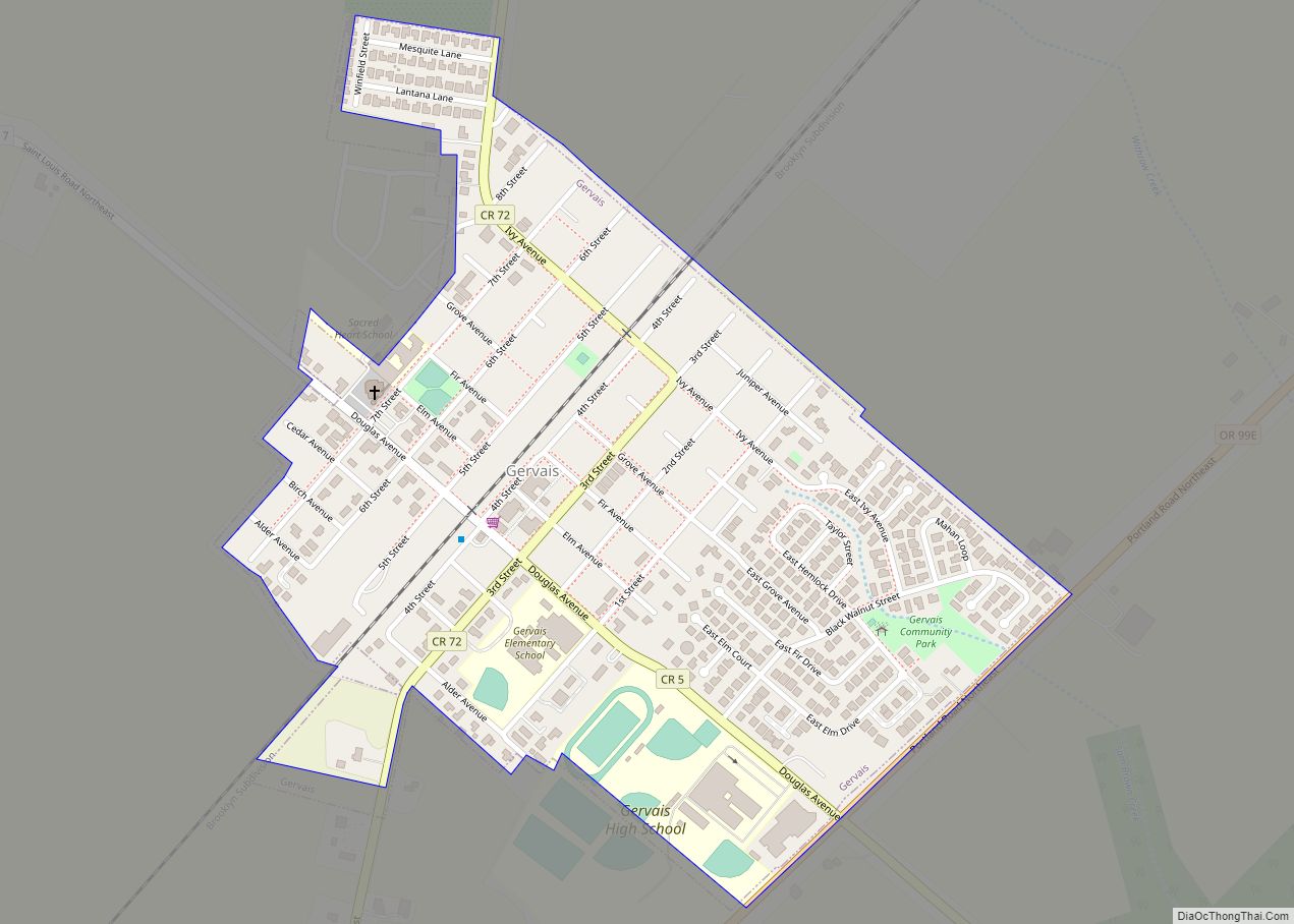
Map of Gaston city, Oregon
Gaston is a city in Washington County, Oregon, United States. Located between Forest Grove to the north and Yamhill to the south, the city straddles Oregon Route 47 and borders the Tualatin River. Named after railroad executive Joseph Gaston, its population was 637 as of the 2010 census. Gaston city overview: Name: Gaston city LSAD ... Read more
Map of Gaston city, Oregon
Map of Garibaldi city
Garibaldi (/ˌɡærɪˈbɔːldi/ GARR-ib-AWL-dee) is a city in Tillamook County, in the U.S. state of Oregon. The population was 830 at the 2020 census. Garibaldi city overview: Name: Garibaldi city LSAD Code: 25 LSAD Description: city (suffix) State: Oregon County: Tillamook County Incorporated: 1946 Elevation: 22 ft (6.7 m) Total Area: 1.37 sq mi (3.54 km²) Land Area: 0.99 sq mi (2.55 km²) Water ... Read more
Map of Garibaldi city
Map of Gardiner CDP, Oregon
Gardiner is an unincorporated community and census-designated place in Douglas County, Oregon, United States, across the Umpqua River from Reedsport. It is located on U.S. Route 101. As of the 2010 census, it had a population of 248. Gardiner is named for a Boston merchant whose ship, the Bostonian, shipwrecked at the mouth of the ... Read more
Map of Gardiner CDP, Oregon
Map of Garden Home-Whitford CDP
Garden Home-Whitford CDP overview: Name: Garden Home-Whitford CDP LSAD Code: 57 LSAD Description: CDP (suffix) State: Oregon County: Washington County FIPS code: 4127825 Online Interactive Map Garden Home-Whitford online map. Source: Basemap layers from Google Map, Open Street Map (OSM), Arcgisonline, Wmflabs. Boundary Data from Database of Global Administrative Areas. Garden Home-Whitford location map. Where ... Read more
Map of Garden Home-Whitford CDP
Map of Grand Ronde CDP
Grand Ronde is a census-designated place (CDP) and unincorporated community in Polk and Yamhill counties, Oregon, United States. Historically noted as a village in Polk County, the sphere of influence and community is in both Polk and Yamhill counties. The name of the community is a variation of the French Grande Ronde or “Grand Round” ... Read more
Map of Grand Ronde CDP
Map of Government Camp CDP
Government Camp is an unincorporated community and census-designated place located in Clackamas County, Oregon, United States, on the base of Mount Hood and north of Tom Dick and Harry Mountain. It is the only town within 5 miles (8 km) of Mount Hood and therefore is the de facto “mountain town” or “ski town”. It is ... Read more
Map of Government Camp CDP
Map of Gopher Flats CDP
Gopher Flats is a census-designated place (CDP) in Umatilla County, Oregon, United States. The population was 401 at the 2000 census. It is part of the Pendleton–Hermiston Micropolitan Statistical Area. Gopher Flats CDP overview: Name: Gopher Flats CDP LSAD Code: 57 LSAD Description: CDP (suffix) State: Oregon County: Umatilla County Elevation: 1,217 ft (371 m) Total Area: ... Read more
Map of Gopher Flats CDP
Map of Gold Hill city, Oregon
Gold Hill is a city in Jackson County, Oregon, in the United States. As of the 2010 census the population was 1,335. It is along a bend of the Rogue River. Gold Hill city overview: Name: Gold Hill city LSAD Code: 25 LSAD Description: city (suffix) State: Oregon County: Jackson County Incorporated: 1895 Elevation: 1,085 ft ... Read more
Map of Gold Hill city, Oregon
Map of Gold Beach city
Gold Beach (Tolowa: yan-shu’-chit, yan-shuu-chit’-dvn) is a city in and the county seat of Curry County, Oregon, United States, on the Oregon Coast. The population was 2,241 at the 2020 census. Gold Beach city overview: Name: Gold Beach city LSAD Code: 25 LSAD Description: city (suffix) State: Oregon County: Curry County Incorporated: 1853 Elevation: 23 ft ... Read more
Map of Gold Beach city
Map of Glide CDP
Glide is a census-designated place (CDP) in Douglas County, Oregon, United States. The population was 1,795 at the 2010 census. Glide CDP overview: Name: Glide CDP LSAD Code: 57 LSAD Description: CDP (suffix) State: Oregon County: Douglas County Elevation: 689 ft (210 m) Total Area: 10.16 sq mi (26.31 km²) Land Area: 10.08 sq mi (26.11 km²) Water Area: 0.07 sq mi (0.20 km²) Total Population: ... Read more
Map of Glide CDP
Map of Glendale city, Oregon
Glendale is a city in Douglas County, Oregon, United States. The population was 874 at the 2010 census. Glendale city overview: Name: Glendale city LSAD Code: 25 LSAD Description: city (suffix) State: Oregon County: Douglas County Incorporated: 1901 Elevation: 1,431 ft (436 m) Total Area: 0.39 sq mi (1.02 km²) Land Area: 0.39 sq mi (1.02 km²) Water Area: 0.00 sq mi (0.00 km²) Total Population: ... Read more
Map of Glendale city, Oregon
Map of Glasgow CDP, Oregon
Glasgow is an unincorporated community in Coos County, Oregon, United States. For statistical purposes, the United States Census Bureau has defined Glasgow as a census-designated place (CDP). The census definition of the area may not precisely correspond to local understanding of the area with the same name. As of the 2010 census the Glasgow CDP ... Read more
Map of Glasgow CDP, Oregon