Enterprise is a city in and the county seat of Wallowa County, Oregon, United States. The population was 1,940 in the 2010 census.
| Name: | Enterprise city |
|---|---|
| LSAD Code: | 25 |
| LSAD Description: | city (suffix) |
| State: | Oregon |
| County: | Wallowa County |
| Incorporated: | 1889 |
| Elevation: | 3,757 ft (1,145 m) |
| Total Area: | 1.47 sq mi (3.80 km²) |
| Land Area: | 1.47 sq mi (3.80 km²) |
| Water Area: | 0.00 sq mi (0.00 km²) |
| Total Population: | 2,052 |
| Population Density: | 1,398.77/sq mi (540.02/km²) |
| ZIP code: | 97828 |
| Area code: | 458 and 541 |
| FIPS code: | 4123500 |
| GNISfeature ID: | 1141885 |
| Website: | www.enterpriseoregon.org |
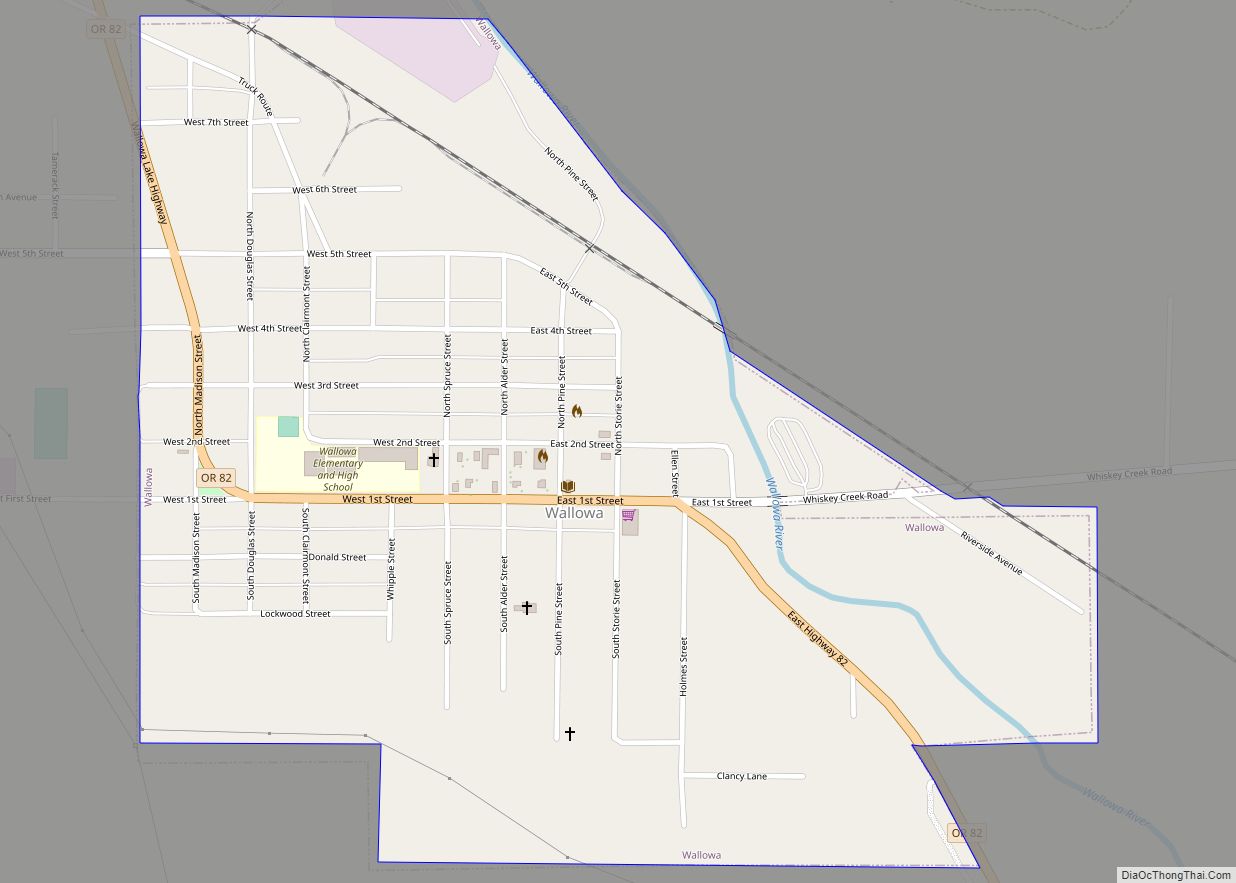
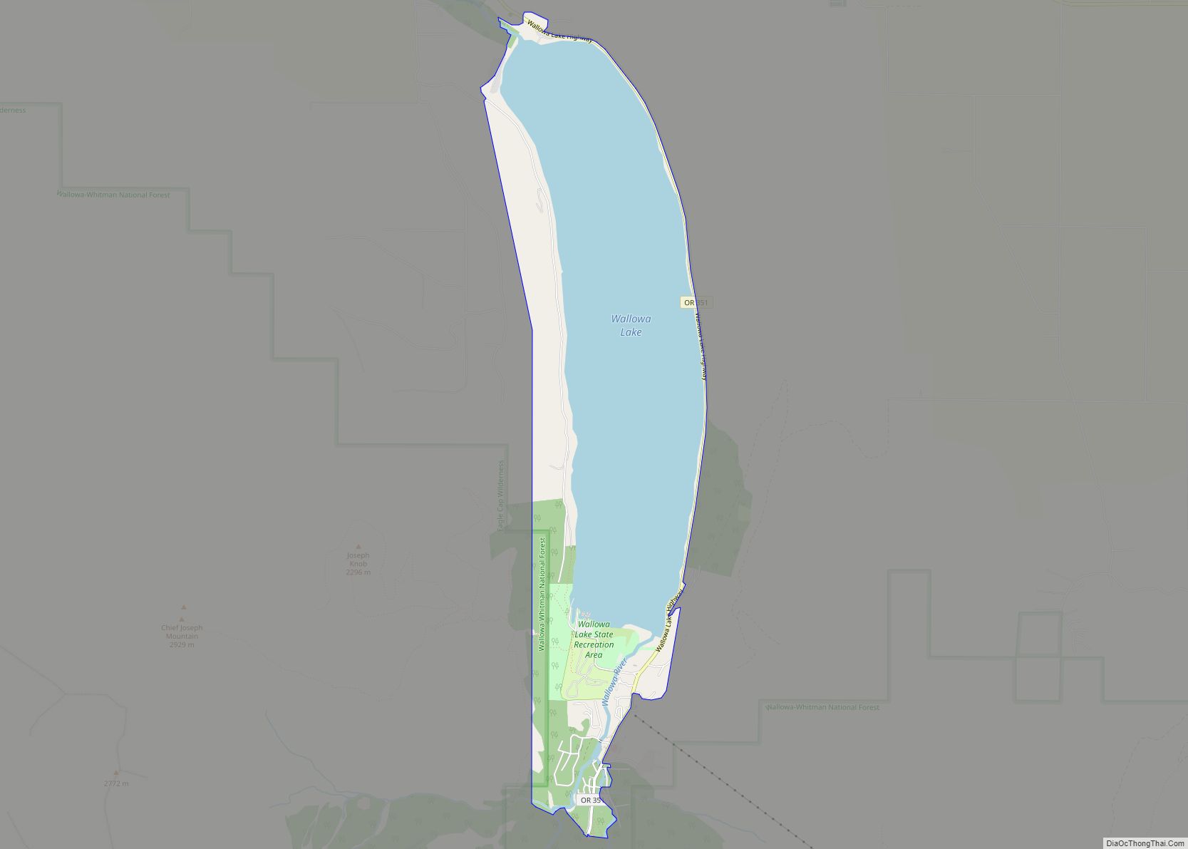
Online Interactive Map
Click on ![]() to view map in "full screen" mode.
to view map in "full screen" mode.
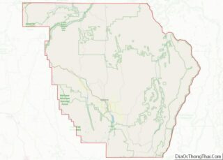
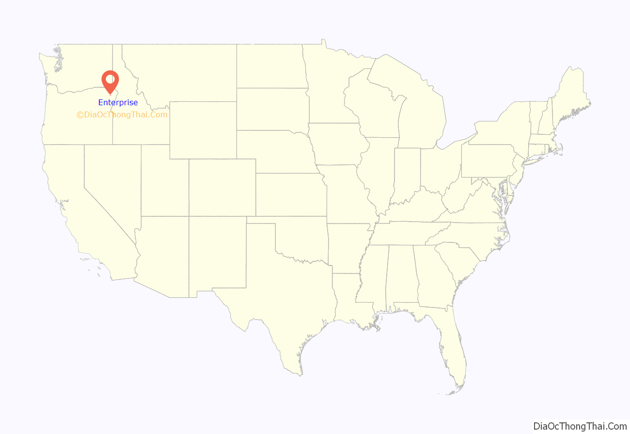
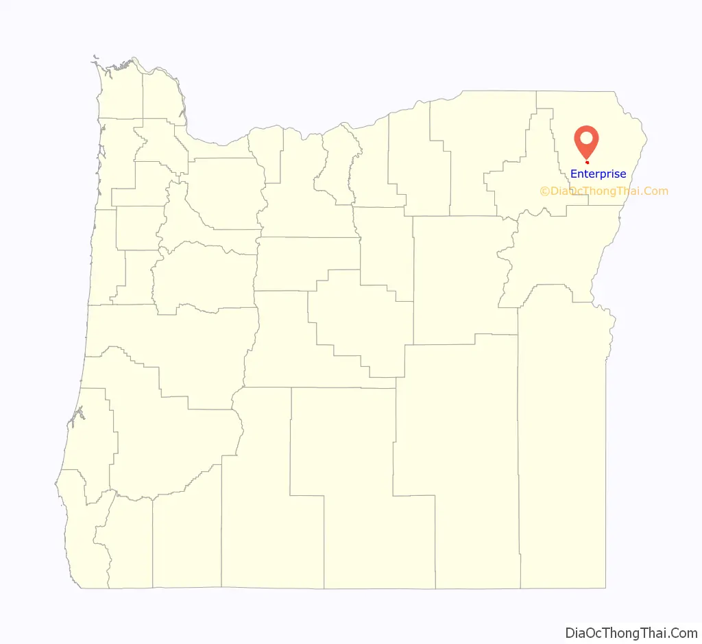
Enterprise location map. Where is Enterprise city?
History
Enterprise was platted in 1886, and in 1887 residents considered Bennett Flat, Wallowa City, Franklin, and other possibilities before voting for Enterprise during a community meeting in a tent owned by a mercantile company. The name was meant to reflect “the policy of its inhabitants”. In November 1887, a post office was established in the community, and Catherine Akin became the first postmaster. The city was incorporated by the Oregon Legislative Assembly on February 21, 1889.
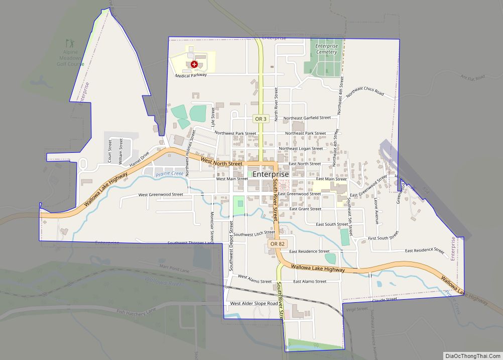
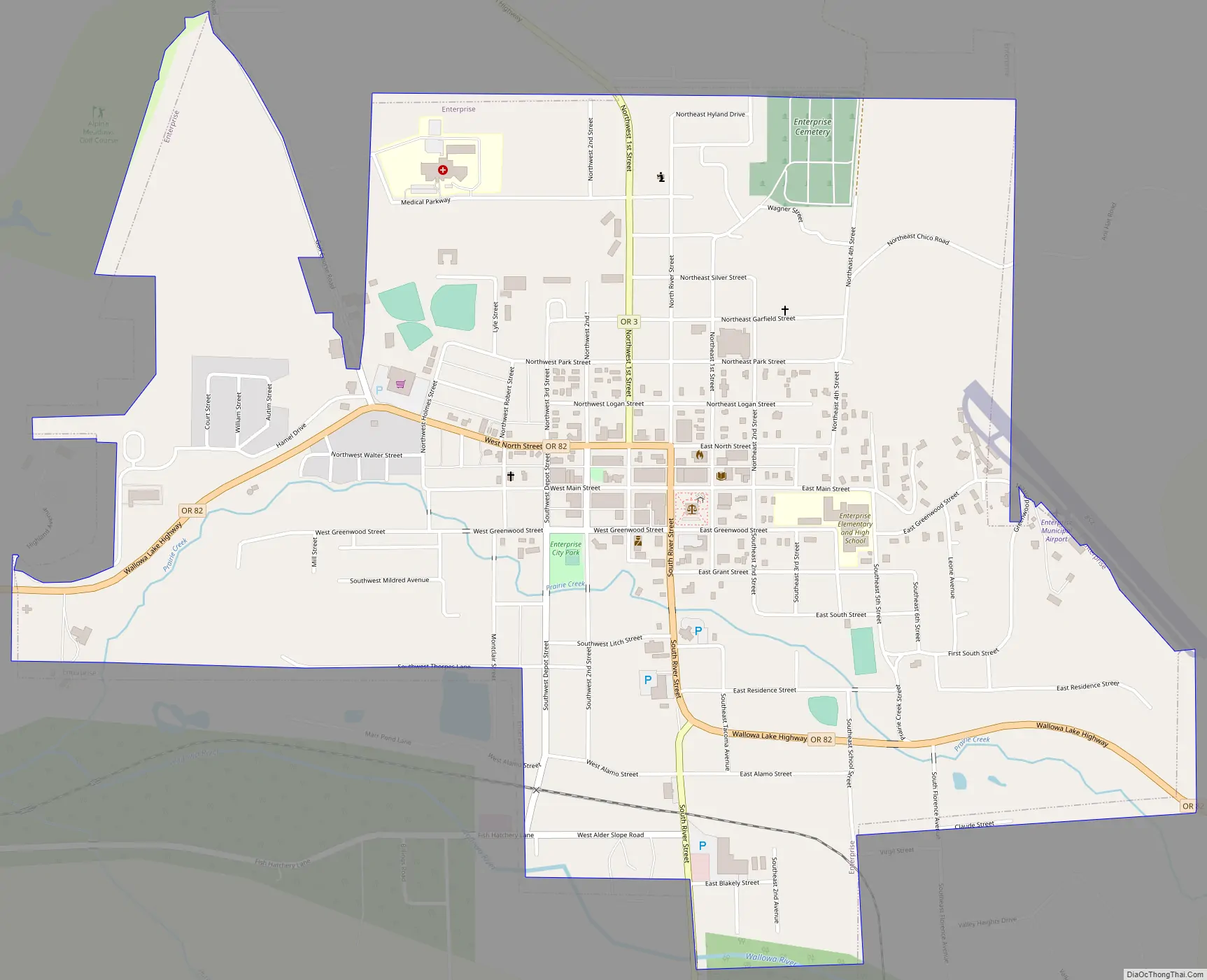
Enterprise Road Map
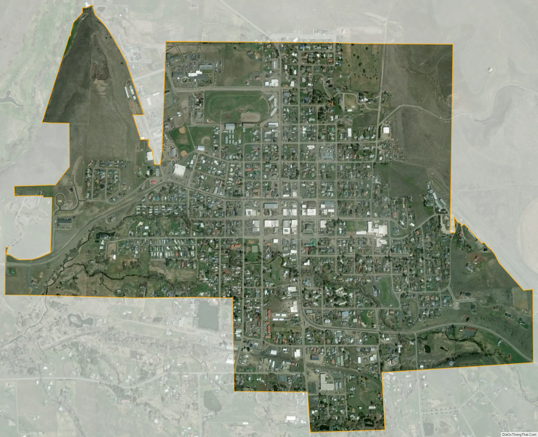
Enterprise city Satellite Map
Geography
According to the United States Census Bureau, the city has a total area of 1.53 square miles (3.96 km), all of it land.
See also
Map of Oregon State and its subdivision: Map of other states:- Alabama
- Alaska
- Arizona
- Arkansas
- California
- Colorado
- Connecticut
- Delaware
- District of Columbia
- Florida
- Georgia
- Hawaii
- Idaho
- Illinois
- Indiana
- Iowa
- Kansas
- Kentucky
- Louisiana
- Maine
- Maryland
- Massachusetts
- Michigan
- Minnesota
- Mississippi
- Missouri
- Montana
- Nebraska
- Nevada
- New Hampshire
- New Jersey
- New Mexico
- New York
- North Carolina
- North Dakota
- Ohio
- Oklahoma
- Oregon
- Pennsylvania
- Rhode Island
- South Carolina
- South Dakota
- Tennessee
- Texas
- Utah
- Vermont
- Virginia
- Washington
- West Virginia
- Wisconsin
- Wyoming