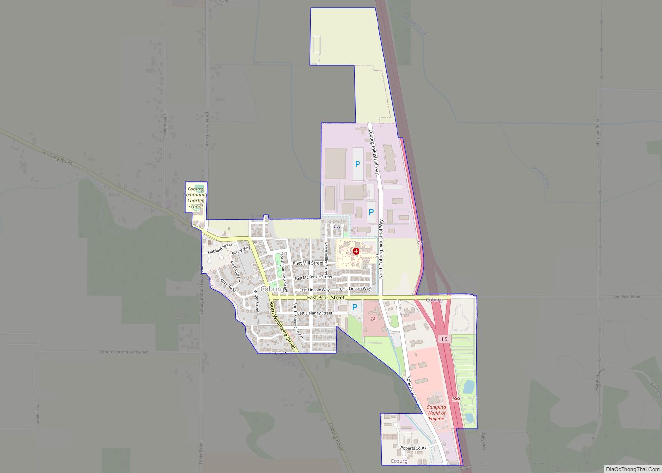
Map of Coquille city

Map of Coquille city

Coquille /koʊˈkiːl/ is a city in, and the county seat of, Coos County, Oregon, United States. The population was 4,015 at the 2020 census. The primary economic base is the timber industry. The city derives its name from the Coquille Native American tribe. Coquille city overview: Name: Coquille city LSAD Code: 25 LSAD Description: city … Read more

Map of Coos Bay city

Map of Coos Bay city

Coos Bay (Coos language: Atsixiis) is a city located in Coos County, Oregon, United States, where the Coos River enters Coos Bay on the Pacific Ocean. The city borders the city of North Bend, and together they are often referred to as one entity called either Coos Bay-North Bend or Oregon’s Bay Area. Coos Bay’s … Read more

Map of Dallas city, Oregon

Map of Dallas city, Oregon

Dallas is a city and the county seat of Polk County, Oregon, United States. The population was 16,854 at the 2020 census. Dallas is along Rickreall Creek, about 15 miles (24 km) west of Salem, at an elevation of 325 feet (99 m) above sea level. It is part of the Salem Metropolitan Statistical Area. Dallas city … Read more

Map of Culver city, Oregon

Map of Culver city, Oregon

Culver is a city in Jefferson County, Oregon, United States. The population was 1,357 at the 2010 census. Culver city overview: Name: Culver city LSAD Code: 25 LSAD Description: city (suffix) State: Oregon County: Jefferson County Incorporated: 1946 Elevation: 2,640 ft (804.7 m) Total Area: 0.69 sq mi (1.80 km²) Land Area: 0.69 sq mi (1.80 km²) Water Area: 0.00 sq mi (0.00 km²) Total Population: … Read more

Map of Crooked River Ranch CDP

Map of Crooked River Ranch CDP

Crooked River Ranch CDP overview: Name: Crooked River Ranch CDP LSAD Code: 57 LSAD Description: CDP (suffix) State: Oregon FIPS code: 4116975 Online Interactive Map Crooked River Ranch online map. Source: Basemap layers from Google Map, Open Street Map (OSM), Arcgisonline, Wmflabs. Boundary Data from Database of Global Administrative Areas. Crooked River Ranch location map. … Read more

Map of Creswell city, Oregon

Map of Creswell city, Oregon

Creswell is a city in the Willamette Valley of Lane County, Oregon, United States, located 13 miles (21 km) south of Eugene, Oregon. The population at the 2010 census was 5,031. Creswell city overview: Name: Creswell city LSAD Code: 25 LSAD Description: city (suffix) State: Oregon County: Lane County Incorporated: 1909 Elevation: 542 ft (165.2 m) Total Area: … Read more

Map of Crawfordsville CDP, Oregon

Map of Crawfordsville CDP, Oregon

Crawfordsville is a census-designated place and unincorporated community in Linn County, Oregon, United States. As of the 2010 census it had a population of 332. It is located about 7 miles (11 km) southeast of Brownsville and 8 miles (13 km) southwest of Sweet Home on Oregon Route 228, near the Calapooia River. It has a post … Read more

Map of Crane CDP, Oregon

Map of Crane CDP, Oregon

Crane is a census-designated place and unincorporated community in Harney County, Oregon, United States, northeast of Malheur Lake on Oregon Route 78. Its population was 116 at the 2020 census. Crane CDP overview: Name: Crane CDP LSAD Code: 57 LSAD Description: CDP (suffix) State: Oregon County: Harney County Elevation: 4,134 ft (1,260 m) Total Area: 10.42 sq mi (26.98 km²) … Read more

Map of Crabtree CDP

Map of Crabtree CDP, Oregon

Crabtree is an unincorporated community and census-designated place in Linn County, Oregon, United States. As of the 2010 census, it had a population of 391. It has a post office with a ZIP code of 97335. Crabtree lies off Oregon Route 226 about 10 miles (16 km) east of Albany. The town received its name when … Read more

Map of Cove city, Oregon

Map of Cove city, Oregon

Cove is a city in Union County, Oregon, United States. The population was 620 at the 2020 census. Cove city overview: Name: Cove city LSAD Code: 25 LSAD Description: city (suffix) State: Oregon County: Union County Incorporated: 1904 Elevation: 2,870 ft (870 m) Total Area: 0.80 sq mi (2.08 km²) Land Area: 0.80 sq mi (2.08 km²) Water Area: 0.00 sq mi (0.00 km²) Total Population: … Read more

Map of Cottage Grove city, Oregon

Map of Cottage Grove city, Oregon

Cottage Grove is a city in Lane County, Oregon, United States. Its population was 10,643 at the 2020 census. It is the third largest city in Lane County. It is on Interstate 5, Oregon Route 99, and the main Willamette Valley line of the CORP railroad. Cottage Grove city overview: Name: Cottage Grove city LSAD … Read more

Map of Corvallis city, Oregon

Map of Corvallis city, Oregon

Corvallis (/kɔːrˈvælɪs/ kor-VAL-iss) is a city and the county seat of Benton County in central western Oregon, United States. It is the principal city of the Corvallis, Oregon Metropolitan Statistical Area, which encompasses all of Benton County. As of the 2020 United States Census, the population was 59,922. Corvallis is the location of Oregon State … Read more