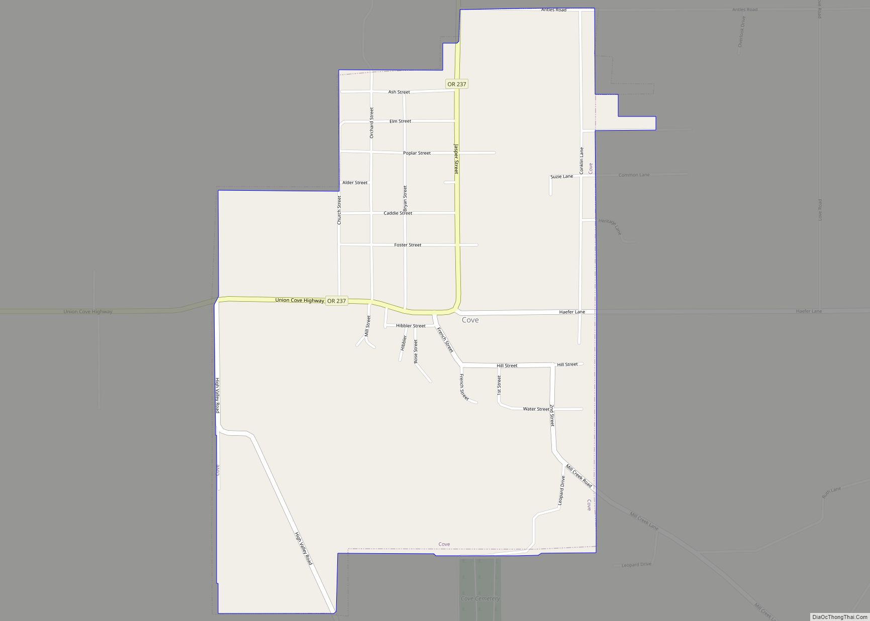
Cove is a city in Union County, Oregon, United States. The population was 620 at the 2020 census.
| Name: | Cove city |
|---|---|
| LSAD Code: | 25 |
| LSAD Description: | city (suffix) |
| State: | Oregon |
| County: | Union County |
| Incorporated: | 1904 |
| Elevation: | 2,870 ft (870 m) |
| Total Area: | 0.80 sq mi (2.08 km²) |
| Land Area: | 0.80 sq mi (2.08 km²) |
| Water Area: | 0.00 sq mi (0.00 km²) |
| Total Population: | 620 |
| Population Density: | 771.14/sq mi (297.66/km²) |
| ZIP code: | 97824 |
| Area code: | 541 |
| FIPS code: | 4116250 |
| GNISfeature ID: | 1136181 |
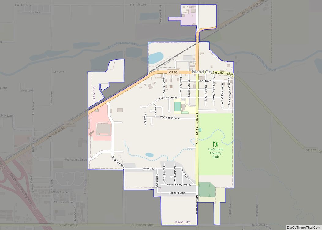
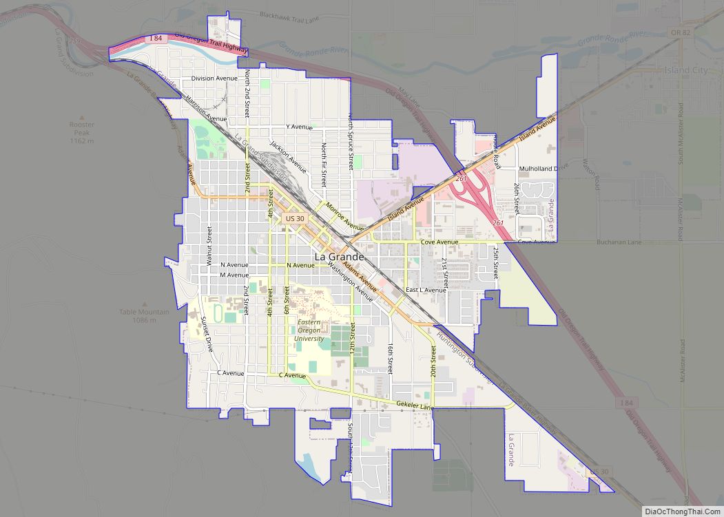
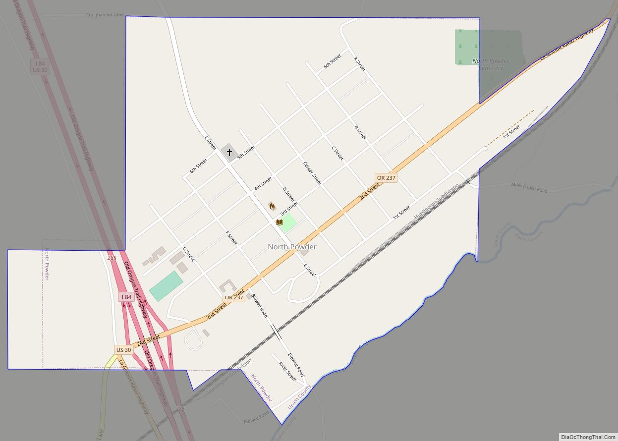
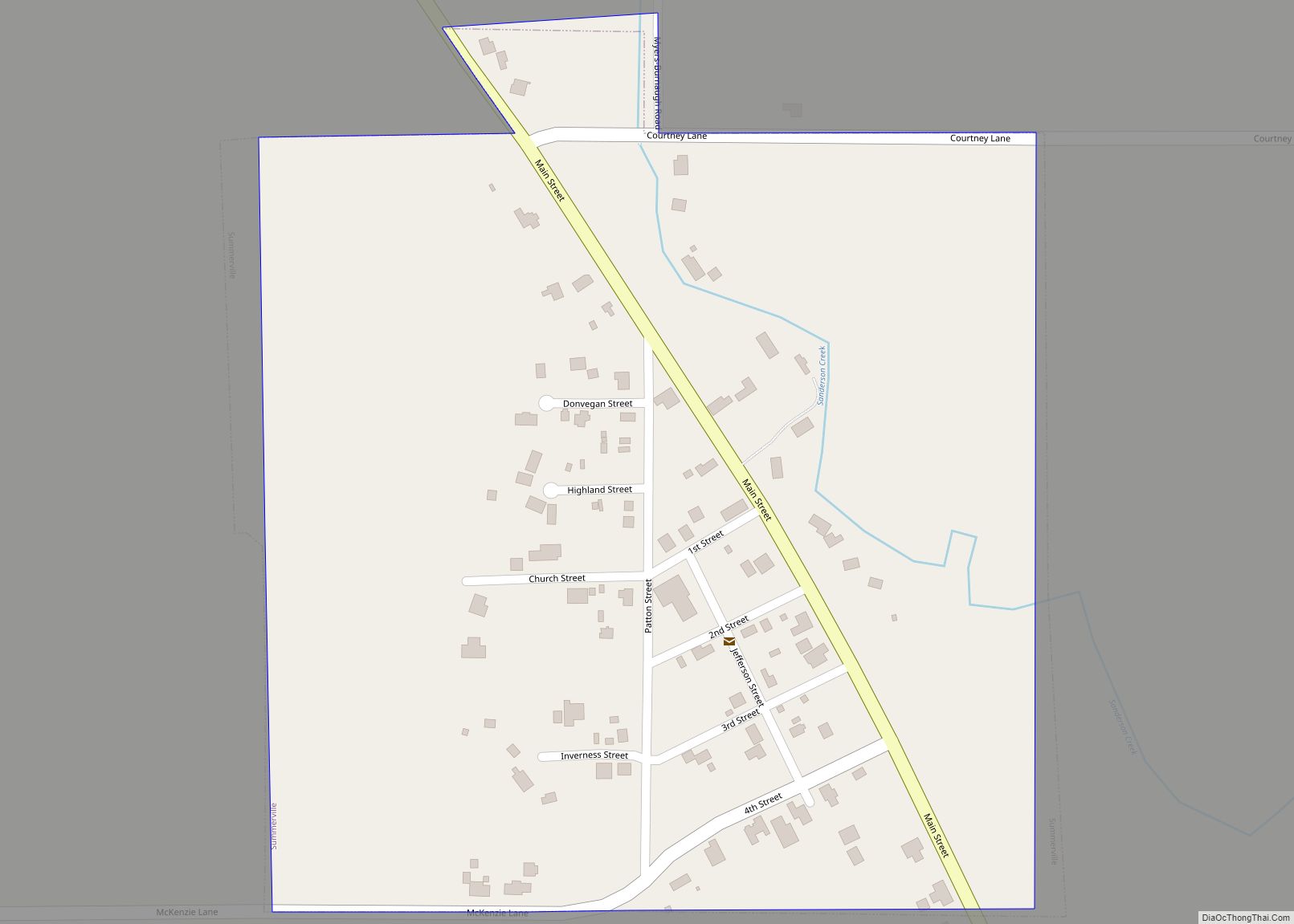
Online Interactive Map
Click on ![]() to view map in "full screen" mode.
to view map in "full screen" mode.
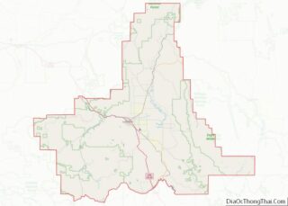
Cove location map. Where is Cove city?


History
This area was well known to the Cayuse and Nez Perce Tribes who referred to it as Wiweeletitpe (wee-walla-tit-puh), meaning “Many creeks flowing at that place”. Euro-Americans first settled here in 1862, and in 1863 they established a post office named Forest Cove. Samuel G. French was the first postmaster. To avoid confusion between Forest Cove and another Oregon community, Forest Grove in Washington County, post office authorities changed the name to Cove in 1868. Cove was platted in the 1870s along Ruckles Road, only the second road over the Blue Mountains.
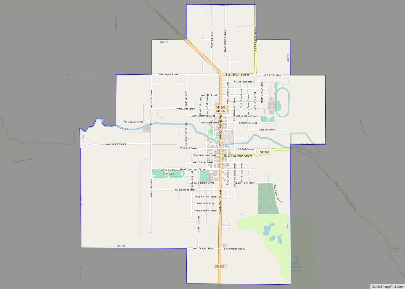
Cove Road Map

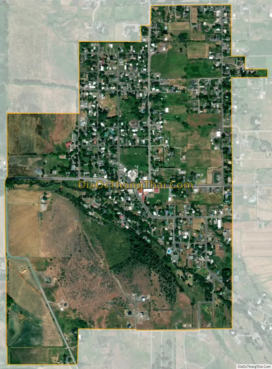
Cove city Satellite Map
Geography
Cove lies east of La Grande and north of Union along the eastern edge of the Grande Ronde Valley of northeastern Oregon. Mill Creek, a tributary of the Grande Ronde River, flows west from the Wallowa Mountains through Cove. Mount Fanny rises to about 7,200 feet (2,200 m) about 3 miles (5 km) east of the city.
According to the United States Census Bureau, the city has a total area of 0.77 square miles (1.99 km), all of it land. Oregon Route 237 passes through Cove.
Climate
This region experiences warm (but not hot) and dry summers, with no average monthly temperatures above 71.6 °F (22.0 °C). According to the Köppen Climate Classification system, Cove has a warm-summer Mediterranean climate, abbreviated “Csb” on climate maps.
The average total annual precipitation in Cove is about 22 inches (560 mm). July has the highest average maximum temperature, about 83 °F (28 °C), while January has the lowest average minimum, 21 °F (−6 °C)
See also
Map of Oregon State and its subdivision: Map of other states:- Alabama
- Alaska
- Arizona
- Arkansas
- California
- Colorado
- Connecticut
- Delaware
- District of Columbia
- Florida
- Georgia
- Hawaii
- Idaho
- Illinois
- Indiana
- Iowa
- Kansas
- Kentucky
- Louisiana
- Maine
- Maryland
- Massachusetts
- Michigan
- Minnesota
- Mississippi
- Missouri
- Montana
- Nebraska
- Nevada
- New Hampshire
- New Jersey
- New Mexico
- New York
- North Carolina
- North Dakota
- Ohio
- Oklahoma
- Oregon
- Pennsylvania
- Rhode Island
- South Carolina
- South Dakota
- Tennessee
- Texas
- Utah
- Vermont
- Virginia
- Washington
- West Virginia
- Wisconsin
- Wyoming