Map of Lawndale town, North Carolina
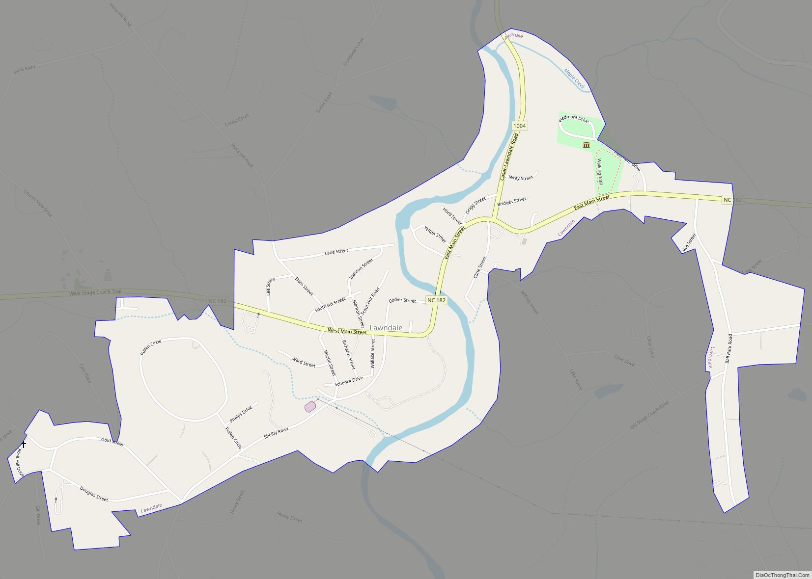
Lawndale is a town in Cleveland County, North Carolina, United States, situated along the First Broad River. The population was 606 at the 2010 census. Lawndale town overview: Name: Lawndale town LSAD Code: 43 LSAD Description: town (suffix) State: North Carolina County: Cleveland County Elevation: 846 ft (258 m) Total Area: 0.86 sq mi (2.23 km²) Land Area: 0.81 sq mi (2.09 km²) ... Read more
Map of Lawndale town, North Carolina
Map of Littleton town, North Carolina
Littleton is a town in Halifax County, North Carolina, United States. The population was 674 at the 2010 census. It is part of the Roanoke Rapids, North Carolina Micropolitan Statistical Area. Littleton town overview: Name: Littleton town LSAD Code: 43 LSAD Description: town (suffix) State: North Carolina County: Halifax County Elevation: 387 ft (118 m) Total Area: ... Read more
Map of Littleton town, North Carolina
Map of Linden town, North Carolina
Linden is a town in Cumberland County, North Carolina, United States. The population was 130 at the 2010 census, the mayor is Frances Collier. Linden town overview: Name: Linden town LSAD Code: 43 LSAD Description: town (suffix) State: North Carolina County: Cumberland County Elevation: 112 ft (34 m) Total Area: 0.55 sq mi (1.42 km²) Land Area: 0.55 sq mi (1.42 km²) Water ... Read more
Map of Linden town, North Carolina
Map of Lincolnton city, North Carolina
Lincolnton is a city in Lincoln County, North Carolina, United States within the Charlotte metropolitan area. The population was 10,486 at the 2010 census. Lincolnton is northwest of Charlotte, on the South Fork of the Catawba River. The city is the county seat of Lincoln County, and is the only legally incorporated municipality which is ... Read more
Map of Lincolnton city, North Carolina
Map of Lillington town
Lillington is a town in Harnett County, North Carolina, United States. Its population was 3,194 at the 2010 census, and was 4,735 in the 2020 census. It is the county seat of Harnett County. Lillington is a part of the Dunn micropolitan area, which is also a part of the greater Raleigh–Durham–Cary combined statistical area ... Read more
Map of Lillington town
Map of Lowesville CDP
Lowesville is a census-designated place (CDP) in Lincoln County, North Carolina, United States. The population was 2,945 at the 2010 census, up from 1,440 in 2000. Lowesville CDP overview: Name: Lowesville CDP LSAD Code: 57 LSAD Description: CDP (suffix) State: North Carolina County: Lincoln County Elevation: 804 ft (245 m) Total Area: 6.80 sq mi (17.62 km²) Land Area: 6.79 sq mi ... Read more
Map of Lowesville CDP
Map of Lowell city, North Carolina
Lowell is a small city in Gaston County, North Carolina, United States, located east of Gastonia. The population was 3,526 at the 2010 census. Lowell city overview: Name: Lowell city LSAD Code: 25 LSAD Description: city (suffix) State: North Carolina County: Gaston County Incorporated: 1879 Elevation: 817 ft (249 m) Total Area: 3.68 sq mi (9.53 km²) Land Area: 3.67 sq mi ... Read more
Map of Lowell city, North Carolina
Map of Love Valley town
Love Valley is a town in Iredell County, North Carolina, United States. It also extends into Alexander County on its western end. The population was 90 at the 2010 census, and in 2020 the estimated population was 154. Love Valley town overview: Name: Love Valley town LSAD Code: 43 LSAD Description: town (suffix) State: North ... Read more
Map of Love Valley town
Map of Louisburg town, North Carolina
Louisburg is a town in Franklin County, North Carolina, United States. As of the 2020 census, the town population was 3,064. It is the county seat of Franklin County. The town is located approximately 29 miles northeast of the state capital, Raleigh, and located about 31 miles south of the Virginia border. It is also ... Read more
Map of Louisburg town, North Carolina
Map of Long View town
Long View is a town in Burke and Catawba counties in the U.S. state of North Carolina. The population was 4,871 at the 2010 census. It is part of the Hickory–Lenoir–Morganton Metropolitan Statistical Area. Long View town overview: Name: Long View town LSAD Code: 43 LSAD Description: town (suffix) State: North Carolina County: Burke County, ... Read more
Map of Long View town
Map of Locust city
Locust is a small rural city in Stanly and Cabarrus counties in the U.S. state of North Carolina. The population was 2,930 at the 2010 census. Locust city overview: Name: Locust city LSAD Code: 25 LSAD Description: city (suffix) State: North Carolina County: Cabarrus County, Stanly County Elevation: 719 ft (219 m) Total Area: 8.19 sq mi (21.21 km²) Land ... Read more
Map of Locust city
Map of Maiden town
Maiden is a town in Catawba and Lincoln counties in the U.S. state of North Carolina. The population was 3,310 at the 2010 census. Maiden was the first public high school in the state with an observatory and is currently home to an Apple iCloud Data Center, covering 500,000 square feet (46,000 m). In May 2012, ... Read more
Map of Maiden town