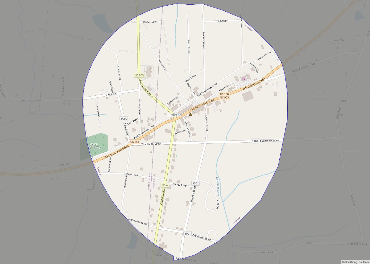
Littleton is a town in Halifax County, North Carolina, United States. The population was 674 at the 2010 census. It is part of the Roanoke Rapids, North Carolina Micropolitan Statistical Area.
| Name: | Littleton town |
|---|---|
| LSAD Code: | 43 |
| LSAD Description: | town (suffix) |
| State: | North Carolina |
| County: | Halifax County |
| Elevation: | 387 ft (118 m) |
| Total Area: | 0.95 sq mi (2.46 km²) |
| Land Area: | 0.95 sq mi (2.46 km²) |
| Water Area: | 0.00 sq mi (0.00 km²) |
| Total Population: | 559 |
| Population Density: | 587.80/sq mi (226.93/km²) |
| ZIP code: | 27850 |
| Area code: | 252 |
| FIPS code: | 3738680 |
| GNISfeature ID: | 0988811 |
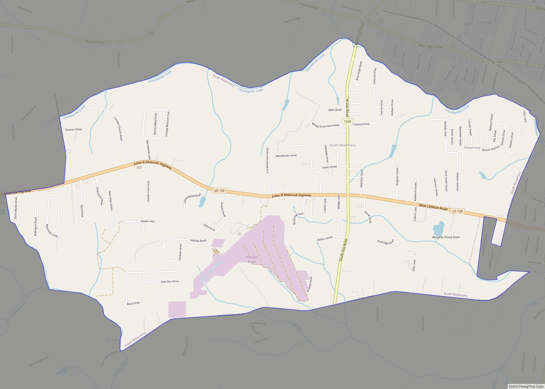
Online Interactive Map
Click on ![]() to view map in "full screen" mode.
to view map in "full screen" mode.
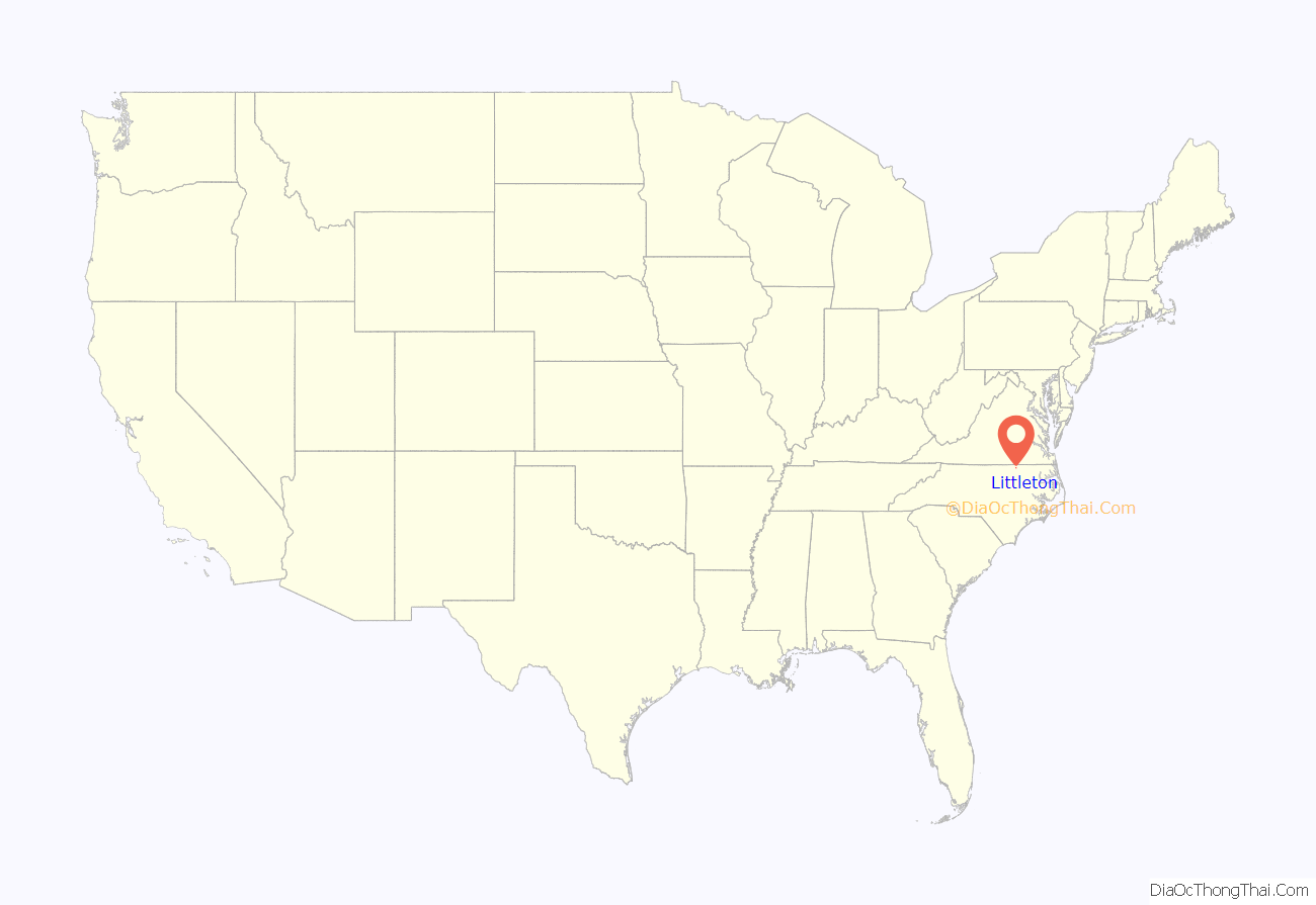
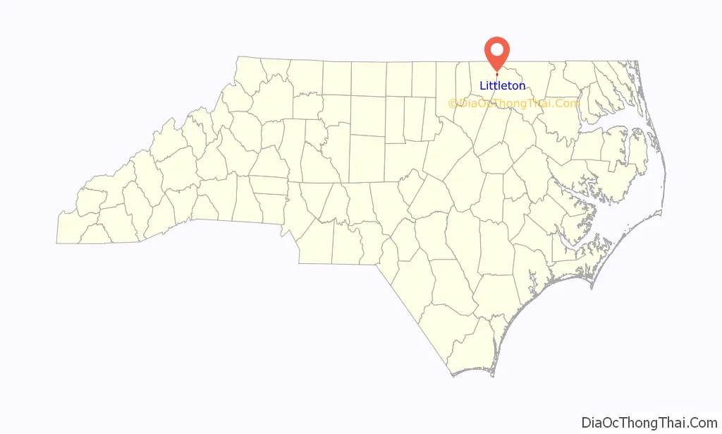
Littleton location map. Where is Littleton town?
History
Littleton was named after William Little, a state senator at the time of founding. In 1882, Littleton College for women was founded with an initial enrollment of eleven students. The college became relatively successful with a peak enrollment of 285 in 1908. On January 22, 1919, the college was destroyed by fire, and without an endowment, it was never rebuilt.
Person’s Ordinary and St. Alban’s Episcopal Church are listed on the National Register of Historic Places.
Originally Littleton was divided between the counties of Warren and Halifax, but on July 1, 1974, an election was made to make Littleton only to be a part of Halifax County.
Little Manor and the Dr. Charles and Susan Skinner House and Outbuildings are listed on the National Register of Historic Places.
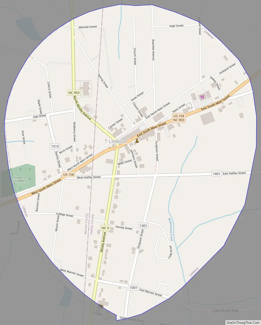
Littleton Road Map
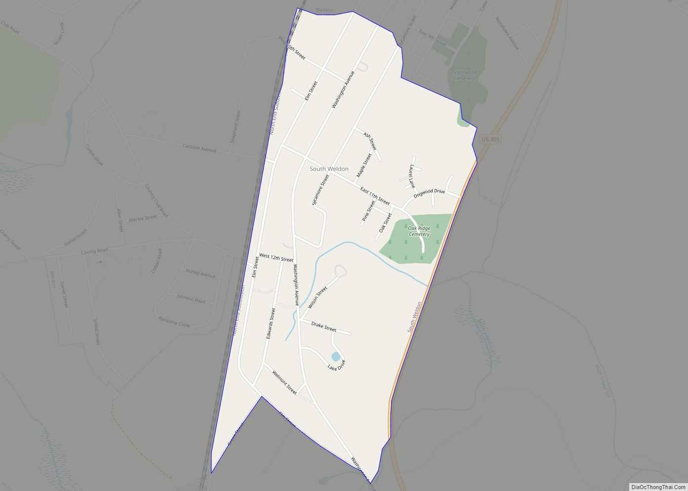
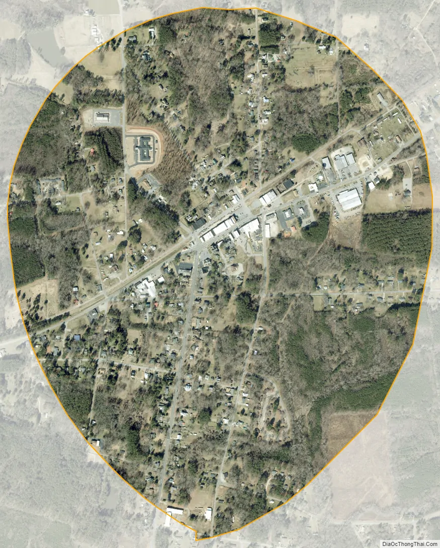
Littleton city Satellite Map
Geography
Littleton is located at 36°26′03″N 77°54′42″W / 36.434208°N 77.911680°W / 36.434208; -77.911680.
According to the United States Census Bureau, the town has a total area of 1.0 square mile (2.6 km), all land.
See also
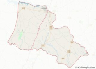
Map of North Carolina State and its subdivision:- Alamance
- Alexander
- Alleghany
- Anson
- Ashe
- Avery
- Beaufort
- Bertie
- Bladen
- Brunswick
- Buncombe
- Burke
- Cabarrus
- Caldwell
- Camden
- Carteret
- Caswell
- Catawba
- Chatham
- Cherokee
- Chowan
- Clay
- Cleveland
- Columbus
- Craven
- Cumberland
- Currituck
- Dare
- Davidson
- Davie
- Duplin
- Durham
- Edgecombe
- Forsyth
- Franklin
- Gaston
- Gates
- Graham
- Granville
- Greene
- Guilford
- Halifax
- Harnett
- Haywood
- Henderson
- Hertford
- Hoke
- Hyde
- Iredell
- Jackson
- Johnston
- Jones
- Lee
- Lenoir
- Lincoln
- Macon
- Madison
- Martin
- McDowell
- Mecklenburg
- Mitchell
- Montgomery
- Moore
- Nash
- New Hanover
- Northampton
- Onslow
- Orange
- Pamlico
- Pasquotank
- Pender
- Perquimans
- Person
- Pitt
- Polk
- Randolph
- Richmond
- Robeson
- Rockingham
- Rowan
- Rutherford
- Sampson
- Scotland
- Stanly
- Stokes
- Surry
- Swain
- Transylvania
- Tyrrell
- Union
- Vance
- Wake
- Warren
- Washington
- Watauga
- Wayne
- Wilkes
- Wilson
- Yadkin
- Yancey
- Alabama
- Alaska
- Arizona
- Arkansas
- California
- Colorado
- Connecticut
- Delaware
- District of Columbia
- Florida
- Georgia
- Hawaii
- Idaho
- Illinois
- Indiana
- Iowa
- Kansas
- Kentucky
- Louisiana
- Maine
- Maryland
- Massachusetts
- Michigan
- Minnesota
- Mississippi
- Missouri
- Montana
- Nebraska
- Nevada
- New Hampshire
- New Jersey
- New Mexico
- New York
- North Carolina
- North Dakota
- Ohio
- Oklahoma
- Oregon
- Pennsylvania
- Rhode Island
- South Carolina
- South Dakota
- Tennessee
- Texas
- Utah
- Vermont
- Virginia
- Washington
- West Virginia
- Wisconsin
- Wyoming