Map of New London town, North Carolina
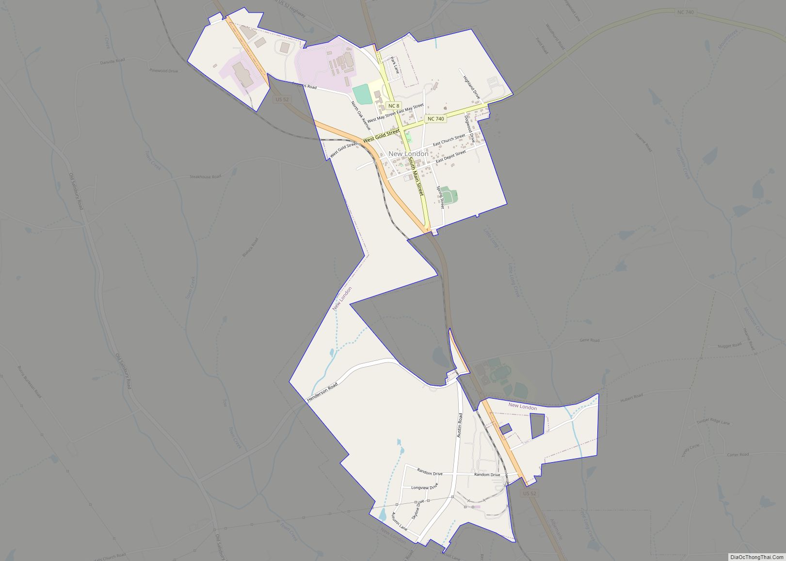
New London is a town in Stanly County, North Carolina, United States. The population was 600 at the 2010 census, and was estimated to be 724 as of 2019. The town lies between Albemarle and Richfield along U.S. 52 in the southern Piedmont region of the state, approximately 45 miles (72 km) east-northeast of Charlotte. It ... Read more
Map of New London town, North Carolina
Map of New Bern city
New Bern, formerly called Newbern, is a city in Craven County, North Carolina, United States. As of the 2010 census it had a population of 29,524, which had risen to 31,291 people as of the 2020 census. It is located at the confluence of the Neuse and the Trent rivers, near the North Carolina coast. ... Read more
Map of New Bern city
Map of Neuse Forest CDP
Neuse Forest is a census-designated place (CDP) in Craven County, North Carolina, United States. The population was 2,005 at the 2010 census. It is part of the New Bern, North Carolina Metropolitan Statistical Area. Neuse Forest CDP overview: Name: Neuse Forest CDP LSAD Code: 57 LSAD Description: CDP (suffix) State: North Carolina County: Craven County ... Read more
Map of Neuse Forest CDP
Map of Navassa town
Navassa is a town in Brunswick County, North Carolina, United States. The population was 1,505 at the 2010 census, up from 479 in 2000. Navassa is part of the Wilmington, North Carolina metropolitan area. Navassa town overview: Name: Navassa town LSAD Code: 43 LSAD Description: town (suffix) State: North Carolina County: Brunswick County Elevation: 16 ft ... Read more
Map of Navassa town
Map of Nashville town, North Carolina
Nashville is a town in Nash County, North Carolina, United States. The town was founded in 1780 and features Victorian and Queen Anne style homes. It is part of the Rocky Mount, North Carolina Metropolitan Statistical Area. The population of Nashville was 5,632 in 2020. It is the county seat of Nash County. The town ... Read more
Map of Nashville town, North Carolina
Map of Nags Head town
Nags Head is a town in Dare County, North Carolina, United States. It is a busy vacation spot because of its beaches and sand dunes of Jockey’s Ridge. The population was 3,146 at the 2020 census. Nags Head town overview: Name: Nags Head town LSAD Code: 43 LSAD Description: town (suffix) State: North Carolina County: ... Read more
Map of Nags Head town
Map of Myrtle Grove CDP, North Carolina
Myrtle Grove is a census-designated place (CDP) in New Hanover County, North Carolina, United States. The population was 8,875 at the 2010 census. It is part of the Wilmington Metropolitan Statistical Area. Myrtle Grove CDP overview: Name: Myrtle Grove CDP LSAD Code: 57 LSAD Description: CDP (suffix) State: North Carolina County: New Hanover County Elevation: ... Read more
Map of Myrtle Grove CDP, North Carolina
Map of Norman town, North Carolina
Norman is a town in Richmond County, North Carolina, United States. The population was 138 at the 2010 census. Norman town overview: Name: Norman town LSAD Code: 43 LSAD Description: town (suffix) State: North Carolina County: Richmond County Elevation: 646 ft (197 m) Total Area: 0.56 sq mi (1.46 km²) Land Area: 0.56 sq mi (1.46 km²) Water Area: 0.00 sq mi (0.00 km²) Total Population: ... Read more
Map of Norman town, North Carolina
Map of Norlina town
Norlina is a town in Warren County, North Carolina, United States. The population was 1,118 at the 2010 census. Norlina town overview: Name: Norlina town LSAD Code: 43 LSAD Description: town (suffix) State: North Carolina County: Warren County Elevation: 423 ft (129 m) Total Area: 1.12 sq mi (2.90 km²) Land Area: 1.11 sq mi (2.88 km²) Water Area: 0.01 sq mi (0.02 km²) Total Population: ... Read more
Map of Norlina town
Map of Newton city, North Carolina
Newton is a city in Catawba County, North Carolina, United States. As of the 2010 census, the city had a population of 12,968. It is the county seat of Catawba County. Newton is part of the Hickory–Lenoir–Morganton Metropolitan Statistical Area. Newton city overview: Name: Newton city LSAD Code: 25 LSAD Description: city (suffix) State: North ... Read more
Map of Newton city, North Carolina
Map of Oak City town, North Carolina
Oak City, formerly known as Goose Nest, is a town in Martin County, North Carolina, United States. The population was 317 at the 2010 census. Oak City town overview: Name: Oak City town LSAD Code: 43 LSAD Description: town (suffix) State: North Carolina County: Martin County Elevation: 82 ft (25 m) Total Area: 1.00 sq mi (2.60 km²) Land Area: ... Read more
Map of Oak City town, North Carolina
Map of Norwood town, North Carolina
Norwood is a town in Stanly County, North Carolina, United States. The population was 2,379 at the 2010 census. Norwood town overview: Name: Norwood town LSAD Code: 43 LSAD Description: town (suffix) State: North Carolina County: Stanly County Elevation: 407 ft (124 m) Total Area: 4.55 sq mi (11.78 km²) Land Area: 4.54 sq mi (11.75 km²) Water Area: 0.01 sq mi (0.03 km²) Total Population: ... Read more
Map of Norwood town, North Carolina